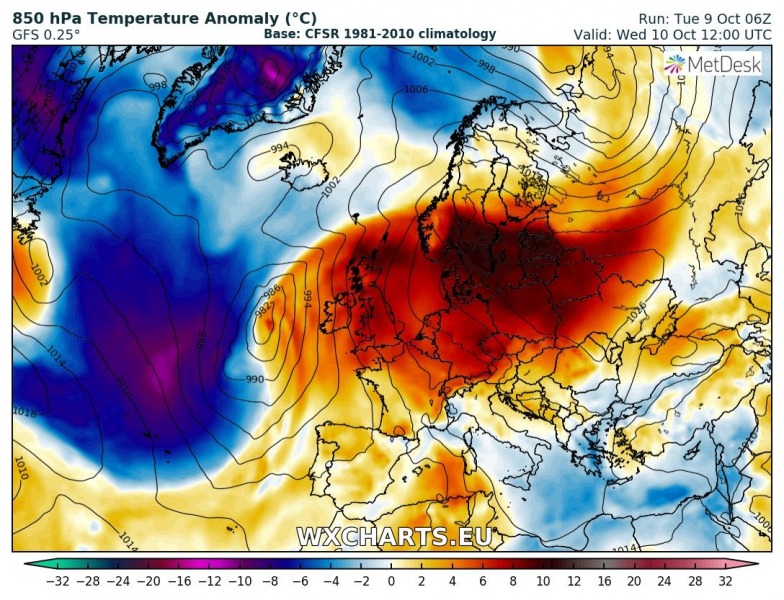
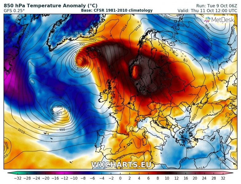
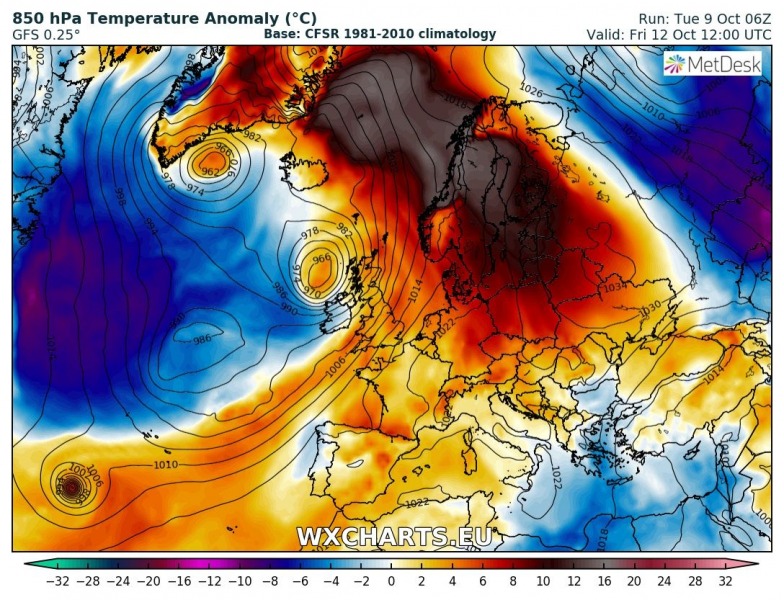
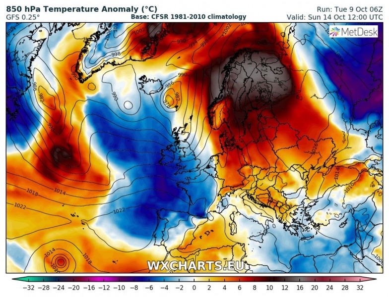
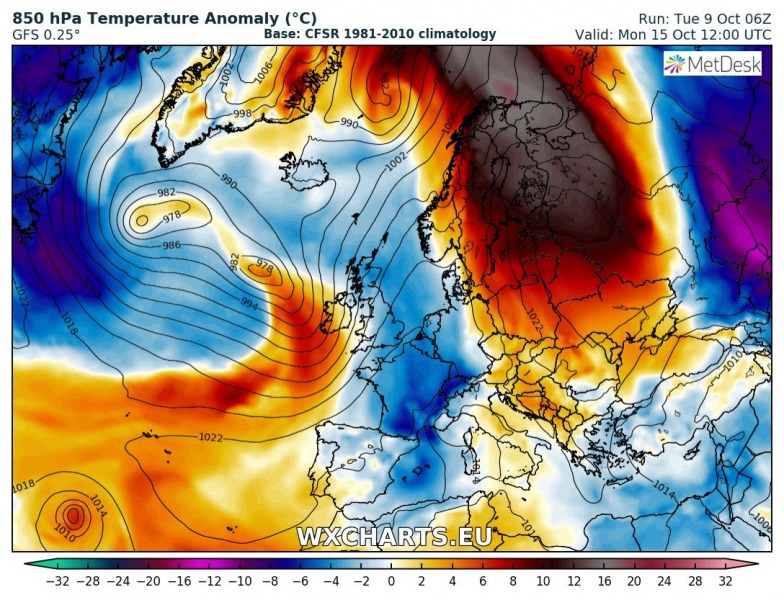
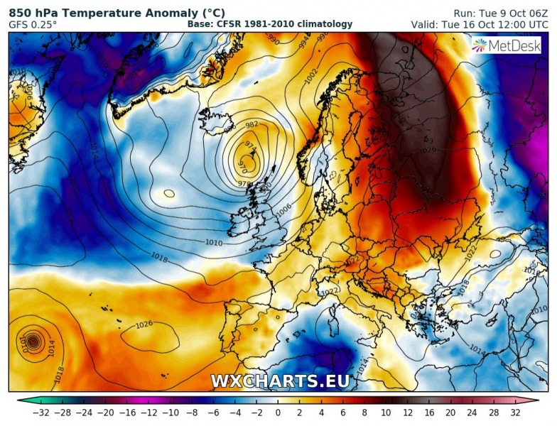
The weather pattern across Europe this week is exceedingly supportive for extreme regional warming across northern Europe and the Arctic region. Temperatures will be 10-15 °C above the long term average, locally even warmer.
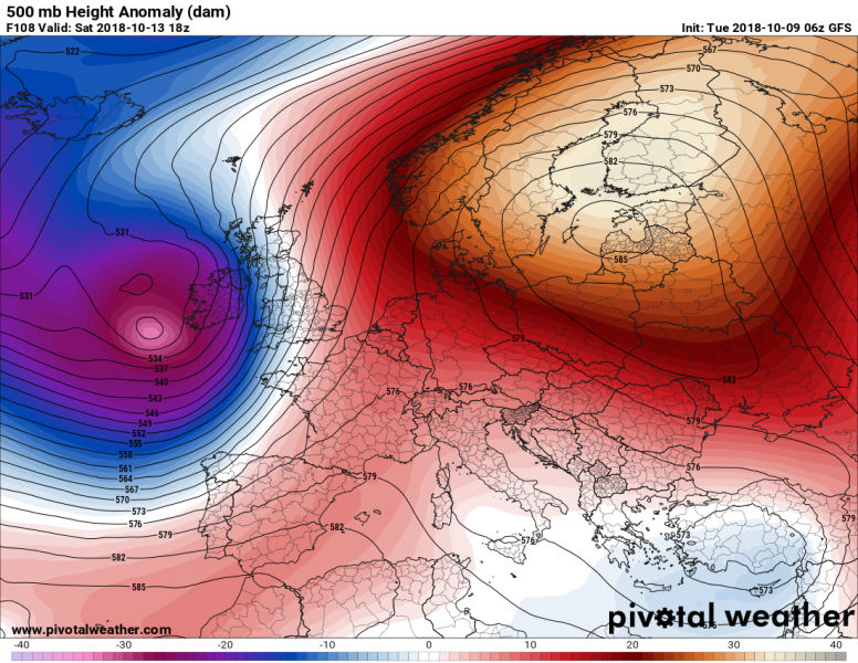
Synoptic situation late on Saturday: a powerful ridge is located over Scandinavia and the Baltic region, while a deep cyclone (Leslie) is just west of Ireland). GFS model guidance. Map: PivotalWeather.com
A rare pattern, dominated by an exceptionally strong ridge over northern Europe and a strong cyclone (Callum) over the Atlantic and western Europe will result in abnormally high temperatures across north Europe later this week. The high temperatures will be the result of warming below the subsidence of the powerful ridge and strong warm air advection from the Mediterranean and western Europe. Strong meridional flow of warm air establishes ahead of the cyclone, pushing warm airmass far north.
Confidence in this event is very good, as both GFS and ECMWF indicate virtually identical evolution of the pattern. Temperatures will be up to 10-16 °C higher than average for this period, locally perhaps even up to 20 °C higher! See the map succession below for daily development of the heat wave.
GFS model guidance on the (2 m) temperature anomaly across Europe for each day between Wednesday and next Tuesday. Map: Wxcharts.eu
Additionally, strong Foehn effect will provide additional warming of the airmass along the fjords of the western coast of Norway as strong southwesterlies push across the mountainous hinterland. Peak temperatures of around 19-22 °C are expected in southern Sweden in the latter half of the week. Northern Norway, Sweden and Finland will likely approach 10 °C and perhaps even reach 10-11 °C locally. Meanwhile the strong Foehn effect will likely push temperatures across the fjords of western Norway up to 14-18 °C, particularly during the weekend.
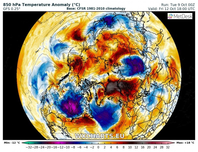
The warm airmass will push all the way to the North Pole.
GFS model guidance on the 850 mbar level temperature anomaly across the Arctic region (and the entire northern hemisphere) on Friday and Monday. Note the tongue of exceptionally warm airmass pushing almost all the way to the North Pole. Map: Wxcharts.eu
We will be reporting on the evolution of this heat wave, as well as review future model runs. Currently the heat wave is expected to end early next week.
More about the deep cyclone Callum, which will be an important element of this pattern
UPDATE: Powerful windstorm ‘Callum’ will develop over Ireland and Scotland on Friday
