As mentioned in the previous discussion on a developing warmer pattern earlier this week, a very strong warm advection and warmth develop over central Europe this weekend. While there will be extreme rainfall and major snowfall ongoing over the western Alps, the northern side of the Alps will be experiencing a very warm weekend due to strong downslope winds from the Alps into the N Austria and S Germany. Temperatures will locally climb into upper 10s due to dry Foehn winds.
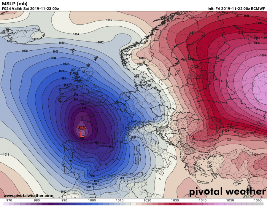
The main cause for strong warm advection into central Europe will be a large eastwards moving upper trough in SW Europe, with an associated deep and also very large surface cyclone. To the east of the system, strong southerly jet-stream results in significant warm advection through mid- and upper-levels.
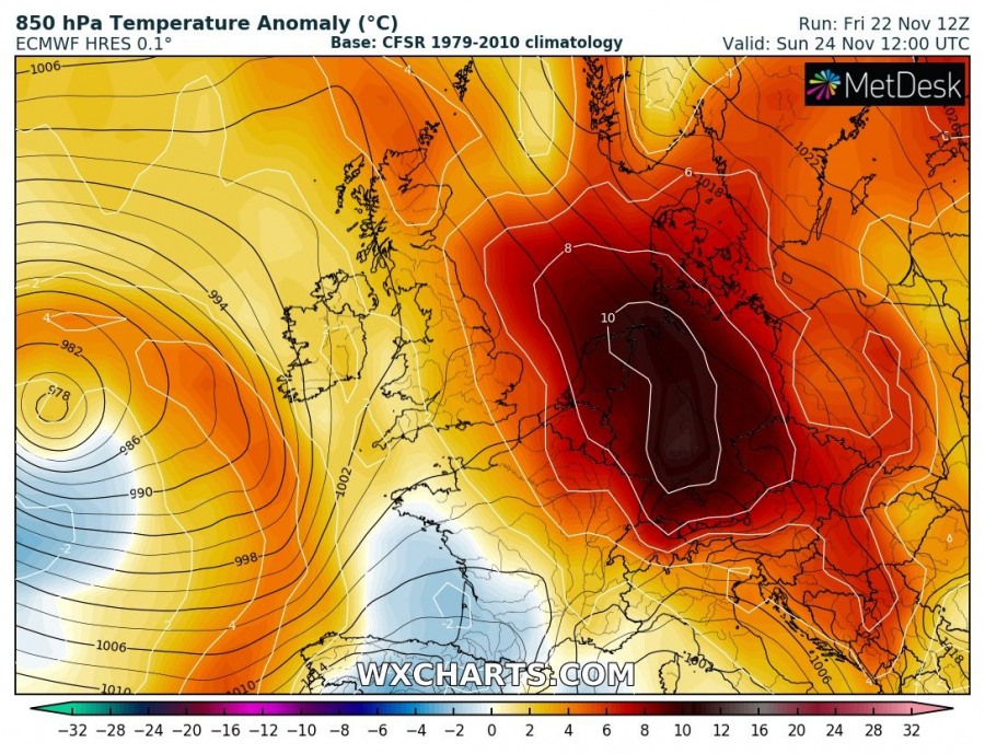
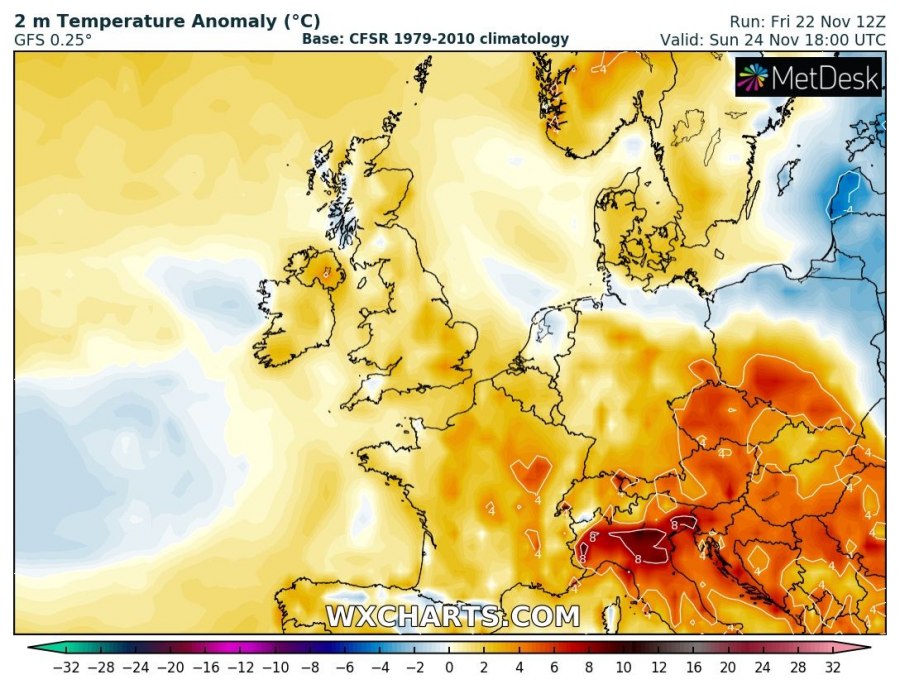
Models are developing a large area of strongly positive temperature anomaly across the mid- and upper-levels, basically on the Lee side of the Alps. The southerly winds blowing across the Alps will be almost perpendicular to the mountain range, therefore resulting in accelerating and drying flow (Foehn winds) into the valleys on the northern side of the mountains. Foehn winds are often gusty winds and due to the adiabatic process while descending, also warm winds. The mid altitudes north of the Alps should experience 8-12 °C warmer weather than normal this weekend, partly also translating towards the ground – especially to the immediate north of the Alpine mountain range. While lowlands further north should remain under inversions layer most of the days and experience less warm weather. Very warm days are also expected across the N Italy and N Balkans.
As mentioned above, southerly winds blowing across the Alps usually bring strong Foehn winds across N Austria and S Germany. This time, the peak gusts could locally exceed 100 km/h and become severe threat in some closed Alpine valleys. The resulting warming airmass should push daytime temperatures into mid/upper 10s and maximum afternoon values could locally reach 16-18 °C! Which is, indeed, quite high for late November.
Read also:
1) Previous discussion on the developing warmth over Europe:
2) Extreme rainfall event will be ongoing over the SE France and NW Italy:
3) Major snowfall event will develop over the highest terrain of NW Italy:
Interested in our calendar? We are proud to present and promote the best weather photographers in Europe – see details:


