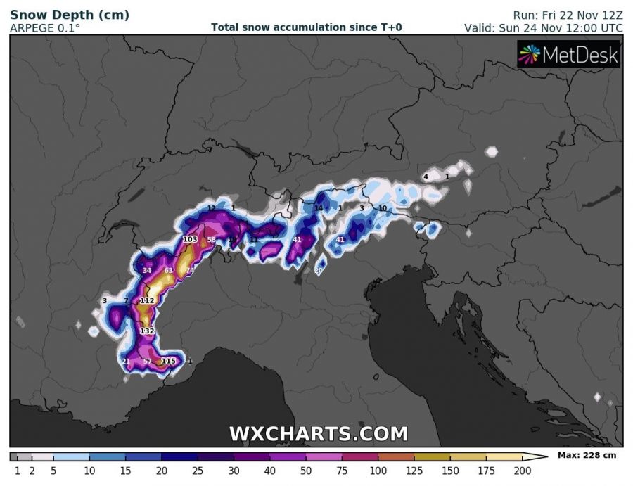
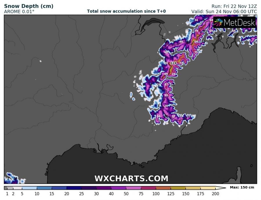
Related to the extreme rainfall event across the SE France and western Alps this weekend, intense snowfall will be ongoing over the higher mountains across NW Italy (W Alps). Models are hinting up to more than 150 cm of fresh snow until Sunday morning, so an extreme amount of snow in just 36 hours. Such amount of snowfall will significantly enhance avalanche danger in the region!
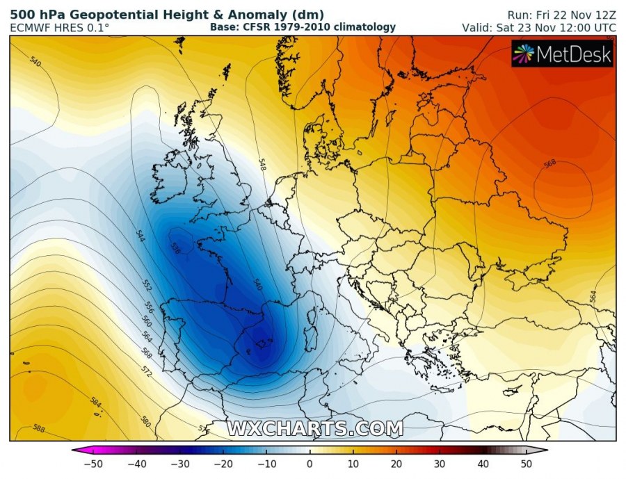
Deep trough sitting over SW Europe will support persisting strong southerlies towards the Alps, advecting huge amounts of moisture into the mountains. As cold temperatures will be present roughly above 2000 m ASL, intense snowfall will occur.
Attached are the ARPEGE and AROME model forecasts for the expected snowfall amount until Sunday morning, Nov 24th. Both models agree there are chances of more than 150 cm of fresh snow in the next 36 hours. Avalanche danger will therefore become a serious threat after Saturday afternoon when higher snow accumulations will occur. Threat for avalanches will continue into Sunday as additional snowfall is expected through Saturday night.
Read also:
Interested in our calendar? We are proud to present and promote the best weather photographers in Europe – see details:


