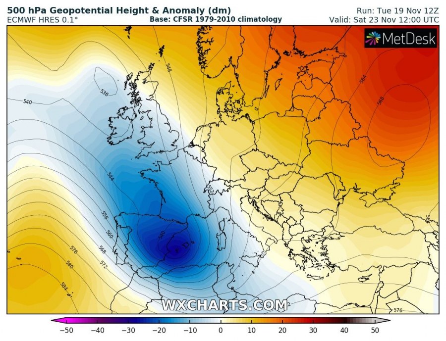
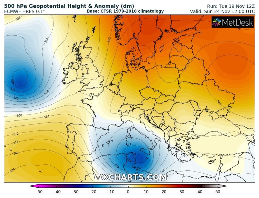
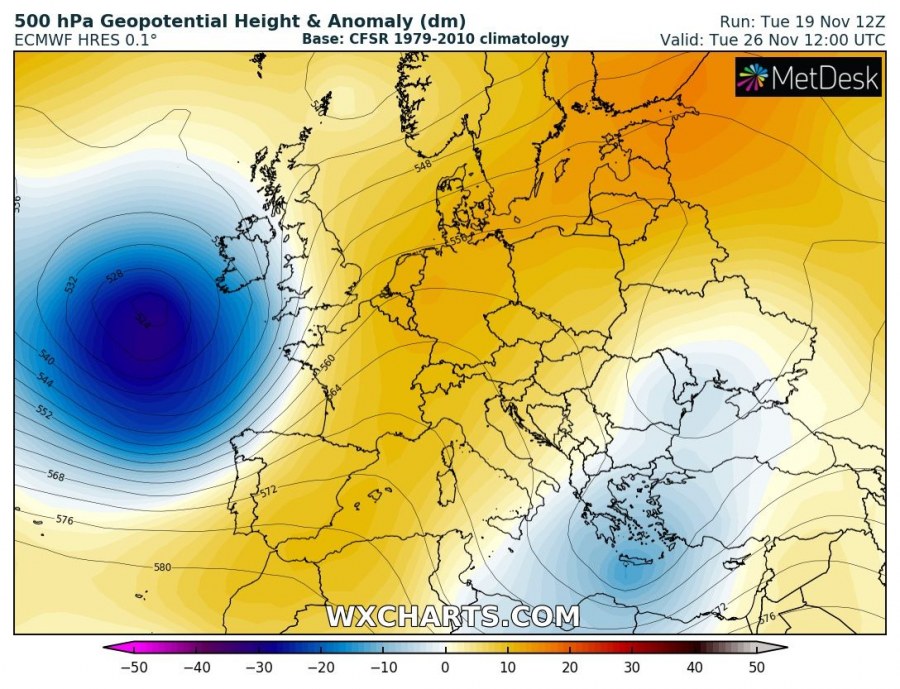
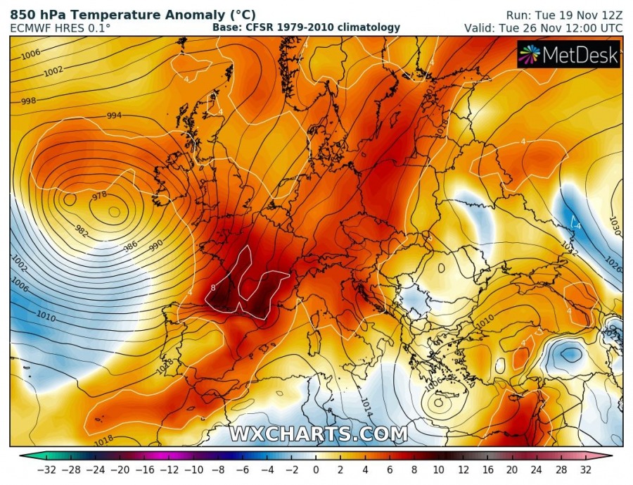
The current rainy autumn pattern across the S, SW and central Europe is coming to an end soon, as large persisting upper-level trough over WSW Europe and the Mediterranean is expected to collapse this weekend and cut off into the S Mediterranean. This means the persisting strong SW flow from the Mediterranean towards the Alps will vanish and limit the moisture advection northwards. To the east, strong ridging should, however, continue across eastern Europe and western Russia. The warm weather will continue for another week and even strengthen in the coming weekend.
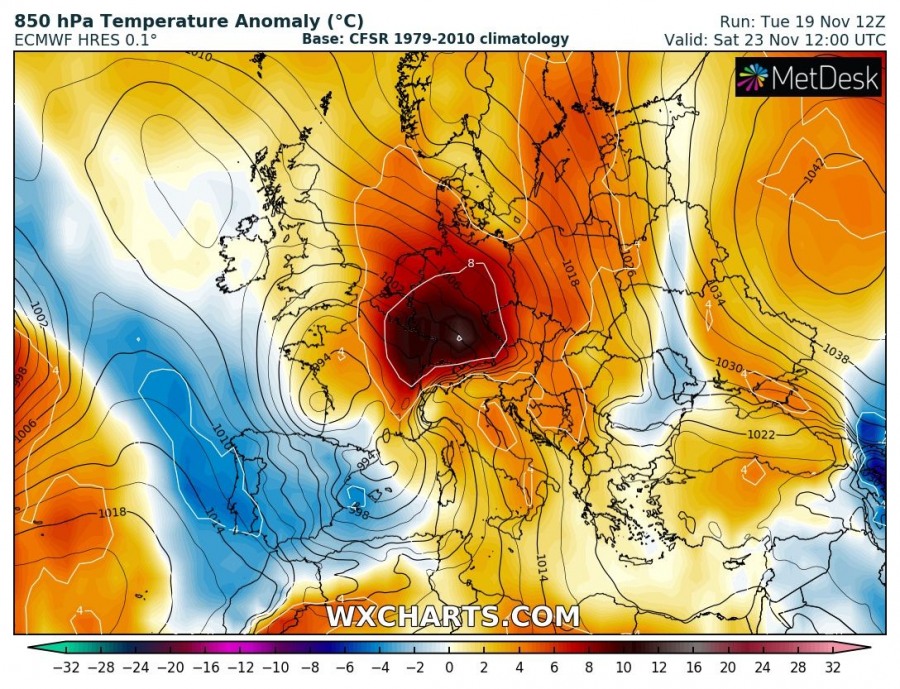
On Friday and Saturday, Nov 22nd & 23rd, a large trough / low over the WSW Europe will begin its weakening trend while drifting SE towards the Mediterranean. The main trough from the WSW Europe becomes smaller with the main core centered over the W Mediterranean and E Iberia. Strong southerlies on its eastern flank will maintain a very warm airmass advection into central Europe, resulting in much warmer weather into the Alps and Germany. Locally close to 10 °C above normal 850 mbar (approx. 1200 m ASL) temperatures are likely, so this should also affect the snow melting in the mid altitudes over the Alps.
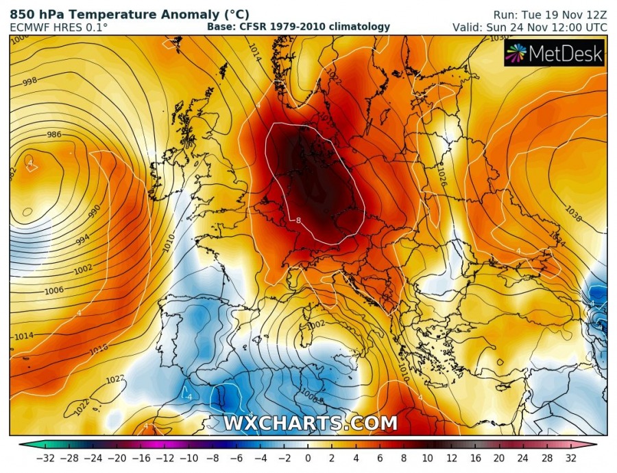
On Sunday, Nov 24th, the still weakening upper low moves into S Mediterranean while ridging from the E Europe expands into central Europe as well. In addition, also the Azoric ridge strengthens and extends towards SW Europe and the Iberian peninsula. Strong warm advection will continue ahead of it into central Europe and result in another very warm day. Overall, above-normal temperatures are likely to spread across much of Europe.
Early next week, Tuesday, Nov 26th, the trough over E Atlantic intensifies, becoming a large and deep upper-level low with strong surface cyclogenesis forming over the Bay of Biscay. Upper ridge expands from SW into central Europe and merges with the E European ridge, as upper low over the S Mediterranean continues east and weakening. Strong warm advection ahead of the large cyclone in the Bay of Biscay pushes into central and western Europe, delivering even higher temperatures into these parts of Europe.
Overall model guidance trends for the next 5-7 days suggest the above normal temperatures can be expected, with even warmer weather than we’re experiencing these days. Warm weather is actually expected to spread across much of Europe over the weekend into early next week. As for now, no signs of any significant cold outbreak or snowy pattern for the lowlands are visible in the mid-range forecasts. We are monitoring the patterns evolution and will keep you updated – stay tuned.
Interested in our calendar? We are proud to present and promote the best weather photographers in Europe – see details:
