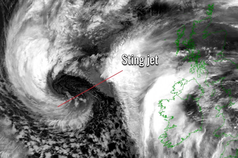
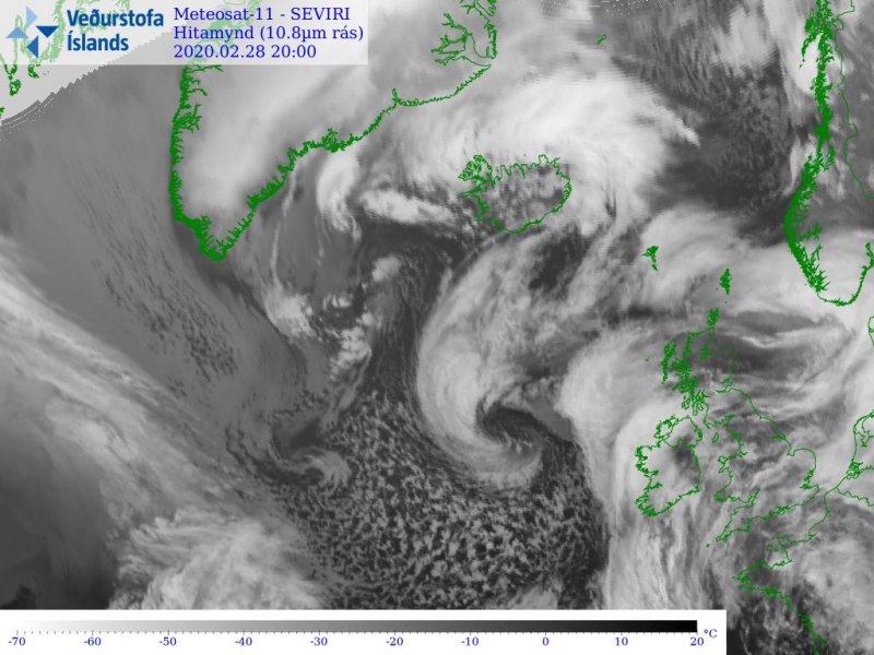
Friday evening storm #Jorge’s update – a rapid strengthening is underway as its central pressure has dropped for more than 30 mbar since Thursday evening. The system is now classified as a bomb cyclone. Satellite imagery suggests a sting jet has formed with this low, resulting in the violent wind field around its core. Jorge will be gradually spreading severe to extremely severe winds towards Ireland first through Saturday morning, then also into Wales and England in the afternoon and evening hours.
*********************************************
*********************************************
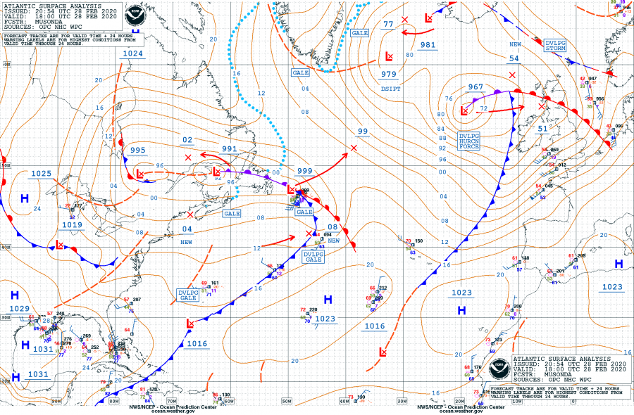
Based on the North Atlantic NOAA OPC 18 UTC (Feb 28th) analysis, #Jorge is now in rapid intensification process. Its central surface pressure has deepened from 998 mbar to 967 mbar since Thursday 18 UTC. That is 31 mbar pressure drop during the past 24 hours which is well beyond the threshold for explosive cyclogenesis / rapid intensification (threshold is 24 mbar pressure drop in the past 24 hours period). An explosive development and deepening is underway now, Jorge should drop its pressure for another 15 mbar or so, reaching very near 950 mbar overnight.
- 967 mbar at 18 UTC, Feb 28th
- 978 mbar at 12 UTC, Feb 28th
- 986 mbar at 06 UTC, Feb 28th
- 994 mbar at 00 UTC, Feb 28th
- 998 mbar at 18 UTC, Feb 27th
Satellite presentation of Jorge is becoming very impressive – a textbook dry conveyor belt is wrapping into the core. It appears likely the sting-jet has developed with the cyclone where violent winds in excess of 150-160 km/h are likely developing. As the system deepens more and mature by tomrorow morning, satellite imagery should be become *much* more impressive!
Note: A sting jet phenomenon is a narrow zone of strong winds, originating from within the mid-tropospheric cloud head of explosive cyclogenesis. Winds are enhanced further as the jet descends, drying out and evaporating a clear path through the precipitation. The evaporative cooling leads to the air within the jet becoming much denser, causing the acceleration of the downward flow towards the tip of the cloud head when it wraps around the cyclone center. Windspeeds in excess of 90 mph (150 km/h) are often associated with the sting jet. This cloud, hooked like a scorpion’s tail, gives the wind region its name the “sting jet”.
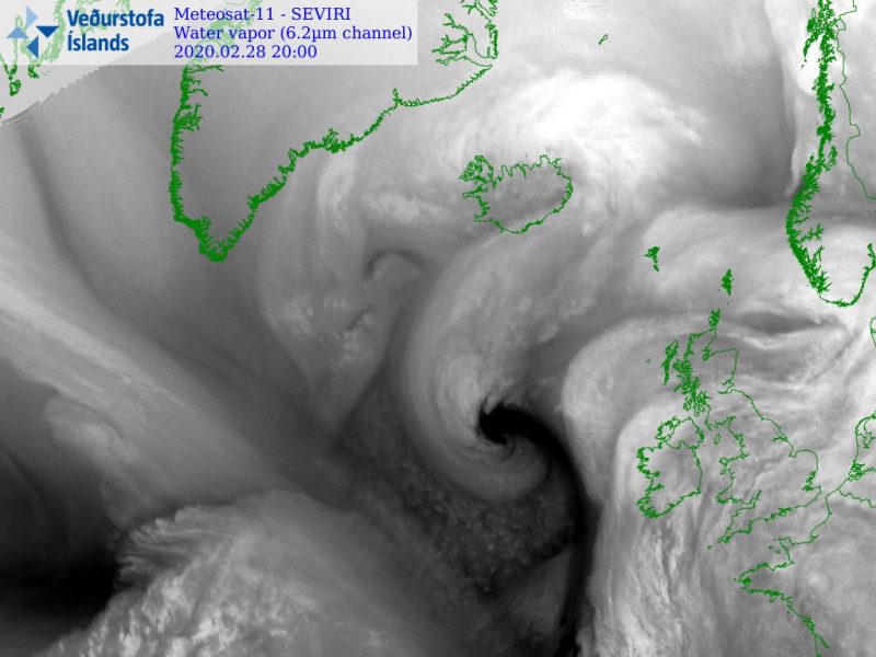
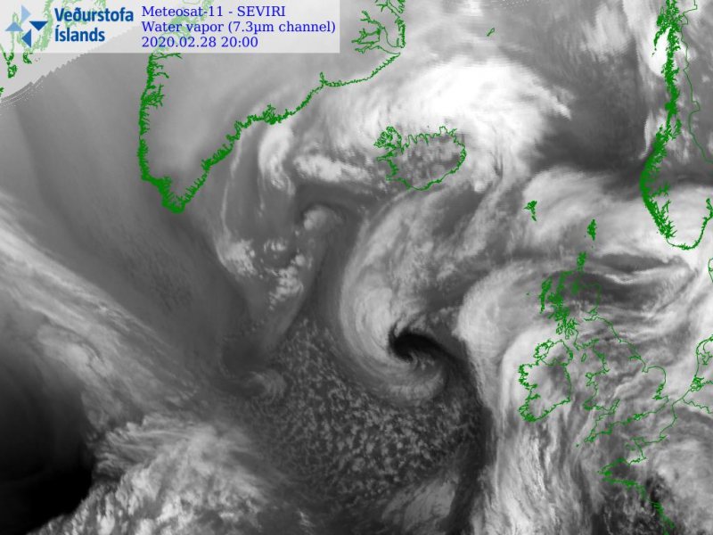
Some more satellite images on a wider scale:
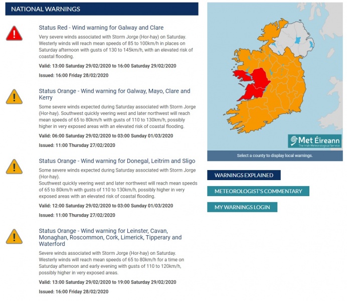
The Met Éireann (the meteorological service of Ireland) has upgraded the whole country to ‘Orange Alert’ with counties Galway and Clare into the highest – ‘Red warning’ with expected very severe winds and flooding associated with the storm Jorge.
Status Red – Wind warning for Galway and Clare
Very severe winds associated with Storm Jorge (Hor-hay) on Saturday.
Westerly winds will reach mean speeds of 85 to 100km/h in places on Saturday afternoon with gusts of 130 to 145km/h, with an elevated risk of coastal flooding.
Valid: 13:00 Saturday 29/02/2020 to 16:00 Saturday 29/02/2020
Status Orange – Wind warning for Galway, Mayo, Clare and Kerry
Some severe winds expected during Saturday associated with Storm Jorge (Hor-hay). Southwest quickly veering west and later northwest will reach mean speeds of 65 to 80km/h with gusts of 110 to 130km/h, possibly higher in very exposed areas with an elevated risk of coastal flooding.
Valid: 06:00 Saturday 29/02/2020 to 03:00 Sunday 01/03/2020Status Orange – Wind warning for Donegal, Leitrim and Sligo
Some severe winds expected during Saturday associated with Storm Jorge (Hor-hay).
Southwest quickly veering west and later northwest will reach mean speeds of 65 to 80km/h with gusts of 110 to 130km/h, possibly higher in very exposed areas with an elevated risk of coastal flooding.
Valid: 12:00 Saturday 29/02/2020 to 03:00 Sunday 01/03/2020Status Orange – Wind warning for Leinster, Cavan, Monaghan, Roscommon, Cork, Limerick, Tipperary and Waterford
Severe winds associated with Storm Jorge (Hor-hay) on Saturday.
Westerly winds will reach mean speeds of 65 to 80km/h for a time on Saturday afternoon and early evening with gusts of 110 to 120km/h, possibly higher in very exposed areas.Valid: 13:00 Saturday 29/02/2020 to 19:00 Saturday 29/02/2020
Please refer to the previous forecasts and updates for further details:
https://www.severe-weather.eu/mcd/update-stormjorge-windstorm-uk-ireland-saturday-mk/
