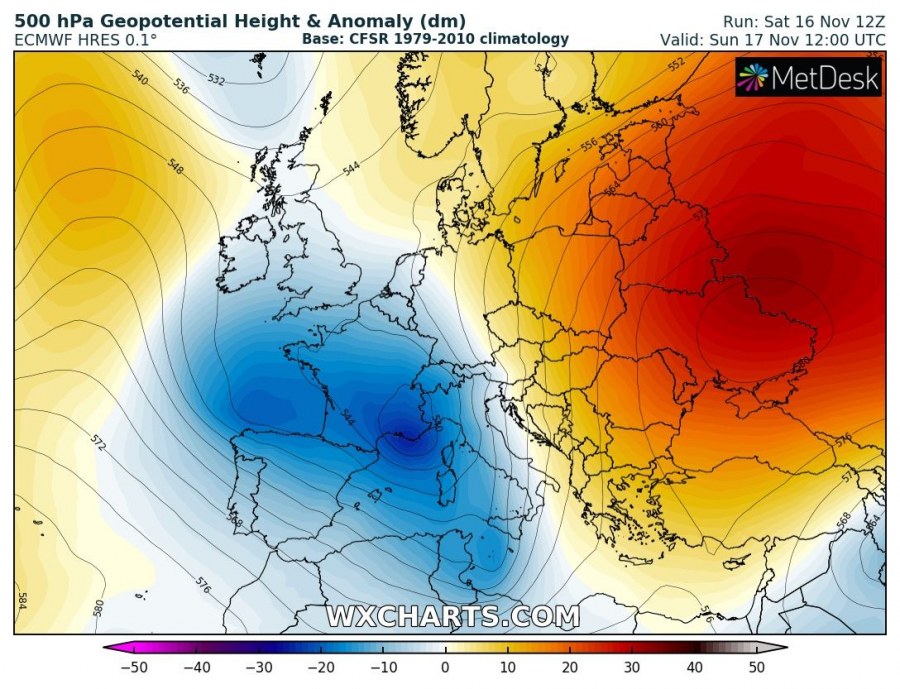
Pattern over Europe this weekend indicates a large upper trough / low over the Mediterranean, central and WSW Europe. With a powerful upper-ridge dominating E Europe and W Russia. A strong southerly winds / jet stream is placed in between these large-scale systems.
Marginal to locally moderate instability should be available across the warm sector as strong, SSE-early low-level jet is advecting very warm and moist airmass along the Adriatic sea. A combination of both strong winds and instability should support some severe storms along the front as well.
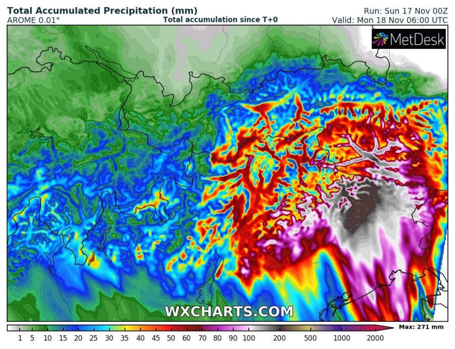
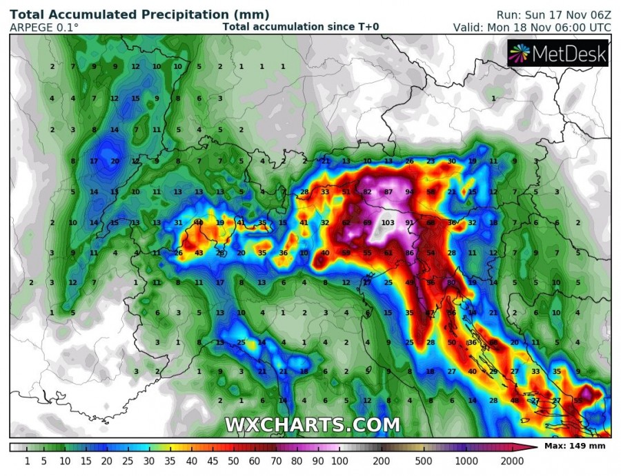
Huge amounts of rain are again expected from NE Italy into WSW Slovenia and NW Croatia, strongly enhanced by orographic features and convective storms. Locally 100-150 mm seems likely, even more close to the mountain ranges where orographic lifting is maximized. Flooding threat will enhance, especially where convective lines could form and result in persisting intense rainfall. Severe storms threat and intense / excessive rainfall threat will be spreading from W to E across N Adriatic into NW Balkans in the afternoon and evening hours.
Stay alert for dangerous flooding threat until the night hours.
Interested in our calendar? We are proud to present and promote the best weather photographers in Europe – see details:


