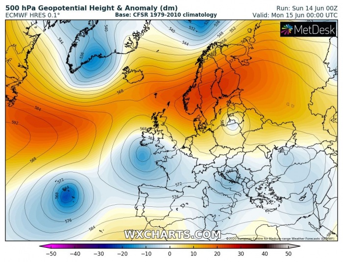
It has been quite an interesting pattern over a large part of Europe lately. The upper-level lows are playing the main role for our weather this month – it is rather unstable in many areas. However, the pattern acts this way due to a strong blocking ridge across the North Atlantic, which extends also over northern Europe. There, unusually very warm to almost hot days have been reported this weekend – heatwave developed over Scandinavia. Sweden (Swedish Lapland) almost hit +30 °C! Very warm weather is likely to continue through this week.
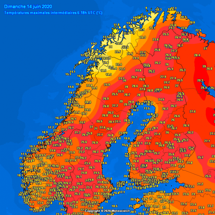
There have been three towns in northern Sweden (Lapland) where temperatures have exceeded 29 °C today, Sunday, June 14th. The city of Boden hit +29.8 °C, so just shy of the ‘hot day’ threshold. It was +28.8 °C in Ylitornio Meltosjarvi, Finland, and +28.1 °C in Meraker-Egge, Norway today as well.
ALMOST +30 °C IN SWEDEN
Attached are the maximum temperatures this afternoon, June 14th across Scandinavia – numerous weather stations were again reporting upper 20s peak values:
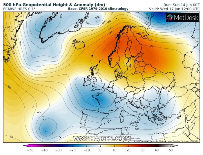
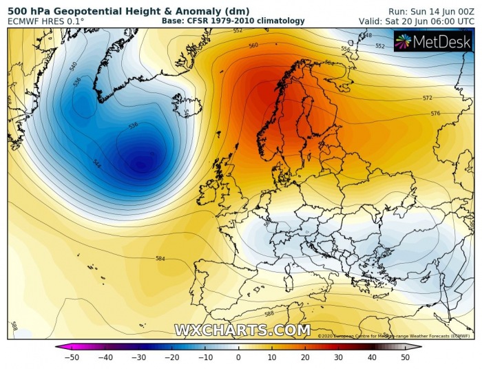
The overall pattern across Europe and North Atlantic reveals there is strong upper-level ridging across northern Europe, while several upper-level lows are further south. Those lows are resulting is dynamic weather patterns over continental Europe. The blocking over the north is extensive and pretty stable, therefore it is expected to sustain for a long period. It is likely such an overall pattern over Europe will continue for another week.
WEEKLY TEMPERATURE OUTLOOK
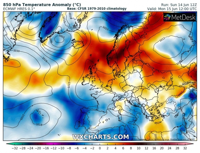
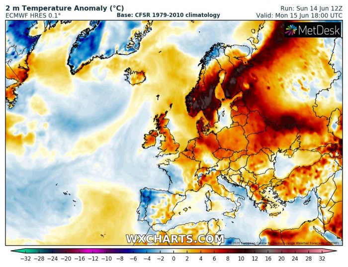
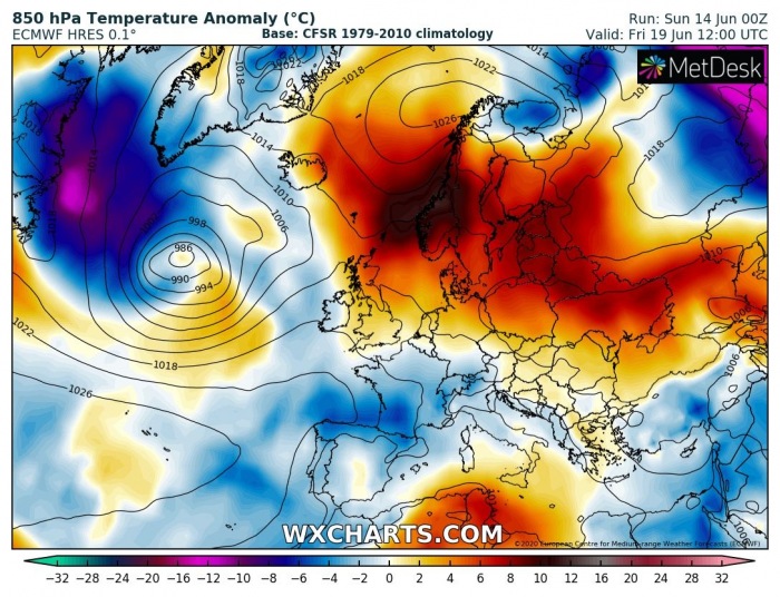
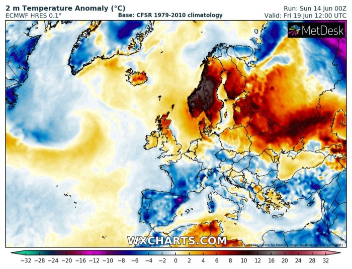
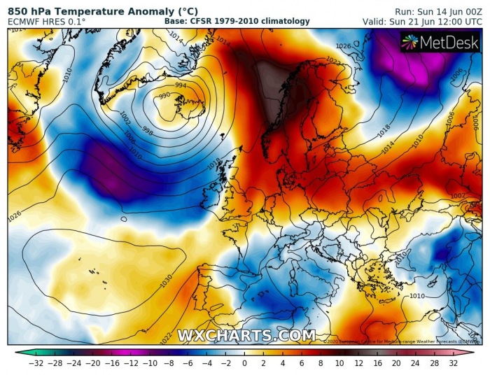
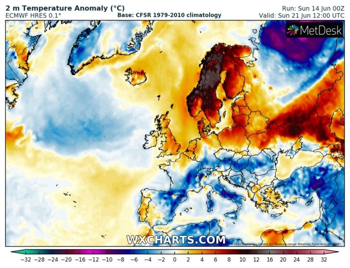
The air mass under the upper ridge across northern Europe is very warm, mostly due to subsidence (descending air) within the high-pressure system over Scandinavia. Partly also combined with a warm advection transport from western Russia. These high mid-level temperatures are resulting in much above normal temperatures lately and are likely to continue through this week. Attached are 850 mbar and 2 m temperatures anomalies over our continent – one can see very warm weather is spread across northern Europe, while the rest of the continent is mostly experiencing near-normal to below normal temperatures this week:
Monday
Wednesday
Friday
Sunday
The heatwave over Scandinavia should continue in the coming days. It does not seem there are any significant pattern changes in the near future, at least over this week. Weather should remain unstable and dynamic in many areas, even supportive of organized storms and flooding. There are also no signs of any stronger heatwaves to spread over any part of Europe yet.
See also:

