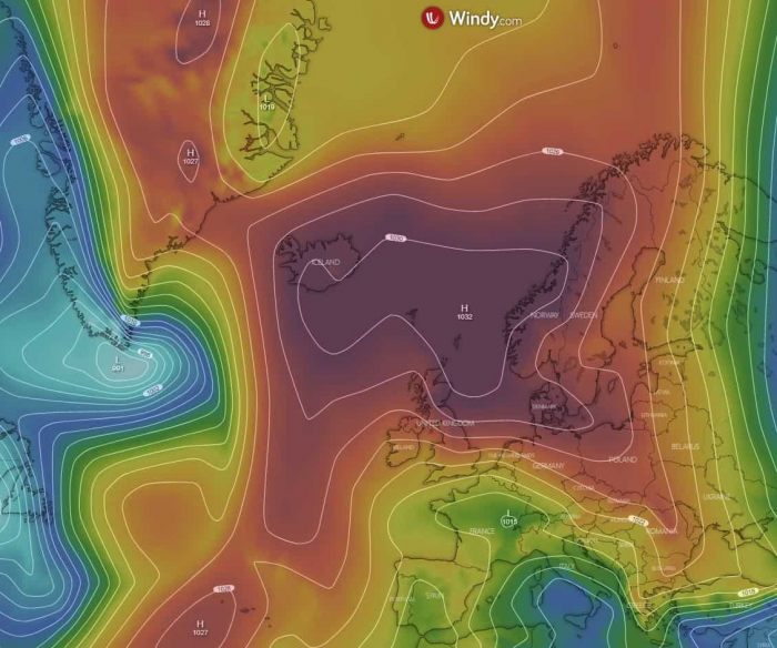
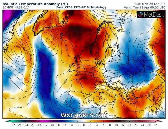
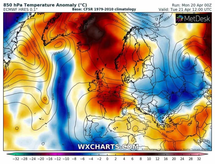
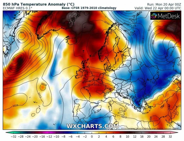
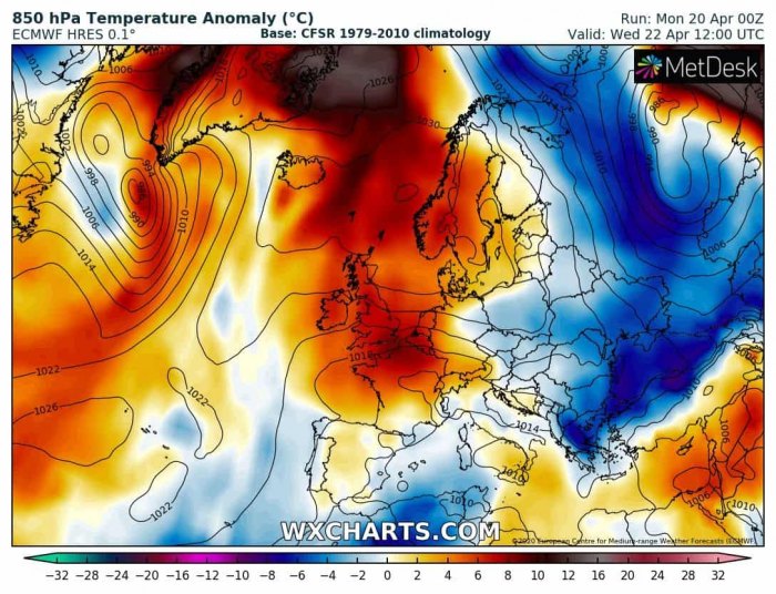
In our other update, we have shared a discussion about an extraordinary ‘heatwave’ into the Arctic region this week. Now, let’s take a look into more details on the temperature and geopotential height anomalies across the far North Atlantic, Greenland and Scandinavia, as a very powerful upper-level ridge and a surface high-pressure system establishes this week.
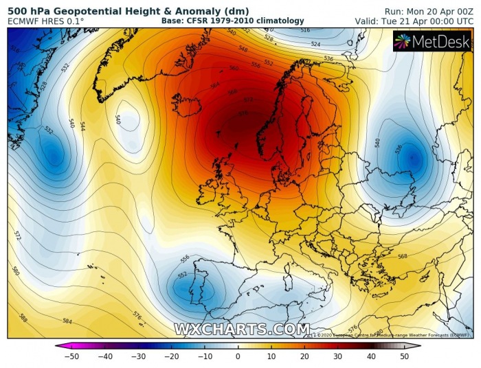
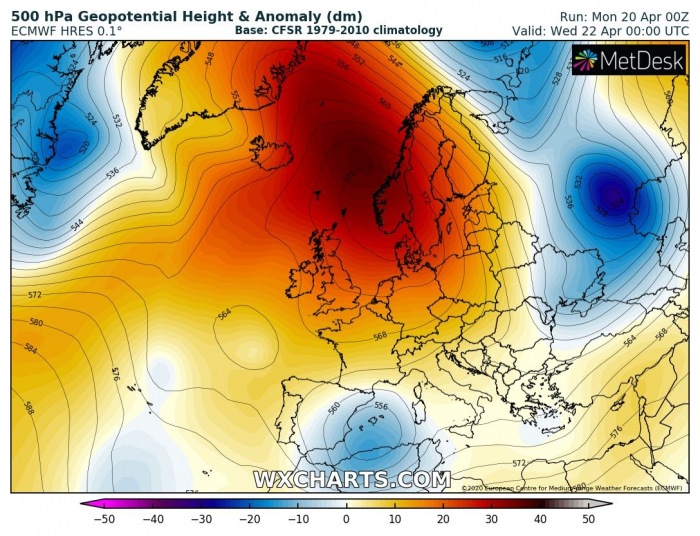
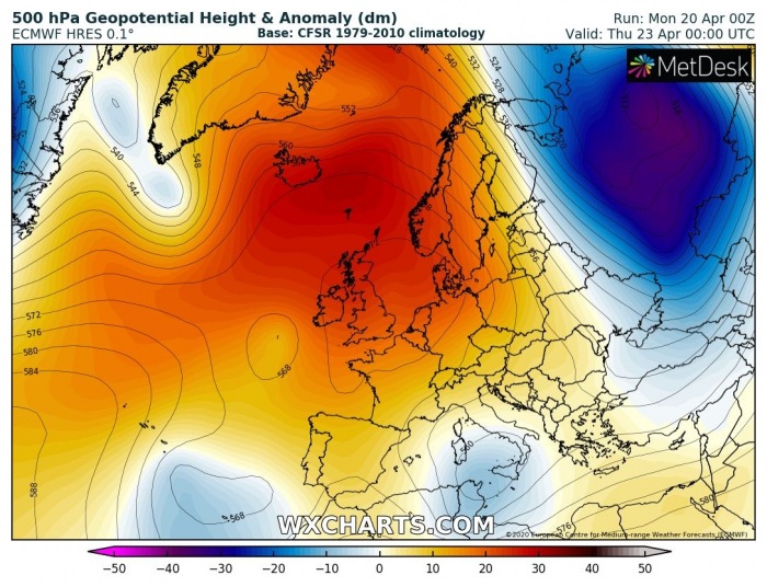
The pattern indicates an extensive and very strong upper ridge over the Arctic region, extending towards northern Europe. The geopotential height anomalies are *extreme*! At the surface, a large high-pressure system is associated with the ridge aloft. To the west of these features, favorable southerly winds are transporting very warm air mass far north into Greenland and surroundings.
Tuesday, Apr 21st
Wednesday, Apr 22nd
Thursday, Apr 23rd
Looking over the 850 mbar temperature anomalies, we can see the advection of warm air mass becomes particularly strong after Tuesday, resulting both from air subsidence within the ridge and additional warm advection to its west from the North Atlantic. It results in air mass more than 15 °C warmer than normally expected over the Arctic region by late April.
Tuesday, Apr 21st
Wednesday, Apr 22nd
Thursday, Apr 23rd
Such a significant warming into the Greenland and other parts of Arctic region should accelerate the spring/summer meltion seasons. We will have updates on this field soon.
See also:
Deadly tornadoes and severe weather outbreak across parts of Mississippi and Alabama today, Apr 12th
Deadly tornadoes and severe weather outbreak across parts of Mississippi and Alabama today, Apr 12th
