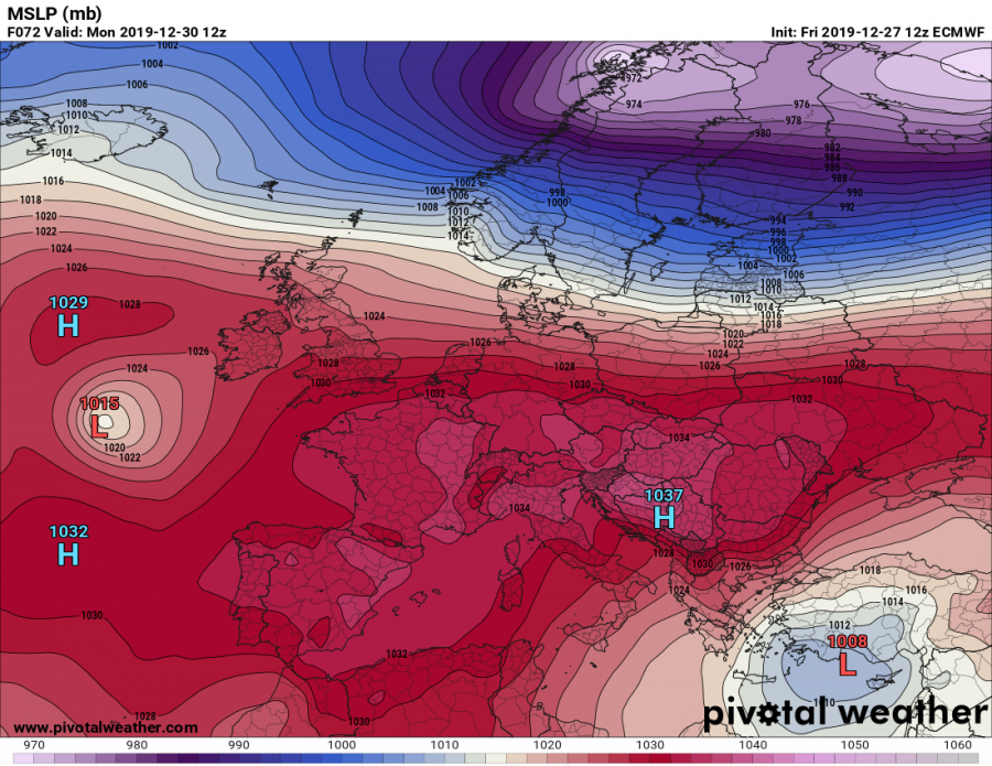
We will be going through the last days of 2019 with a powerful high-pressure system over Europe. It will maintain a rather stable weather across most of the European continent this weekend into early next week. Some more dynamic weather will be over the southeastern parts of Europe where upper low delivers a short cold outbreak. But the high-pressure system should bring very warm weather into parts of the west, north and central Europe until the New Years’ eve, Dec 31st.
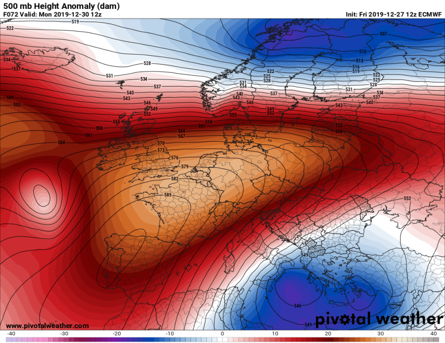
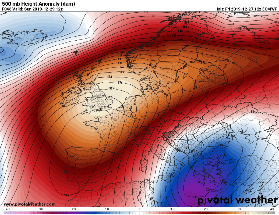
The pattern which is responsible for such a high-pressure system over Europe is a result of the very dynamic North Atlantic, allowing ridges to build up to its east. Pattern consists of a very large long-wave trough over the North Atlantic and a powerful blocking/upper-level ridge forming over the western and northern Europe. A very strong 500 mbar geopotential heights (35-40 dam over the UK) build-up on Sunday. We can also see a deep upper low and surface cyclone over the SE Europe and the eastern Mediterranean, responsible for a cold outbreak into the Balkan peninsula and the Mediterranean this weekend.
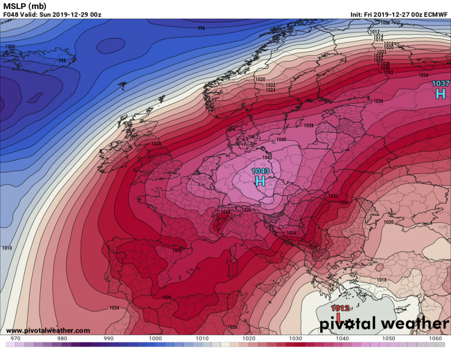
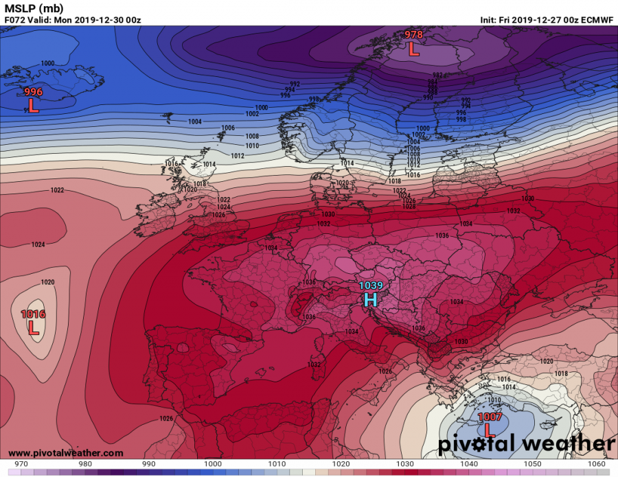
Mean sea-level pressure forecast sequence from Saturday, Dec 28th, 00 UTC until Monday, Dec 30th, 12 UTC – the extensive high-pressure system is developing tonight, with the central pressure still rising, approaching low 1040s. The upper ridge above continues strengthening, so is the surface pressure while it is gradually drifting from the north/west Europe into central Europe. Models are hinting the highest pressure will likely develop across the area from southern Scandinavia across Germany, Poland and the Czech Republic – probably peaking at around 1040-1045 mbar through Saturday and early Sunday. High-pressure tomorrow, on Saturday, will literally expand across much of the European continent as only the far north and southeast parts will have lower pressure than the average sea-level pressure of 1013 mbar.
Saturday, Dec 28th
Sunday, Dec 29th
Monday, Dec 30th
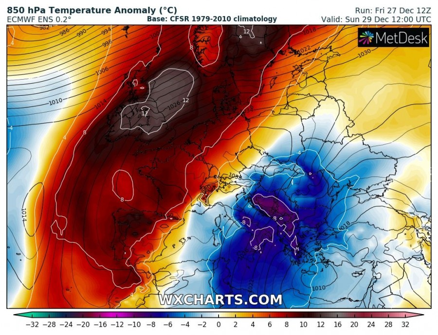
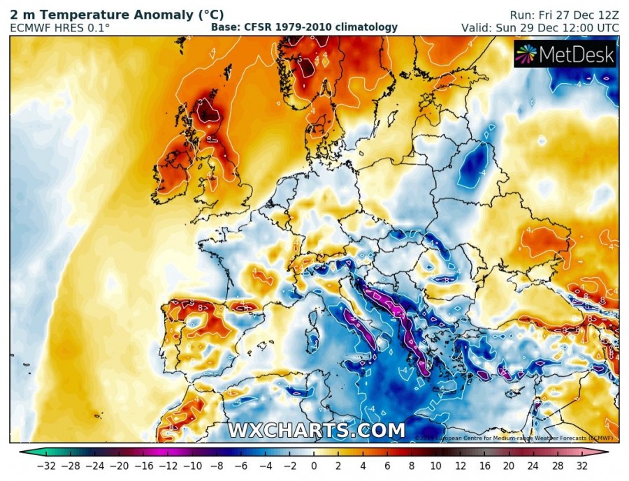
The result of an extensive high to the north against the low over the southeast Europe and the Mediterranean, will be the northerly flow across east-central and southern Europe. That usually means an advection of colder airmass from the north to south, therefore below normal average temperatures. But under the strongest part of the upper-level ridge, a descending air results in warming/drying airmass and therefore much warmer average temperatures than normal. For this reason, an extremely warm airmass develops over western and northern Europe, with 10-12 °C warmer 850 mbar temperatures (approx. 1500m ASL) then we would expect for the end of December. Similar, but less robust, temperature conditions are also expected near the surface, but will strongly depend on the developing thermal inversions over the lowlands and valleys. As it usually happens under the high-pressure systems, the lack of stronger winds forms cold pools in the valleys and therefore strong thermal inversions with low cloudiness or fog which could last for days. And therefore obscuring the majority of Sun’s heating, keeping the lower temperatures through much of the day. So the strongest temperature anomaly will remain across the mid-levels. The higher elevations (mountain ranges) will be above the thermal inversion layer – there, very warm days for the end of December are expected!
Sunday, Dec 29th
Monday, Dec 30th
See also:
Interested in our calendar? We are proud to present and promote the best weather photographers in Europe – see details:
