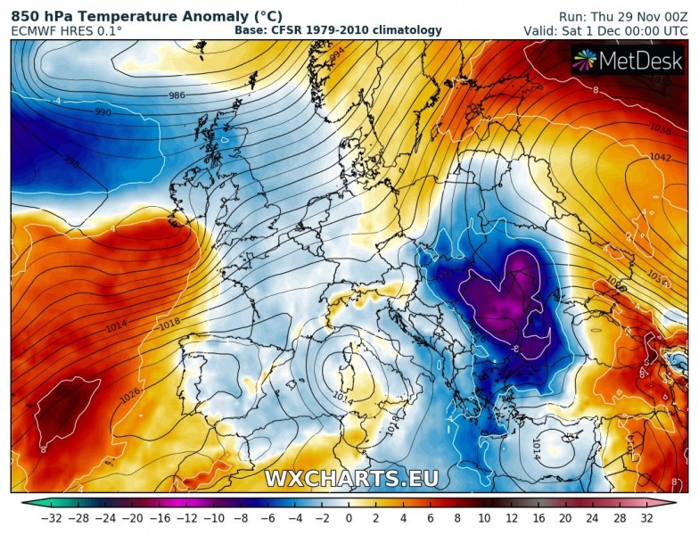
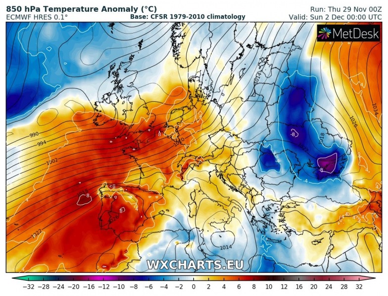
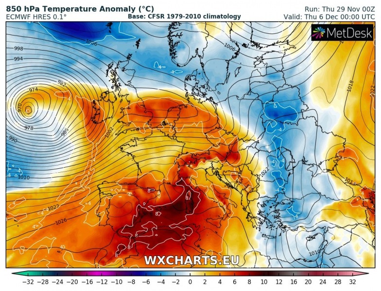
The weather has been pretty cold across east-central and northern Europe this week and also across the Balkan peninsula. A rather significant pattern change is shaping up through early December as more zonal flow will establish. Deep troughs will be located over the N Atlantic and western Europe and will maintain persistent warm advection with frontal systems across the continental Europe. Weather will be quite dynamic, but warm. Winter weather will mostly be limited to the Scandinavian region.
The cold weather across the east-central Europe and Balkan peninsula will rapidly diminish this weekend as strong westerlies push from western towards central Europe. This will establish a very warm days for large part of Europe.
On Monday, a deep cyclone will push across western Europe towards Scandinavia and temporarily bring some colder weather behind the main cold front. On late Tuesday, a new very deep cyclone will push towards the British isles and Ireland – this will again establish a very strong warm advection towards central Europe as strong warm front will be pushed towards northeast.

A deep cyclone over the N Atlantic will maintain for a few more days and results in sustained warm advection towards the continental Europe, so a similar pattern as the whole week should also continue into the next weekend after December 7th.
Stay tuned for further updates on the pattern evolution in the coming days!
See also:
http://www.severe-weather.eu/calendar-2019/


