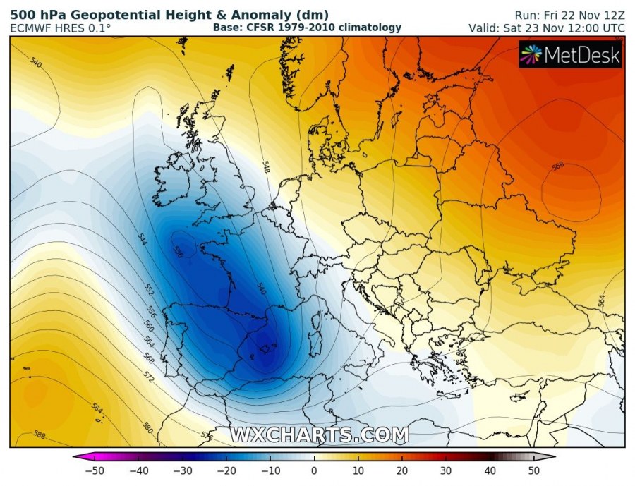
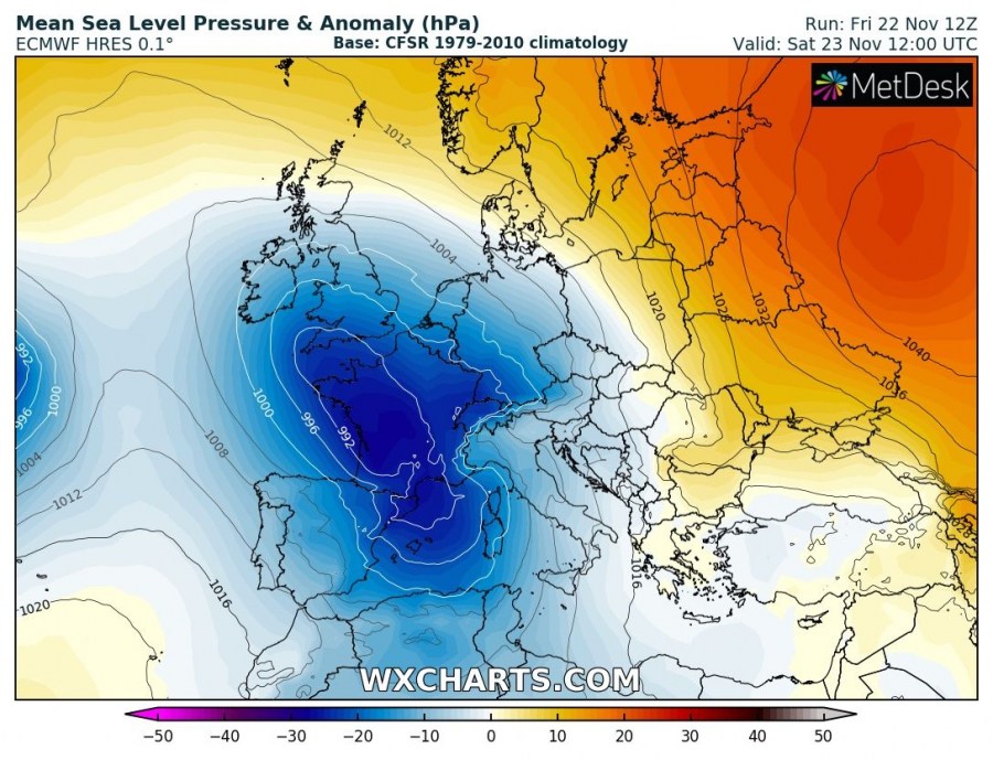
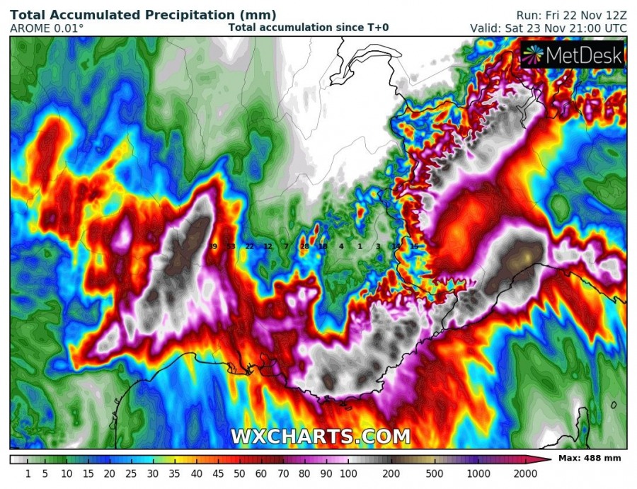
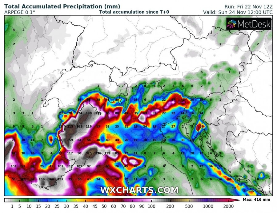
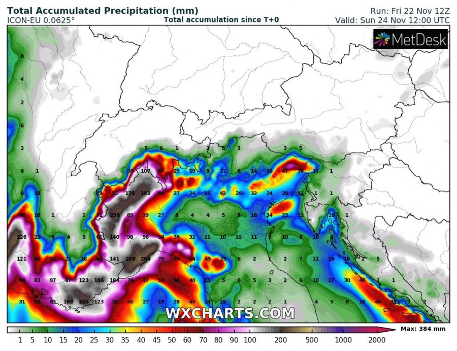
A large cyclone that produced an intense windstorm across the Bay of Biscay today is becoming larger in size while moving into France. Strong southerlies will deliver huge amounts of very moist and unusually warm air mass from the Mediterranean northwards into the threat area. Forecast models are in very good agreement an extreme amount of rainfall will result, locally exceeding 400 mm of rain in less than 48 hours! Significant flooding in locally expected!
Severe Weather Outlook – HIGH RISK has been issued:
The overall pattern across Europe reveals a very large upper trough / low with a broad surface low moving from the Bay of Biscay into France and the western Mediterranean, while a strong upper-level ridge persists across eastern Europe and western Russia. A powerful jet stream rounds the base of the trough, resulting in large scale ascent towards the western Alps.
Various models are in very good agreement developing an intense rainfall event, with strongly enhanced orographic rainfall across the higher terrain of SE France and the western Alps, including NW Italy and NW Apennines. Combined with convective storms closer to the Mediterranean sea, very high rainfall sums are expected. High-resolution models are hinting more than 400 mm will be possible in some areas (Provence Alps – SE France, Piemonte, Aosta and Liguria – NW Italy).
Stay alert for dangerous weather event, the rainfall is already intensifying this evening!
See also – the same cyclone developed a windstorm along the N Spanish coast and the Bay of Biscay:
Interested in our calendar? We are proud to present and promote the best weather photographers in Europe – see details:
