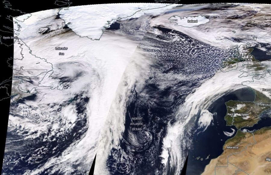
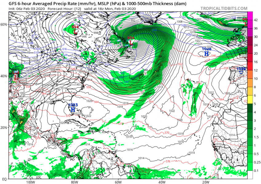
Once again we have a large system ongoing over the Atlantic. The former rapidly deepening extra-tropical cyclone crossing the Newfoundland last night, has significantly deepened until this morning while drifting further north into the Labrador Sea. It appears quite spectacular on the satellite imagery. Central pressure was 957 mbar at 12 UTC today, Feb 3rd. The system has become very large with a textbook cyclonic structure. Hurricane-force winds have developed along southern Greenland. It is near its peak today and will continue moving north tonight and gradually weaken tomorrow.
Attached are some impressive satellite images in Infrared and Visible channels – notice how large the system is compared to Europe
As of 12 UTC today, Feb 3rd, the cyclone’s minimum central pressure was 957 mbar, located just due north of Newfoundland. It crossed the islands overnight with significant pressure change/drop.
- 999 mbar at 00 UTC, Feb 2nd
- 986 mbar at 06 UTC, Feb 2nd
- 975 mbar at 12 UTC, Feb 2nd
- 974 mbar at 18 UTC, Feb 2nd
- 970 mbar at 00 UTC, Feb 3rd
- 965 mbar at 06 UTC, Feb 3rd
- 957 mbar at 12 UTC, Feb 3rd
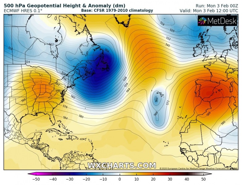
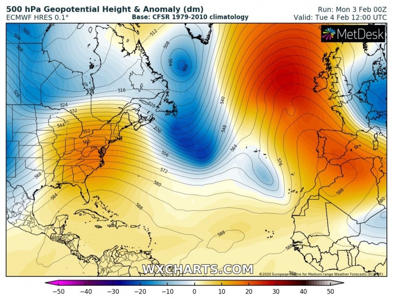
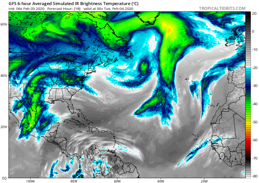
The system has formed with deep upper-level wave ejecting eastern Canada into the Northwest Atlantic. Tonight, the core of the wave weakens while drifting north. We can also see a strengthening upper-level ridge further east towards Europe.
Simulated infrared satellite by GFS model – it is quite likely we will be seeing even more impressive structure of this cyclone tonight and tomorrow morning when it will be centered over the southern Labrador Sea:
The overall wind field will remain large tonight, bringing hurricane-force winds across the Northwest Atlantic and across the southern Labrador Sea. Peak gusts will likely exceed 120-130 km/h.
Stay tuned for further updates!
See also:
North Atlantic today – a small but very photogenic cyclone delivers a spectacular satellite show


