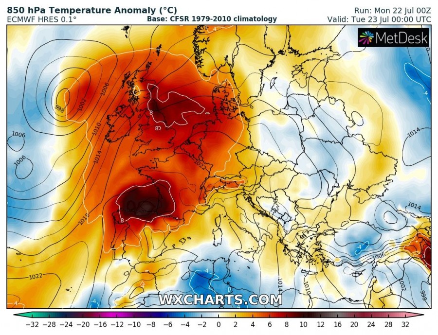
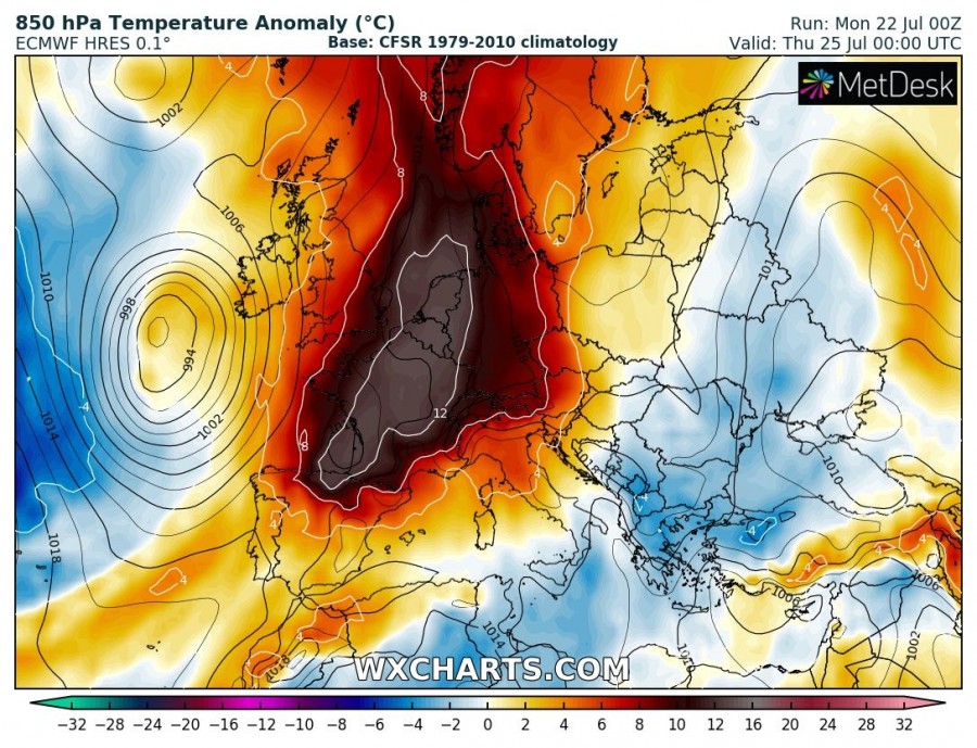
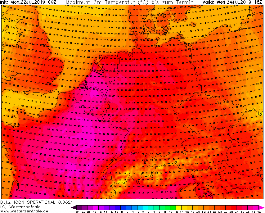
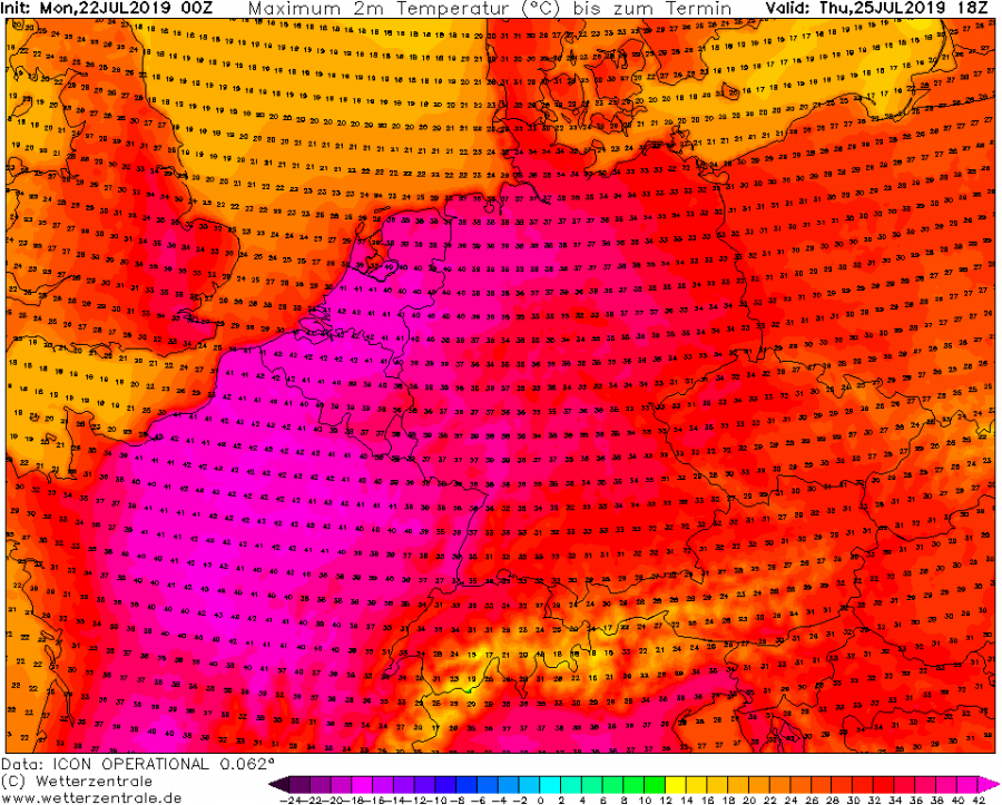
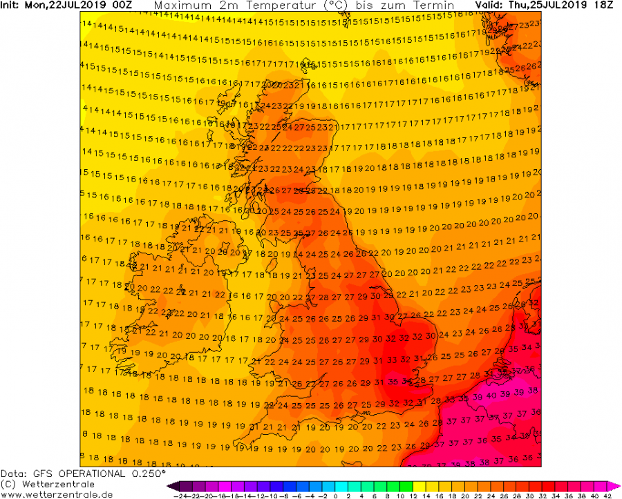
A development of another potentially record-breaking heat wave is expected this week. Again, similar to the late June intense and record-breaking heat wave for S France, extreme heat will spread across western Europe. We could actually see additional new record-breaking temperature values, precisely across parts of NE France, Benelux and W Germany by Thursday, as models are hinting at peak afternoon temperatures in excess of 40 °C!
The highest temperatures ever recorded (per country) there are:
- +40.3 °C in Kitzingen, Germany on 5th of July 2015 and 7th of August 2015
- +38.6 °C in Warnsveld, Netherlands on the 3rd of August 1944
- +38.8 °Cin Hechtel Eksel, Belgium on July 2nd, 2015 and July 27th, 2018
A textbook Spanish plume pattern takes place with a deep trough/low over the N Atlantic and strong Omega blocking ridge pattern over western, central and northern Europe. The heat wave ramps up today as pronounced advection of warm airmass begins over the Iberian peninsula.
Powerful warm advection then continues spreading NNE across France and towards Benelux and UK through the next few days, peaking on Wednesday and Thursday over Benelux and the North Sea. Models are in very good agreement of developing extreme heat with 12-16°C warmer airmass than average in the lowest levels!
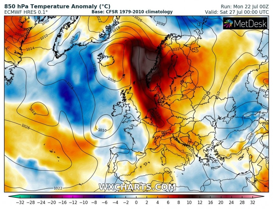
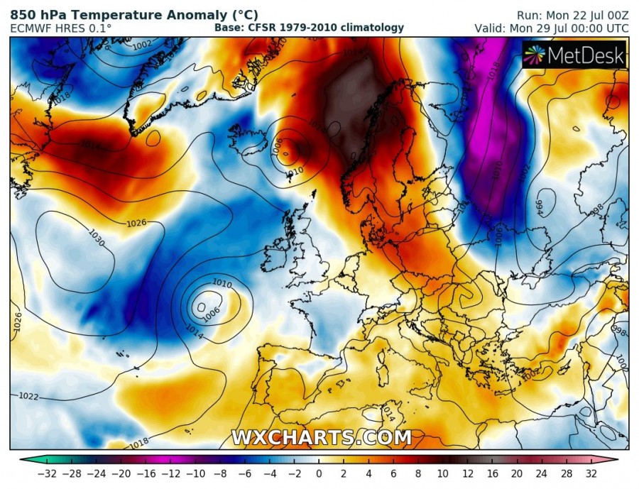
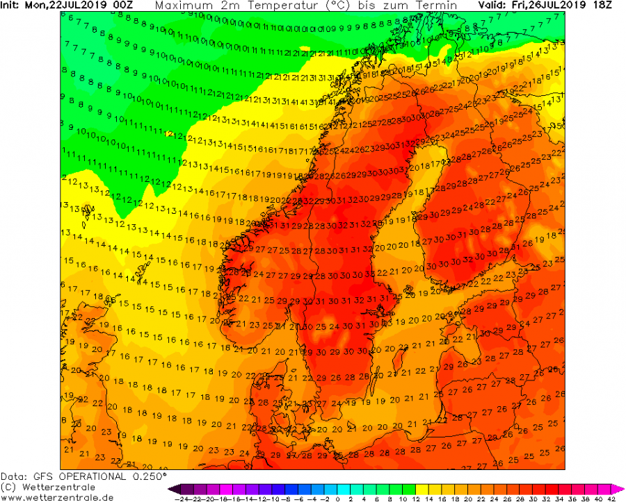
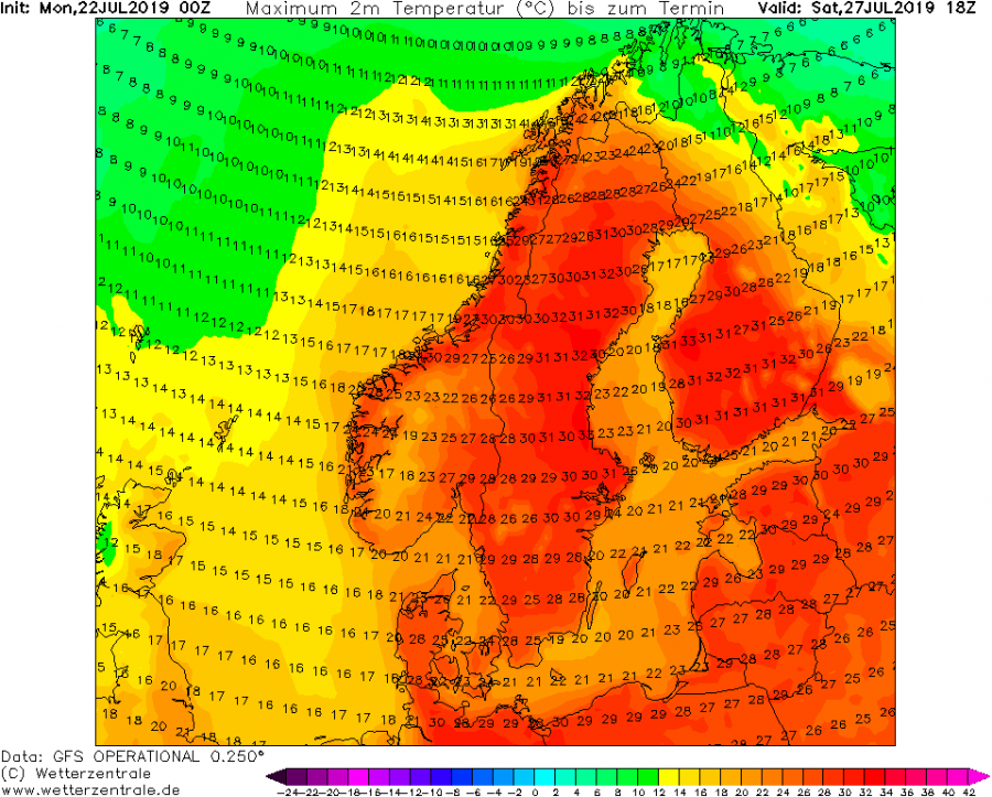
After Thursday, heat gradually dissipates over UK and France as maritime airmass, associated with the deep trough, advects from the west. But warm advection continues into northern Europe and brings hot days with afternoon temperatures in the low 30s across Sweden, Norway and Finland over the weekend.
Lets get into regional details.
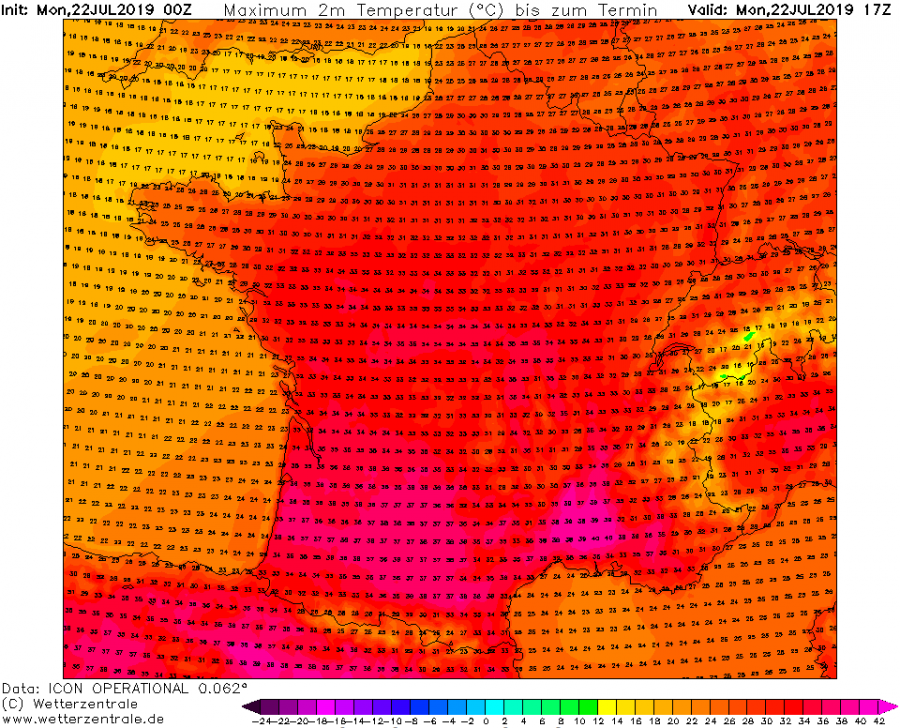
Today, Monday July 22nd, yet another very hot day is expected over Spain and S/E Portugal, afternoon temperatures could locally reach 38-42 °C.
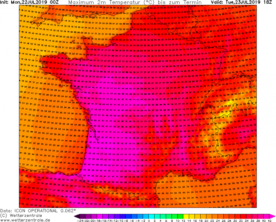
With strong warm advection under the Spanish plume, heat intensifies over southern France this afternoon as well. Locally, 36-39 °C is expected. Intense warmth spreads north overnight, resulting in extreme heat by Tuesday afternoon. Low 40s are likely on Tuesday afternoon, some models are hinting at 42-43 °C during the peak time heating hours, especially across the WSW parts of France.
Very warm airmass then spreads further north, reaching N France, Benelux and W Germany on Wednesday when models are hinting at potentially record-breaking heat across the region. The high 30s to near 40s are likely by Wednesday afternoon while even higher, low 40s (40-42 °C) are simulated by Thursday afternoon – if this verifies, NE France, Benelux and even W Germany would shatter all-time heat records!
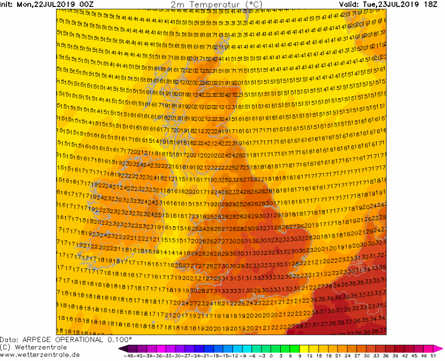
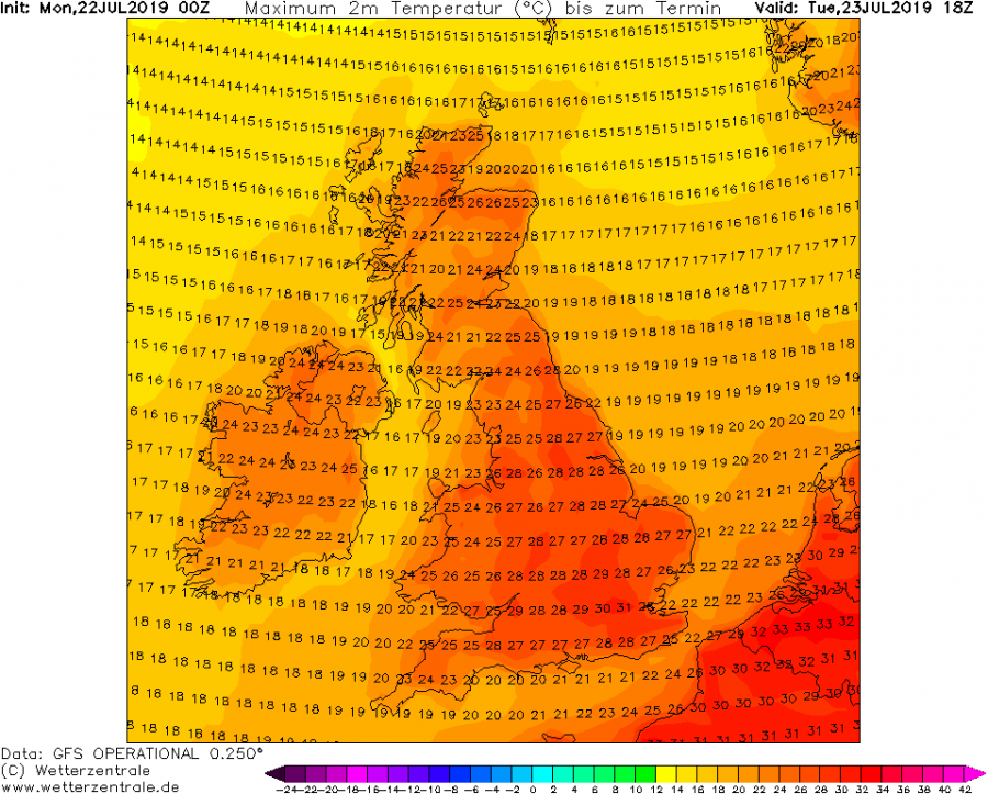
The heat wave also reaches the UK, where especially southern parts should experience very hot days. Models are trending into 32-36°C across SE England from Tuesday to Thursday!
Stay alert for dangerous heat conditions and stay tuned for additional updates – we will update model trends and actual reports in the coming days!

