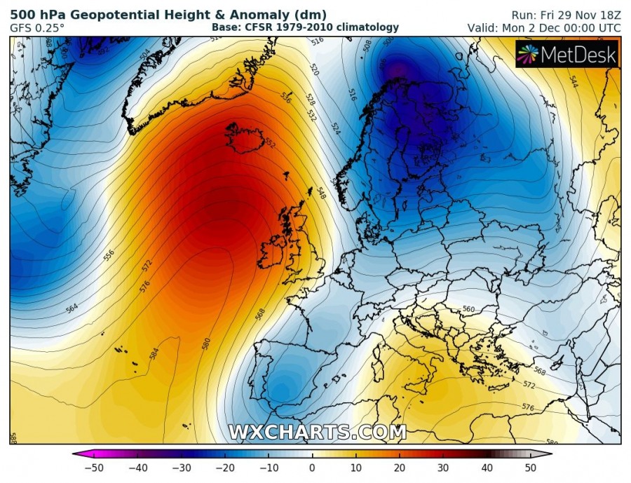
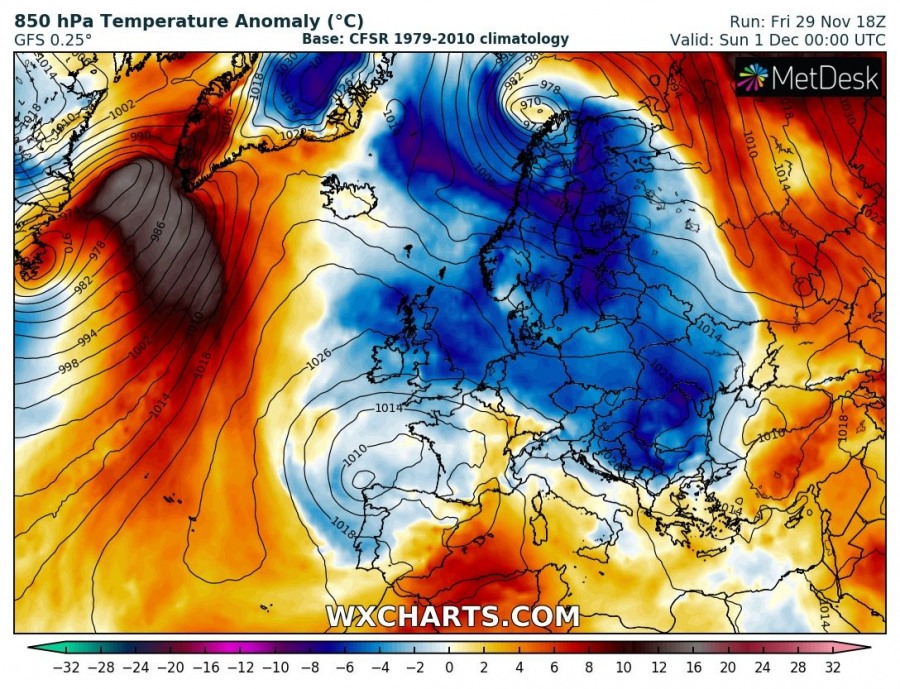
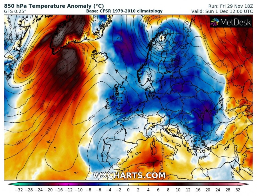
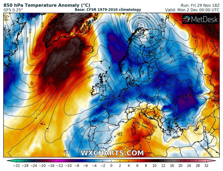
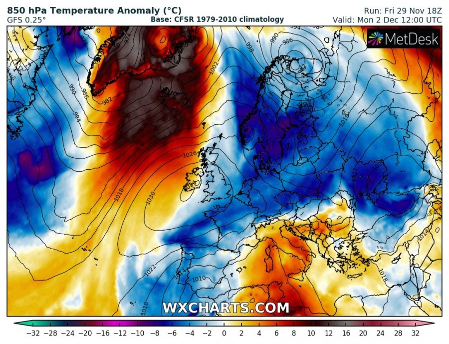
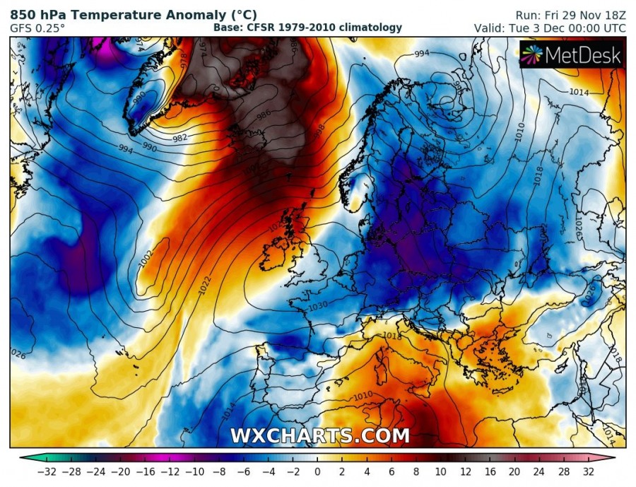
The pattern flip this week leads into some extreme anomalies in some parts of Europe and North Atlantic through early December. While a cold outbreak develops over E-CNTRL Europe, a very warm airmass spreads into the North Atlantic and the Arctic region. A broad area of more than 15 °C warmer temperatures expands across a few days period (Nov 30th – Dec 3rd) and delivers unusually warm weather into Greenland and Iceland.
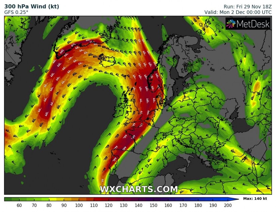
An upper ridge (an Omega blocking pattern) builds up across the North Atlantic in the wake of a large long-wave trough across the N Europe and NW Russia. While the west of the ridge, another trough is located across eastern Canada and the Labrador Sea. As a result, an intense jet stream in-between establish a south-southwesterly flow into the Arctic region.
Extreme anomaly of temperature in the lowest 2 km is foreseen, supported by all models. A surface cyclone forms near Newfoundland tomorrow, Saturday, Nov 30th, with a powerful advection of very warm airmass across the Labrador Sea. As the cyclone drifts further northeast and the gradient towards the ridge to its east strengthens, 12 to more than 15 °C warmer airmass than normal spreads into the N Atlantic, Iceland and Greenland on Sunday and continues through Monday and Tuesday next week.
Read also – to the east of the ridge, cold outbreak spreads across the eastern half of Europe.
Interested in our calendar? We are proud to present and promote the best weather photographers in Europe – see details:
