The increasingly likely “Medicane” or tropical-like cyclone in the Tyrrhenian sea will also likely bring extreme rainfall to parts of the region. The nearly stationary system, very warm sea and a persistent wind field are very favourable for prolonged persistent torrential rainfall.
Models are currently in very good agreement on the formation of a “Medicane” or tropical-like cyclone in the Tyrrhenian sea over the next several days.
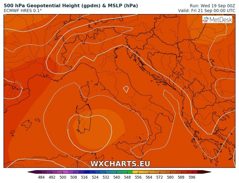
Geopotential height anomaly over the Mediterranean indicating the cold core upper low, associated with the expected Medicane. Map: wxcharts.eu
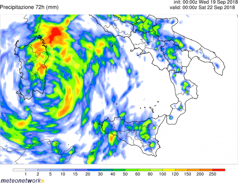
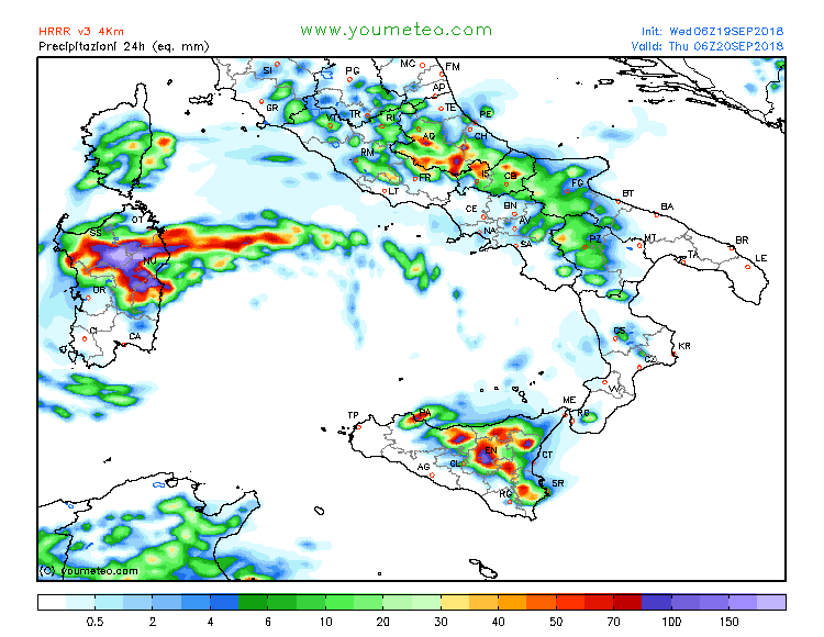
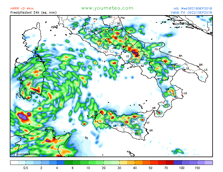
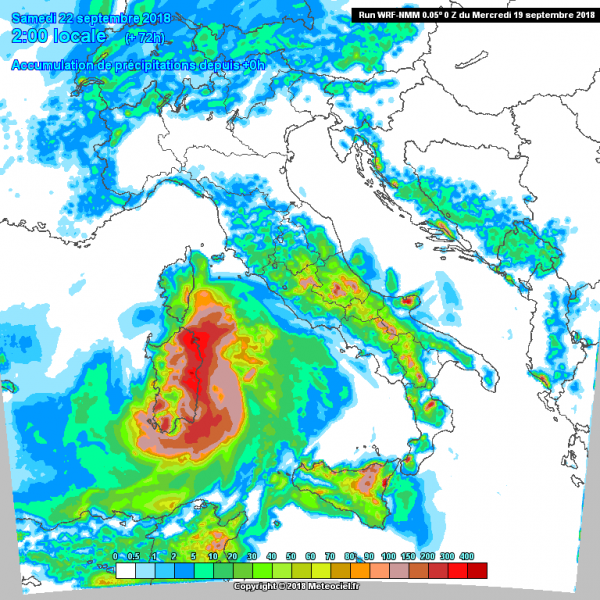
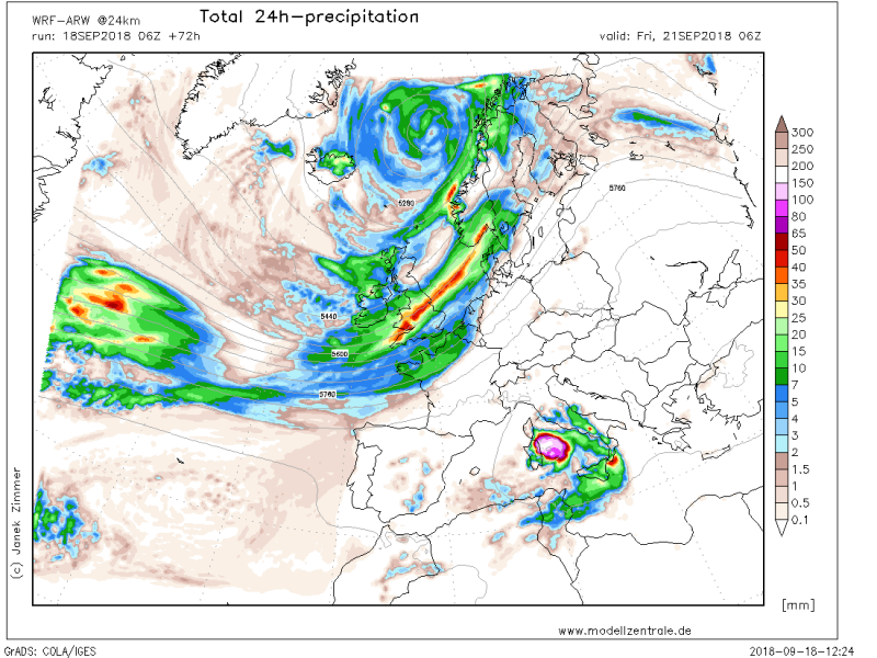
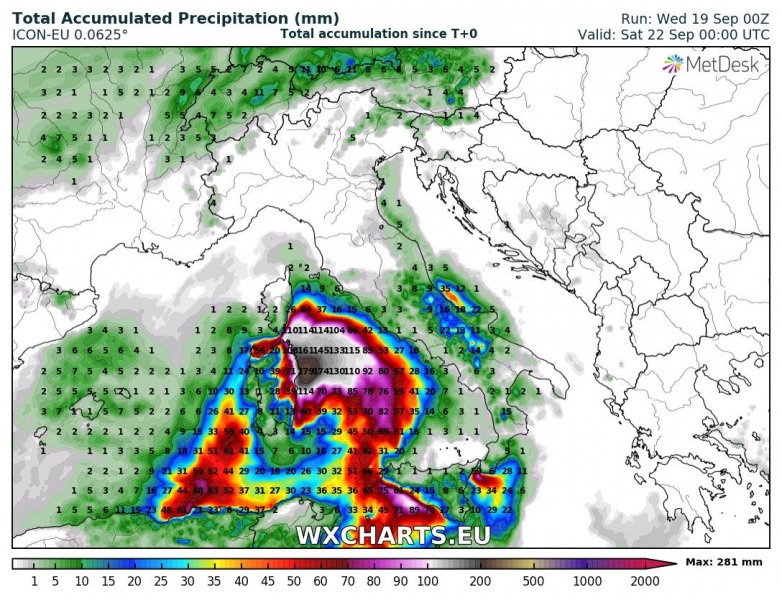
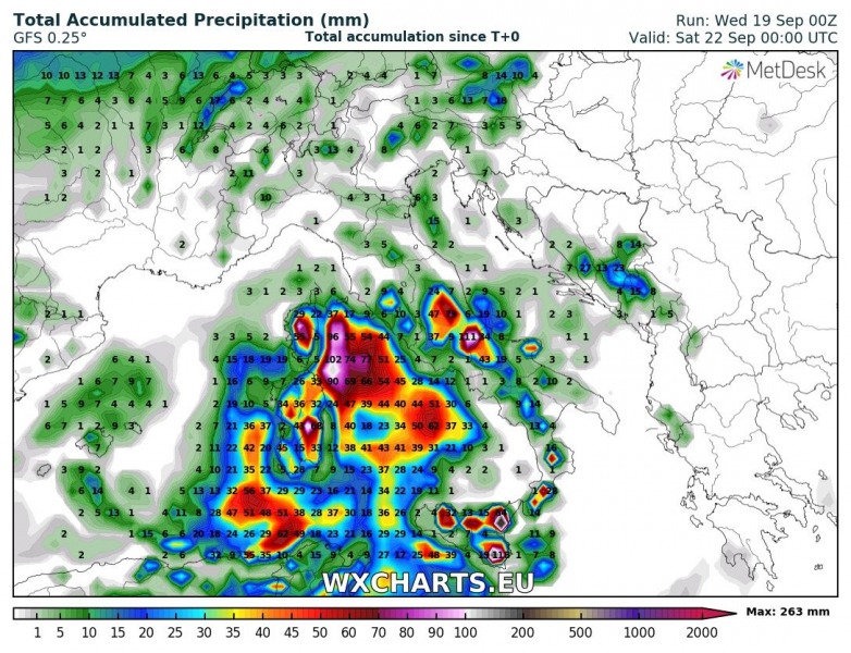
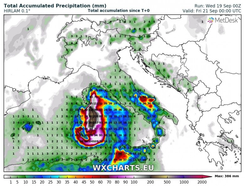
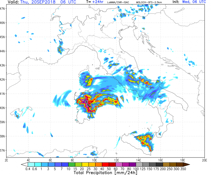
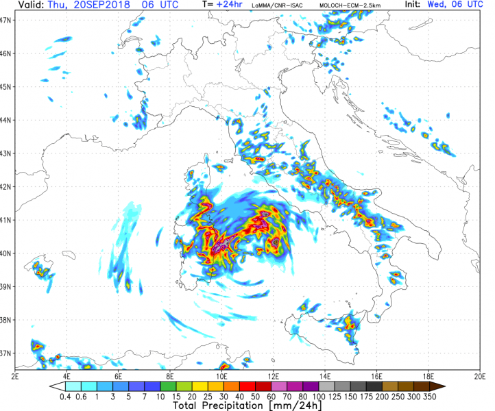
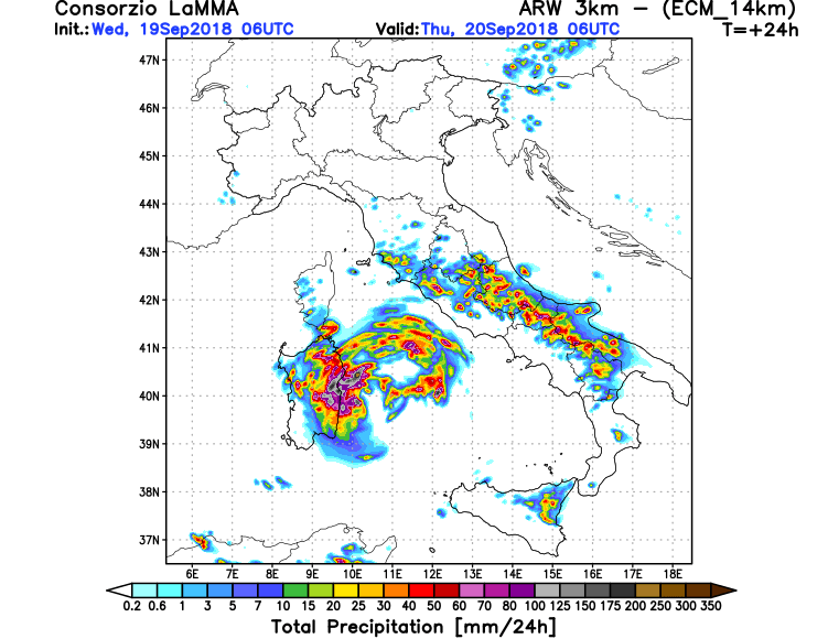
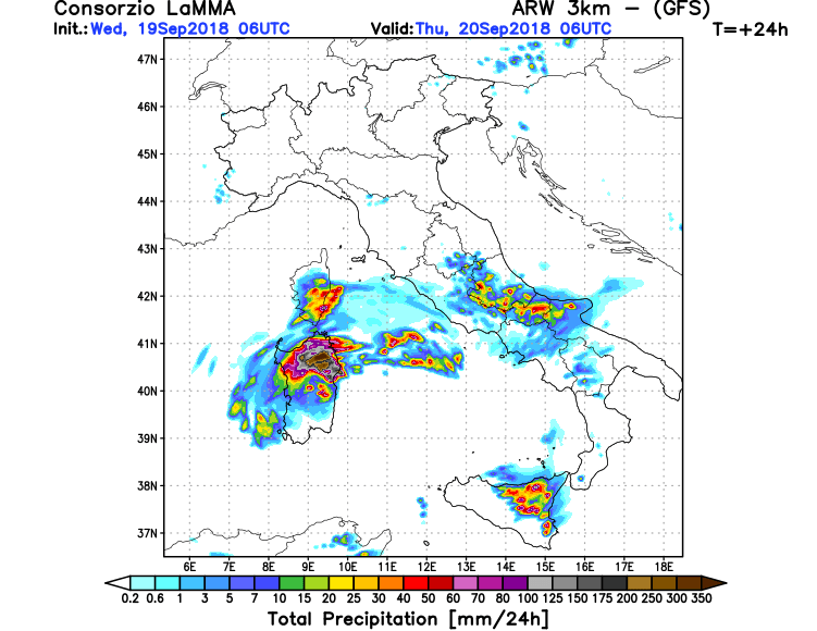
The Medicane will produce prolonged intense convective rainfall over parts of the Tyrrhenian sea. The exact rainfall distribution depends on the exact position, track and strength of the system, however, models are in good agreement for the highest cumulatives over the western Tyrrhenian sea, east of Sardinia and southern Corsica. Additionally, strong orographic rainfall is also registering on models: southerly winds along the coast of Sicily and in particular easterly winds along the coast of Sardinia and southern Corsica will advect very warm and moist air along the elevated terrain on the coast and produce additional orographic rainfall. In total, up to 200-300 mm of rainfall appears likely over parts of Sardinia and locally over 100 mm in Sicily and Corsica in the next 48-72 hours. Expect local flooding. In particular, areas where torrential convective rainfall will be enhanced by orographic forcing, very large amounts of rain may fall in short time periods, strongly increasing flash flooding threat.
Total rainfall over the region by Saturday morning. WRF model guidance. Map: Meteonetwork.it
Total rainfall over the region by Saturday morning, 24h totals. HRRR model guidance. Map: Youmeteo.it.
Total rainfall over the region by Saturday morning. WRF-NMM model guidance. Map: Meteociel.fr
Total rainfall over the region by early on Friday. WRF model guidance. Map: Modellzentrale.de
Total rainfall over the region by Saturday morning. ICON-EU model guidance. Map: wxcharts.eu
Total rainfall over the region by Saturday morning. GFS model guidance. Map: wxcharts.eu
Total rainfall over the region by Saturday morning. HIRLAM model guidance. Map: wxcharts.eu
Total rainfall over the region over the next 24 hours. WRF ARW-GFS/ECM and MOLOCH-GFS/ECM. Map: Consorzio LaMMA.
In regions where persistent torrential rainfall occurs, particularly where short, very intense downpours happen, will have strongly increased flash flood threat. This is a potentially dangerous situation in mountainous areas and (upwind) coastal areas of Sardinia in particular and also parts of Corsica and southern Italy. We will be providing further updates on the evolution of this system and the consequent flood threat, stay tuned.
