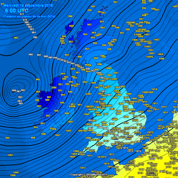
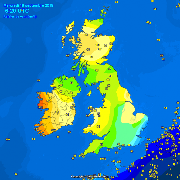
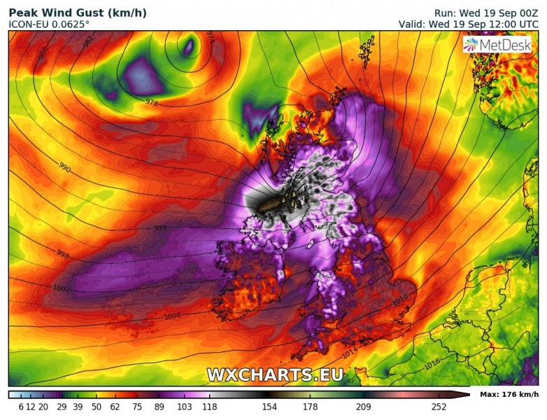
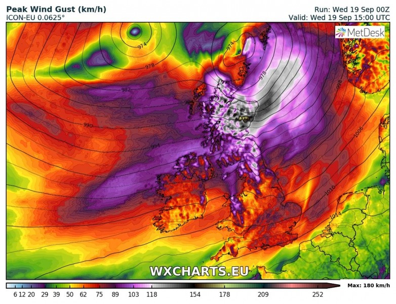
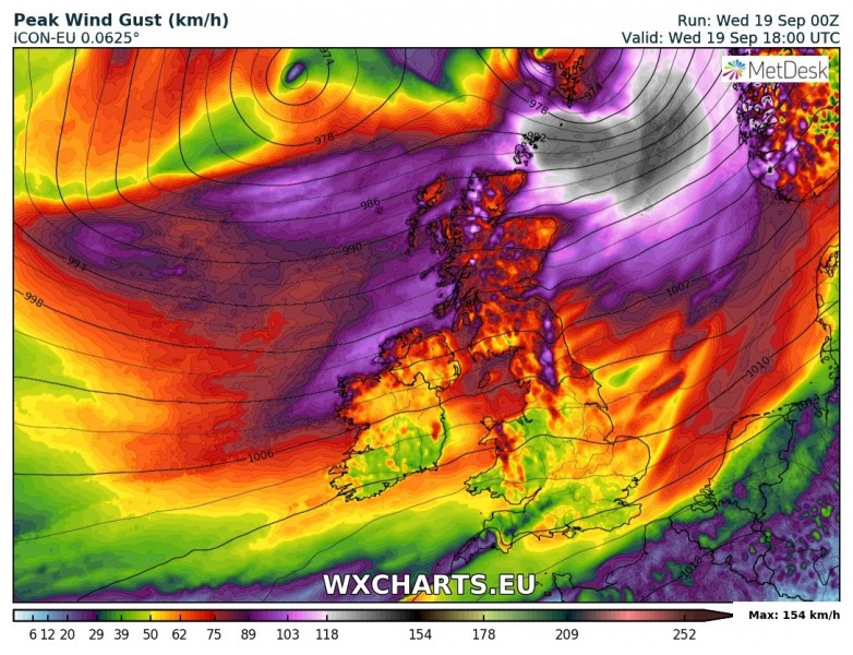
The deep cyclone ‘Ali’ is nearing western and northwestern Ireland this morning. Its central pressure is around 980 mbar. It is developing a large wind field of severe wind gusts, which is pushing towards northern Ireland. Peak gusts up to around 110 km/h are already being reported from western Ireland and much higher gusts are expected through the rest of the morning. Severe wind threat then shifts into south-central Scotland in the afternoon hours.
Morning (7 am local time) analysis of mean sea level pressure and peak gusts for the western Europe reveals a deep cyclone just west of Ireland, moving towards the northeast. Tightening pressure gradient suggests the region is in for a very windy morning before cyclone moves towards Scotland. Gust up to 108-112 km/h were already reported from west Ireland (Mace Head, Belmullet), as well as up to 104 km/h along the coast of SW Ireland in Cork/Kerry region (Valentia Observatory).
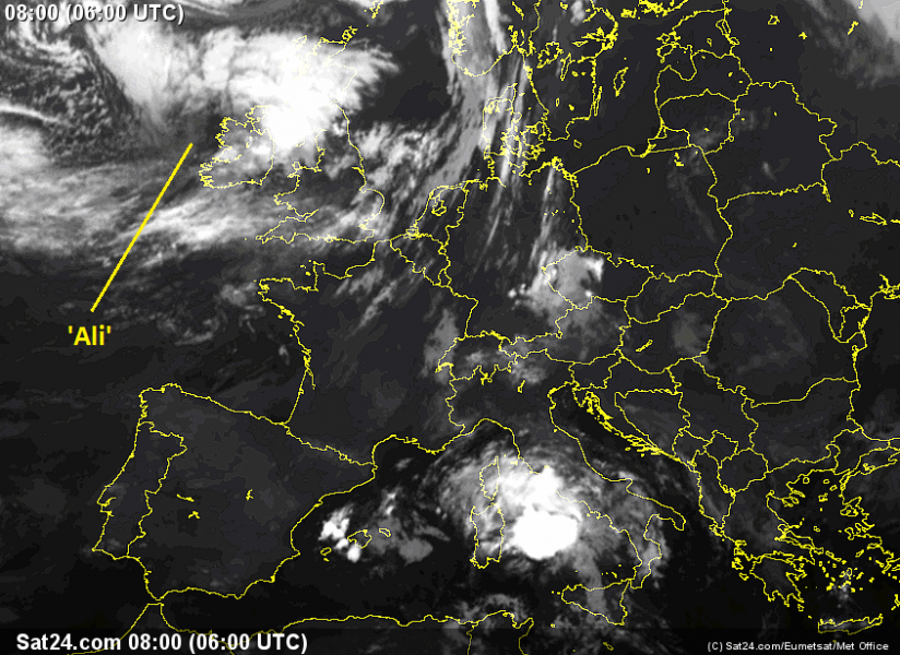
Infrared satellite image this morning at 06 UTC (7 am local time) reveals quite an impressive structure of the developing cyclone. A well-defined core with much drier airmass (dry intrusion) is pushing just south of the cyclone’s center. This is the area where the strongest gusts are occurring.
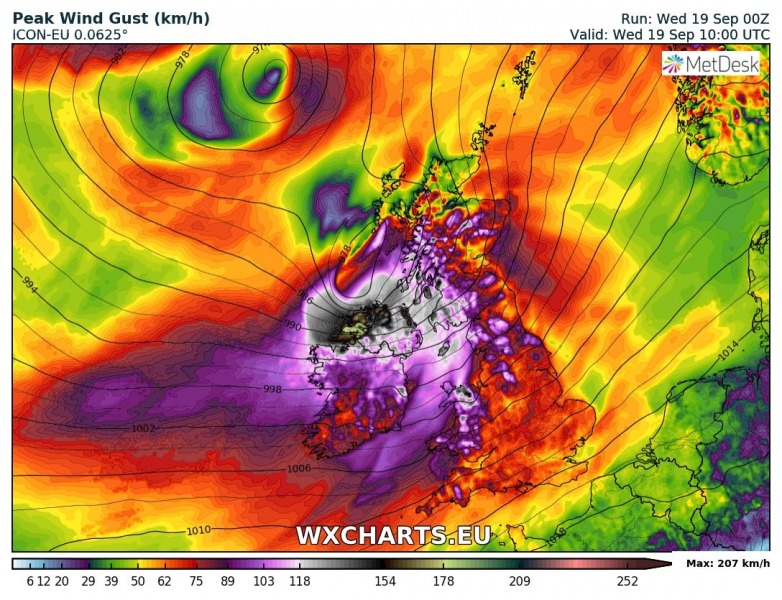
Latest ICON-EU model (00 UTC run today) sequence regarding the evolution of this powerful windstorm affecting Ireland and Scotland today: peak gusts could locally well exceed 150-160 km/h! Even much higher (closer to 200 km/h) in the mountains terrain of Cairngorms National Park.
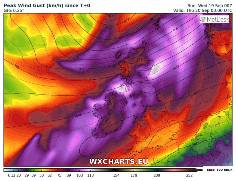
GFS model (00 UTC run today) peak gusts swath until this evening. The highest gusts should affect Ireland, northern England, south-central Scotland and North sea towards SW Norway as well. The global model usually underestimates the peak gusts due to poor resolution, ignoring local complex topography.
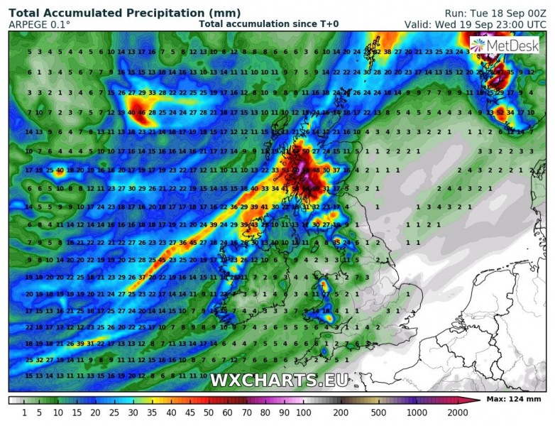
An additional threat with this cyclone will be excessive rainfall, especially over Scotland where persisting SW flow could locally bring more than 100 mm of rainfall today. Besides this, heavy rain squalls could occur during the frontal passage as well.
Stay alert for dangerous weather conditions and stay tuned for further updates later today!
