Models are now in even better agreement regarding a significant Arctic cold outbreak into Europe next week. Updated guidance suggests much colder airmass will spread into east-central Europe, but also into western Europe!
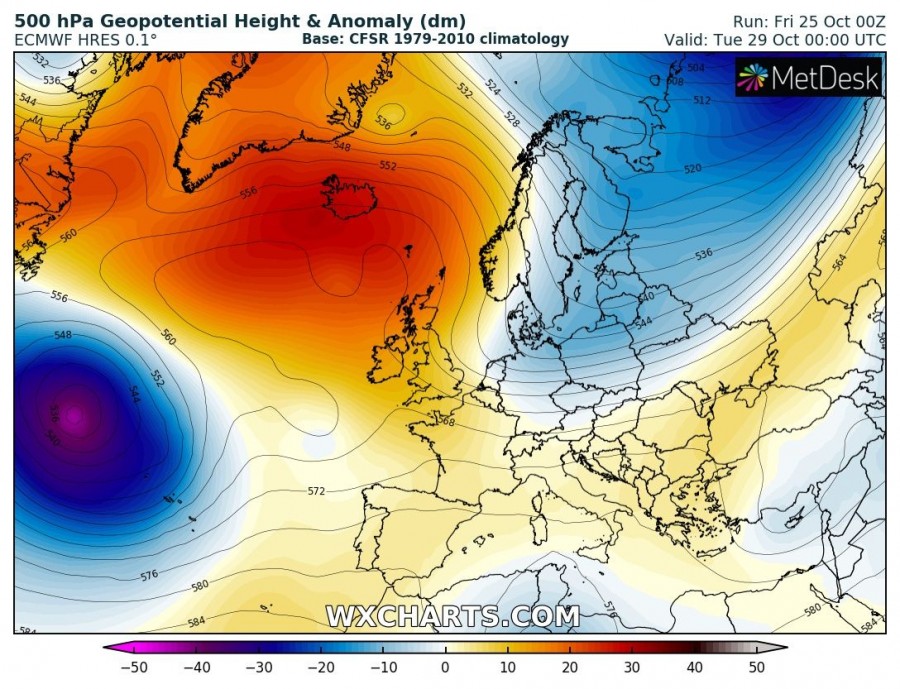
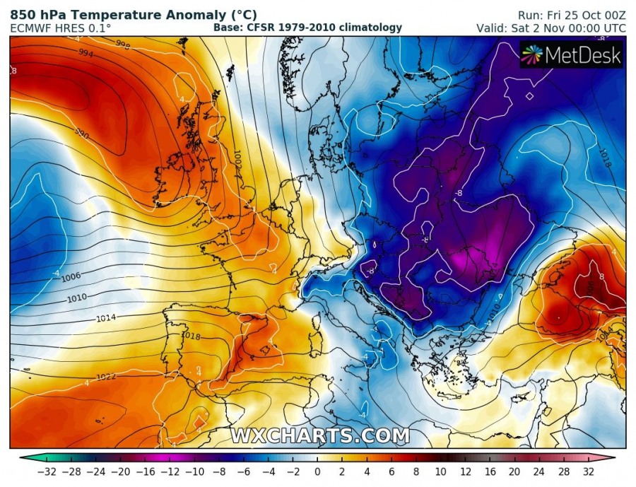
A classic textbook pattern for an Arctic cold blast develops across Europe by the end of October as powerful upper-ridge takes place over the N Atlantic and Greenland while a deep trough establishes across Russia and eastern Europe. This results in a strong meridional flow in between, delivering Arctic cold airmass far deep south towards central Europe, the Balkans and N Mediterranean.
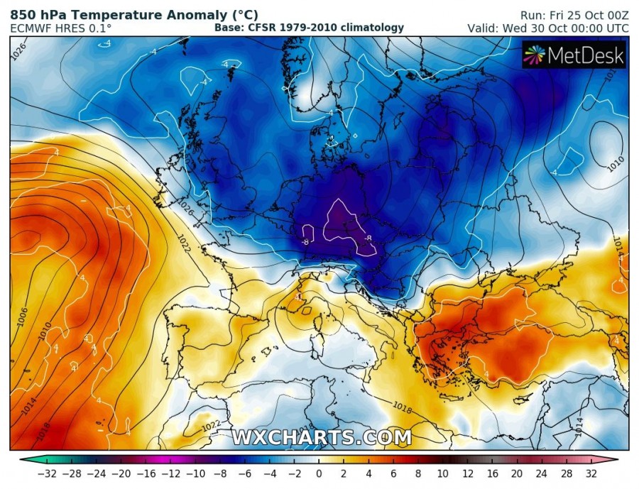
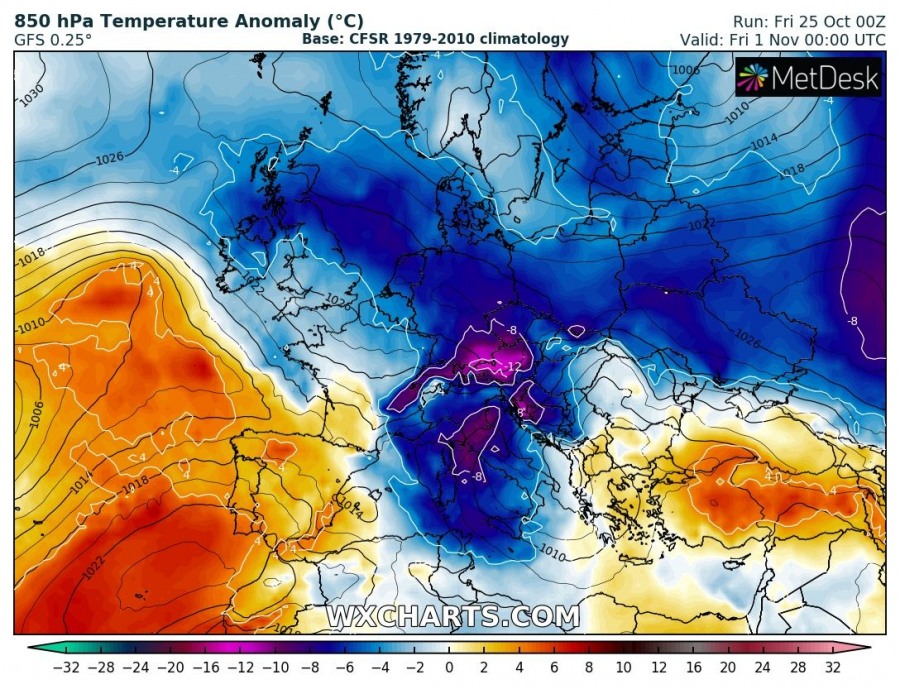
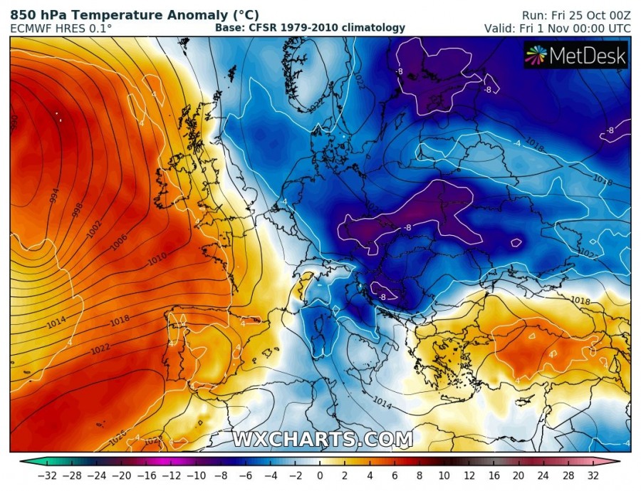
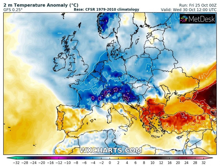
A day-by-day comparison of global models, GFS and ECMWF from Oct 30th until Nov 2nd. Both models are in very good agreement regarding the intensity and also regional effects. The cold airmass oubreak is now expected to spread across large part of Europe, including British Isles and France – previous simulations were pushing the cold blast more into east-central Europe only.
Wednesday, Oct 30th
Thursday, Oct 31st
Friday, Nov 1st
Saturday, Nov 2nd
Looking over the 2m temperature anomaly we can see the cold airmass will spread far south towards the Mediterranean as well. A cold period is expected to persist across the western, central and eastern Europe for several days.
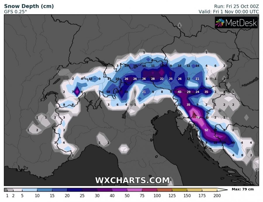
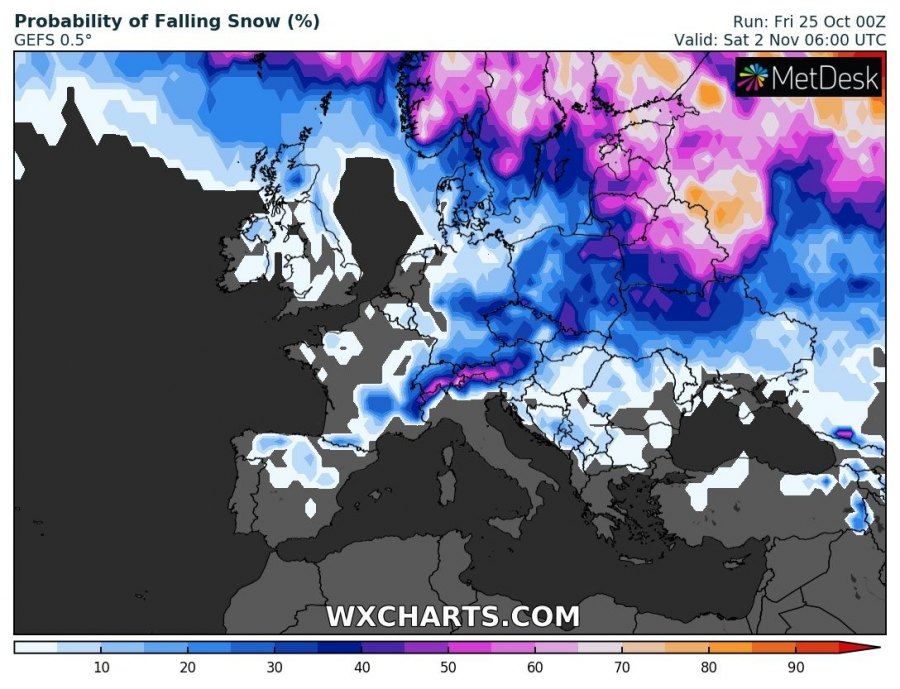
When the main cold front pushes into the Alpine region, snowfall will develop as well. While the snowfall amount details are still rather uncertain, some model runs have been impressive so far – possibly bringing quite a good amount of fresh snow into the Alpine region and NW Balkans with the most optimistic scenarios. However, trends on the snow amounts across Europe will be monitored further and we will keep you updated in the coming days!
Stay tuned for the follow-up updates until the Arctic outbreak unfolds!
Previous discussion on the Arctic outbreak:
See also – the pattern shift across the N hemisphere:
