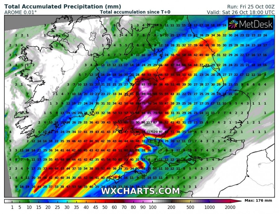
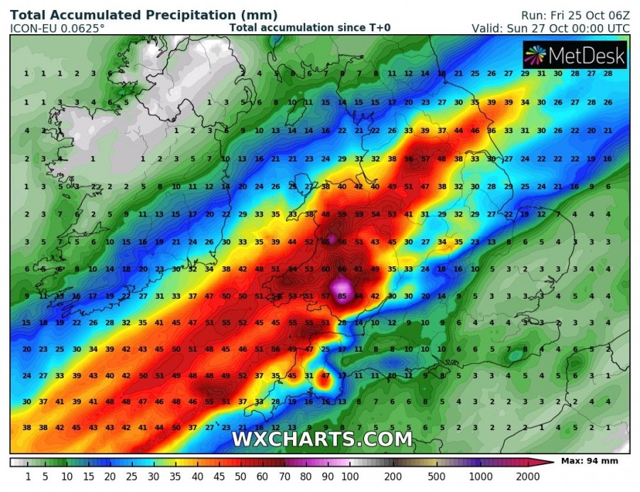
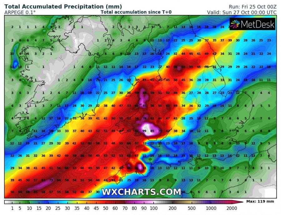
A rapidly northeastwards moving surface cyclone along the baroclinic zone will develop an excessive rainfall threat across SW UK, precisely across WSW England and especially across Wales. Models are in fairly good agreement up to 100-150 mm of rainfall should accumulate by tomorrow evening, Saturday, Oct 26th.
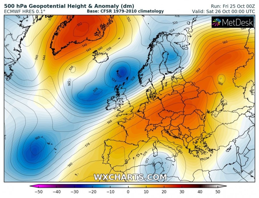
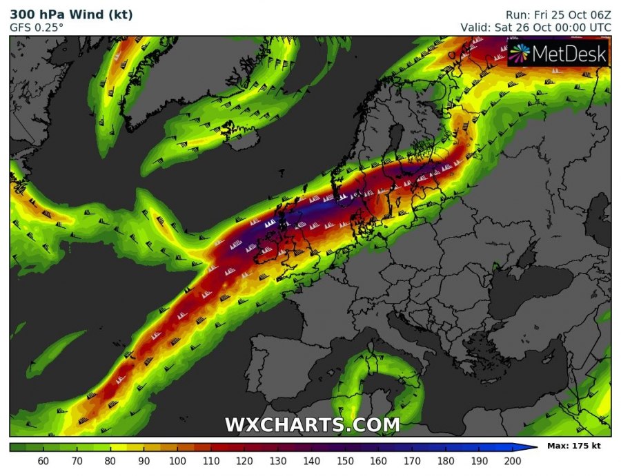
A powerful jet stream between the long-wave trough over NW Europe and ridge across east-central Europe will bring a short-wave across S UK and North Sea tonight, with a surface low rapidly moving towards the northeast.
Rainfall totals based on ARPEGE, ICON-EU and AROME models indicate 100 to more than 150 mm of rainfall will be possible within the next 36 hours, especially across Wales. Persisting strong southwest winds should develop heavy orographic rainfall. Such amount in a relatively short period of time should strongly enhance local flooding.
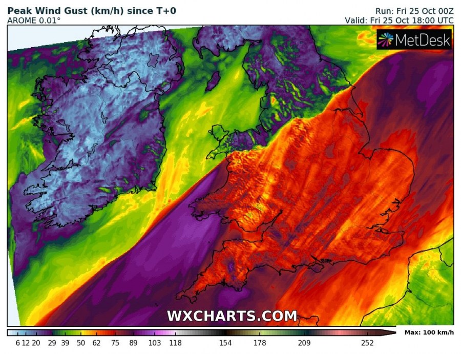
Besides the excessive rainfall threat, severe winds are likely across SW England and Wales, associated with the cyclone passage. Peak gusts could exceed 100 km/h in some areas.
See also the overall pattern update across the western Europe and S Scandinavia tonight:
