Another round of severe thunderstorms will affect E France, BeNeLux and W Germany today. Severe thunderstorms with large to very large hail, severe straight line winds and torrential rainfall are expected. Tornado threat is somewhat elevated as well.
Severe Weather Outlook:
A broad low is positioned over western Europe, producing successive long wave troughs. A new trough pushes across the Iberian peninsula and France today, producing a new round of severe thunderstorms. The trough is rounded by a 60 kt mid-level (500 mbar) jetstreak, producing northerly mid-level flow over the region.
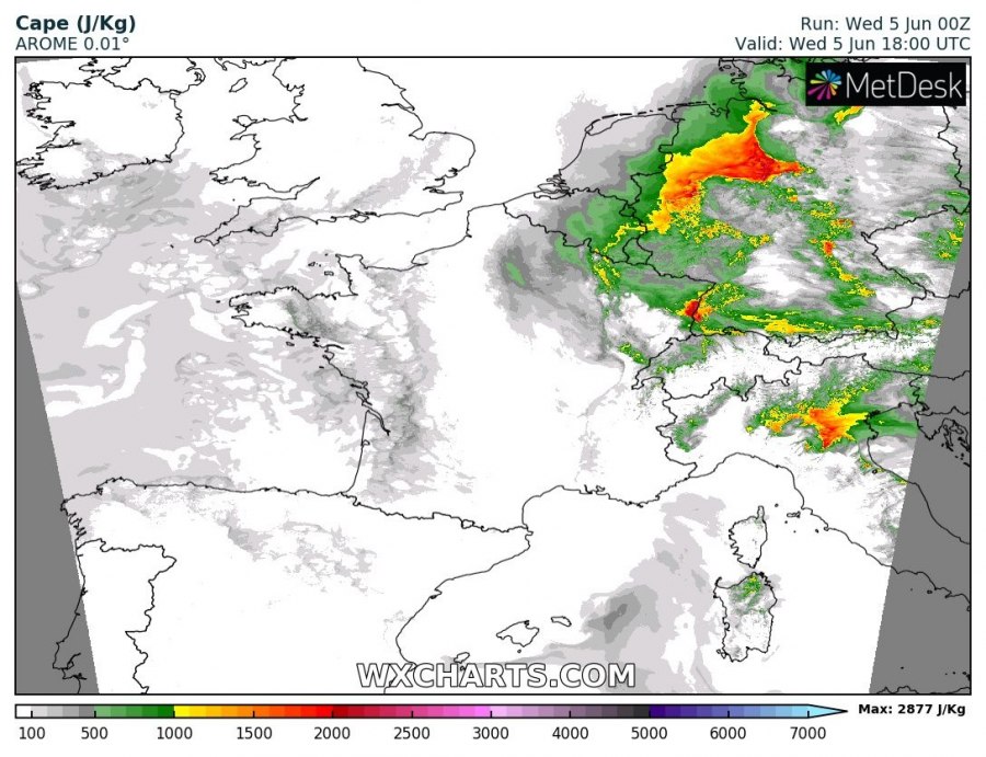
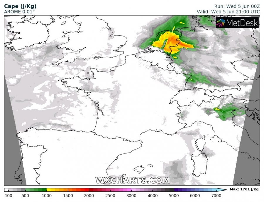
A surface low will develop over E-CNTRL France by late morning, pushing northwards towards Belgium in the afternoon and evening hours. Backing easterly winds will advect warm, unstable airmass with up to 1500-2500 J/kg MLCAPE. The 10 kt easterly surface flow will combine with the northerly mid-level flow into a strongly sheared environment, with up to 50-70 kt deep-layer shear (!!). Notably, at 700 mbar level, up to 40-60 kt southerly to southeasterly flow will be present. Impressive veering vertical wind profiles will be present in the warm sector of the surface low, again producing SREH3 values in 200-300 m2/s2 range.
Instability (MLCAPE) across the region. AROME model guidance. Map: Wxcharts.
The environment will be supportive for organized severe thunderstorms. Expect storm initiation along the cold front, the triple point and sporadically in the warm sector with first storms initiating in mid to late afternoon in W Switzerland and E France. Storm coverage will gradually increase as the initially isolated / discrete thunderstorms move northwards and merge into a MCS/squall line. Expect bowing segments to form within the MCS as it moves towards and across BeNeLux and western Germany.
Main threats with initially isolated/discrete storms (mostly supercells) will be severe straight line winds and large to very large hail (>5 cm hail possible) and to a lesser extent torrential rainfall. Favourable easterly surface flow will enhance 0-1km helicity, however, tornado threat may be limited due to comparatively high LCLs (generally >1000 m). As storms merge into the MCS the main threat will be torrential rainfall and severe straight line winds.
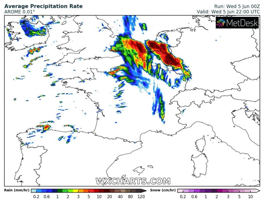
Simulated average precipitation rate across the region. AROME model guidance. Map: Wxcharts.
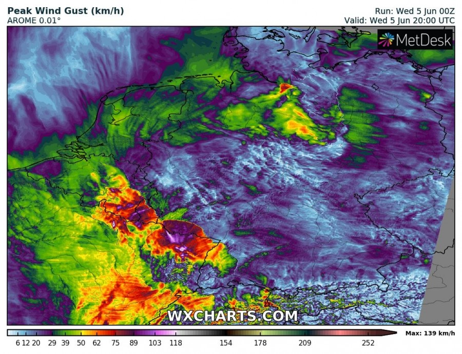
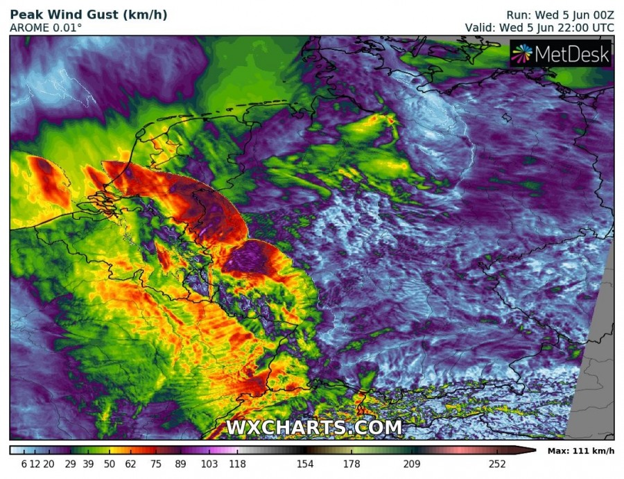
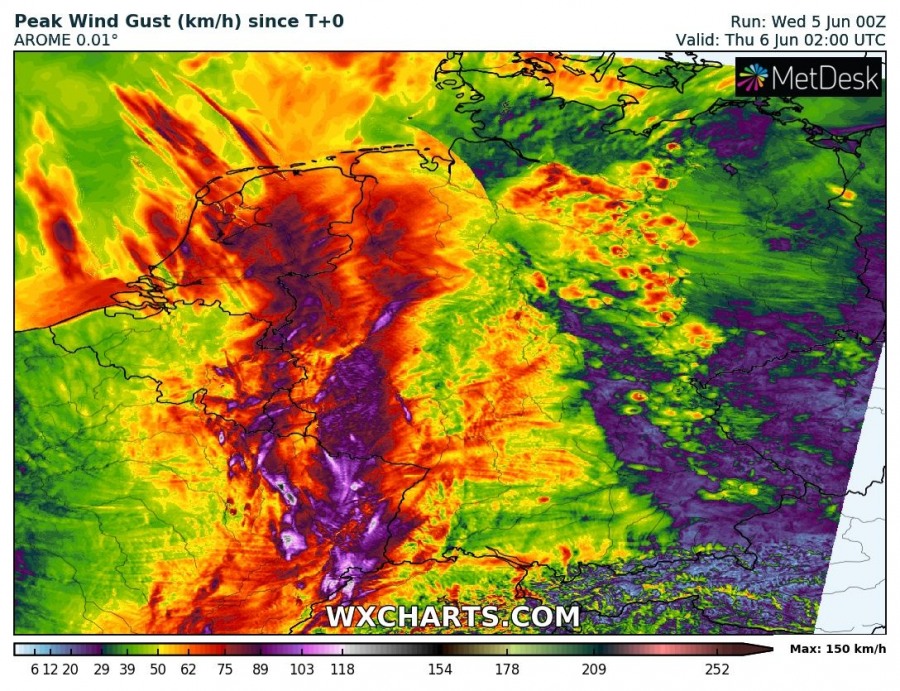
Peak wind gusts across the region through early on Wednesday. AROME model guidance. Map: Wxcharts.
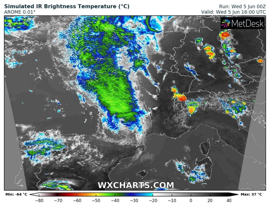
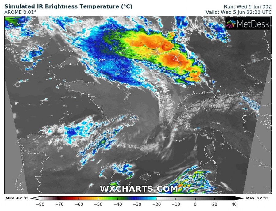
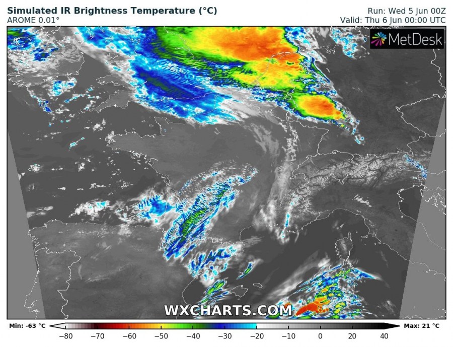
Simulated IR brightness across the region (showing anvils and overshooting tops). AROME model guidance. Map: Wxcharts.
