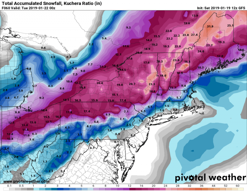
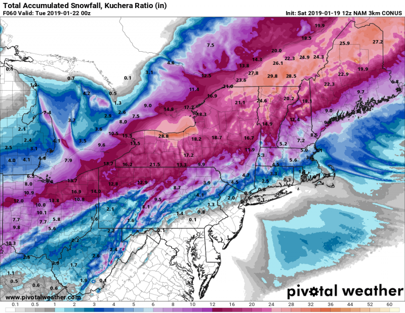
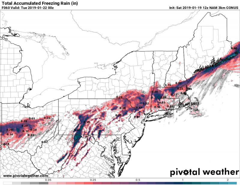
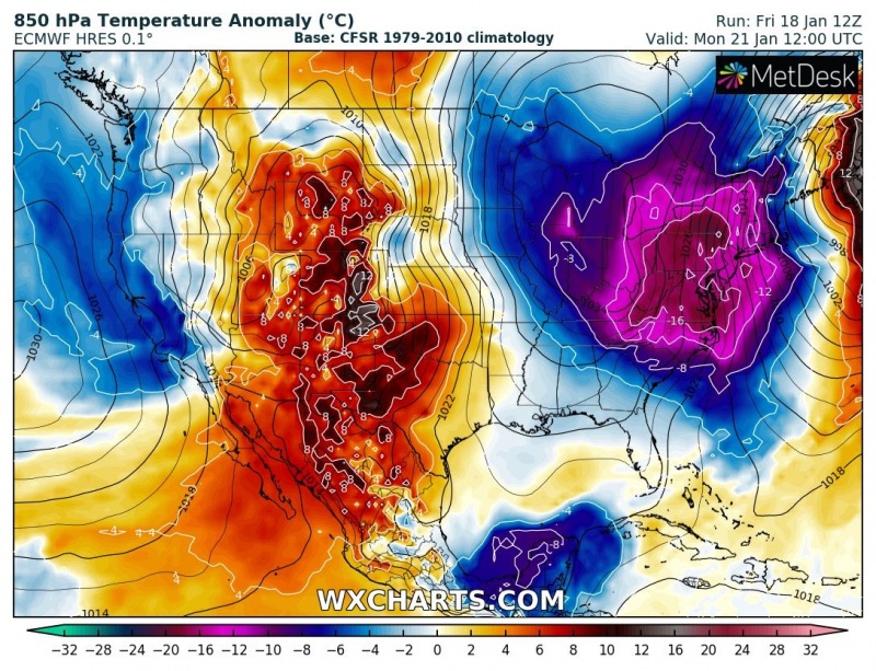
The first seriuos winter storm of the year Harper – a Northeaster’, will hit parts of Midwest and northeast US this weekend, Sunday January 20th. A swath of 15-25″ (40-60 cm) of snow is expected along the cyclone’s track, combined with intense blizzard and also some freezing rain near the front. Very cold airmass behind the system will then push across the East coast and Northeast US on Monday.
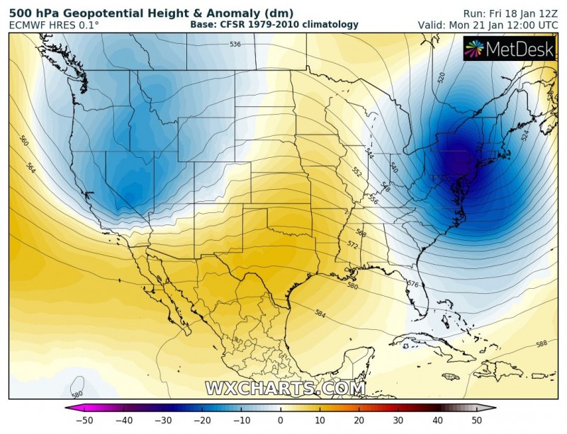
500 mbar height anomaly and surface pressure anomaly maps are indicating a deep trough will push across the East coast and results in a classic, but powerful northeaster’ storm – Harper.
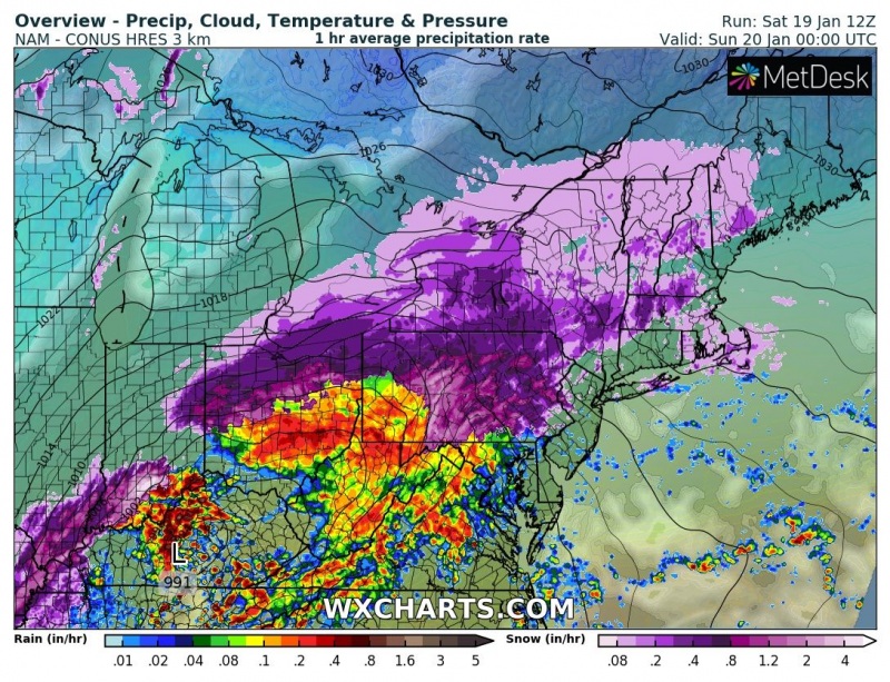
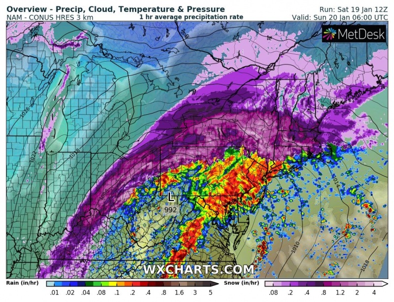
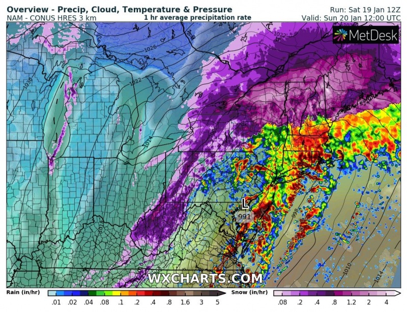
The event starts when the cyclone deepens over the state of Kentucky tonight around 00 UTC (local evening) and rapidly moves towards the northeast overnight and tomorrow, reaching the East coast and ejecting into the Atlantic ocean near Rhode Island around Sunday 18 UTC (local midday). Maps perfectly reveal where the intense rainfall and snowfall will be ongoing, a very sharp contrast is indicated along the frontal boundary.
Total snowfall accumulation based on GFS and NAM models – some areas across the Midwest and northeast US will likely receive 15-25 inches of snow (40-60 cm) in 36 hours period. Additional threat with the intense snowfall will be strong north/northwesterly winds on the back side of this deep cyclone, resulting in intense blizzard conditions, huge snow drifts and whiteout conditions. Expect numerous road blocks and extremely dangerous conditions in places.
A narrow corridor near the surface front will also be favorable for freezing rain and black ice formation, where surface temperatures will remain below zero, but strong warm advection in the mid levels will produce rainfall. These areas are across parts of Ohio, Pennsylvania, New York, Massachusetts, New Hampshire and Maine – up to 1-1.5 inches (2-4 cm) of ice can acumualate in some areas before cold advection develops snowfall conditions behind the front. Then, intense blizzard conditions will develop there too.
A very intense cold wave will push behind the cyclone, directly from the Arctic region and 850 mbar temperatures will be more than 15 °C lower than normal across the East coast and northeast US on Monday, Jan 21st.
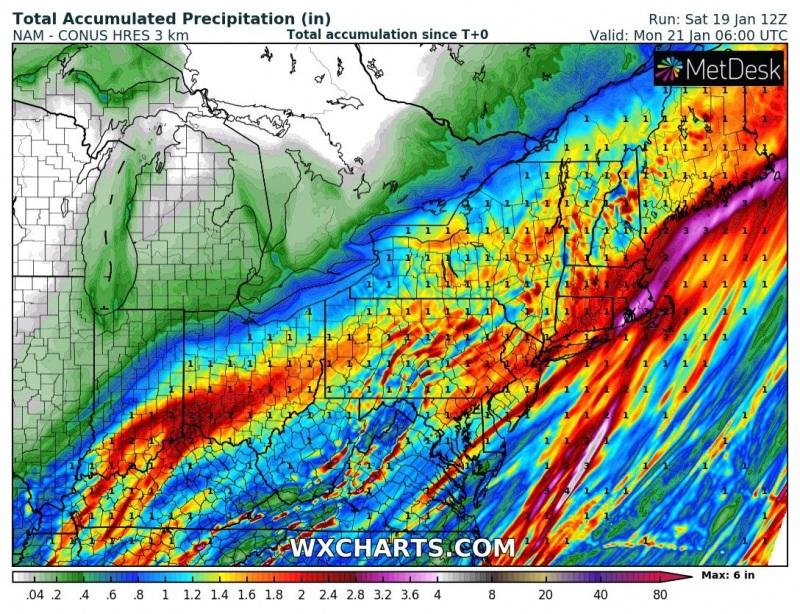
Total accumulated ranfall associated with this deep cyclone should bring 3-6 inches (70-150 mm) locally, especially across south Ohio, Rhode Island, Massachusetts and Maine coast. A combination of excessive rainfall and strong southerly winds on the front side of the storm should also enhance threat for coastal flooding along the Massachusetts coast.
Stay alert for dangerous whiteout conditions locally and very low windchill temperatures behind the front once the snowfall diminishes towards Monday.
See also: an intense cold outbreak is also expected across Europe while extreme heat wave continues across large part of Australia:
https://www.severe-weather.eu/mcd/a-very-significant-trough-with-a-deep-cyclone-will-bring-severe-weather-into-south-central-europe-next-week-jan-21-26th/
https://www.severe-weather.eu/mcd/extreme-heat-across-parts-of-australia-will-continue-and-even-intensify-through-the-next-4-6-days-jan-20-26th/
Last copies of our calendars are available – you can get your copy here:
https://www.severe-weather.eu/calendar-2019/
