January 2025 is about to start, and the latest forecasts show an unusually cold month developing over the United States. At the beginning of the month, the weather patterns will rapidly change, setting up a longer-lasting northerly flow, also known as the “Polar Express”. It will bring cold and snow at least into the middle of the month, with the latest trends extending the proper winter weather even further.
There are various factors behind these large-scale pattern changes. As you will see, the main feature will be a high-pressure area over the Arctic, opening the floodgates of cold air directly into the United States and Canada.
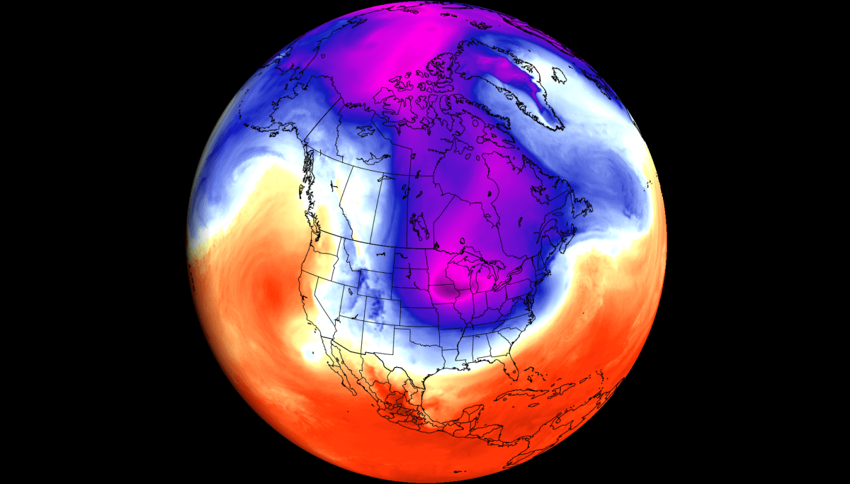
Below is an example of the airmass movement for the second week of January. It shows a strong displacement of very cold air over the United States, with the potential to bring the coldest temperatures in the past years or even decades and several snowfall events into the whole northern and eastern half of the United States.
NEW WINTER MONTH BRINGS NEW COLD
January is forecast to start with a pressure pattern change. Below is the pressure forecast for the first days of the month, which shows the high-pressure blocking anomaly rising towards the far north. Under the blocking, there is a low-pressure area moving across the northern, central, and eastern United States, extending the jet stream into a more northerly flow.
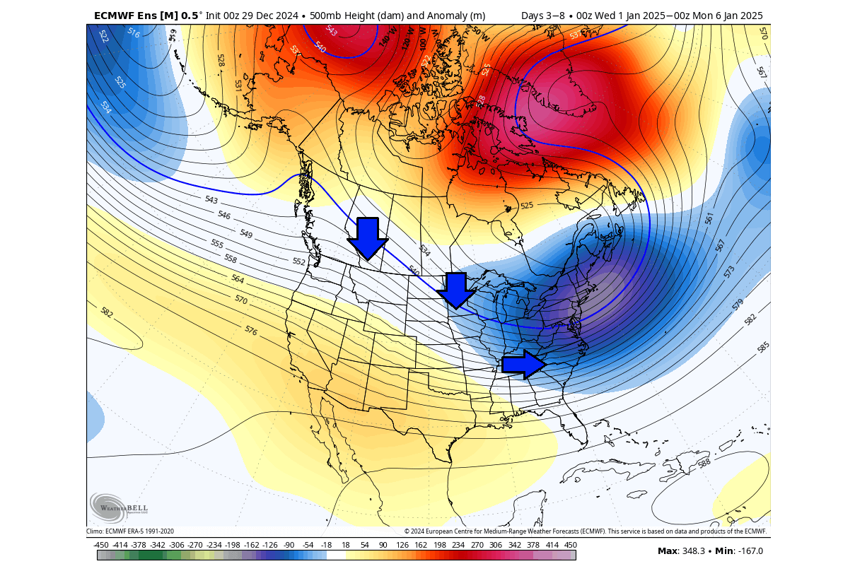
You can see the jet stream in the forecast image below for later next week. As the low-pressure area spins counter-clockwise, that creates a northerly flow across the United States when the low is over the eastern United States or eastern Canada.
This northerly flow can be seen below in the temperature forecast for Friday, January 3d. The main course region of the cold air will be over western Canada. With the low-pressure anomalies over the east starting to intensify, the northerly flow will get stronger, bringing ever colder air into a large part of the United States and western Canada.

The pilling up of the cold air is even better seen in the forecast for the end of this week. An unusually cold airmass will spread from western Canada into the central and eastern United States. This will unfold as the northerly airflow will strengthen all the way down from far northern Canada with the large-scale pressure changes.
Forecast images in this article were provided by WeatherBell, using a professional/commercial user license.
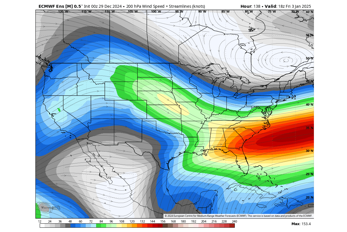
The temperature patterns directly correspond to the movement of the pressure systems. These pairs of pressure systems are also known as Rossby Waves. You can see an example of Rossby waves in the image below by NOAA and how they are all connected and function with the jet stream.
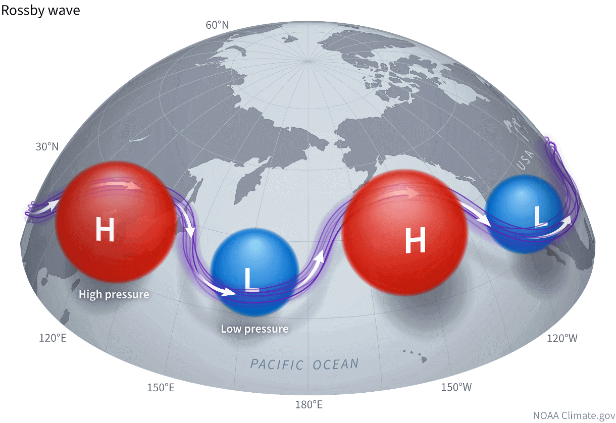
The purple line connecting these pressure systems is called the jet stream. This rapid stream of air is found around 9 to 14 kilometers (6 to 9 miles) above sea level.
This is even better seen in the high-resolution video animation below, which shows the flow and movement of the jet stream across North America. It was developed by the NASA/Goddard Space Flight Center Scientific Visualization Studio.
The first week of January will already bring widespread snowfall to the whole northern United States, down into the central plains and the northeast. Snowfall potential will also be high at this time over central and eastern Canada.

But as the current forecasts suggest, the first week of 2025 will be just the start of the cold winter period. Stronger and more widespread cold will arrive in the second week of January.
A COLD AIR ADVANCE
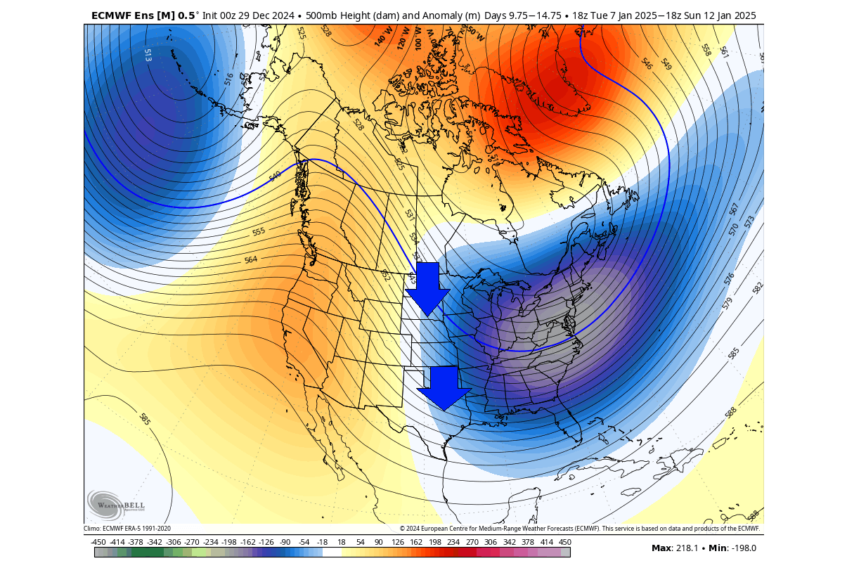
Looking into the second week of January, things are expected to ramp up. Below is the pressure forecast, and it shows a deep and broad low-pressure area over the eastern United States. That will enable a strong northerly flow across the central and especially the eastern United States, pulling the cold air down directly from the Arctic.
We can see that if we look at the temperature at the 850mb level (1500m/5000ft). This way, we can understand the overall airmass movement. You can see that most of North America will be under a very cold airmass in the 2nd week of January. This airmass will be sourced from the far north and pushed directly into the central and eastern United States, hence the name “Polar Express”.
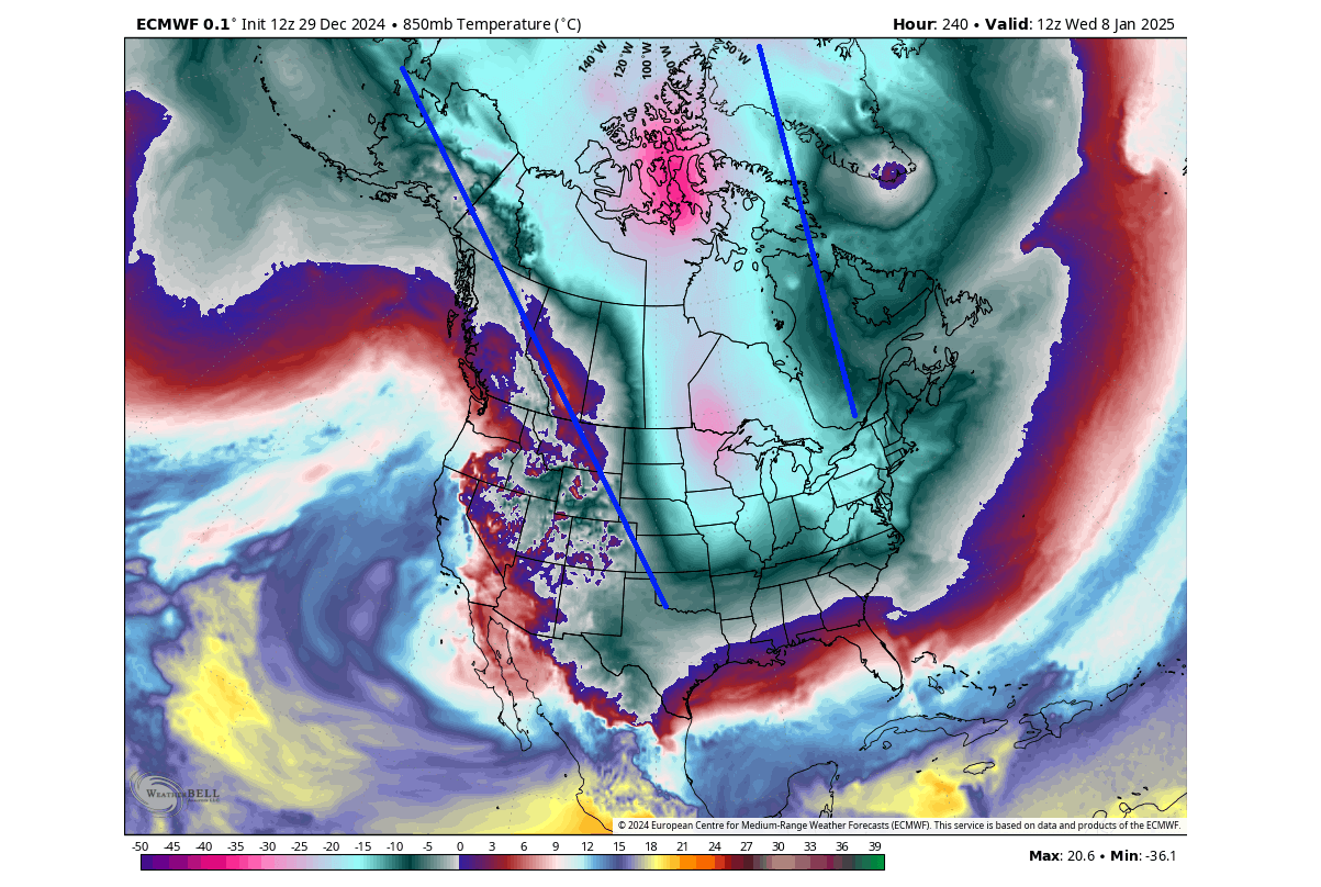
But just like water spills on the table, the cold air also spills further around the surface, covering the southern United States, the East Coast, and further out over the Atlantic. The exception is the far western U.S., where the Rockies act like a barrier, and there is also the effect of the warm Pacific air along the west coast.
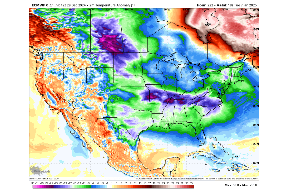
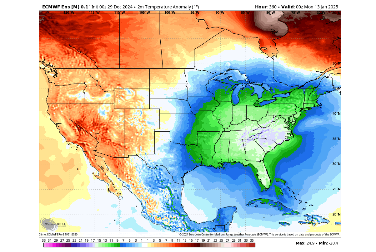
Below is the surface temperature anomaly for January 8th. You can see the full extent of the cold air event and how it is sourced far back to the north. Most of the central and eastern United States and Canada will be covered by the cold polar air mass in this event. This will be the first major cold of 2025 and also the strongest one of the winter season so far.

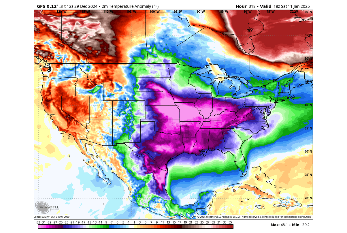
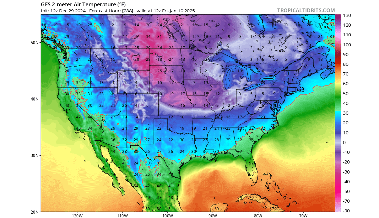
Below is a single-run forecast from the GFS model that shows one of the potential scenarios around January 10th. You can see a significant cold air anomaly across the central and eastern United States, with the potential for the strongest cold event in recent years or even decades.
Looking at some of the lowest temperature scenarios in this period, you can see almost all of the United States in near-or-below-freezing temperatures, except for California. A large part of the northern United States, central plains, the Midwest, and the Northeast can experience even sub-zero temperatures, which is a really significant cold event.
We can also look at some snowfall scenarios, with the snowfall forecast below for the 2nd week of January. You can see intense snowfall across the eastern half of the United States, with the potential for quite significant snowfall amounts.
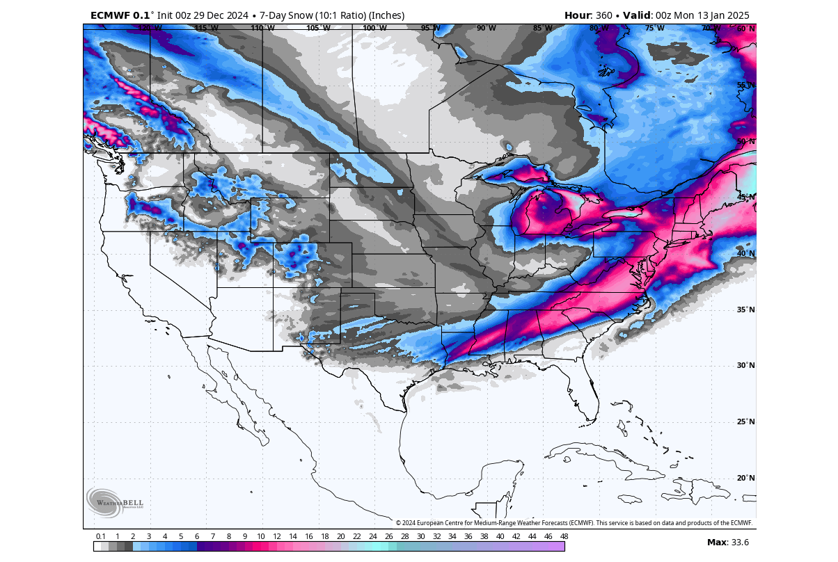
Of course, this is just a single model scenario, but we can look at these forecasts to evaluate the potential for cold and snow. All forecasts show high potential for a very strong winter episode in at least the first half of the month across the central and eastern United States.
Looking at the surface temperature anomaly for the end of week 2, you can still see a broad cold area covering the eastern half of the United States. Because the high-pressure blocking will persist over the northern regions, it will help to sustain a low-pressure anomaly over the eastern U.S., along with a colder airmass. But for how long will the cold persist?
Before we look into the trend for the rest of January, we have to look at what the trends looked like for the upcoming cold period. Below is the airmass temperature anomaly forecast for the 2nd week of January, which was issued on December 16th! So this image was a forecast almost one month into the future.
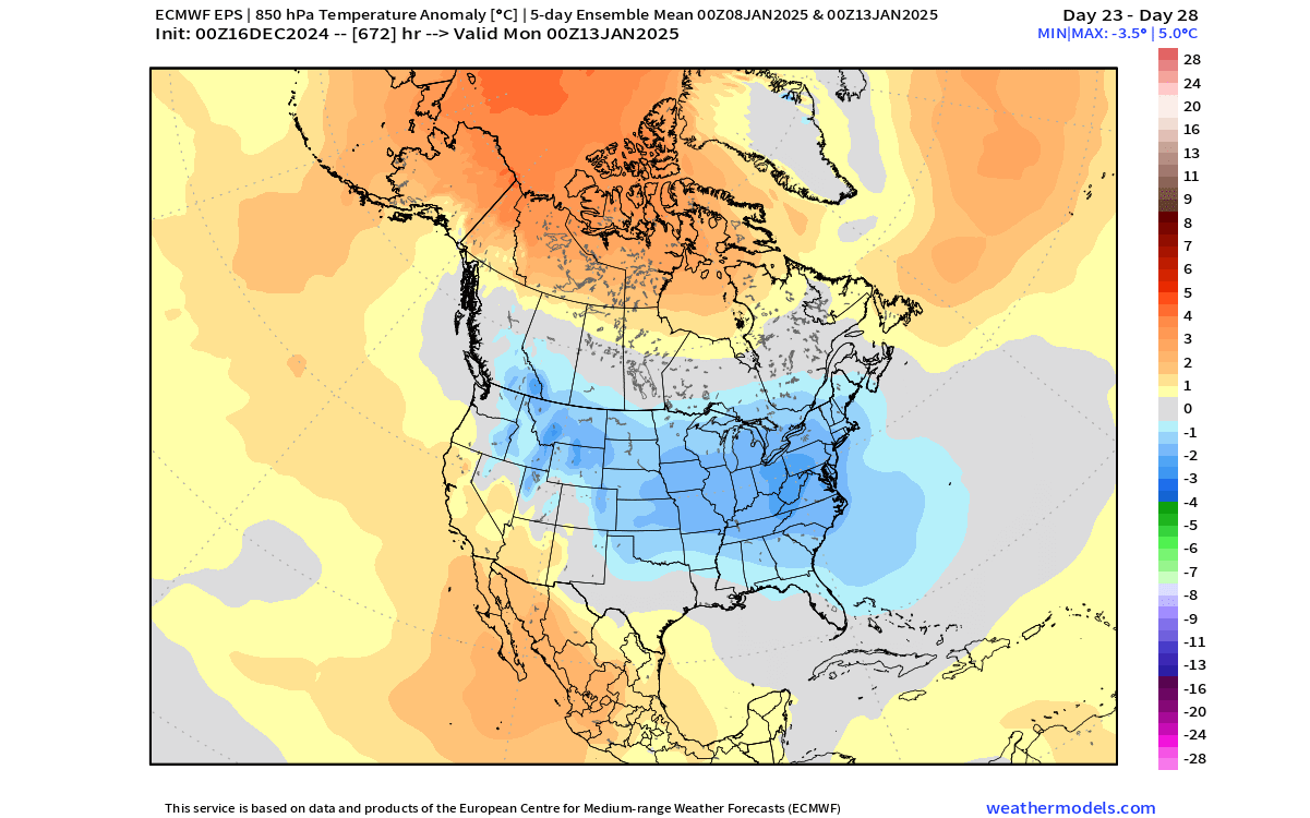
As you can see, the forecast trends already showed a broad cold air spread across the United States, almost a month into the future. This shows that despite the longer ranges, we can still use these forecasts as an indication of a trend (warmer/colder), and this season the extended-range forecasts were unusually good.
So now that we know the extended forecasts are useful indicators of what to expect, we can look deeper into the first month of 2025.
WINTER AT ITS PEAK
Looking at the extended-range forecast trend for the third week of January, you can see low-pressure areas persist over the eastern United States. This pattern continues to support a northerly flow into the central and eastern United States.
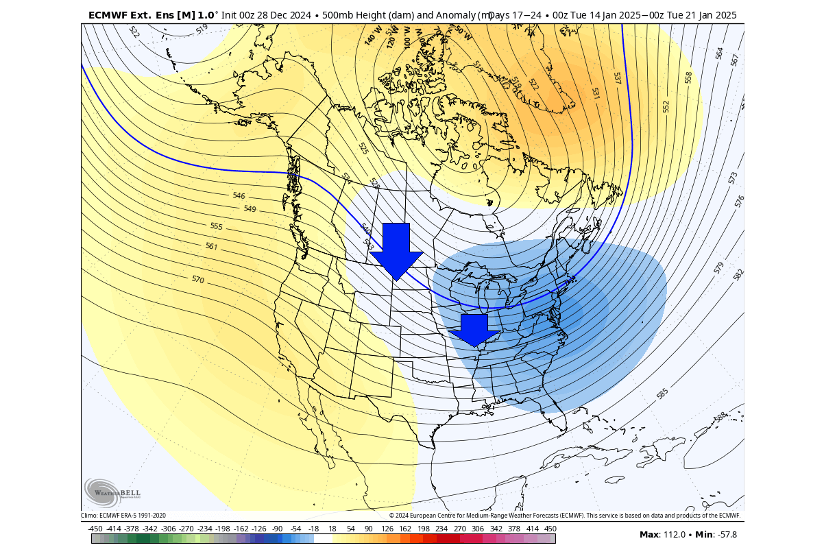
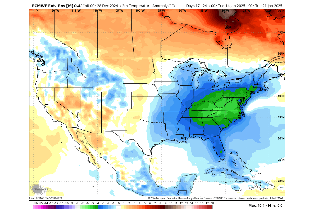
The temperature forecast trend shows a negative anomaly over the central and eastern United States. This anomaly is supported by the low-pressure area pattern, helping to sustain a northerly air flow into the United States. At the same time, you can see that warmer-than-normal temperatures continue over southern Canada.
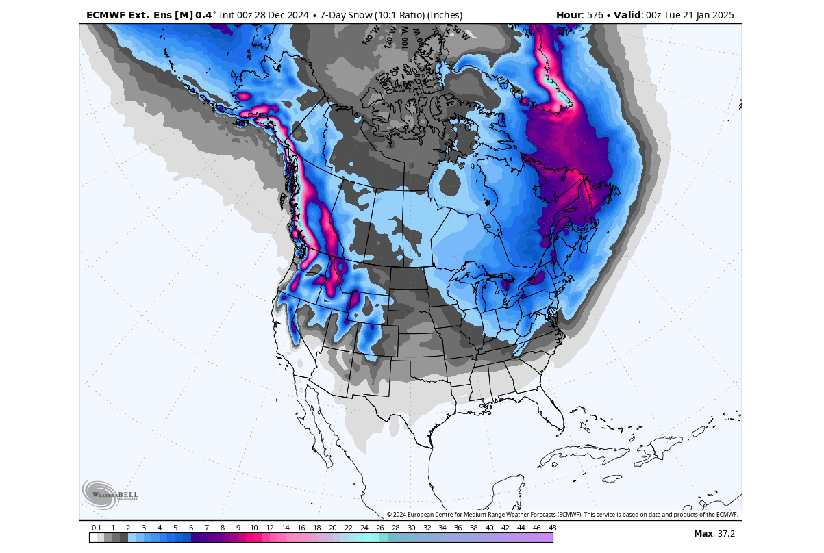
The snow forecast trend for week 3 shows snowfall over the western elevations of North America. You can also see some snowfall over the central and northern Plains. But more snowfall is indicated over the Midwest, the eastern United States, and the eastern half of Canada.
This pretty much confirms that the winter period over the United States is expected to last deep into January.
LATE MONTH, NEW PATTERNS
Looking at the final week of January, you can see the low-pressure area pulling back to the northwest. This still enables a northerly flow over the northwestern and northern United States. It depends on the pressure anomaly in the eastern U.S., but in these cases, as we transition into a new pattern, some of the cold air transport can still take place towards the east.
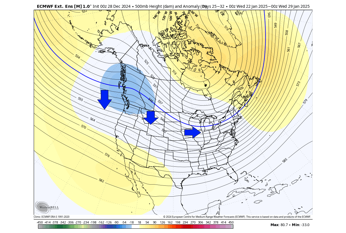
This is confirmed by the temperature forecast below. You can still see remaining cold air over the eastern United States and the Pacific Northwest. You can see a warm anomaly starting to climb over the plains. This would confirm that there is actually a second low-pressure area still present over the eastern U.S., just not seen in the pressure forecast due to its weak anomaly.
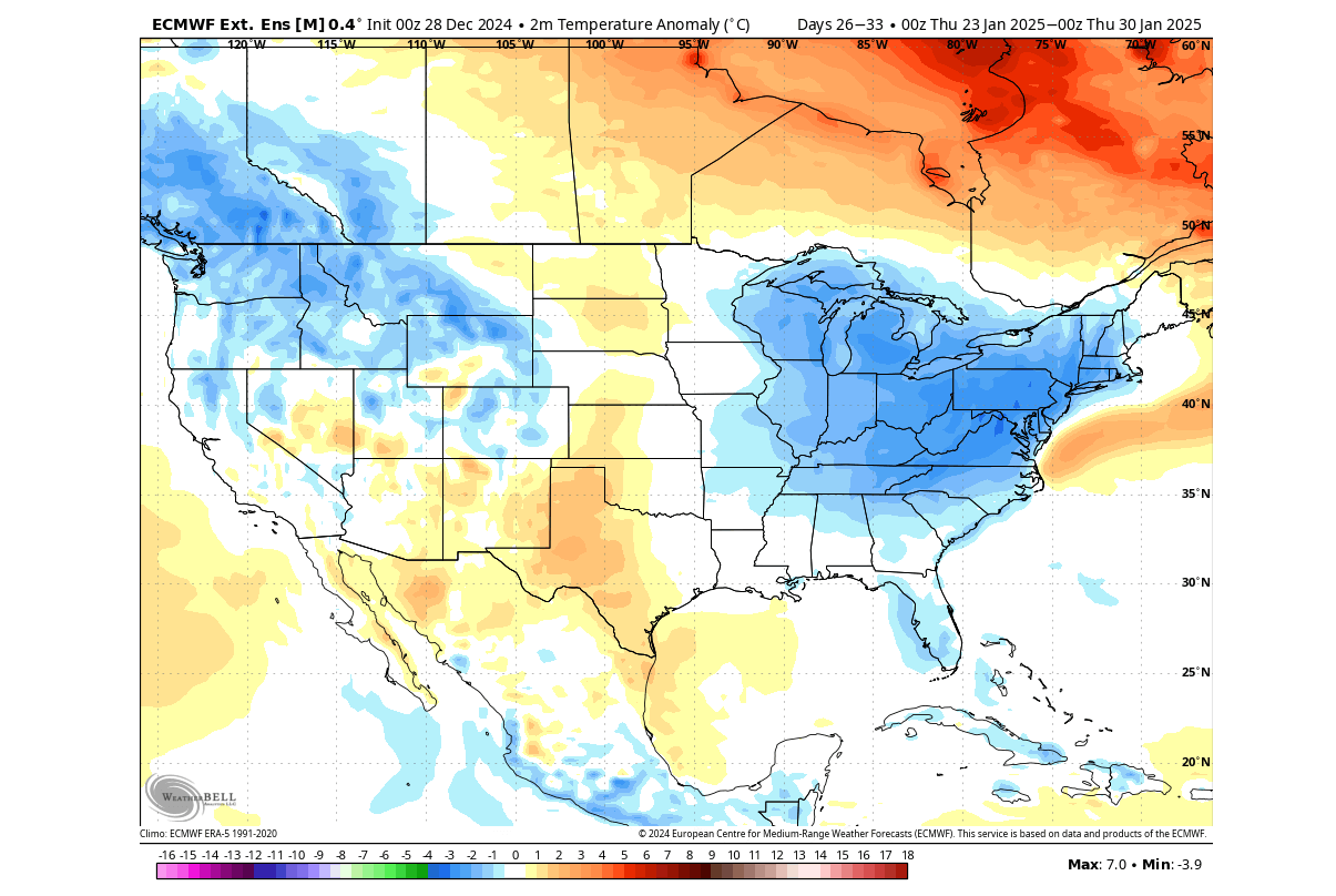
Once we go into week 4 of the forecast, it is advised to look at different forecast solutions, not just one. For this reason, we decided to also look at the GEFS extended ensemble forecast from the NCEP weather modeling and forecasting center.
This model also hints at the return of the low-pressure area back into the northwest. It also shows a ridge starting to return over the far eastern United States, which is different than the previous weather model above. Until the ridge is fully established, we can still see the cooler air over the eastern U.S. while it slowly moves out.

But the GEFS temperature forecast still shows a leftover cool anomaly over the east despite the high-pressure ridge starting to build over. This shows that the colder air will take some time to fully move out, and will need a proper pattern change to start shifting out.
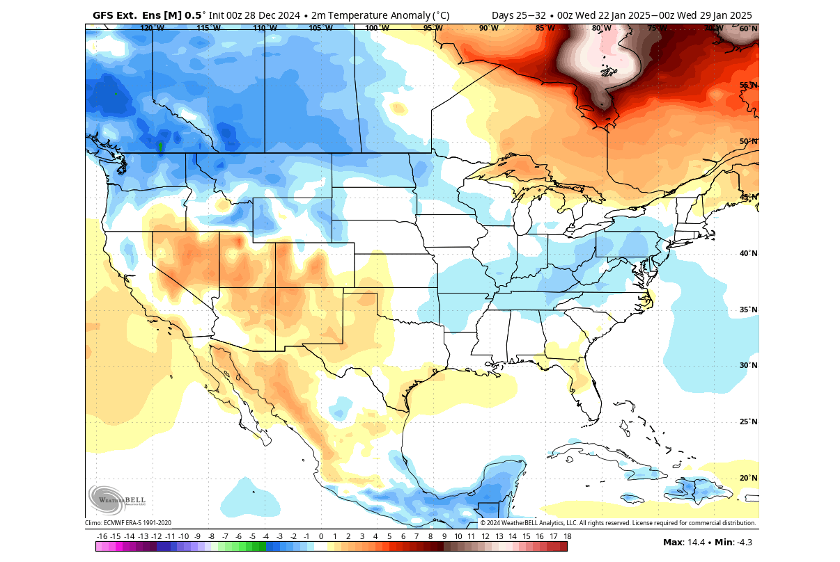
But this model has a limited range, and going further out does “water down” the signal, so we won’t use it beyond this point.
In this range, these are just current trends. And the real value of this forecast will be when we compare it next time with a fresh foreast. Then, we can compare the change in the development of this forecast and if the trends move perhaps towards a colder solution again or a warmer solution for certain parts of North America.
We will keep you updated on the developing weather trends in the coming weeks, so make sure to bookmark our page. Also, if you have seen this article in the Google App (Discover) feed, click the like and follow button there to see more of our forecasts and our latest articles on weather and nature in general.
Don’t miss: Polar Vortex 2025: How will the Polar Vortex movement intensify the January Cooldown over the United States?