A proper Winter period is forecast to arrive within the first days of the new year. Large-scale pressure changes over North America and movement in the Polar Vortex will create a weather pattern that will bring cold air and snowfall into the United States at least in the first half of January but can last longer into the new month.
A brief warm period is expected until the end of this month over North America, followed by a large contrast in temperatures as the cold polar air starts to descend from the north.
This change is also aided by the movement of the lower Polar Vortex, which is always important. One of its cores will move over North America, helping to create and sustain a low-pressure anomaly over the continent and a train of cold air waves over the central and eastern United States, extending from southern and western Canada.
THE POLAR VORTEX AND WINTER WEATHER
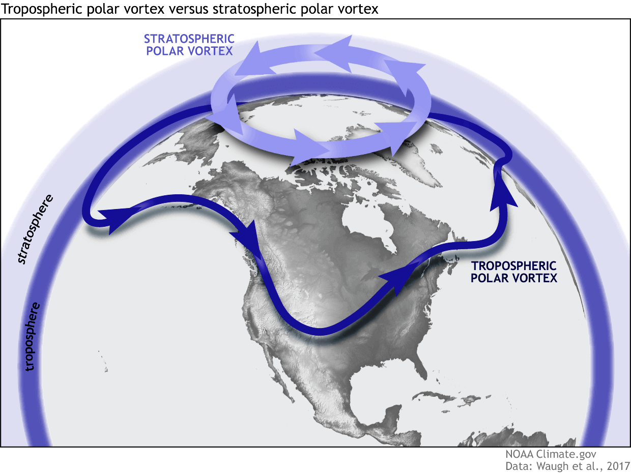
Polar Vortex is one of the important factors in every winter season. This is a rather broad term, but in most cases, it is used to describe the whole weather circulation in the lower half of the atmosphere.
This is why separate the entire Polar Vortex into an upper (stratospheric) and a lower (tropospheric) part. They both play their role differently, so we monitor them separately. But it is also very important how they are connected. Image below by NOAA-Climate.
Below is an example 3D image of the Polar Vortex, extending from the lower levels into the Stratosphere. The vertical scale is greatly increased for better visual presentation. You can see the actual shape and structure of the winter Polar Vortex.
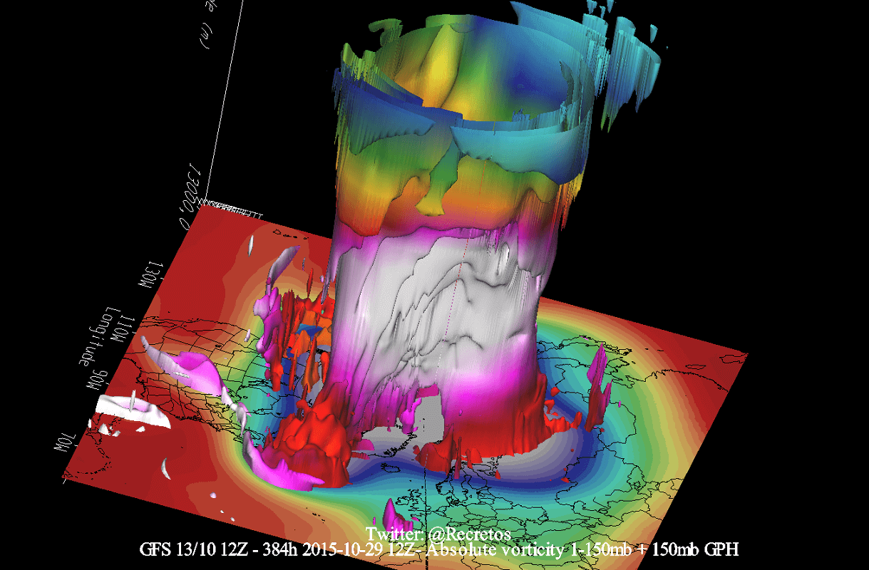
As you can see, the lower Polar Vortex is larger and more disrupted because it has to interact with complex terrain and mountains across the Earth’s surface, and strong pressure systems. This means that the lower Polar Vortex is much more dynamic and can be broken apart, and its cores are more free to move around.
This is better seen in the video below, which shows the vortex in 3D, giving you a better idea of what it actually looks like and its dynamics. But note that the vertical size of the vortex was greatly enhanced for visual purposes.
We have seen many times how the movement of the Polar Vortex plays a role in changing the weather patterns over North America. One such example was just at the start of this month.
Below is the image of the Polar Vortex in the lower Stratosphere at the 50mb pressure level (20km/12.5miles) 3 weeks ago. You can see how the Polar Vortex was elongated in shape, pressed from both the Pacific and the North Atlantic sides. That elongated the Polar Vortex, pushing its core into an oval shape and extending it into North America.
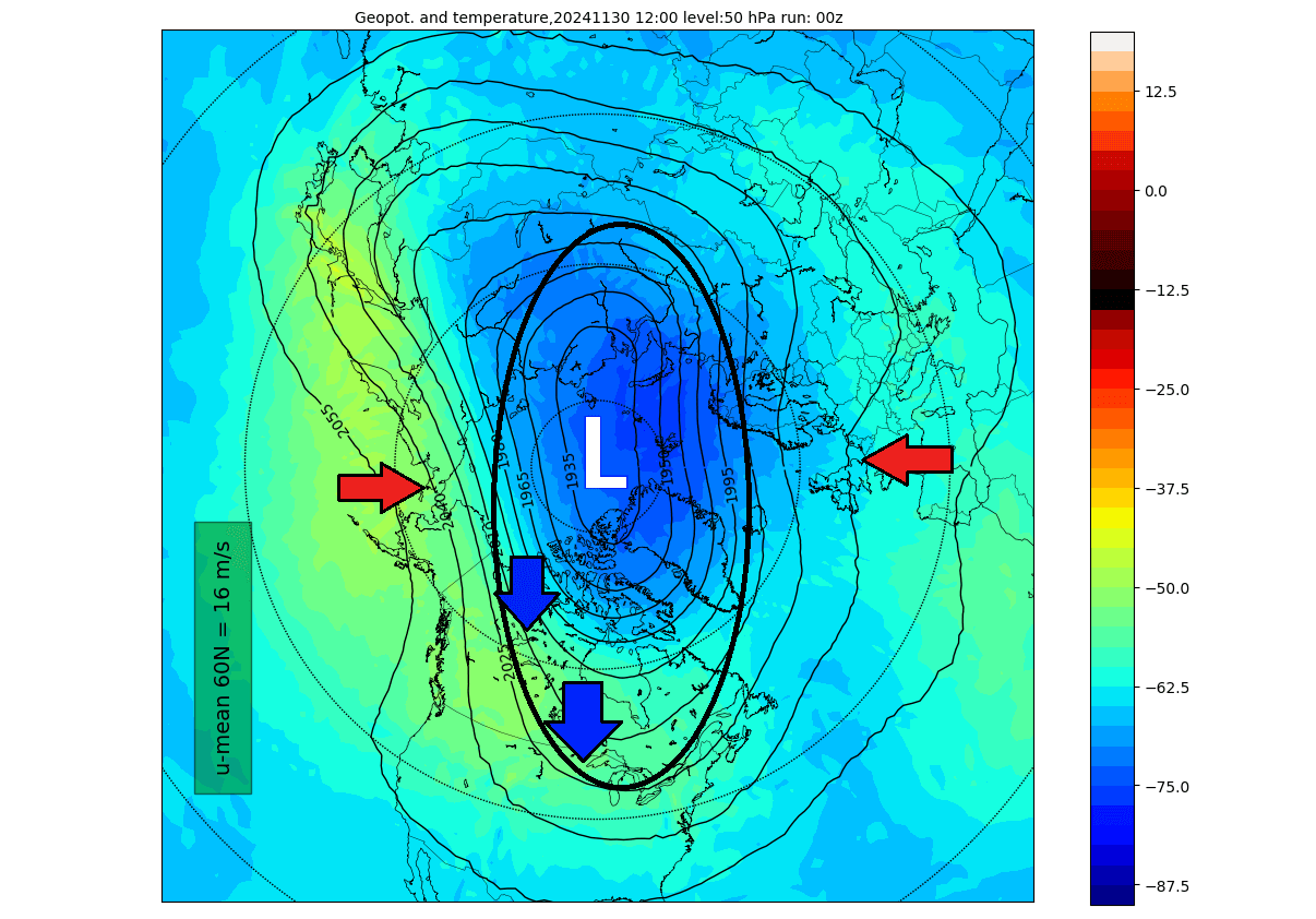
This elongation was connected to the lower levels and helped to create a broad low-pressure area over the United States and eastern Canada. Because a low-pressure system spins counter-clockwise, this started an active cold air transport line directly from the polar regions, called the cross-polar flow. Images by:weathermodels.com

Looking at the atmospheric pressure analysis for December 1st, you can see how the large low-pressure anomaly over North America was directly connected upwards into the main Polar Vortex above. This has brought the first major cold air event of the season into the United States and Canada.

We will look at how another such event will unfold at the start of January, bringing another round of Arctic air. But before that, a warmer wave will temporarily spread over North America.
BEFORE THE COLD ARRIVES
Looking at the pressure anomaly for the final week of the year, you can see a strong high-pressure anomaly covering the eastern United States and southeastern Canada. An anticyclone system spins clockwise, bringing upwards a warmer-than-normal airmass from the south.
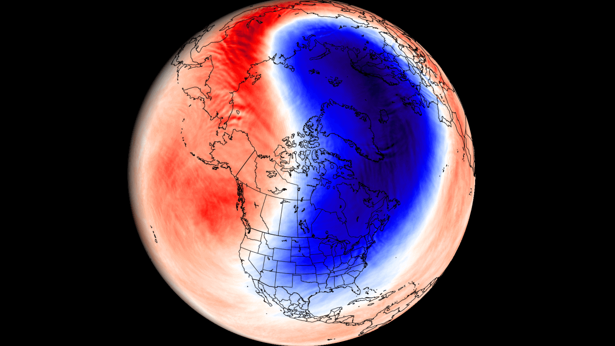
You can see this strong warm transport in the surface temperature anomaly map below. Temperatures will be much above normal throughout the post-Christmas period, with unusually high anomalies over eastern Canada, where temperatures will reach 28°F above normal over a large area.

Looking at the temperature anomalies at the 850mb level (1500m/5000ft), we can reveal the overall airmass above the surface level. Most of North America will be under a warmer-than-normal airmass in the final week of the year. There is even a proper warm “dome” over Canada, directly under the high-pressure anomaly.

The snowfall forecast for the next 8 days shows some snowfall over the far northern United States and parts of Canada. You can also see snowfall around the Great Lakes and over the northeastern United States, but that is mainly associated with the upcoming cold front in the next few days.

Looking into January 2025 weather with the normal forecasting tools can be a bit of a stretch. But what we can do, is look at the early trends and large-scale anomalies and signals. So the following forecasts should be taken for what they are, just the latest forecast trends and ideas.
THE POLAR VORTEX ARRIVES
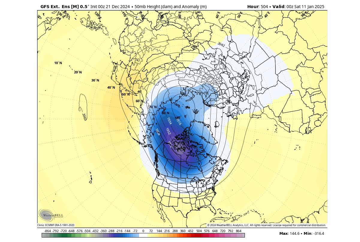
Below is the Polar Vortex forecast image in the lower Stratosphere at the 50mb pressure level (20km/12.5miles) in early January. You can nicely see how the Polar Vortex is again elongated in shape and squeezed from both the Pacific and the North Atlantic sides. That shows its inner core split into two parts, with one core part over the eastern hemisphere and one core reaching into North America.

We can see this dynamic if we look at the forecast of the stratospheric winds, which is usually a measure of the polar vortex strength. As you can see, the forecast shows a significant slowdown in the stratosphere towards and into January, which indicates movement and a temporary disruption of the Polar Vortex.

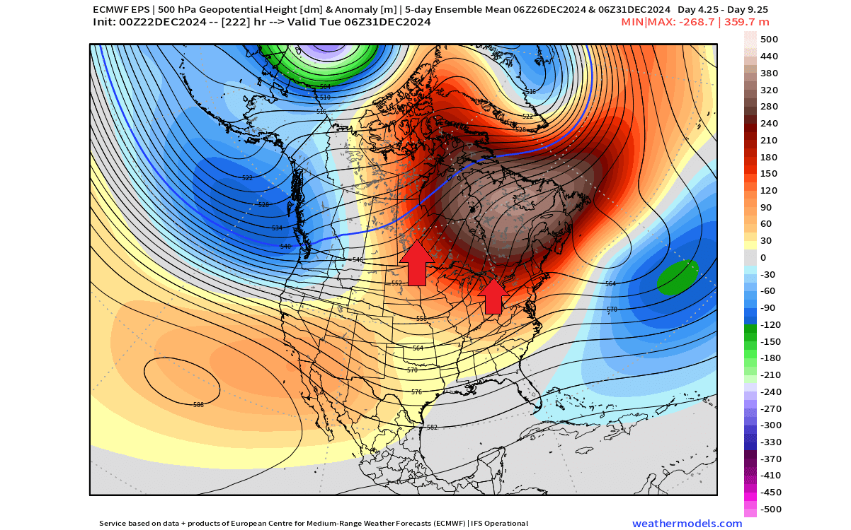
Below is the low-level forecast for the first week of January, which shows a broad low-pressure area over the United States and a trough developing down over central Canada. Because a low-pressure system spins counter-clockwise, this will create an active cold air transport line directly from the polar regions. Images by:weatherbell maps, using a professional license.

Looking at the whole lower half of the atmosphere in early January, you can see how the large low-pressure anomaly over North America shows a direct core connection upwards into the main Polar Vortex above. The rest of the low-pressure structure is scattered further towards the eastern hemisphere.

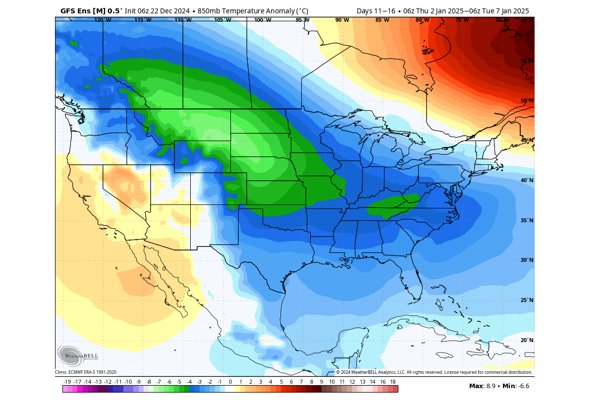
Below, you can see the temperature forecast image for the first week of January. It shows the temperature anomaly and reveals a strong cold air blast to develop, thanks to the northerly flow from the low-pressure anomaly. Cold air is forecast to expand from western Canada down into the northern, central, and eastern United States.
The forecast above is an ensemble average and is thus slightly averaged out in this far range. We can also look at individual (deterministic) forecasts, which are unreliable in this range. But we usually look at them to see the potential scenarios that can develop from that average. Because the actual weather on those days will not look like that average, as it just shows a more reliable trend.
Below is a single forecast example from ECMWF in that range. It shows a deep low-pressure system moving over the central and eastern United States. This deep system would bring a strong northerly flow and polar air, as the forecast above already suggests. These single forecasts just serve to show potential scenarios and are not fixed forecasts.
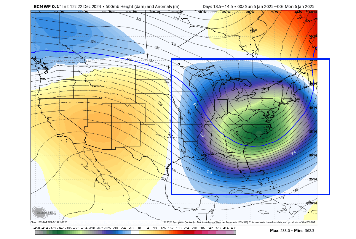
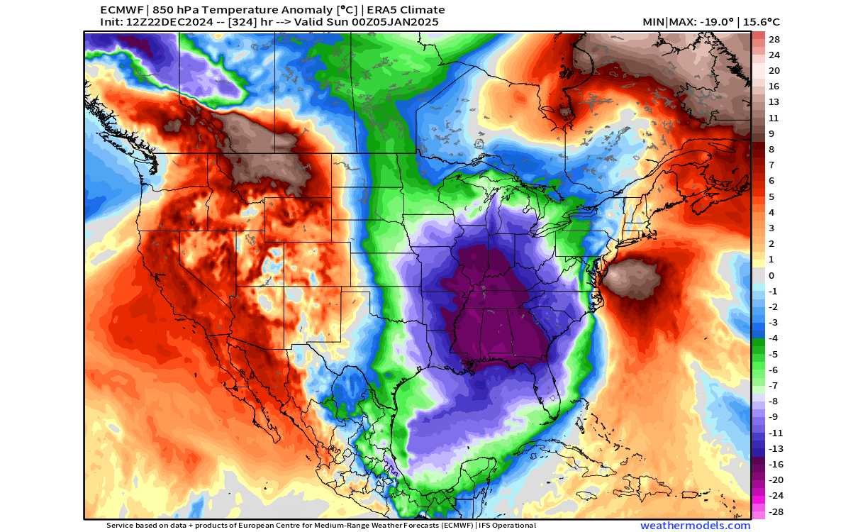
Such a system would pump the polar air into the United States. That can be seen in the temperature map below from the same forecast, which shows the coldest air of the season so far over the central and eastern United States in the first week of January.
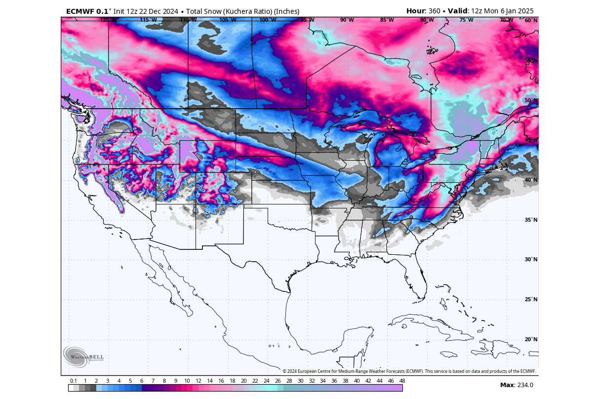
Looking at the total snowfall forecast from this same system, you can see the whole of southern and eastern Canada with plenty of snowfall. But more impressive, you can see the large amount of snowfall that such a system would bring into the eastern United States, sometimes called a “snowmageddon.”
As said before, there are no guarantees for this exact scenario to develop, as this is just one forecast run, which does serve as an example of how the upcoming trend could develop. The reason we look at these individual runs is to have a better idea of how the weather systems might develop, as the ensemble-average forecast hides a lot of details.
PROPER WINTER SEASON UNDERWAY
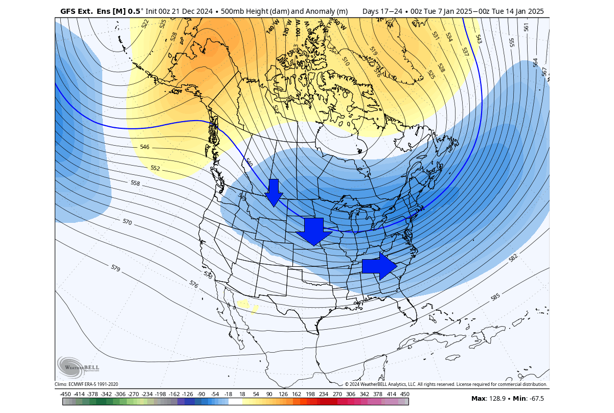
Going deeper into the extended-range forecast trend for the second week of January, we can first look at the lower stratosphere forecast. You can see the core of the polar vortex is extended and the pressure anomaly in the lower stratosphere is reaching into North America. This shows continued support for a low-pressure anomaly below in the lower levels.
Looking at the lower-level pressure pattern, you can see a broad low-pressure area sits over the eastern United States and southern Canada. This indicates continued support for a northerly flow and transport of colder air into the United States through southern and western Canada.
The airmass temperature forecast for the same period does show a broad cold-air anomaly over much of the northern, central, and eastern United States, extending from southern and western Canada. At this forecast range, the anomaly is usually weaker in the maps, as it gets averaged out the further out we go. But for this range, this is still an impressive anomaly to see.
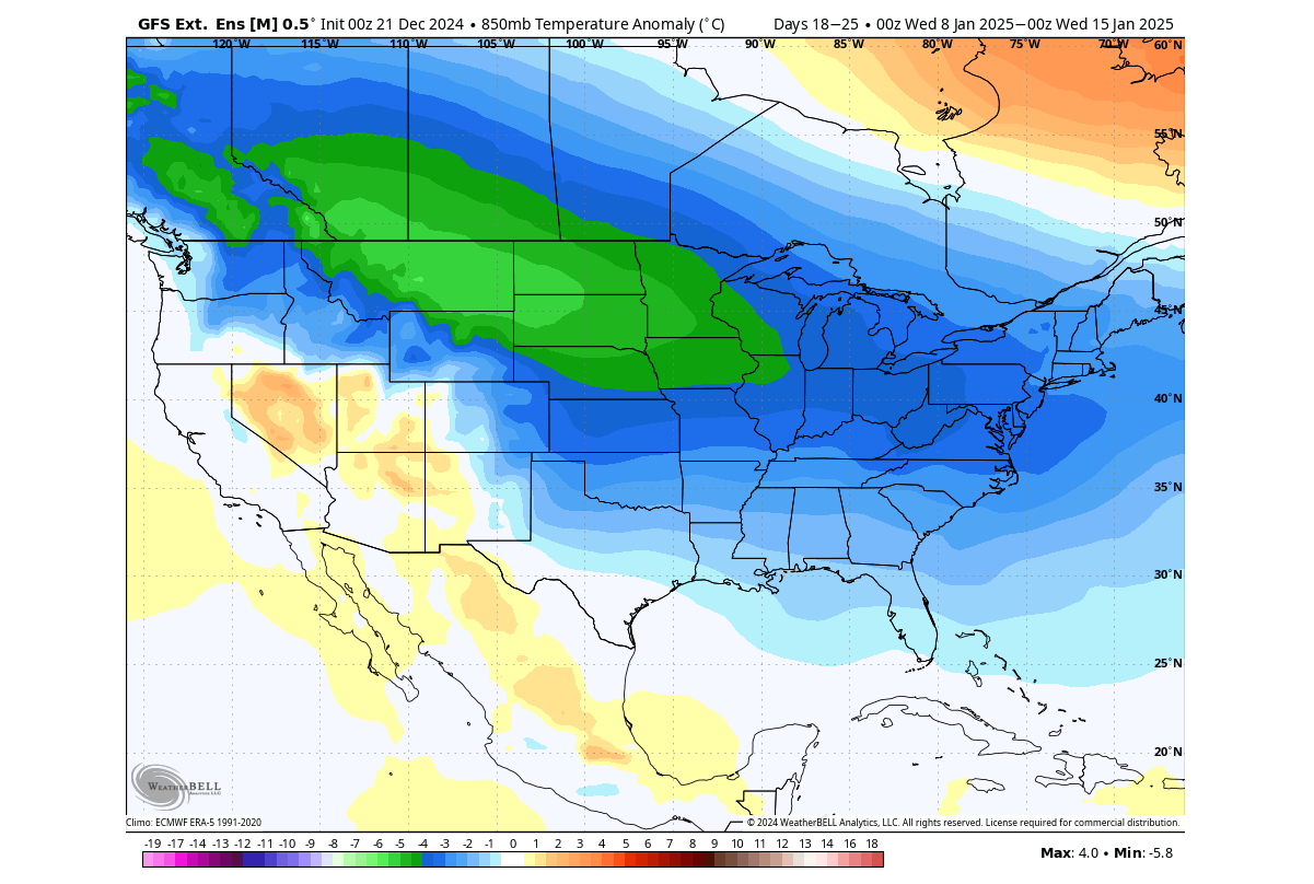
If we look at the surface temperature anomaly in this range, it shows continued cold air covering most of the United States. The exception is the southwestern U.S., which is protected behind the Rocky Mountains, but can still get snowfall in the elevations. This forecast indicates a proper winter period, going at least into the middle of January.
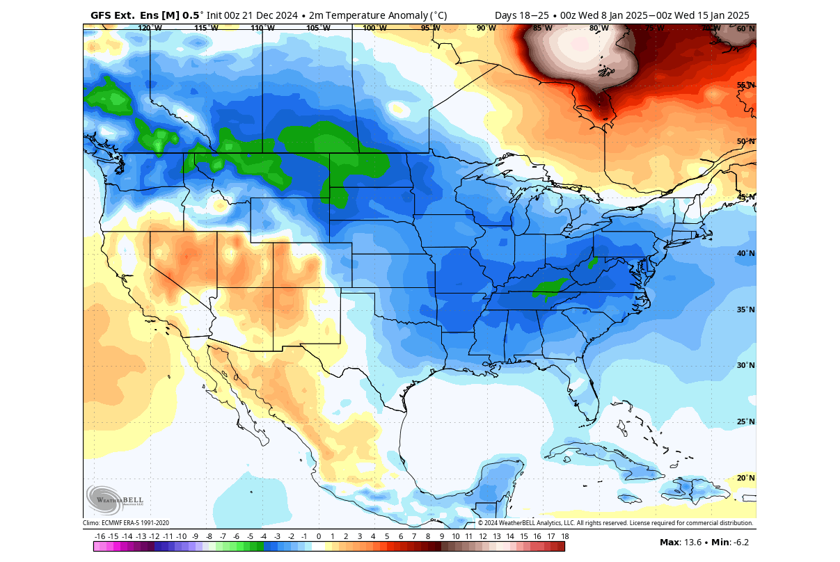
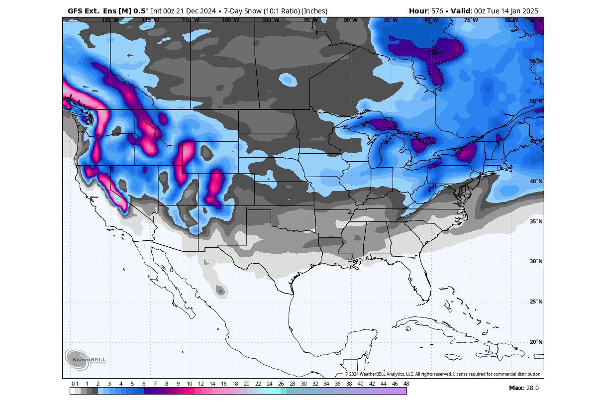
The snow forecast for this period shows this proper winter phase. This is just an ensemble average at a very extended range, so it only serves as a trend. It does show snowfall potential coming with the pattern change, with the main areas for stronger snowfall events being over the plains, Midwest, and the eastern United States and eastern Canada.
Looking into the extended range we just see the current trend. The real value of this forecast is when we follow their change and development as we get closer to the events.
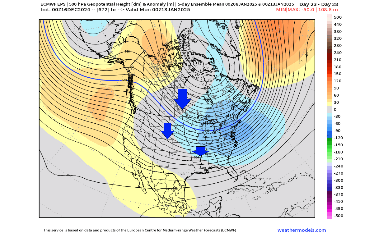
Below is the forecast for the same period (2nd week of January), but it was issued a week ago on December 16th. You can see that it has already hinted at this development a month into the future. And based on the latest forecasts, it appears to be spot on.
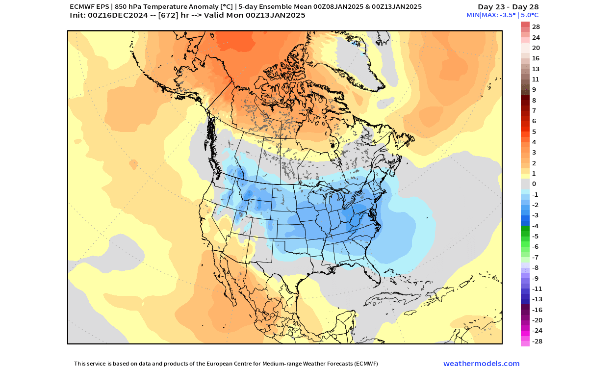
The temperature forecast for this period, also issued a week ago on the 16th, showed this same temperature trend that is now getting more established and stronger the closer we get to this period. A broad cold polar air outbreak, spreading across the United States, bringing along proper seasonal winter weather.
We will keep you updated on the developing weather trends in the coming weeks, so make sure to bookmark our page. Also, if you have seen this article in the Google App (Discover) feed, click the like and follow button there to see more of our forecasts and our latest articles on weather and nature in general.
Don’t miss out previous article with the first hints at this winter period: Weather pattern change over North America and proper Winter over the United States in January 2025