The latest forecasts show an early taste of warmer Spring-like weather will come next week over North America. A high-pressure ridge will spread into the United States, bringing unseasonably warm temperatures to the U.S. and Canada. But low-pressure systems and colder air will return in early March, extending the Winter season.
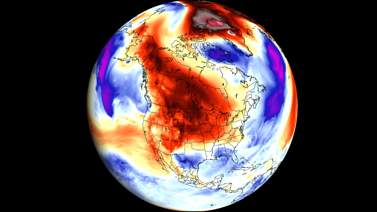
The persistent low-pressure area over Canada helped initiate large-scale cold air transport from the Arctic into the United States and Canada, also powered by the Polar Vortex in the stratosphere.
The current forecast shows a break in this pattern, as a high-pressure area will bring an early Spring, at least for a few days. But we already see a new wave of low-pressure and colder air lurking for the United States and Canada in early March.
COLD WINTER WAVE
February is the last month of meteorological winter. That means we only have eight days of winter left, at least on paper. But in reality, the winter continues with full power over North America.
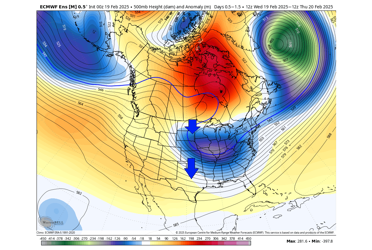
Below is the current pressure pattern that will last for the next few days. While you can see a high-pressure area over Canada, a strong low-pressure system is dropping into the eastern United States. As a low-pressure area spins counter-clockwise, it creates a strong northerly flow over much of the United States.
You can also see this nicely in the temperature analysis below. A very strong cold anomaly is currently spreading over the United States, reaching all the way to the southern coast. This Arctic airmass will continue to spread across the northern, central, southern, and eastern United States in the coming days.

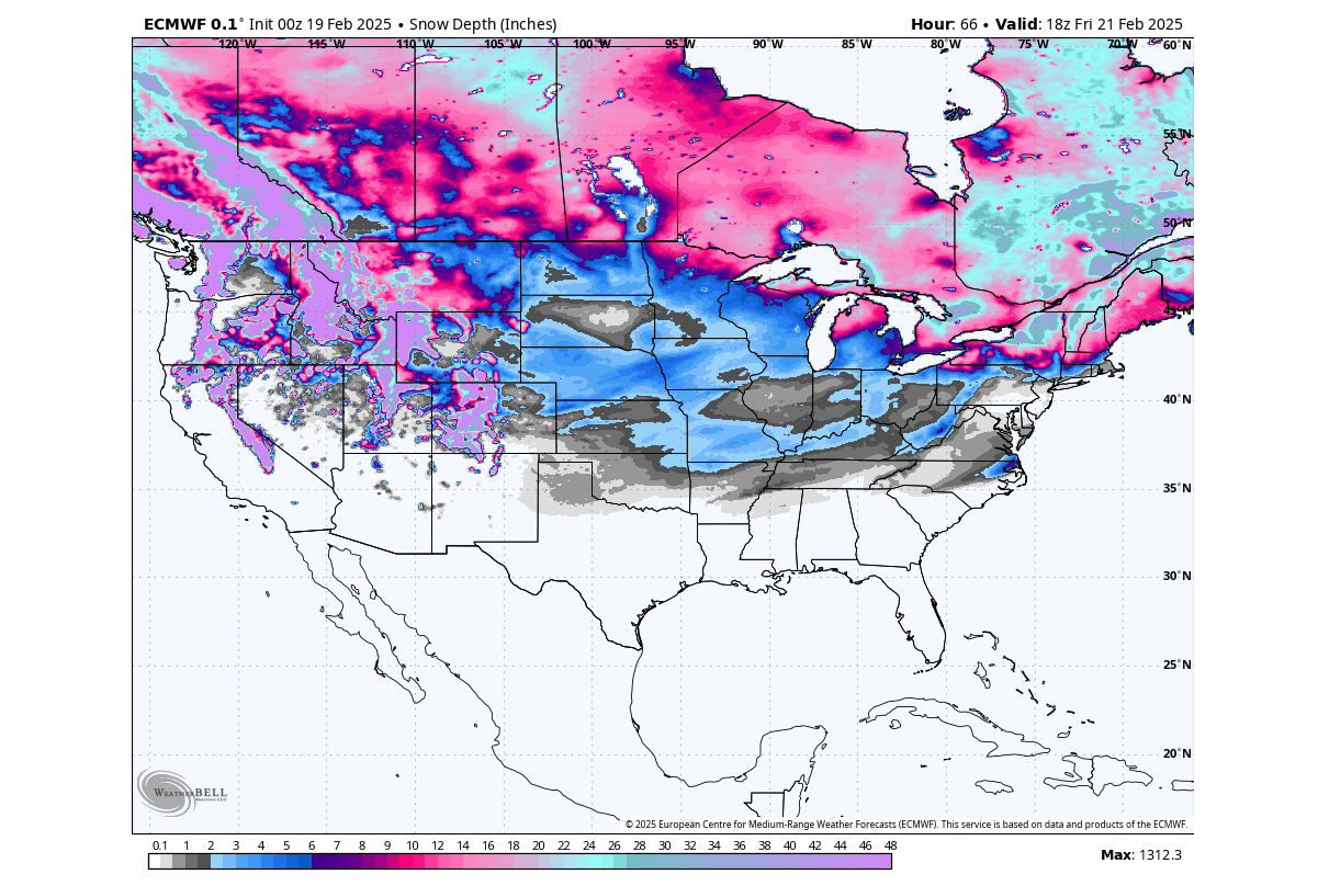
We can also take a look at the snowfall pattern. You can see snowfall reaching quite far down into the central Plains. But as this cold air is mostly dry, the overall lack of precipitation limits the snowfall amount. The highest snowfall amounts in the coming days will thus be over the western elevations and also over the northeastern United States and over the upper Midwest.
But, by the end of the week, the cold airmass will move further east and slowly start to lose its strength. In its wake, you can see a warmer anomaly is forecast to start building over the northern United States and southern Canada. This temperature change is initiated by changes in the pressure patterns driven by the jet stream.
The movement of the pressure systems drives these temperature patterns and weather changes. Pairs of pressure systems are also known as Rossby Waves. The image below by NOAA shows an example of Rossby waves and how they are all connected and function with the jet stream.
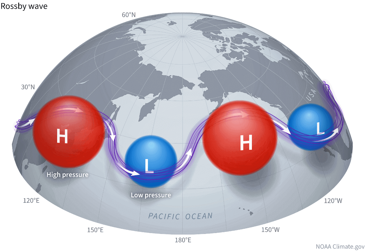
The purple line connecting these pressure systems is called the jet stream. This rapid stream of air is found around 9 to 14 kilometers (6 to 9 miles) above sea level.
We produced a high-resolution video that shows an example of the polar airmass movement over North America last month. This way, you can see how the cold air was transported down from the north like it has its own “cold highway”, driven by the Rossby waves of highs and lows and the jet stream in between.
With the cold air moving out, the warm wave is forecast to also expand over the central and eastern United States, bringing a brief pause from the cold weather.
AN EARLY TASTE OF SPRING
Looking at early next week, you can see a different pressure pattern setting up. A high-pressure ridge is rising over the western United States, while a low-pressure area over the North Pacific pushes a westerly jet stream from the Pacific.
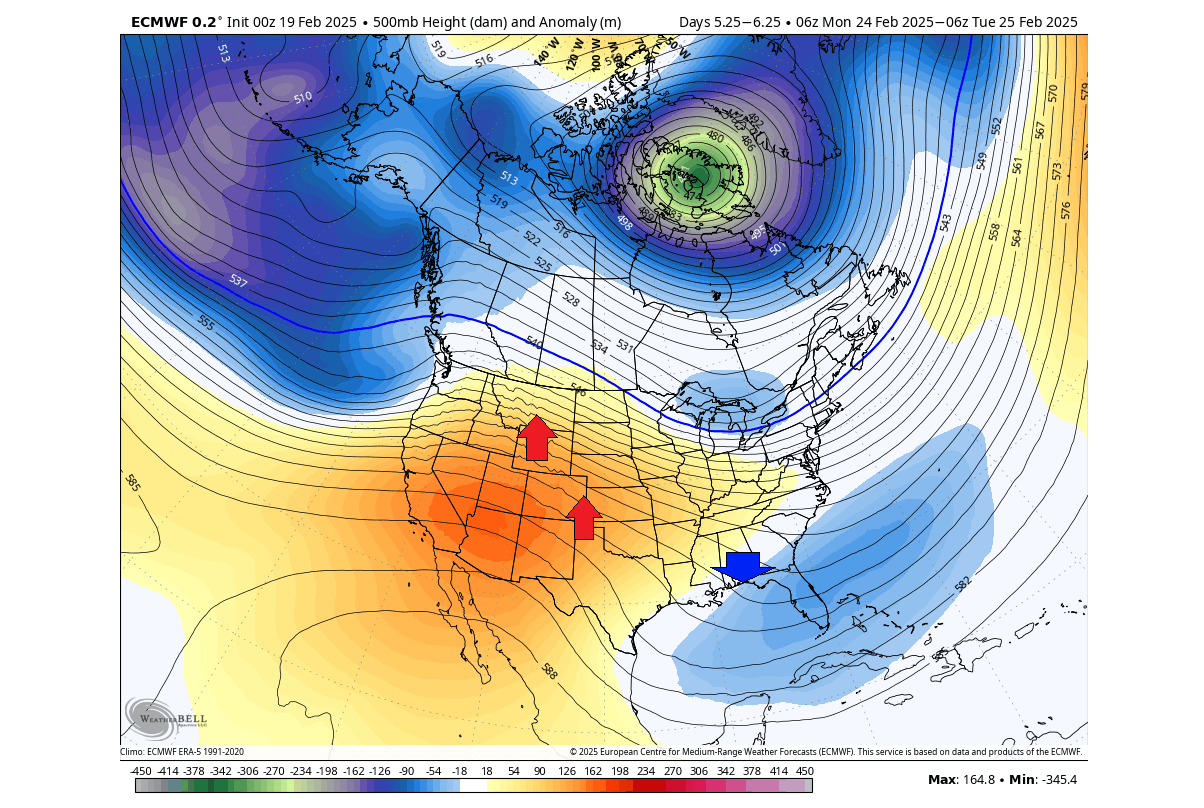
Such a westerly flow usually amplifies the warmer pattern over the United States and southern Canada. You can also see an area of low pressure over the southeastern United States, bringing normal to below-normal temperatures to the southeast.
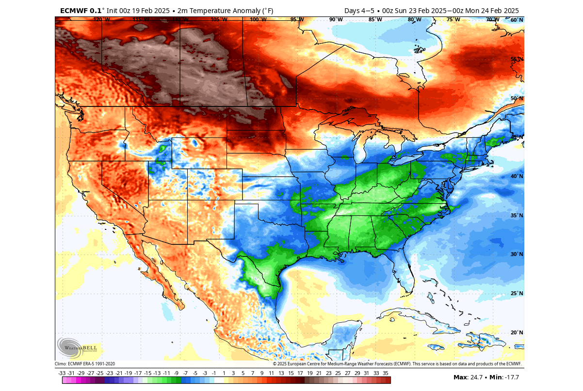
Below is the surface temperature anomaly, averaged for early next week. You can see the large area of above-normal temperatures over the northern, western, and parts of the central United States and southern Canada.

Below is the 5-day temperature forecast at the 850mb level (1500m/5000ft). This way, we can understand the overall airmass movement. The image below is for next week and nicely shows the spread of an abnormally warmer airmass across much of the United States and southern Canada.

A relatively cooler airmass will remain over the southeastern United States. But normal temperatures are usually high enough, so a few degrees cooler is still far from freezing in that region of the United States.
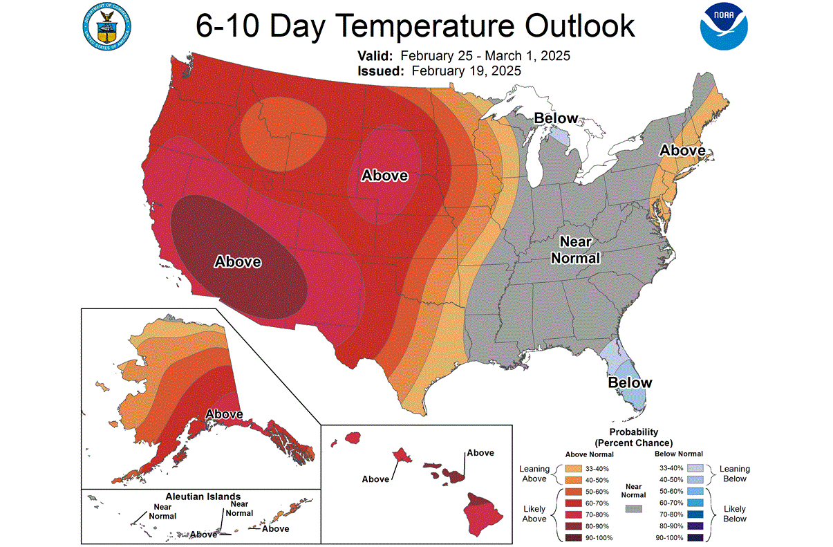
The official 6-10 day temperature outlook also shows this airmass separation, keeping the warmer air over the central and western parts of the United States. At the same time, cooler temperatures will return to the eastern United States in the early days of March.
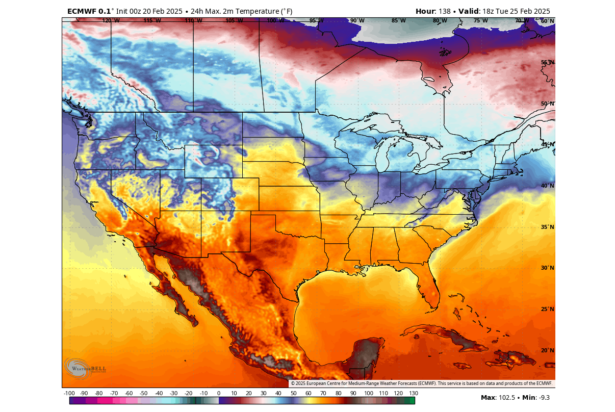
As mentioned above, the multi-day average does not show the full picture. So below is a single-day forecast of daily high temperatures for Tuesday. You can see warmer temperatures in the 50s reaching far to the north, with the central and southern parts of the United States also in the 60s. There are no parts of the United States or deep southern Canada (besides elevations) to have daily highs below freezing.
This will be a proper “Spring wave”, giving a taste of Spring weather in February across the United States and parts of southern Canada.
Looking at snow depth in around 10 days, you can see that most of the snow cover will be melted away. The exceptions are the Rockies, the upper Midwest, and the northeastern United States. These parts will retain snow on the ground, as the spring weather will not reach so far, or at least not for long or very strongly.

But after this early Spring wave passes, the forecast already shows a new round of “polar express” arriving in waves across the United States.
WINTER IS NOT OVER YET
Looking at the first week of March, a new low-pressure area is forecast to drop into eastern Canada and the eastern United States. While the warmer airmass remains under the ridge in the west, a new northerly flow will be established over the eastern United States and Canada.

This currently looks like a repeat of the common scenario of the past two months: a low-pressure system over the eastern United States, bringing down a cold airmass with its northerly flow.
The temperature forecast below is for late next week and shows colder air pooling over southeastern Canada. It is currently forecast to descend into the upper Midwest and the eastern United States. At the same time, most of the central and western United States and western Canada will remain under the influence of the high-pressure area.
But looking into the end of next week, the current forecast trends show the large mass of cold air descending from southern Canada and spreading over much of the eastern and central United States. This comes right at the start of meteorological Spring, but it shows that seasons are not bound by calendar or statistics.
A quick look at the snowfall potential below, shows that the main snow belt is forecasted for the upper Midwest and the northeastern United States. But this is just a single-run forecast, so it is still subject to change. It just serves as an idea of the snowfall potential in this upcoming event.

As the cold air is usually drier, it limits the snowfall potential to the available moisture. That why we only see another snowfall are over northern Texas and Oklahoma, where the edge of the colder air is, with enough moisture from the south for snowfall.
EARLY MARCH FORECAST
Going deeper into March, we will use the medium and extended-range ensemble forecasts. These forecasts serve as trends that show the prevailing idea of where the pressure systems are positioned and how the airmass is expected to move.
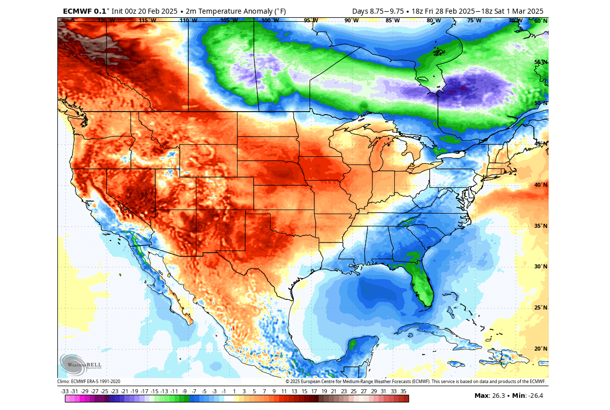
At the end of the first week of March, the low-pressure area looks to expand again across southern Canada and the United States. The forecast now also shows high pressure returning to the North Pacific, increasing the chance of a northerly flow with colder air across the United States.
This scenario is seen in the surface temperature forecast below. The cold airmass is forecast to cover much of the United States. Cold air will also cover southeastern Canada, aided by the influence of the low-pressure zone. But as this is an ensemble forecast made from many different calculations, it also perhaps shows a weaker anomaly.
We can also examine a single-run ECMWF forecast to understand what this scenario might look like in more detail. The forecast shows the spread of cold air across a large part of the United States, while the warm anomaly remains over western Canada.
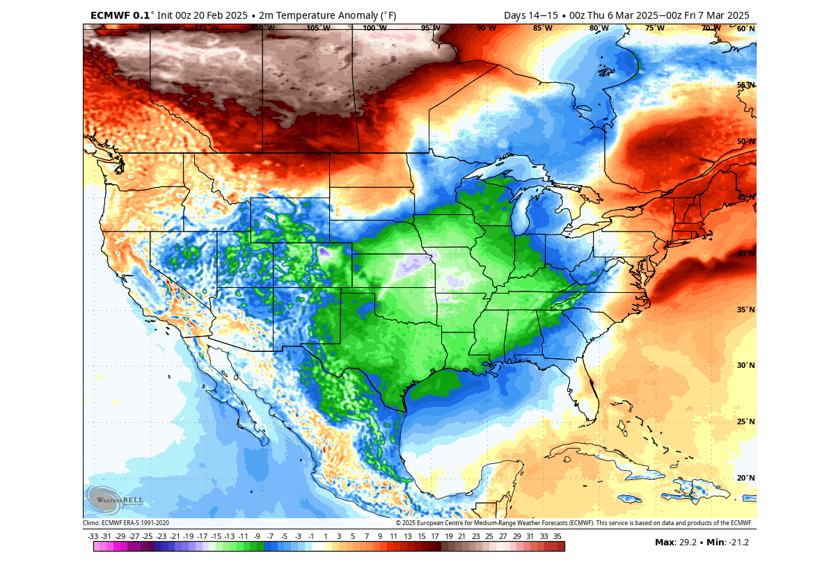
Both models trend towards a cold airmass entering the central and eastern United States and southeastern Canada in the first week of March 2025.
EXTENDED WEATHER TRENDS
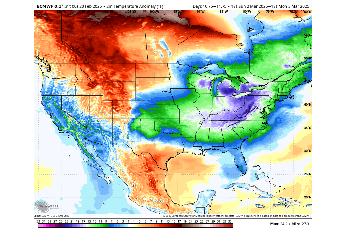
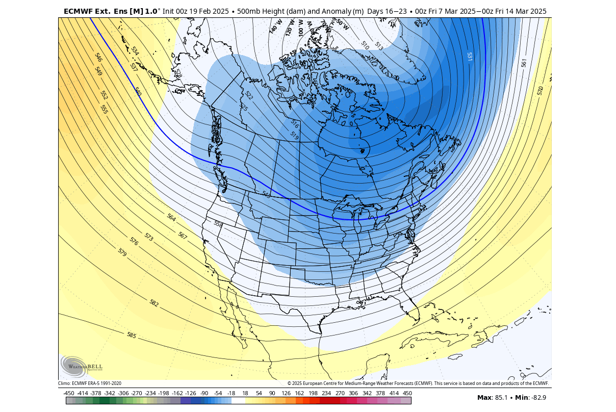
In the week 2 of March we see a clear low-pressure trend over Canada and the upper United States. The model shows a broad low-pressure area over North America, with the potential to sustain and extend the northerly flow over the United States.
The temperature forecast trend better shows this northerly pattern. Cold air is again present over the western and much of the eastern United States. We see a small area in between where a warmer anomaly is trying to push from the Plains up into the northern U.S. and southern Canada.
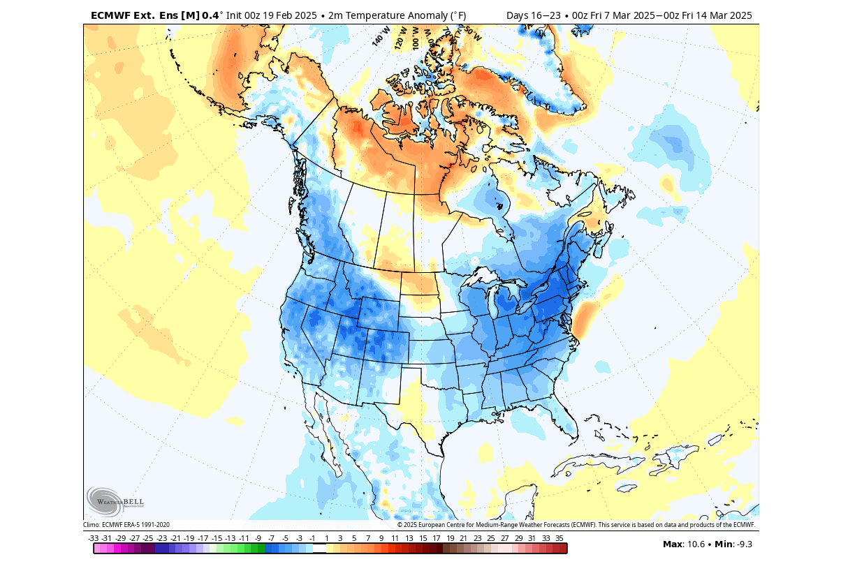
Overall, the weather forecast trends continue to show a colder pattern until further notice, briefly interrupted by a Spring wave next week.
Forecast images in this article were provided by WeatherBell, using a professional/commercial user license.
We will keep you updated on the developing weather trends in the coming weeks, so make sure to bookmark our page. Also, if you have seen this article in the Google App (Discover) feed, click the like and follow button there to see more of our forecasts and our latest articles on weather and nature in general.