In this section, we will take a general look at the thunderstorms. What is a typical thunderstorm? We will examine its essential components and how they make the thunderstorm work.
Typical thunderstorm – Cumulonimbus capillatus incus
The most distinctive and typical cloud shape associated with thunderstorms is Cumulonimbus capillatus incus, a convective tower (updraft) flattened into an anvil shape. Cumulonimbus capillatus incus is typically over 10 km high and sometimes so high that it turns day into night for anyone underneath it.
If you see a cloud of this shape from a distance – that is a thunderstorm. While other cumulonimbus clouds also produce thunderstorms, the anvil-shaped incus is the most distinctive and is associated with the strongest thunderstorms.
Why is it this shape? Let us see.
Updraft and Downdraft
A thunderstorm (or even a rain shower) is organized into two main components: updraft and downdraft. The updraft is the rising warm, moist air within the thunderstorm. The downdraft is the descending cooled air containing precipitation.
The updraft
The thunderstorm’s updraft is the convectively rising moist, warm air. Below the condensation level, it is invisible to the eye and becomes visible as the ‘cauliflower’ cloud above it.
The updraft varies a lot between different thunderstorms. Its strength, the air velocity within it (i.e., how quickly that air parcel rises), tilt, and possibly rotation depend on:
- How buoyant the warm rising air is
- What the CAPE is like: Is it short, fat or long, thin
- How wind speed changes with height
- How wind direction changes with height
We will work our way from the bottom up.
Thunderstorm updraft depending on the wind
As you watch cumulus and cumulonimbus clouds form on different days, you will notice that the updrafts grow vertically upwards while tilting on some days.
The tilt of an updraft depends on its strength, upward speed, and how the wind changes with altitude. The change in wind speed and direction with increasing altitude is called wind shear. The more shear there is, the more the updraft is tilted.
We will take a look at three different situations:
- Little or no wind shear
- Wind shear is present; wind changes speed with height, but not direction
- Wind shear is present; wind changes speed and direction with height
Little or no wind shear
A typical setting with convective clouds developing in an environment with virtually no wind at any altitude is within a summer anticyclone. Generally, the weather is very stable during anticyclones; as an anticyclone gradually weakens and temperatures near the ground become very high, typical summer heat thunderstorms develop.
These updrafts stay vertical as they grow through the Cumulus congestus phase into the Cumulonimbus. Thunderstorms in this environment are essentially a single updraft or pulse that dissipates in 20-30 minutes. As they dissipate, new updrafts may sometimes form on their flanks.
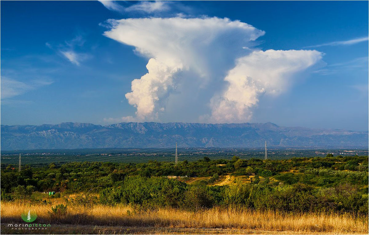
Cumulonimbus capillatus incus in minimal wind shear. Note the symmetric anvil. The updraft rising to the left produces a slightly tilted appearance. However, it is a new updraft, separate from the one that created the anvil. Photo by Marin Pitton
Wind shear present; wind changes speed with height, but not direction
Environments with wind shear typically produce tilted updrafts. Shear in which only the wind speed changes (usually increases) with height is called unidirectional or speed shear. The updraft is carried further downwind with increasing winds as it rises higher in the troposphere.
Thus, tilted updrafts are a visual sign of a sheared environment. Typically, if thunderstorms form in this environment, they are multicell thunderstorms. We will go into more detail on multicells in the chapter “Severe thunderstorms.”
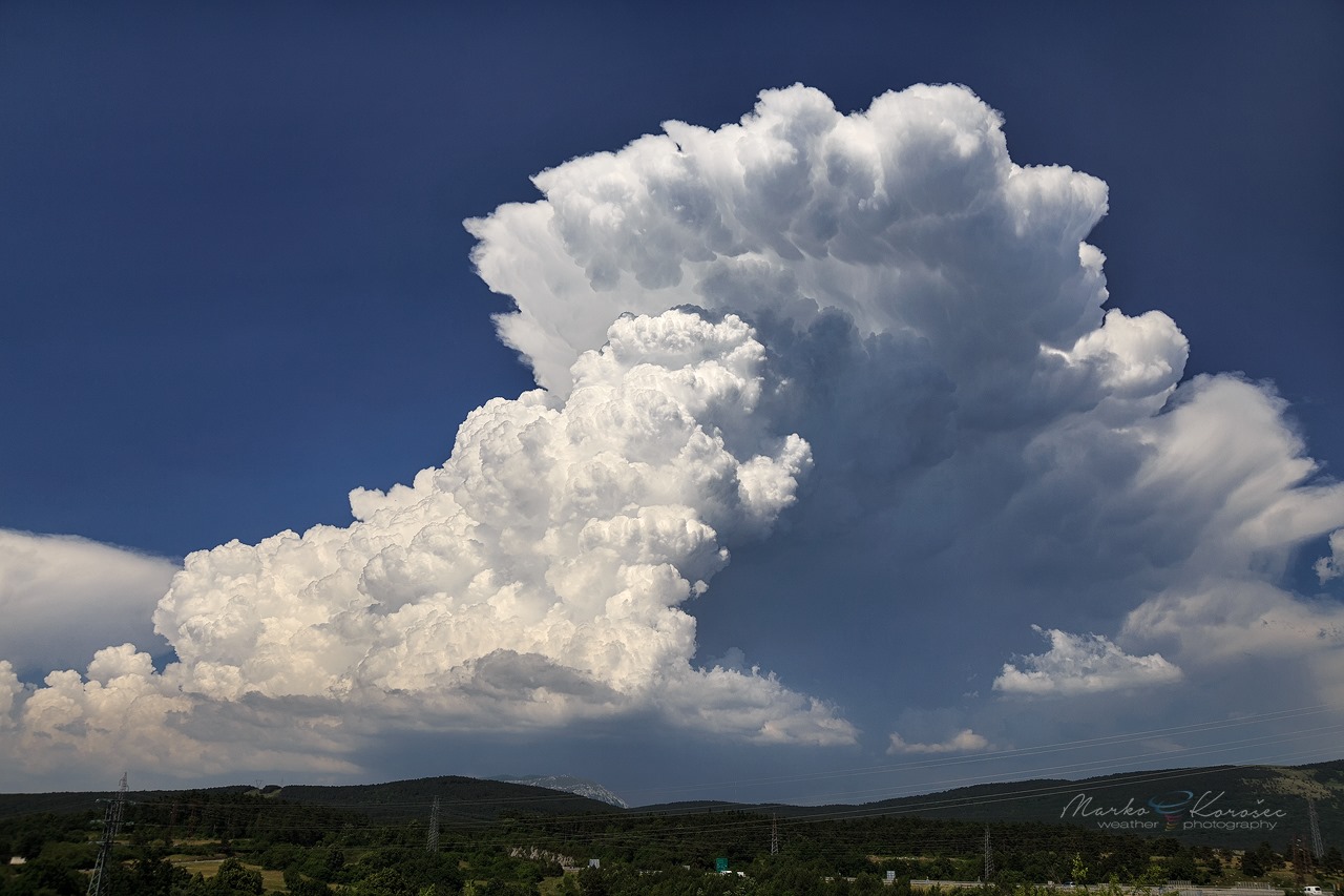
An isolated thunderstorm with a tilted updraft within the unidirectional speed shear environment was photographed over Mt. Nanos, Slovenia, on June 16th, 2019. Photo by Marko Korošec
Wind shear present; wind changes speed and direction with height
The environment is particularly conducive for severe thunderstorms where the wind changes speed and direction with height. This is called directional shear. If the wind changes direction clockwise with increasing height, it produces a veering vertical wind profile.
A counterclockwise change in direction produces a backing vertical wind profile. Backing wind profiles are rarely associated with thunderstorms as they are typically associated with the inflow of cold air at the surface. Veering profiles, however, are usually related to the inflow of warm air at the surface, often with severe thunderstorms.
An environment where wind direction changes with height produces a rotating updraft. The entire updraft rotates around its vertical (tilted) axis. A thunderstorm with a persistently rotating updraft is called a supercell. Rotation often produces visually apparent rotational features, such as striations.

An isolated thunderstorm with a strongly tilted updraft within a strong directional and speed shear, resulting in a low-precipitation supercell. The photo was taken in Friuli plains, NE Italy, on June 6th, 2009, by Marko Korošec.
Recap: Wind and wind shear affect an updraft’s behavior. If there is little wind shear, updrafts rise vertically. If the wind changes speed with height but keeps the same direction (speed shear), updrafts become tilted. If winds also change direction with height (directional shear), updrafts may start to rotate.
Let’s see some more examples below:

Volatile and highly sheared environment: numerous strongly tilted Cumulus congestus clouds forming a flanking line. Trieste, Italy. Photo by Marko Korošec
Strong Cumulus congestus clouds would appear along the surface convergence when the convective temperature is breached. Those convective towers will be strongly tilted if sheared conditions are in place.
An example below is an explosive development of convection along the coastal convergence, also known as sea-breeze convergence, in southwestern Slovenia.

Strongly tilted Cumulus congestus. Divaca, Slovenia. Photo by Marko Korošec
Another look at a rotating updraft (on a supercell): note that only the front of the updraft shows distinct rotational features, while the back is cumuliform (“cauliflower” appearance).
The storm was moving towards the right. Revealing a textbook ‘barber pole’ structure within the strongly sheared updraft.
Strongly tilted rotating updraft on the supercell near Vučja vas, Slovenia. Photo by Marko Korošec
Next, we find out why some updrafts have thin white caps.
Pileus cloud caps
A white wispy cloud cap often forms above a rapidly rising updraft—a pileus cloud. It forms as moist but stable air above a rapidly rising updraft is pushed upward, causing the water to condense. It is a short-lived cloud that either fades or is overtaken by the rising updraft, forming a wispy collar cloud called a velum cloud.
Stage 1: rising updraft still below the stable layer of moist air aloft.
Stage 2: A rising updraft pushes the stable layer of moist air upwards, causing it to condense and forming the pileus cloud (cap).
Stage 3: Rising updraft punches through the pileus cloud cap, forming a velum cloud.
Pileus clouds are often found above rapidly growing Cumulus congestus and Cumulonimbus calvus clouds.
Fun fact: pileus clouds can be found above other rapidly rising updrafts, such as volcanic eruption columns and nuclear explosions.
On to examples!

Explosive storms over northwestern Croatia, with multiple pileus cloud caps on the most intense convective towers. Photos taken on July 22nd, 2024 by Marko Korošec
A whispy pileus cloud layers on the rising convection on the hills above Nova Gorica, Slovenia, on July 8th, 2019. Photo by Marko Korošec
Explosive convection with pileus cap cloud near Kozina, Slovenia, on August 10th, 2018. Photo by Marko Korošec
Visual appearance and upward speed of the thunderstorm updraft
The visual appearance of the updraft can tell a lot about its strength and potential to produce a strong thunderstorm. As the updraft rises through various phases of Cumulus and potentially Cumulonimbus, it cools and eventually loses buoyancy.
In addition to the speed at which the updraft increases, the appearance of its edge indicates its strength.

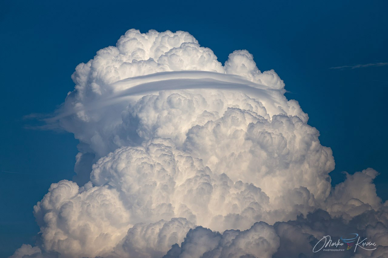
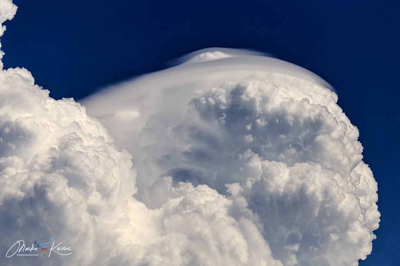
Sharp, crisp updraft on a severe thunderstorm over north Italy. This is a strong updraft. Photo: Marko Korošec
A sharp, crisp edge that may resemble an explosion indicates a strong updraft. It may, sometimes, form a pileus cloud cap on top of it. On the other hand, a soft, fuzzy edge indicates a weak updraft that has lost its strength and upward speed and is likely not rising anymore.
The upward speed of the updraft
Fairweather Cumulus humilis and Cumulus mediocris clouds typically have gentle updrafts with 2-3 m/s vertical speeds. Weak thunderstorms may have vertical updraft speeds of 6-12 m/s. At such a speed, a thunderstorm will vertically develop by 10 km in about 15 minutes.
On the other side of the spectrum are severe thunderstorms. A severe thunderstorm may have a vertical updraft at 30-35 m/s.
In extreme cases, severe thunderstorm updrafts grow to 75-80 m/s! That means the updraft rises by a full kilometer in less than 15 seconds and can reach 10 km in 2-3 minutes – this is called explosive thunderstorm development, with a volatile storm evolution.
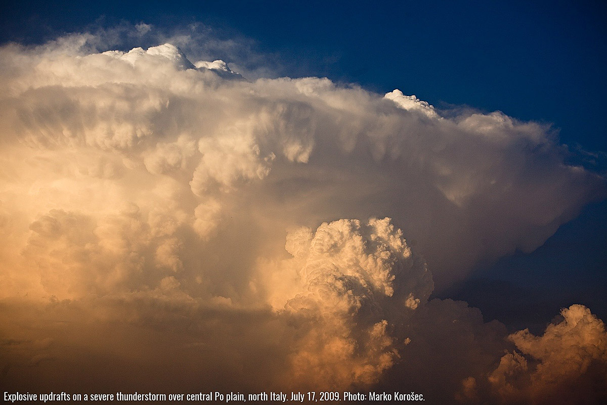
Explosive updrafts on a severe thunderstorm over central Po plain, north Italy. July 17, 2009. This storm had an updraft strong enough to hold aloft tennis ball-sized hail. Photo: Marko Korošec

Explosive updraft on a severe thunderstorm over central Slovenia. Note the crisp edges of the updraft, indicating its strength. June 28, 2008. Photo: Marko Korošec

Explosive updrafts after the capping inversion eroded in eastern North Dakota, US. Perfectly illuminated with sunset colors. June 2nd, 2015 by Marko Korošec
Equilibrium level (‘anvil level’)
We have seen why some updrafts are vertical while others are tilted, and some even rotate. Now, we will examine the top of the updraft and why.
We asked ourselves at the beginning of this section:
- Why does a Cumulonimbus capillatus get its distinctive fibrous top?
- Why does a Cumulonimbus capillatus incus have this form?
- Why do many thunderstorms have a distinct anvil shape but not all?
We will see why Cumulonimbus capillatus clouds have a fibrous appearance and why Cumulonimbus capillatus incus spreads out into its distinct anvil shape. It all has to do with the equilibrium level.
Rising air and Buoyancy
As the air in the updraft rises, it cools. The cooling is adiabatic, meaning it cools due to expansion as the pressure drops with height. There is virtually no cooling due to heat transfer with the cooler surrounding air.
It is buoyant as long as the rising air (parcel) is warmer than the surrounding air. As it reaches ambient temperature, it ceases rising, reaching the equilibrium level (EL). This level is also known as neutral buoyancy (LNB) or the limit of convection (LOC).
In other words, the equilibrium level is the altitude at which a rising updraft ceases to rise; its air has cooled to the same temperature as the surrounding air.
We will take a look at the two different situations:
- The equilibrium level is the height at which the rising updraft cools to the temperature of the surrounding air
- The equilibrium level is produced by a temperature inversion, which prevents the updraft from rising further
The equilibrium level is the height at which the rising updraft cools to the temperature of the surrounding air
In this case, the rising and adiabatically cooling updraft eventually runs out of energy. As the air in the updraft cools down to the temperature of the surrounding air, it loses buoyancy and stops rising.
The height at which this happens can be anywhere from several kilometers to over 10 kilometers.

In this case, you can visually discern an updraft that has reached equilibrium level: an updraft that has ceased rising (or is about to) loses its sharp edge and becomes soft.
The most vigorous updrafts rise above freezing, and the water droplets rise with the updraft freeze into ice crystals. As the updrafts cease to increase, the top spreads out in a fuzzy, wispy, fibrous edge, forming a Cumulonimbus capillatus.
The updraft rises to equilibrium through the Cumulus congestus and Cumulonimbus calvus stages. Senozece, Slovenia by Marko Korošec
The updraft reaches the equilibrium level. The cloud’s top becomes fibrous as ice crystals form a wispy, fuzzy top. This is a Cumulonimbus capillatus. Divaca, Slovenia on June 6th, 2018 by Marko Korošec
The equilibrium level is produced by a temperature inversion, which prevents the updraft from rising further.
In this case, the rising updraft encounters a sharp temperature inversion, which acts as a ceiling. The updraft rapidly loses buoyancy in and above the inversion, effectively encountering a ceiling for its vertical motion.
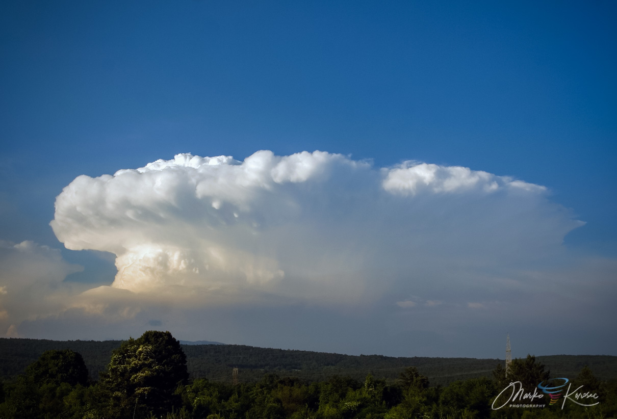
The updraft spreads laterally underneath the inversion, forming the distinctive anvil shape of a Cumulonimbus capillatus incus.
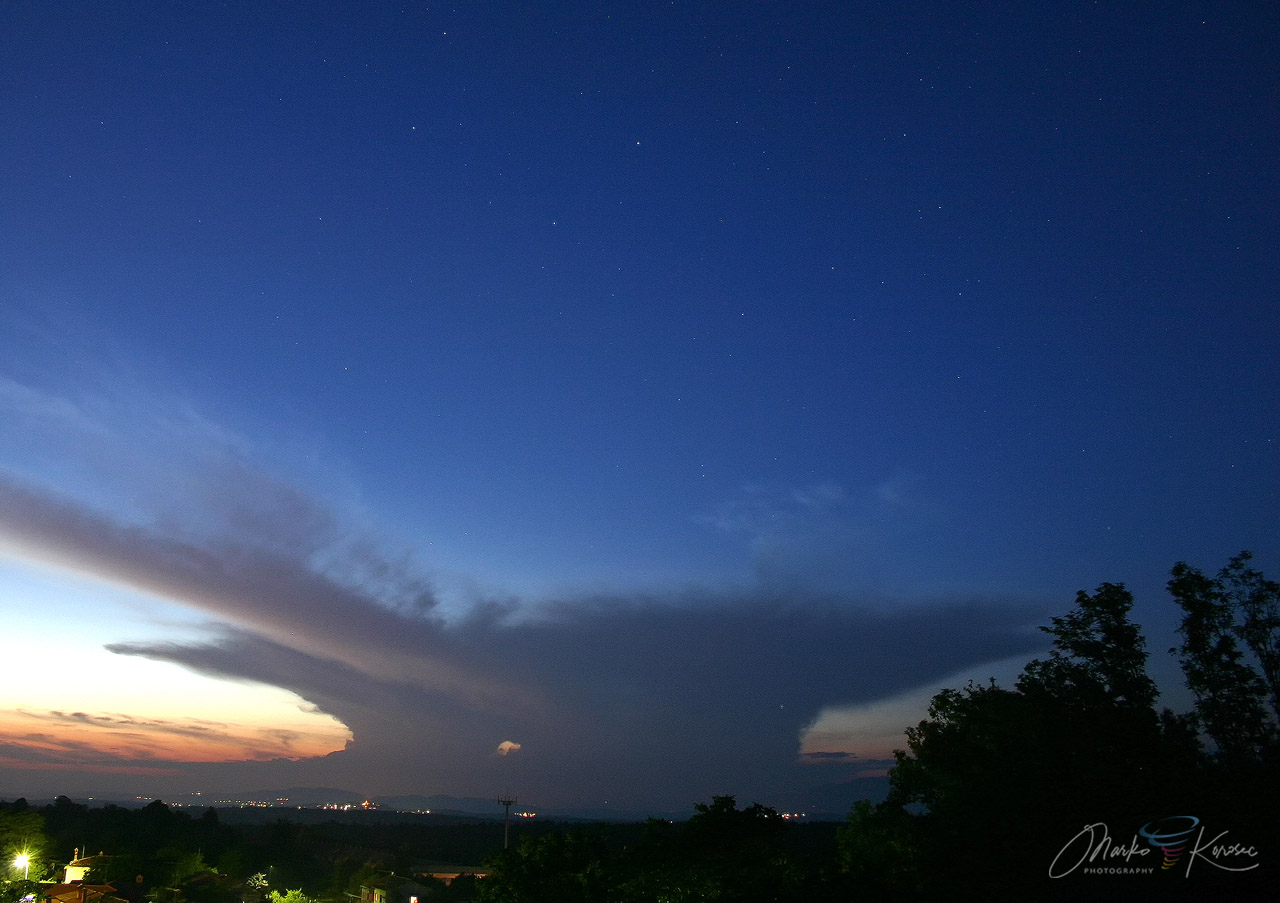
A distant evening storm over the Alps, central Europe. This is a good example of a Cumulonimbus capillatus incus. Zirje, Slovenia by Marko Korošec
The temperature inversion, the main feature controlling the vertical development of strong thunderstorms, is known as tropopause.
The role of Tropopause
The tropopause is the boundary between the troposphere and stratosphere in Earth’s atmosphere. It is a strong temperature inversion: the temperature drops with height as you ascend through the troposphere but begins rising again as you cross the tropopause into the stratosphere.
The World Meteorological Organization defines tropopause as:
The boundary between the troposphere and the stratosphere is where an abrupt change in lapse rate usually occurs. It is defined as the lowest level at which the lapse rate decreases to 2 °C/km or less, provided that the average lapse rate between this level and all higher levels within 2 km does not exceed 2 °C/km.
In other words, it is a boundary, a layer with a minimal lapse rate, i.e., the air temperature changes minimally with increasing altitude.

The height of the tropopause is not the same everywhere in the world. It depends on the latitude: at latitudes above 60° (North or South), it is 9-10 km high but reaches up to 17-18 km close to the equator. This is because the troposphere, the lowest layer of Earth’s atmosphere, is the thickest at the equator and the thinnest at the poles.
Powerful updrafts that form strong thunderstorms rise to the tropopause, a robust temperature inversion that limits the growth of even the most vigorous updrafts.
As we can see from the chart above (thick yellow line), the vertical temperature lapse rate in the stratosphere (above the tropopause) is positive, so the updraft is no longer buoyant. The tropopause is the ultimate limit of updraft upward development.
Very little upward development is possible above this level. This is also why the strongest thunderstorms have large anvils that develop at the tropopause level.

Diagram of a Cumulonimbus capillatus incus with equilibrium level in the tropopause. The updraft remains buoyant throughout the troposphere: it cools as it rises (at the moist adiabatic lapse rate) but does not cool to the temperature of the surrounding air. As it reaches the tropopause, the surrounding air does not cool with increasing height anymore, and the rising air in the updraft soon cools to the temperature of the surrounding air, not rising anymore. In effect, it reaches the ceiling and cannot rise anymore. The upward momentum is transformed into lateral (sideways) momentum, and the updraft spreads into an anvil shape.
Recap
The equilibrium level limits the upward development of an updraft. This is the level at which the rising air in the updraft cools down to the temperature of the surrounding air. Thus, the air in the updraft loses its positive buoyancy and stops rising.
The height of the equilibrium level depends on the temperature of the air in the rising updraft and the temperature of the surrounding air (i.e., on the available convective potential energy of the rising air).
Weak updrafts have low equilibrium levels, while stronger updrafts have higher equilibrium levels.
In thunderstorms, the shape of the Cumulonimbus cloud depends on the equilibrium level. When a temperature inversion does not define the equilibrium level, the rising updraft forms a wispy, fibrous, icy top, becoming a Cumulonimbus capillatus.
When a temperature inversion defines the equilibrium level, it acts as a ceiling, and the updraft spreads into an anvil shape, becoming a Cumulonimbus capillatus incus. Updrafts in strong thunderstorms usually rise to the tropopause.
On to some examples.
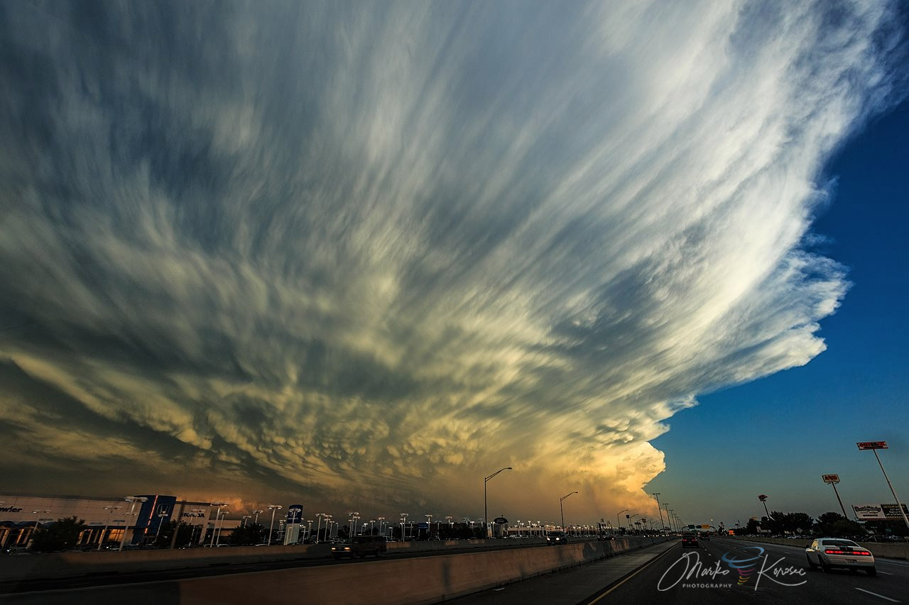
Large anvil of an intense thunderstorm over southern Oklahoma on May 27th, 2016. The updraft has reached the tropopause and is spreading into a large anvil – forming a Cumulonimbus capillatus incus.
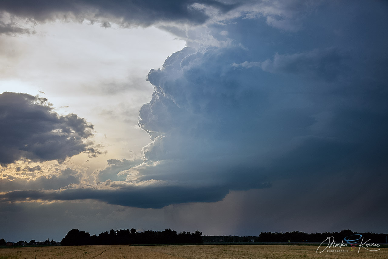
Next … Thunderstorms over the northern Adriatic Sea display a much different morphology. The updraft went through the cumulus congestus (a cumulus congestus on the right edge of the photo) into the cumulonimbus calvus. It hit the equilibrium level (EL) significantly below the tropopause, probably around 7-8 km altitude.
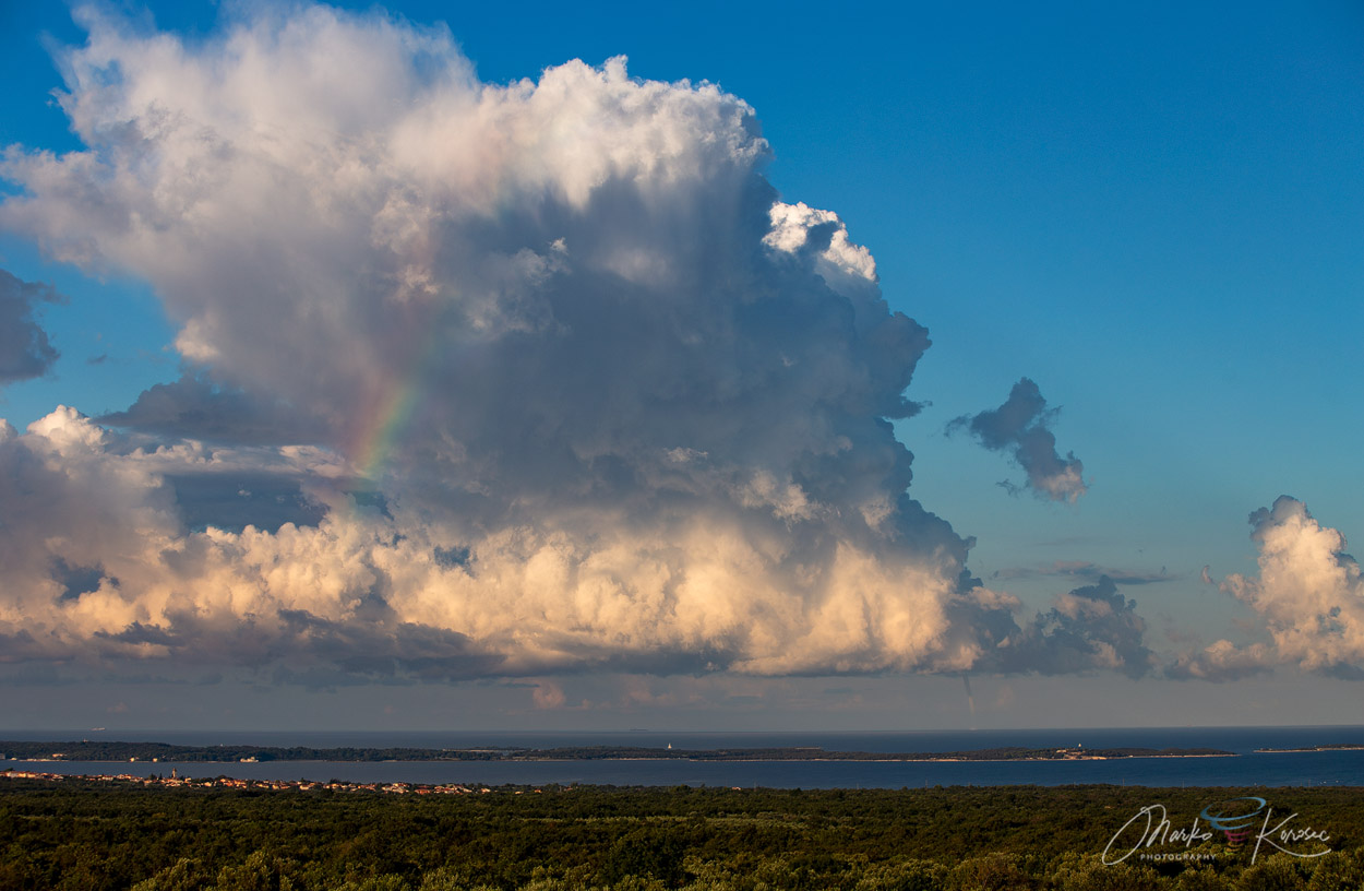
The updraft developed a very weakly defined anvil, fibrous in appearance—cumulonimbus capillatus. Virga is visible in the downdraft around the fragmentary rainbow. Note that the rainbow is terminating at a high altitude, indicative of evaporation of precipitation (i.e., precipitation completely evaporates—virga).
There is a waterspout underneath the main updraft – can you spot it?

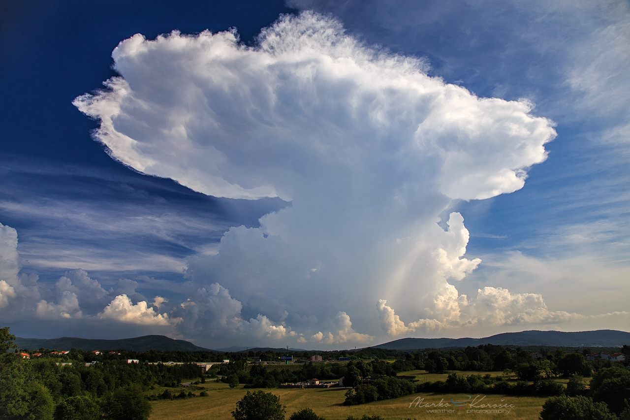
Anvil of a supercell thunderstorm over the Trieste, Italy. A huge anvil cloud with a relatively sharp edge and numerous mammatus clouds developed.
Related topics: