Atmospheric instability is where the Earth’s atmosphere is generally considered unstable.
As air near the ground heats, it becomes more and more unstable and becomes more and more likely to rise convectively. We now look at when the atmosphere is stable, less stable, and unstable, what that means, and how convection initiates.
Stable and unstable atmosphere – instability
Observing the clouds is the easiest way to notice the difference between stable and unstable air masses.
A stable atmosphere will have flat clouds with barely any vertical development. Often, it will be a clear sky.
An unstable atmosphere generally has vertically developed clouds, e.g., cumulus clouds. These clouds grow quickly, a sign that upward motion is present in them.
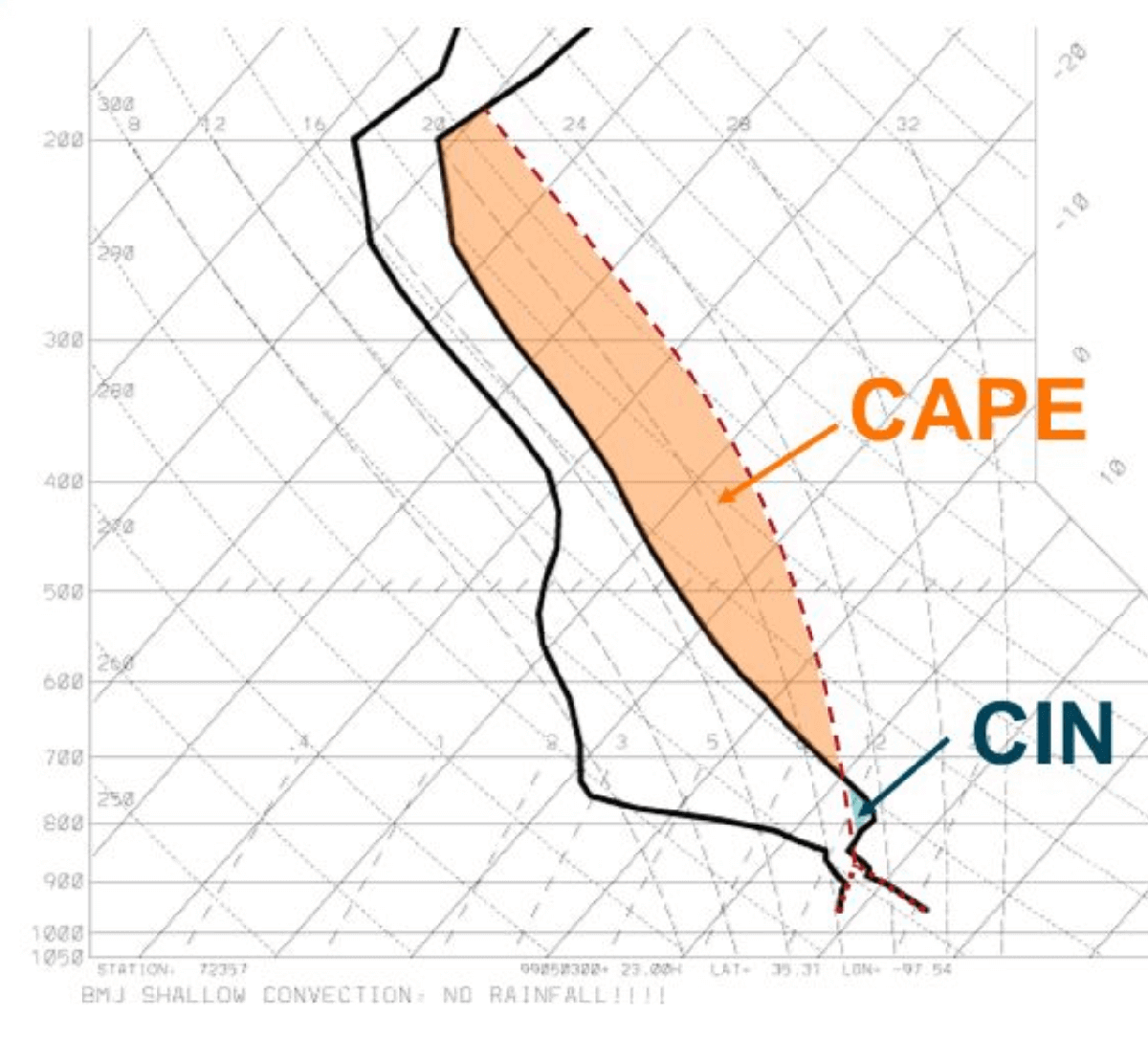
Atmospheric stability is the atmosphere’s resistance to the vertical motion of air. A stable atmosphere inhibits vertical motion. An unstable atmosphere encourages vertical motion. The stability depends on how the air temperature changes with altitude (the temperature lapse rate).
Additionally, several mechanisms will encourage air parcels to start rising. Typically, this includes surface heating by the Sun during the day, local topography (e.g., hills and coasts), wind convergence, or weather fronts.
Atmospheric stability is divided into five levels:
- Very stable: temperature increases with altitude; we have a temperature inversion. Air at ground level is negatively buoyant and does not rise. If air is forced to rise, it will sink back towards the ground again.
- Stable: The temperature lapse rate is less than the dry adiabatic lapse rate (i.e., it falls less than 9.8 °C for every kilometer you go up), but the temperature does decrease with altitude. Air at ground level is negatively buoyant and does not rise. If air is forced to rise, it will sink back towards the ground again.
- Neutral: temperature is the same as the dry adiabatic lapse rate. I.e., if the air is forced to rise, it will cool at the same rate as the temperature around it drops. It will be neutrally buoyant.
- Unstable: temperature lapse rate exceeds the adiabatic lapse rate (9.8 °C/km). Air at ground level is buoyant and will rise.
- Very unstable: The temperature lapse rate is much greater than the adiabatic lapse rate (9.8 °C/km). Air at ground level is buoyant and will rise rapidly.
Neutral stability is also known as conditional instability. This means that the atmosphere is essentially stable until we get a trigger to disturb its stability. Typically, this would be some sort of convection, e.g., a weather front.
Related topics:
Spotting convective weather: clouds and thunderstorms