A massive Heat Dome is making a dramatic return across Europe as September draws to a close, setting the stage for an unseasonably warm spell that will stretch into early October. A powerful upper-level ridge building north from the Mediterranean and North Africa is driving a warm plume northward. Significant 850 hPa temperature anomalies will locally climb 8 to 12 °C above long-term averages and will overspread vast portions of Western, Central and Northern Europe.
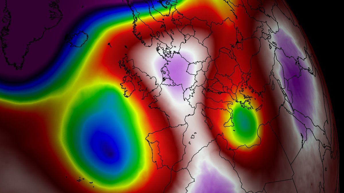
The primary engine behind this late-autumn thermal surge is a classic atmospheric dipole pattern. A deep, high-amplitude upper-level trough will establish over the North Atlantic and force an intense southerly jet stream plume to advect warm, tropical air deep into continental Europe.
Beneath the core of this expansive blocking ridge, strong atmospheric subsidence is compressing and warming the lower atmosphere, suppressing cloud cover and driving afternoon surface temperatures well into the upper 20s and peaking into the low 30s in some areas.
This is extremely warm for late September or early October.
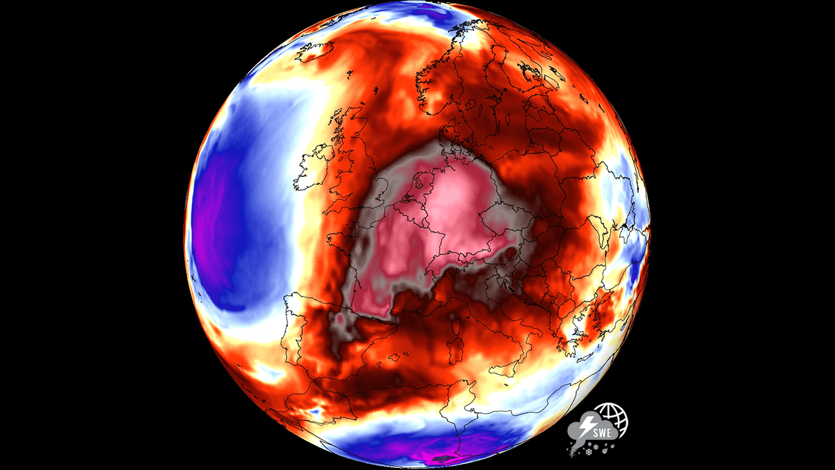
As the calendar turns to October, this persistent high-pressure block will restrict Atlantic weather systems to the far western portions of the continent. The resulting stable, dry air mass will prolong early-autumn warmth across low-lying agricultural basins and urban valleys, creating exceptional late-season temperature contrasts between Western and Central Europe and the deep troughing over the Atlantic.
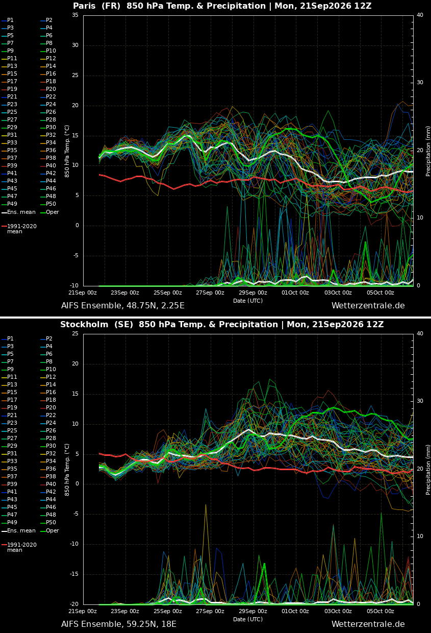
The following chart shows the mid-range forecast for Paris, France, and Stockholm, Sweden. Both indicate the warm wave will be long-lived, with temperatures significantly above the average. Predictions also hint it will generally expand into early October.
The forecast weather model anomaly animation below represents the steady expansion of this upper-level ridge across continental Europe, highlighting where the strongest 850 hPa thermal anomalies will center through the end of September and into the first days of October.
Before we dig into the details, let’s look at what a heat dome is and why it matters to understand its dynamics.
Atmospheric Dynamics: How High-Pressure Heat Domes Compress and Trap Air
When significant, record-breaking heatwaves occurred in the United States, Canada, and Europe in the past, heat domes played a role. Heat domes are usually the dominant feature of summer weather patterns on both continents.
We call this phenomenon a heat dome when extremely high temperatures develop. Here’s how it works and why understanding it on a broader scale is essential. The upper-level ridge pattern, or very warm air mass at higher altitudes, also known as the Upper High (or blocking High), usually forms the heat dome. This weather pattern brings high, and sometimes record-breaking, temperatures to the region below.
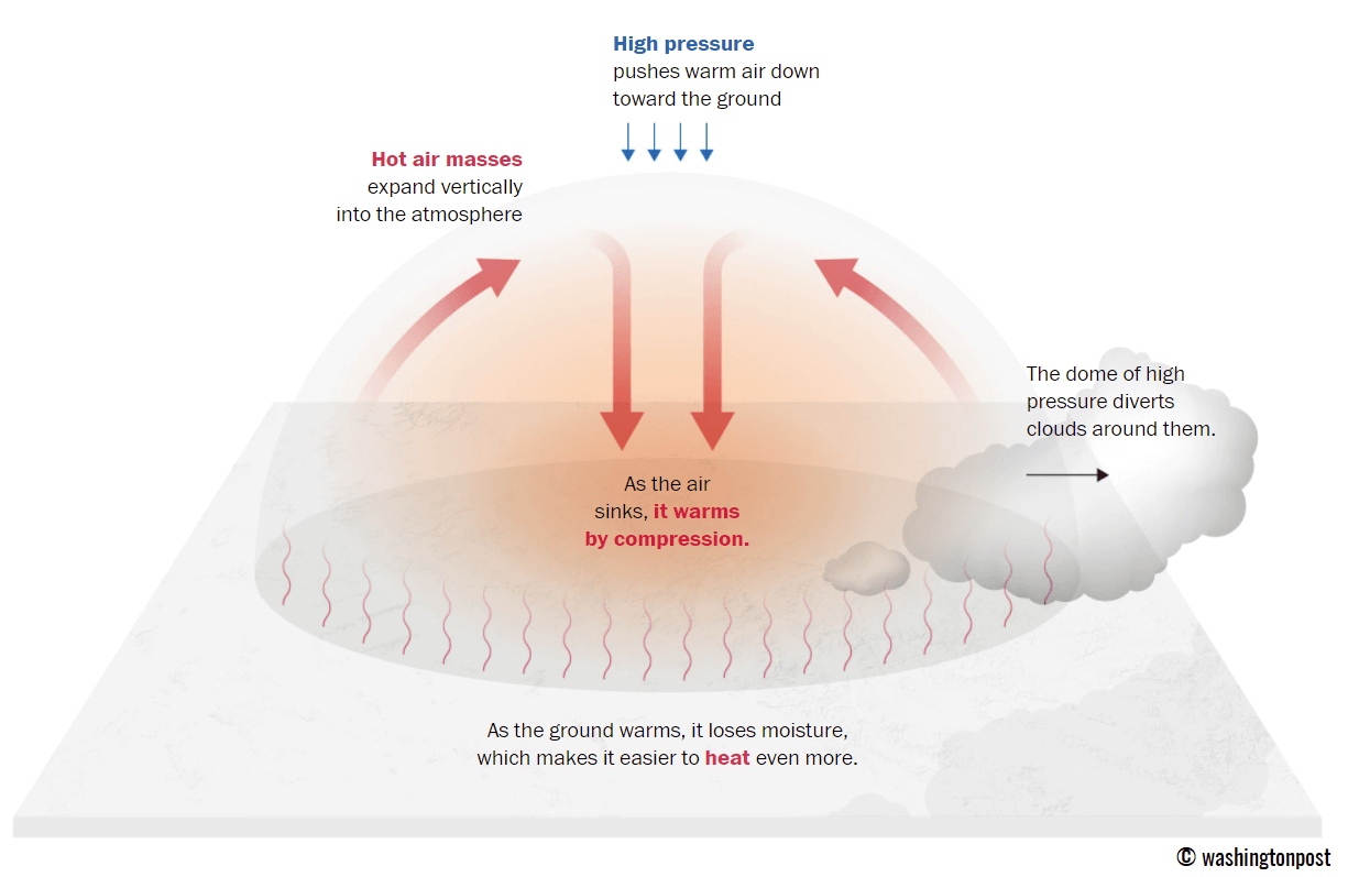
This term describes a broad area of high-pressure air that parks over a large portion of the continent. If the event is remarkably stable and extreme, it usually lasts several days or weeks.
The heat dome works like a lid on a pot. The extensive dome traps warm air at all levels underneath, with layers sinking toward the ground. As a result, the air mass becomes anomalously warm at the lowest elevations and extremely hot near the surface.
Health and Grid Impacts: Managing Nocturnal Heat Stress and Heat Index Extremes
Excessive heat in heat domes can significantly impact human health and be dangerous to particularly vulnerable populations, such as elderly individuals, children, and those with pre-existing health conditions that can be worsened by extreme heat.
Because of prolonged exposure to high temperatures, construction workers, farmers, and other long-hour outdoor workers face an increased risk of heat-related illness. People living in poverty are also more susceptible to the fatalities of heat domes, as their houses are often built with heat-trapping surfaces such as concrete and asbestos.
Heat exhaustion occurs with prolonged exposure to high temperatures. It leads to dehydration and dizziness, and in more severe cases, it can progress to heat stroke.
High relative humidity during a heatwave can also significantly affect the body. For this reason, we use the Heat Index to represent the perceived feel of scorching-hot temperatures and high humidity. It illustrates the natural relationship between temperature and humidity.
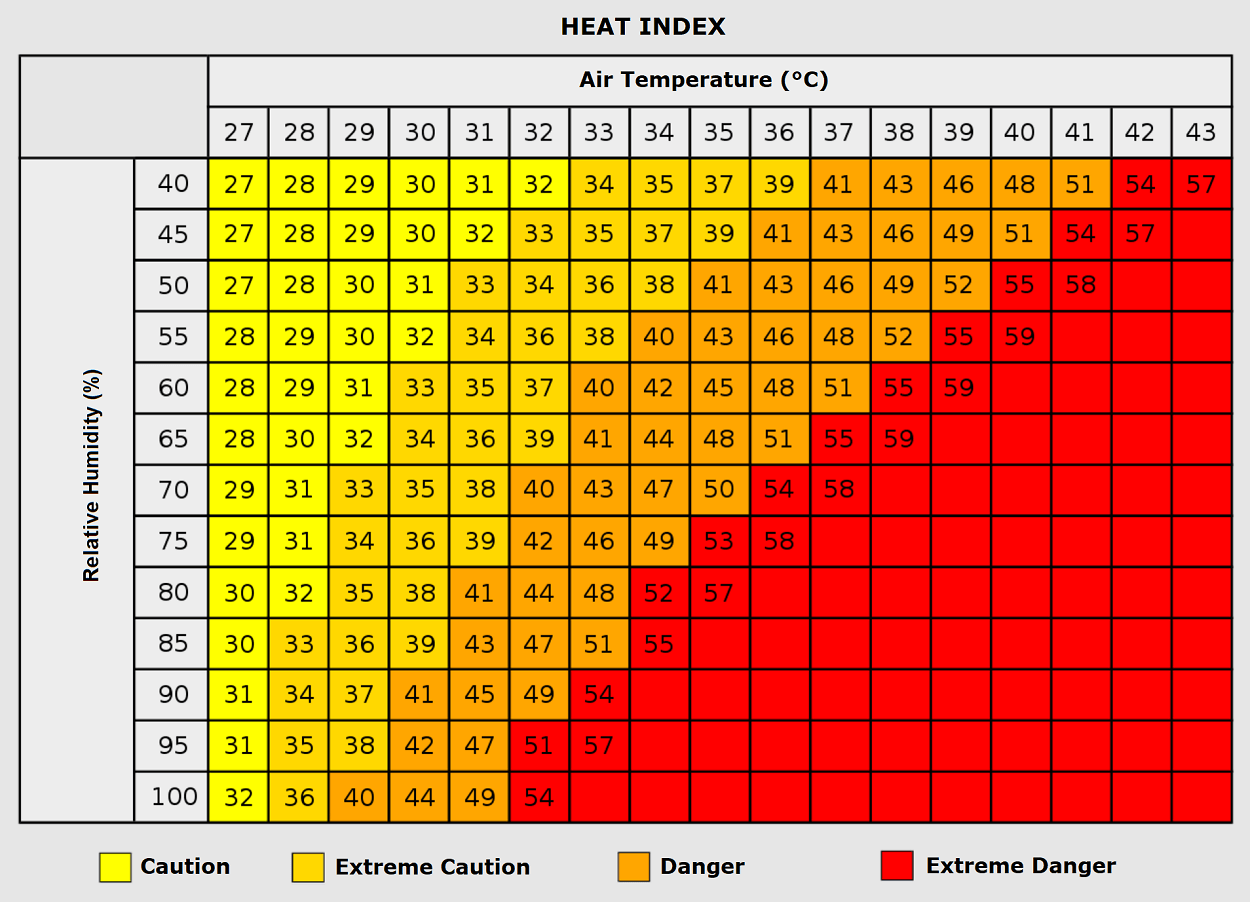
When the air mass has a temperature around +35 °C, humidity below 60 percent is much less challenging than when humidity is very high (e.g., above 80%). Thus, the actual feel temperature would be near 50 degrees Celsius. Heat waves have also been associated with increased rates of heart attacks, strokes, and respiratory illnesses.
Our additional article, Health risks during a heatwave and sweltering hot weather, provides further details on the health risks.
Beneath these staggering meteorological statistics lies an even grimmer threat. The danger is magnified by suffocating so-called ‘tropical nights’ where temperatures don’t drop below 24 °C, denying the human body its vital window to cool down.
Synoptic Setup: Atmospheric Dipole Drives North African Warm Plume into Europe
The general weather picture over the European continent and the Atlantic Ocean this week shows a strong, deep upper wave building over the North Atlantic, with an upper-level ridge gradually expanding into western and central Europe and continuing into the final week of September.
A new persistent Heat Dome will develop and dominate the continent through the remainder of the month.
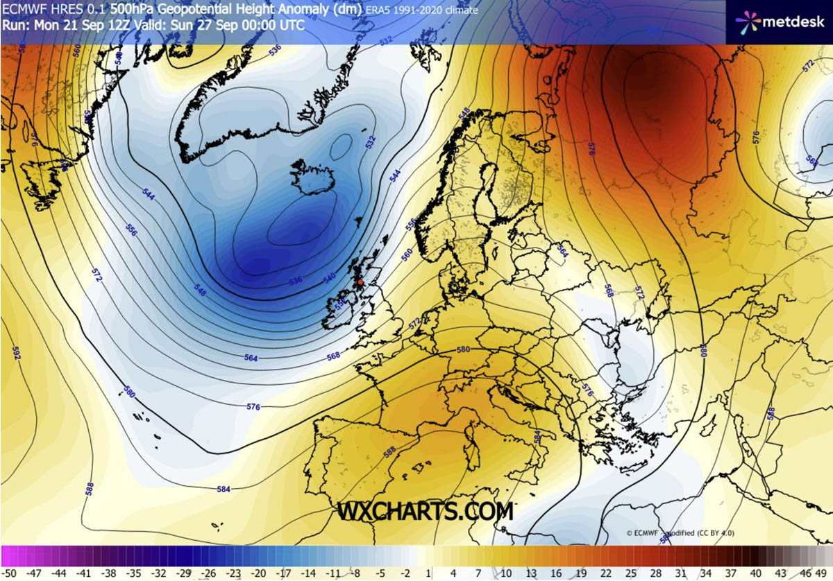
The warmest air mass is trapped underneath the core of the heat dome aloft, spread across western and southwestern Europe until Friday and Saturday. The most anomalous temperatures will be over Spain, Portugal and France.
The deep wave over the North Atlantic will keep temperatures lower over the western British Isles and will remain locked in through next week.
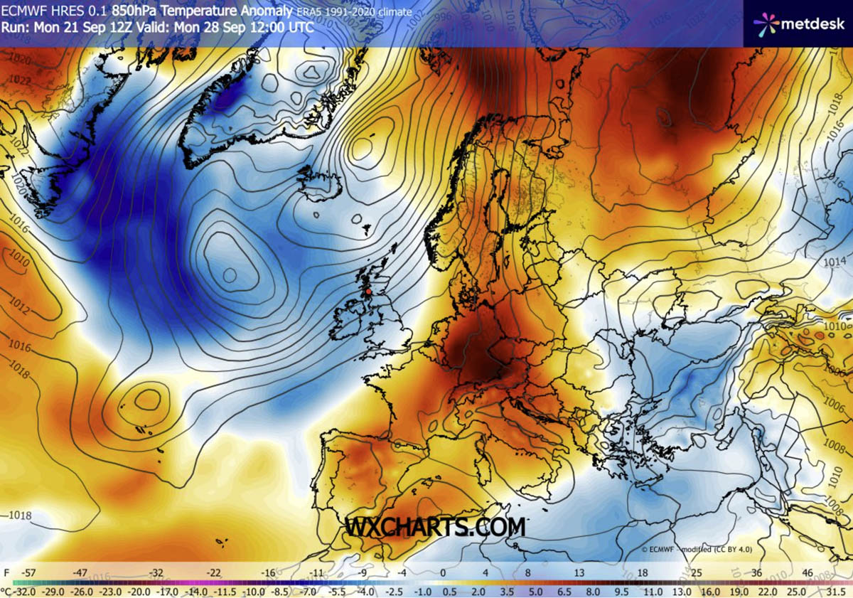
As the heat dome gradually strengthens, the surface heatwave will bring the highest temperatures from Spain and Portugal into southern and central France throughout this week and the following weekend.
The 2m temperatures will be around 10 to 14 °C above the long-term thermals for late September.
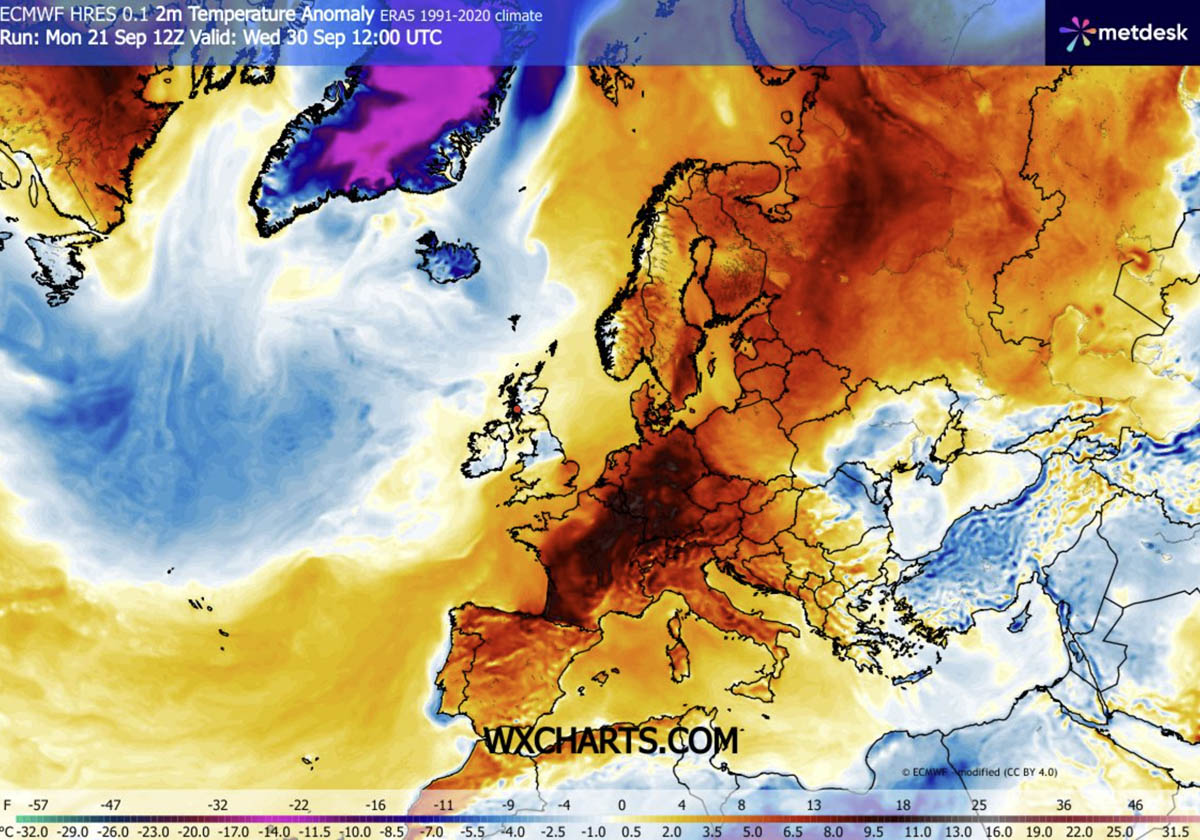
The air mass will remain unseasonably hot through the end of September and into Sunday.
One thing to note in the developing pattern is that the strong southwesterly jet stream between the deep Atlantic low and the ridge over continental Europe will bring an atmospheric river of high moisture into the western British Isles. Meaning high rainfall accumulations will develop from western Ireland to Scotland and southwestern Norway.
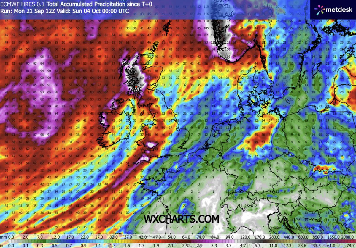
Through early October, orographic rainfall sums could reach more than 150 mm in places.
Daytime Highs & Regional Breakdown: 30°C+ Extremes Target France, Above 35°C+ over Iberia
Southwestern Europe: Temperatures from 34-38 °C across south-central Spain and Portugal until the weekend
The intense warm plume associated with the late September heat dome will keep temperatures extremely high across the Iberian Peninsula, gradually expanding into southwestern France late this week.
Peak daytime highs until Saturday will be above 35 °C across central and southern Spain and Portugal, with an extremely dry air mass. Across central and northeastern Spain, temperatures will climb into the low to mid-30s.
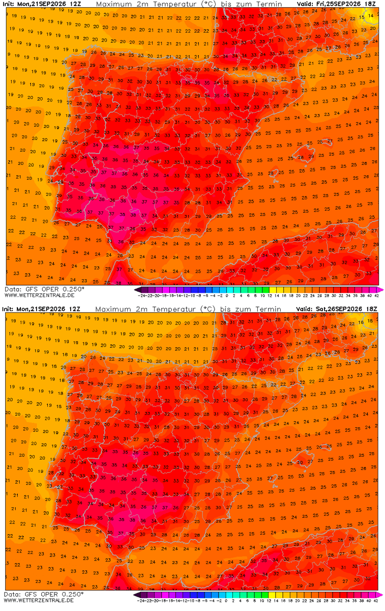
Temperatures could peak around 40 °C from Thursday through Saturday.
Western Europe: Southern France pushes to near 36 °C in the south; hot days continue until the weekend
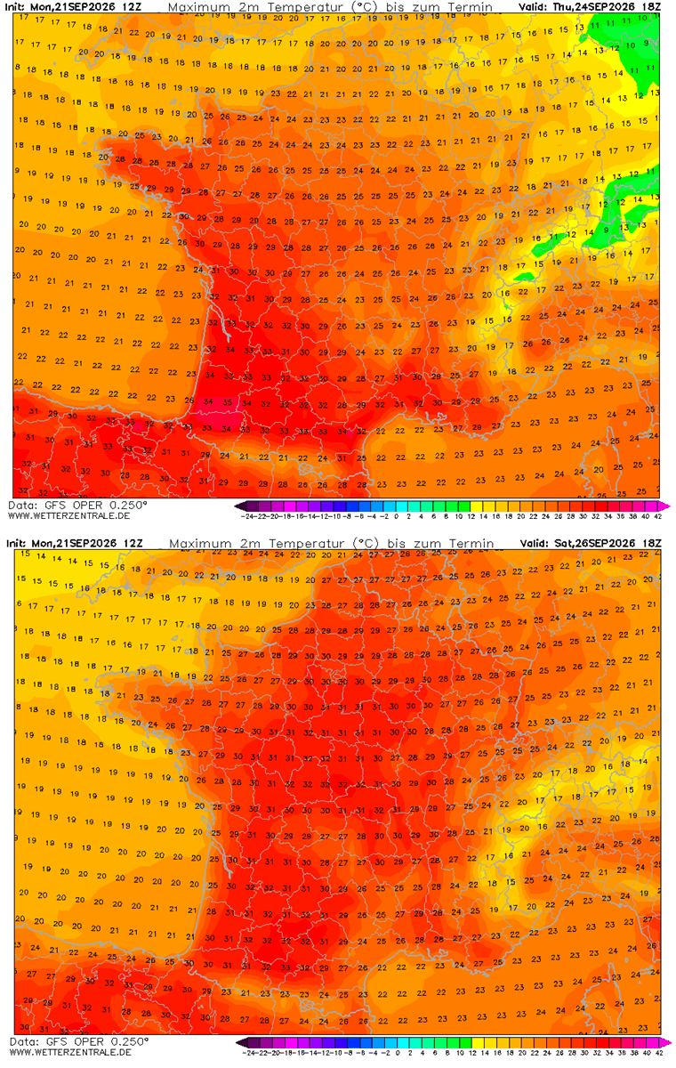
As the heat dome expands aloft, the hotter air mass will spread across most of France again and intensify. The hottest days will be across southern and central France, with the highest temperatures in the interior south and southwestern France.
Temperatures over central France will reach into the mid-30s, while northern France and the Benelux should remain in the low 30s over the weekend.
UK: Shorter period of mid to upper 20s through Sunday
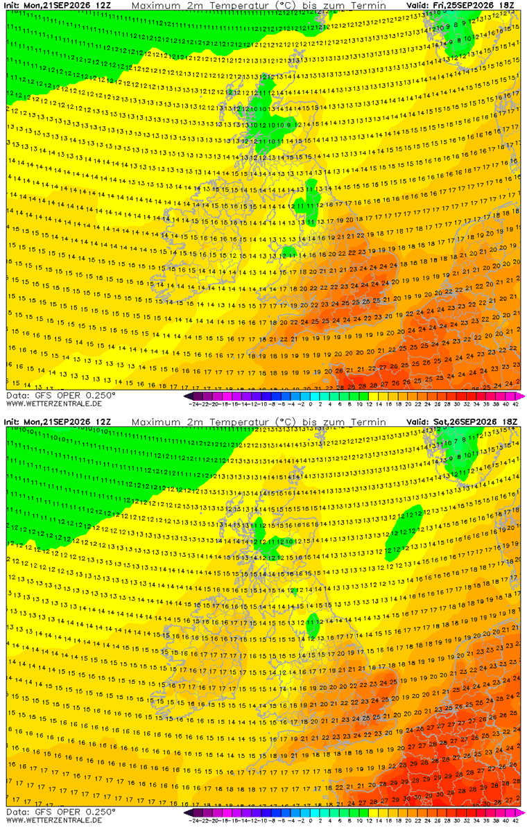
Although temperatures will not be particularly hot over far western Europe, the daytime highs will push into the mid-20s from Thursday until Saturday, which is pretty high for the end of September. The warmest air mass will be over south-central England.
Temperatures over Ireland and Scotland will be lower, around mid-10s at most.
Central Europe: Germany peaks near 27-29 °C, warmest from Sunday through next Tuesday
From Saturday into early next week, the warmest air mass will advect from France toward the Benelux and Germany, gradually surging northeast toward Poland and the Baltic region.
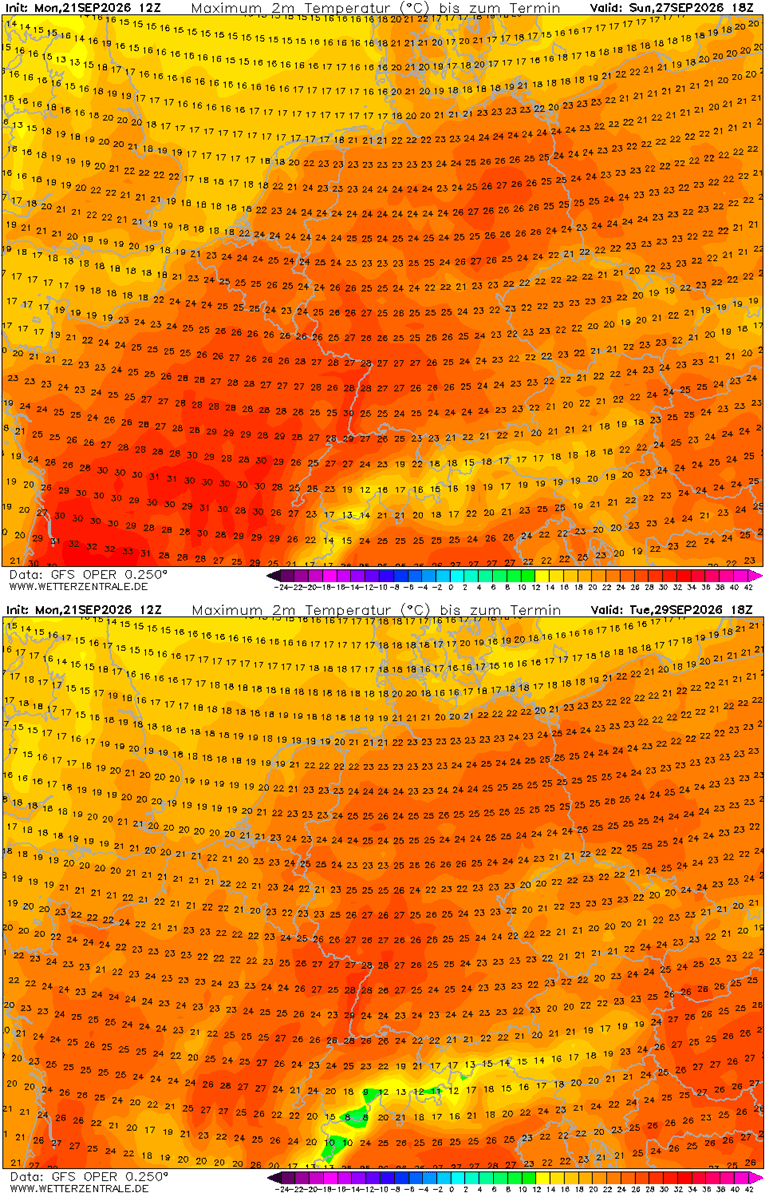
Temperatures will return to the mid-to-upper 20s, with some areas nearing 30 °C across western, central, and northern Germany.
Southern Europe: Italy and central Balkans peak near 28-30 °C, warmest over northern Italy
From Saturday into the early next week, the warmest air mass will remain over the Mediterranean, gradually surging north into Central Europe and the Balkan Peninsula. Temperatures will return to the upper 20s, with some areas reaching 30 °C across northern Italy, challenging late-September record highs.
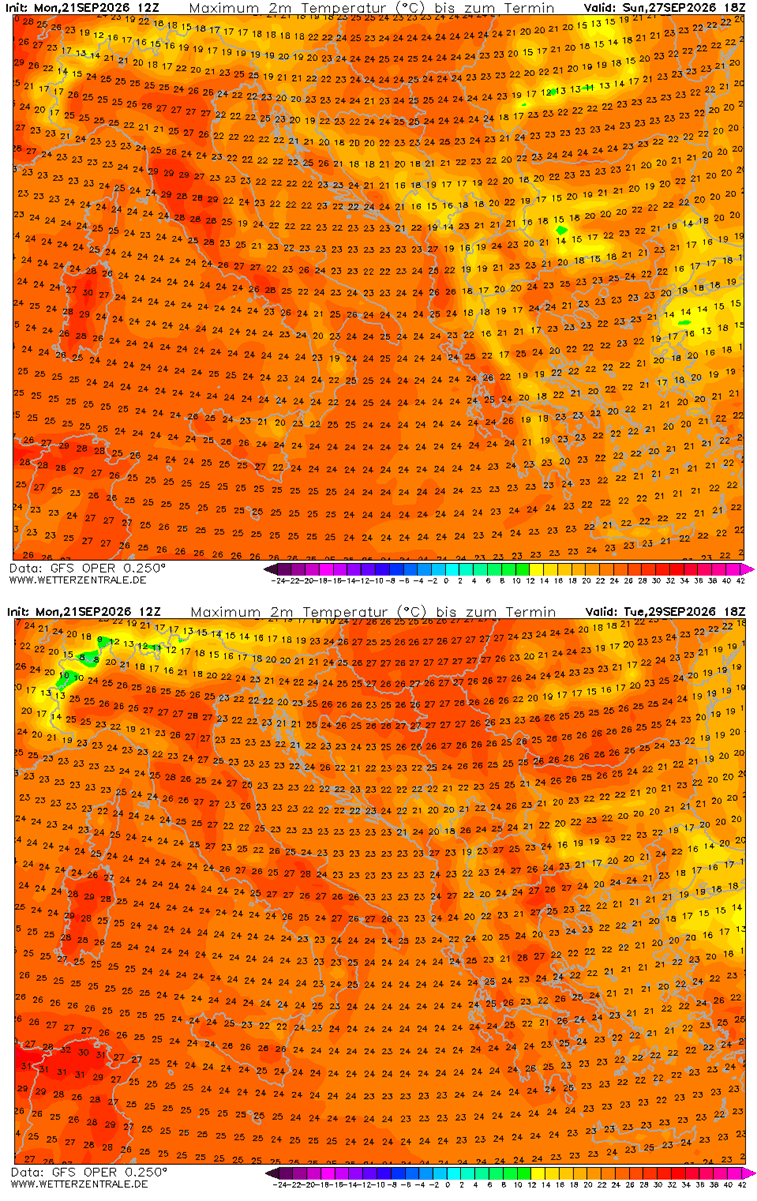
The most anomalous and warmest air mass will be over the Po Valley in northern Italy and Tuscany in central Italy, the north-central Balkans, and Greece.
Long-Range Outlook: How Long Will the Early October Blocking Ridge Persist?
Based on GFS and ECMWF ensemble model trends, the similar pattern through the end of September will continue into early October. A sharp boundary will form between the Atlantic and continental Europe.
By the end of September, which arrives next week, the upper-level ridge expands further north and east, dominating most of continental Europe. A strong ridge develops and centers over Northern Europe. While the low over the Atlantic intensifies.
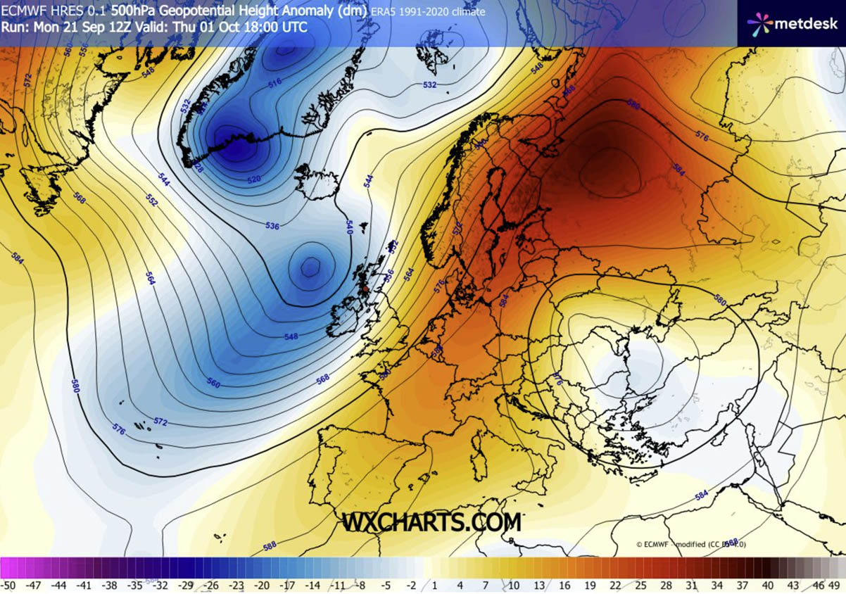
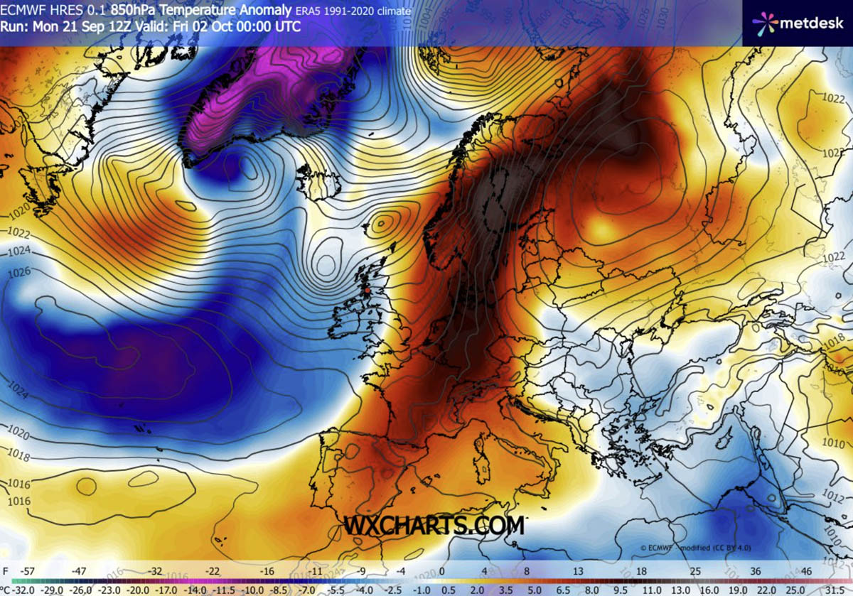
A stable and dry air mass will expand over the continent. The warm wave will cover Spain, France, Germany, and Scandinavia. The most significant thermal anomaly will be over Sweden and Finland.
This will be unusually intense for early October, bringing significantly higher-than-normal temperatures from France into Denmark, Sweden, and Finland.
We will continue to monitor the weather pattern and update the forecasts accordingly. Long-term trends suggest the pattern will become more dynamic later in October. Stay tuned for updates.
PivotalWeather and WXcharts provided images used in this article.
See also:
Winter 2026/2027 Snowfall Explorer: See the Latest Forecast for Your State and Region