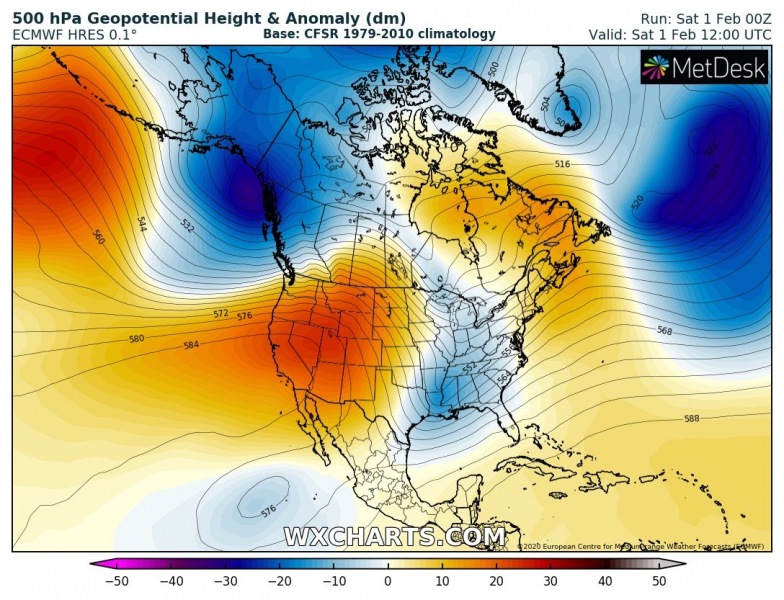
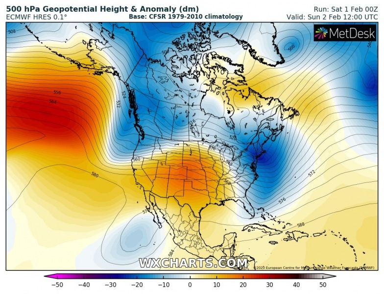
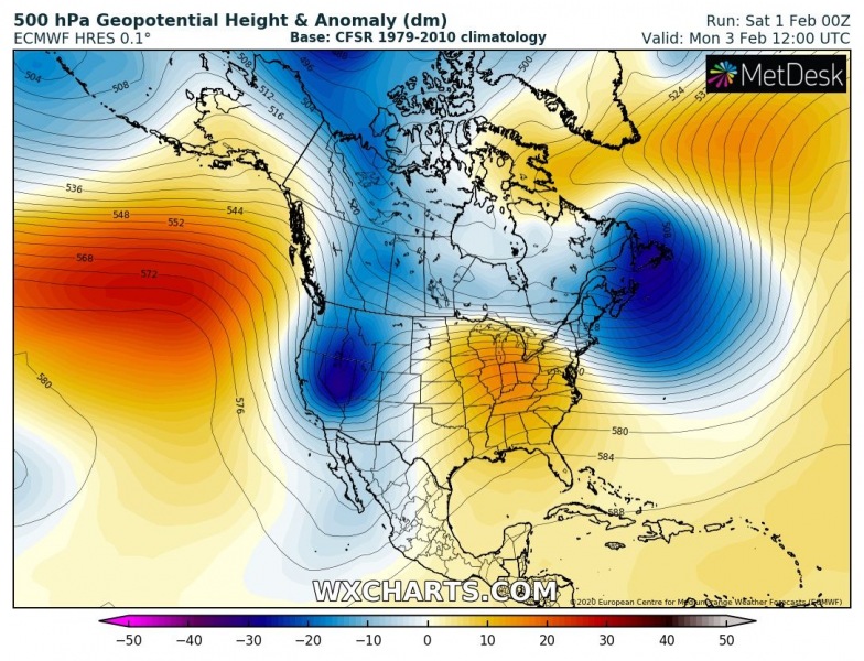
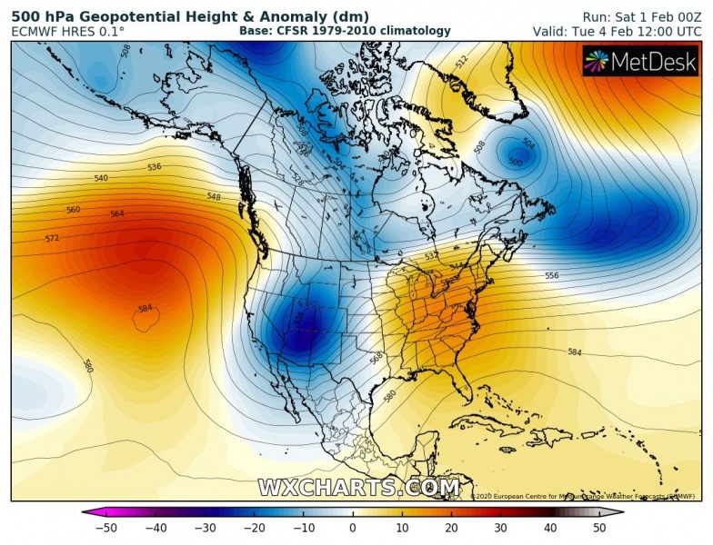
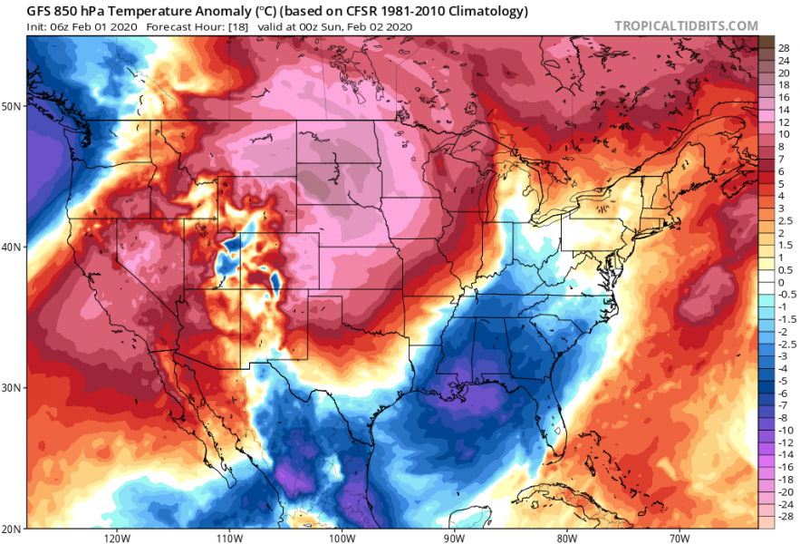
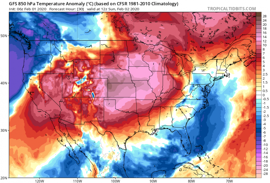
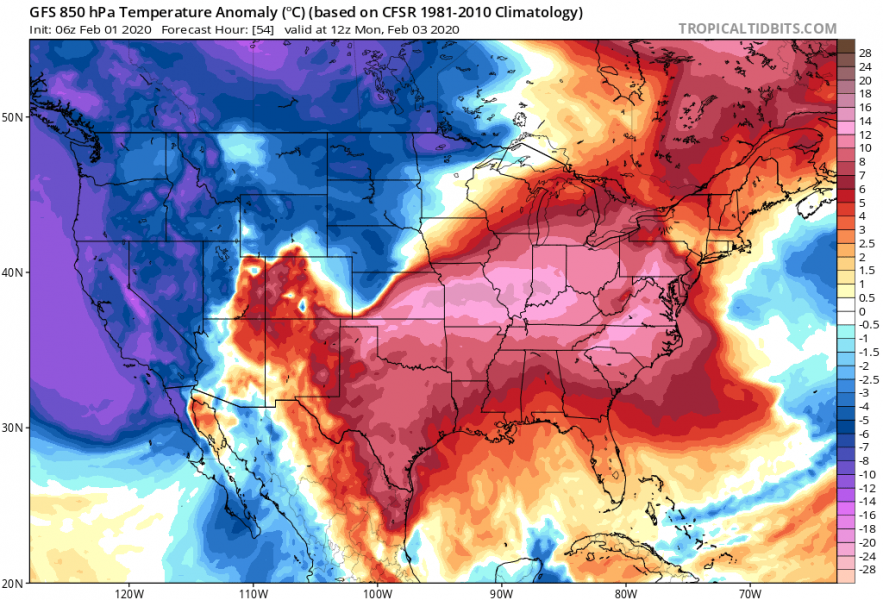
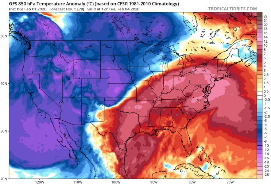
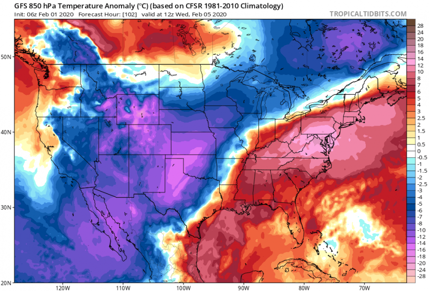
After a relatively mild pattern across the United States lately, pattern is in front of a significant change and flip this weekend. A widespread cold pool that persists over Alaska and lately also over the far North Pacific, results in a significant cold outbreak towards the western half of the US. It will be spreading south across the Southwest US and reaching north Mexico by mid next week. The frontal system with an intense cold pool delivers much colder weather than normal for this period and lots of snow into the Rockies.
Finally, the upper ridge which is resulting in very high temperatures across the Northwest US (40-50 °F on Saturday) weakens and pushes east while a deep trough from the North Pacific / Alaska pushes into the west Continental US (CONUS) and deepens while drifting southeast towards the Southwest US. A strong upper ridge develops behind it over the North Pacific.
First, there will be a very warm air mass spread across the large part of CONUS this weekend, while the cold outbreak starts appearing across the far Northwest US and North Pacific. It gradually but quite fast spread towards the Rockies and northern Plains, then continues south-southeast towards the central Plains and Southwest US through early and mid-next week. The surface cold front will be very sharp, delivering around 25-30 °F / °C lower temperatures in less than 24 hours in some region (Plains in particular)!
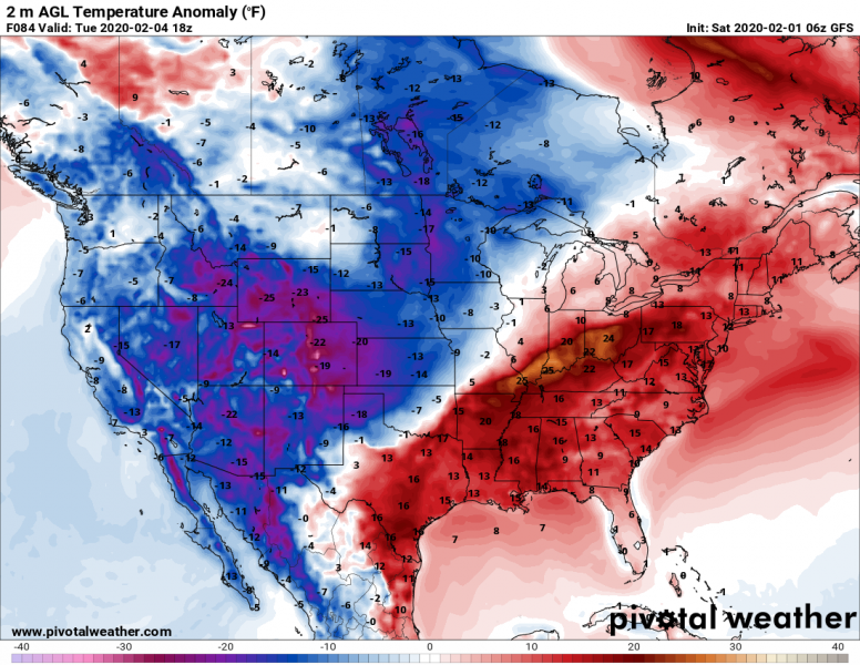
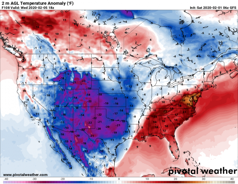
Here is 2m temperature anomaly – we can see it will be a very intense cold outbreak, delivering even more than 20 °F colder temperatures which are normally observed in early February:
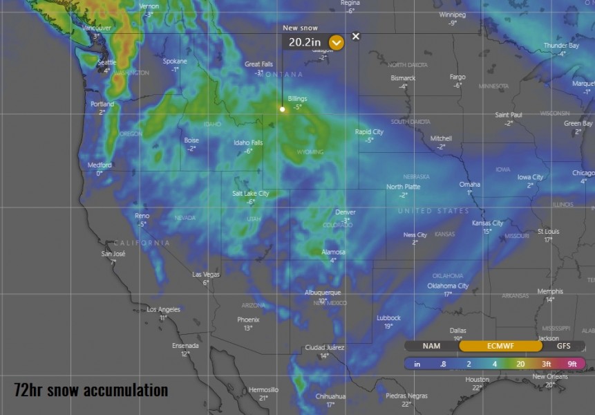
Snowfall will start during late Sunday across parts of Idaho, Wyoming, and Nevada and spread southeastward through Sunday night and into Monday into Utah and Colorado as well. Locally 10-20″ (= 25-50 cm) of snow totals are expected, also with blizzard conditions.
Stay alert for much colder weather in the coming days, also with lots of snow locally across the northern Rockies.
Further west in the North Pacific, a violent extra-tropical cyclone is moving into Aleutian Islands, Alaska:
