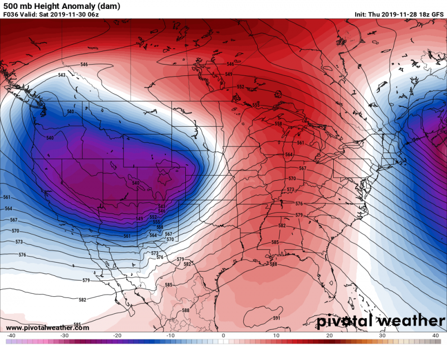
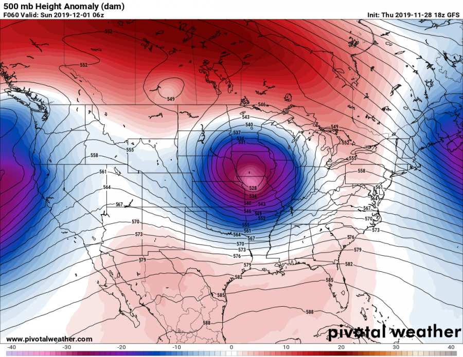
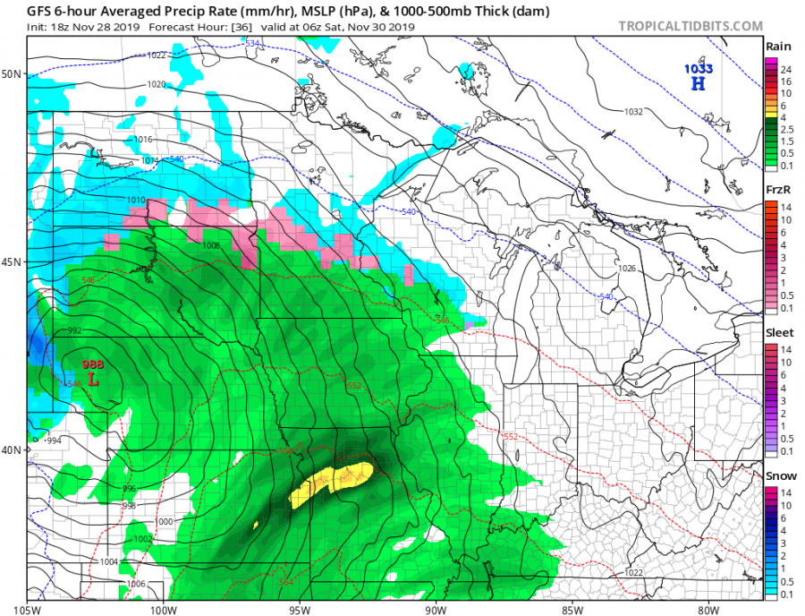
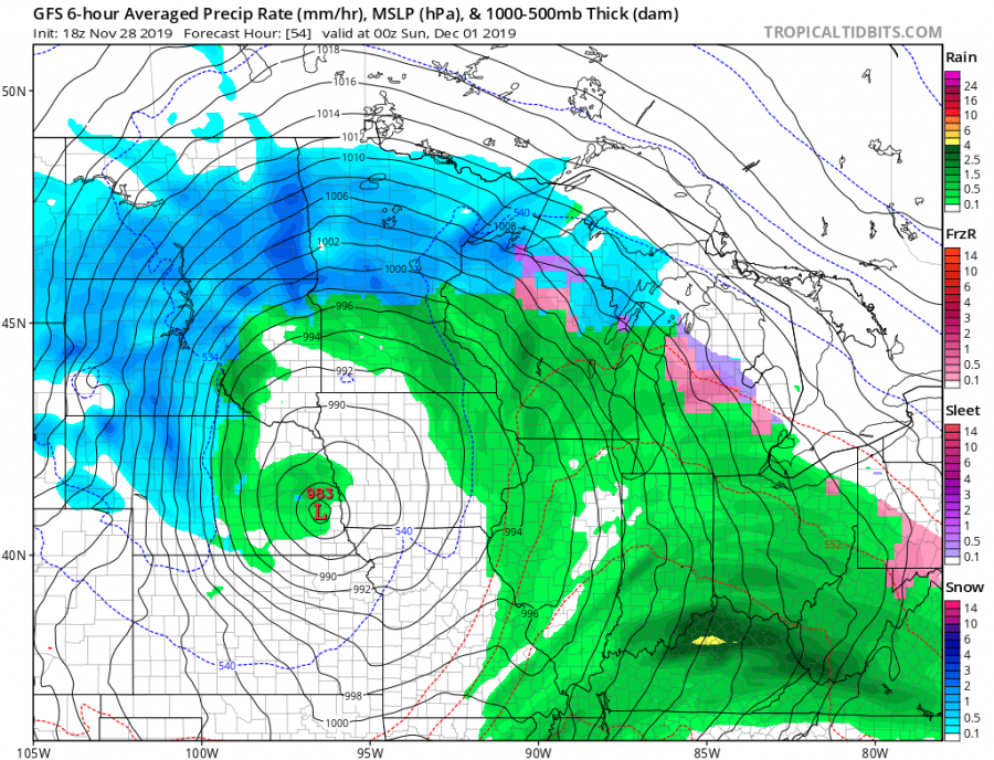
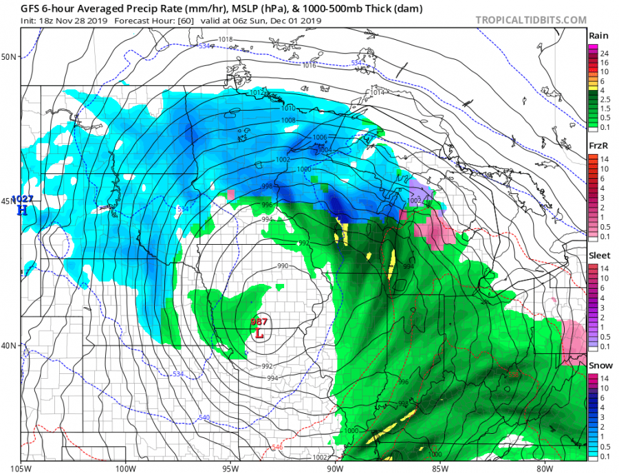
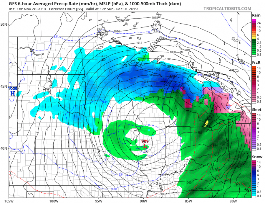
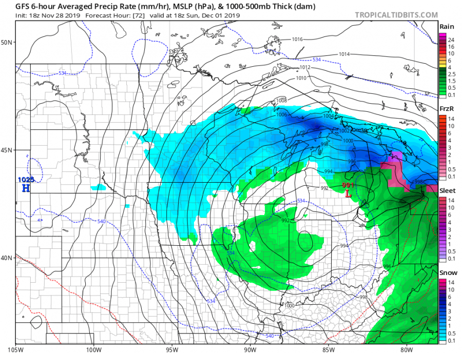
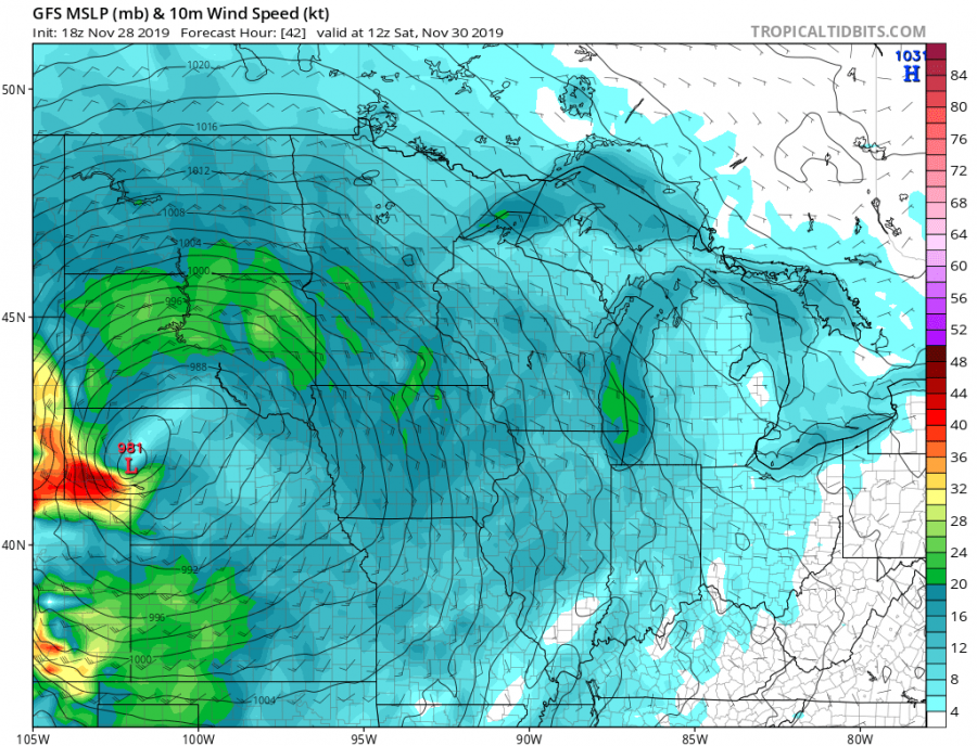
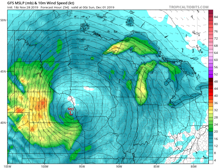
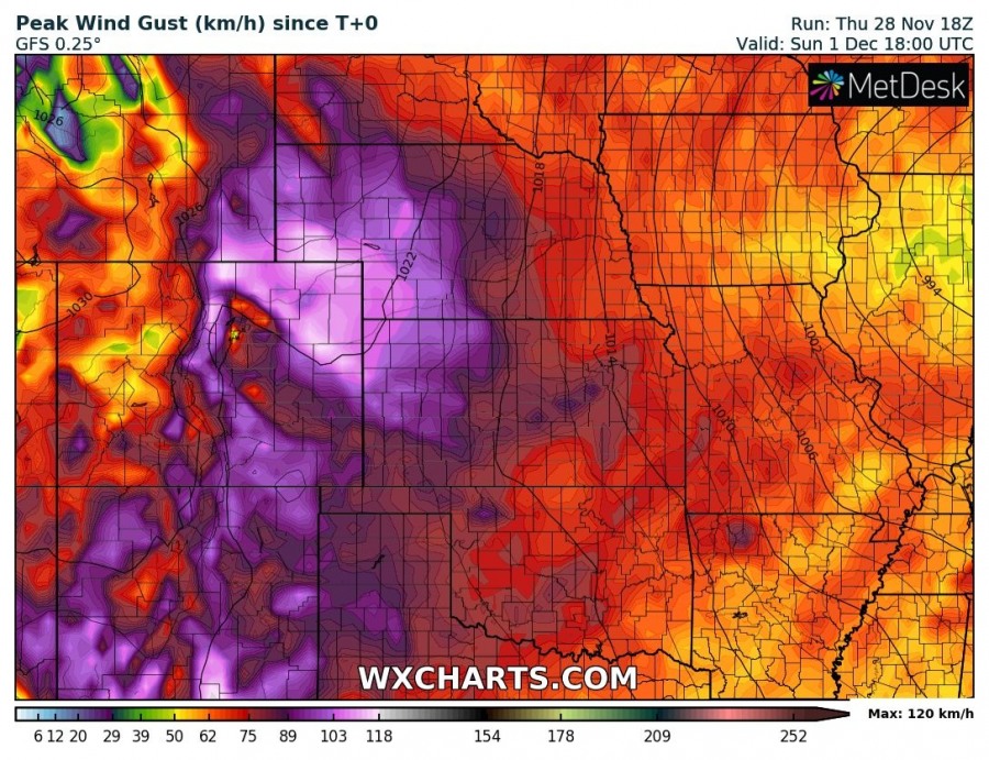
The end of November brings a very powerful cyclone across the northern parts of the United States, technically a perfect textbook explosive surface cyclogenesis / bombogenesis cyclone with sharp frontal boundaries and severe weather. While strong pressure / temperature gradient will result in severe winds and together with heavy snowfall, also dangerous severe blizzard conditions!
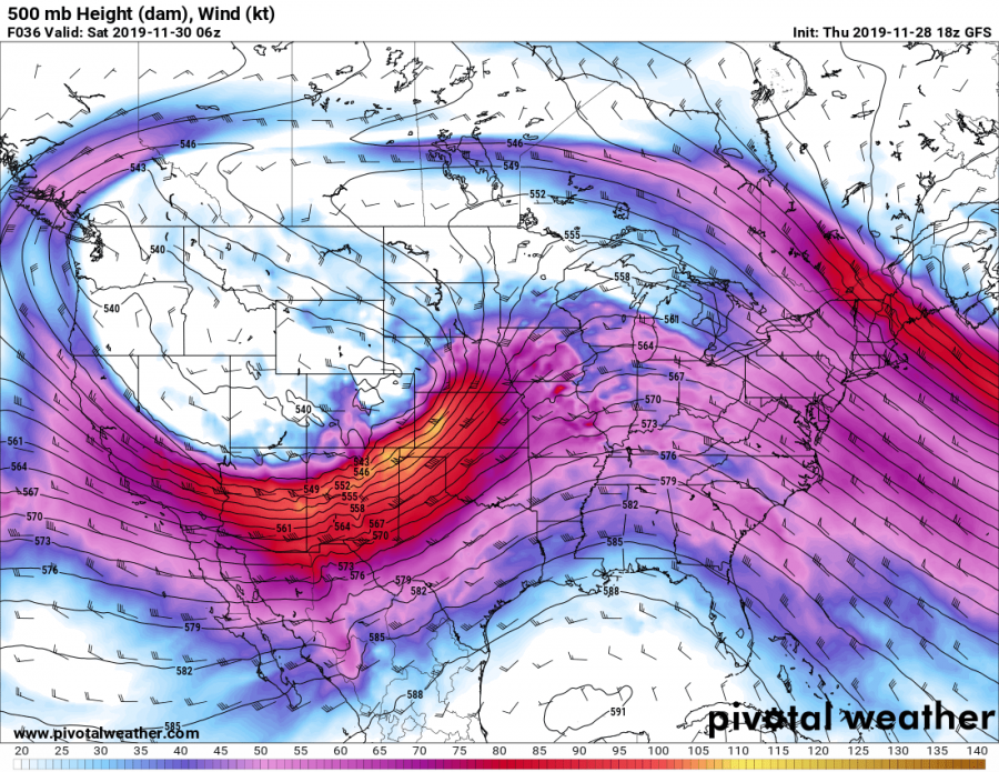
A very intense core will develop over northern parts of CONUS and deepening even more while drifting across the Northern Plains towards the Great Lakes. With a very powerful 100+ knots jet stream rounding the base of the trough to its south.
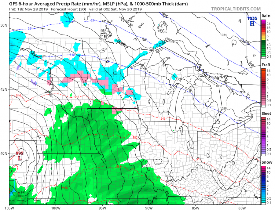
A 3-hour sequence of mean sea-level pressure and precipitation type indicate around 992 mbar Lee cyclone developing in the NE Colorado by Saturday, Nov 30th 06 UTC, beginning the rapid intensification / bombogenesis phase overnight to Saturday. As of 12 UTC Saturday, cyclone moves into W Nebraska with already around 981 mbar central pressure and intense winter precipitation banding with the occluding from in its wake. Until Saturday’s evening, cyclone deepens below 980 mbar while drifting east across Nebraska but soon begins its weakening trend when nearing Iowa. Cyclone continues east across Iowa and Illinois on Sunday, Dec 1st, losing its strength. As it can be seen on the maps, a very intense snow blizzard conditions will develop around the cyclone to its north and northwest, very likely bringing whiteout conditions and significantly reduced driving conditions.
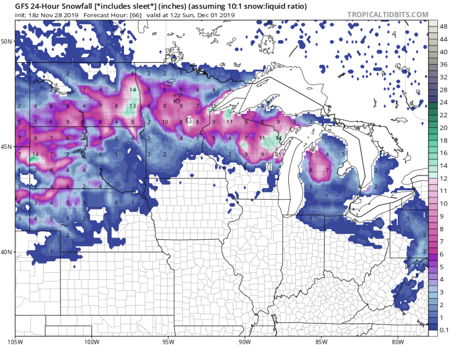
A closer look at the cyclone’s wind field reveals how intense the winds will be, affecting driving conditions and combined with snowfall to the west and north of the low, also significantly reduced visibility and could potentially result in even impossible driving. The highest snowfall rates and blizzard conditions are expected across Wyoming and Dakotas.
A very sharp pressure gradient will be present around the center of the low, especially across the NW and SW quadrants of the system. This will result in extremely severe wind gusts locally. Peak wind gusts should likely exceed 120-130 km/h (75-80 mph), even higher near the slopes of the eastern Rockies where downslopes winds could push above 150 km/h (90+ mph)!
The total snowfall along the swath north of the cyclone’s center is expected to reach 10-20 inches, even more locally. Huge snowdrifts will become a serious issue with time and should locally lead to road closures.
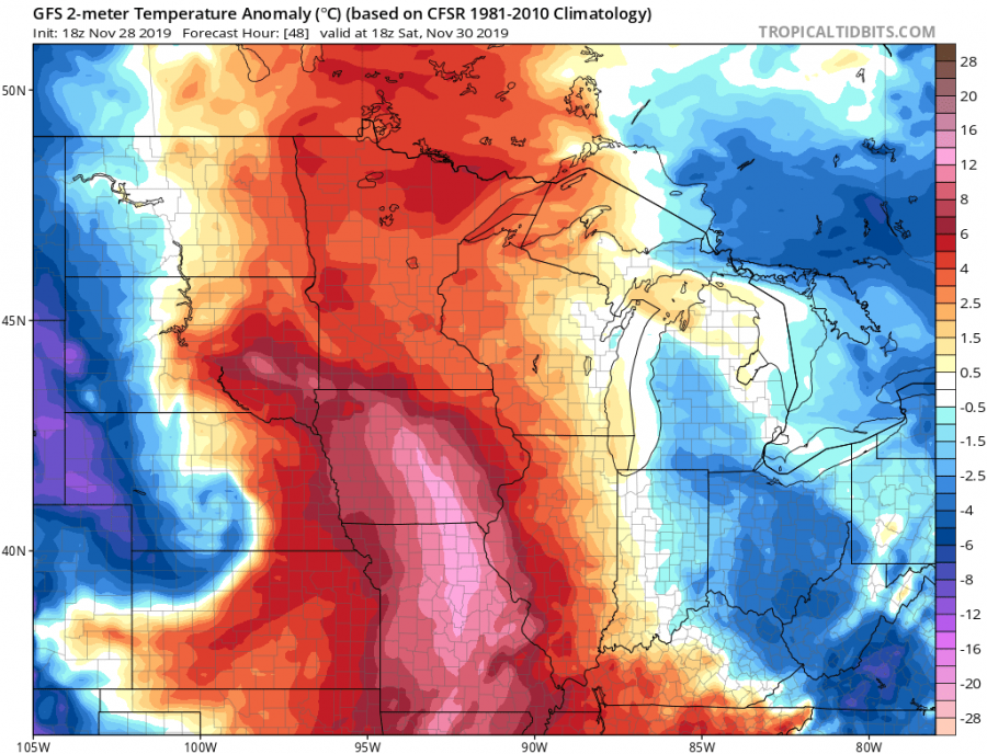
A couple of more impressive graphics of this textbook cyclone developing. Looking over the temperature anomaly, one can notice how sharply defined the surface front becomes. Further east ahead of the low / trough, a very warm airmass advects north and bands back west around the surface low and creates a broad warm sector with even more impressive gradient against the cold airmass behind, a really textbook features to observe! Such sharp gradients and fronts will also result in quite significant boundaries with intense rain vs. heavy snow or sleet / freezing rain. Or indeed blizzard!
Stay alert for extremely dangerous conditions developing, both with severe winds and blizzard conditions!
Interested in our calendar? We are proud to present and promote the best weather photographers in Europe – see details:
