Noctilucent Clouds: A rare atmospheric phenomenon
Have you ever seen noctilucent clouds (NLC)? These may be the most unusual and rare clouds you may ever see. Noctilucent clouds are to normal …
Have you ever seen noctilucent clouds (NLC)? These may be the most unusual and rare clouds you may ever see. Noctilucent clouds are to normal …
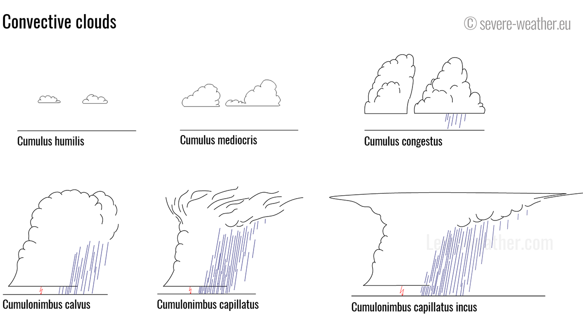
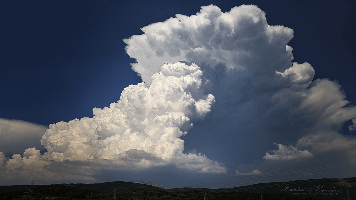
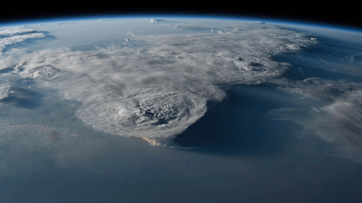
Convection forms distinct types of clouds. Convective clouds are divided into two types (genera): cumulus and cumulonimbus. Each successive kind and species displays more vertical …
In this section, we will take a general look at the thunderstorms. What is a typical thunderstorm? We will examine its essential components and how …
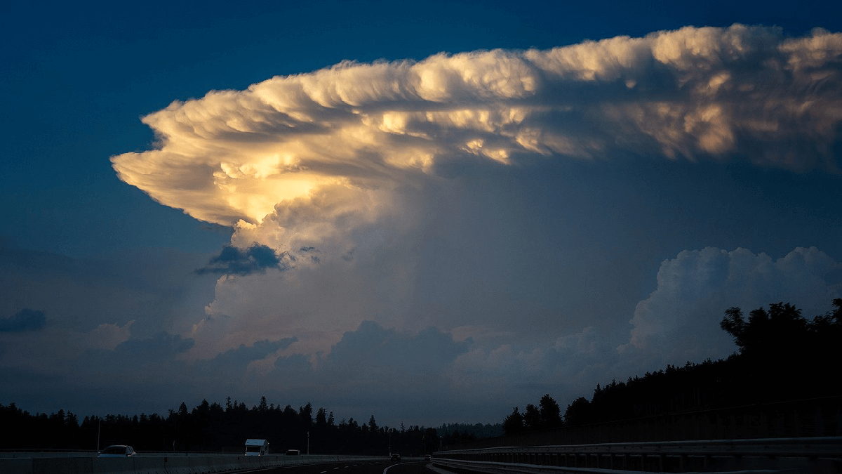
A back-sheared anvil is the expression for a cumulonimbus anvil that spreads against (upwind) into relatively strong winds (jet stream) aloft. Anvil vs. wind …
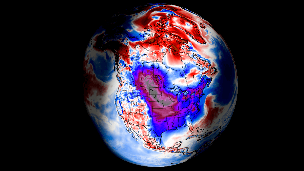
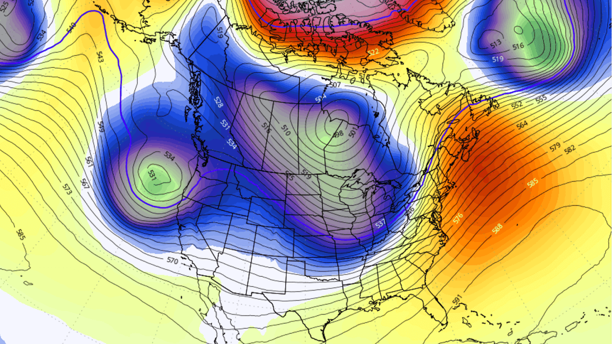
Active Polar Vortex above North America takes no break. Next week, its southern lobe will generate another significant, frigid cold Arctic Blast from Canada into …
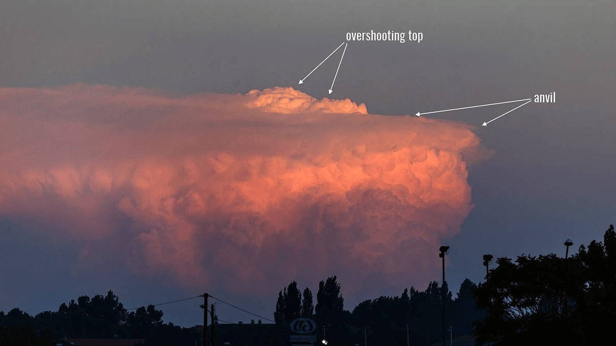
Overshooting tops develop on thunderstorms that have powerful updrafts. Overshooting tops typically develop on Cumulonimbus capillatus incus clouds. The updraft punches through the equilibrium level …
The active Polar Vortex southern lobe is blazing across the Northern Hemisphere, producing significant cold waves across the North American continent. Two major storms are …
How high into the sky can thunderstorms develop – what are the highest ever measured thunderstorms? The most vigorous updrafts reach the tropopause and produce …