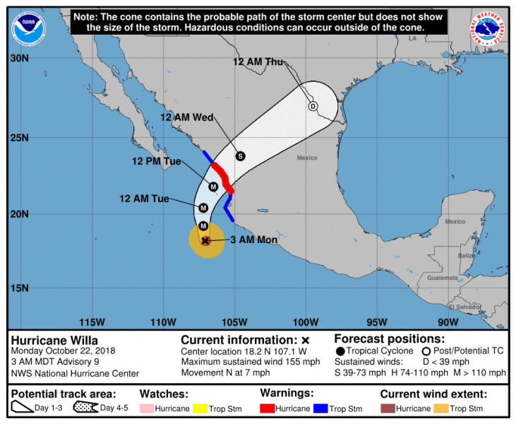
Another very intense hurricane in ongoing in eastern Pacific right now – the borderline Category 5 major hurricane Willa has gone through incredibly rapid strengthening in only 24 hours (an increase from 70 mph on Oct 21st 03 GMT to 145 mph on Oct 22nd 03 GMT)! From a Tropical storm to a Category 4 strength! Willa is packing max sustained winds of 155 mph with central pressure around 930 mbar. It is expected to maintain strong Category 4 or even Category 5 strength for another 24 hours before it starts weakening while it nears southwest Mexico late tomorrow and makes landfall overnight.
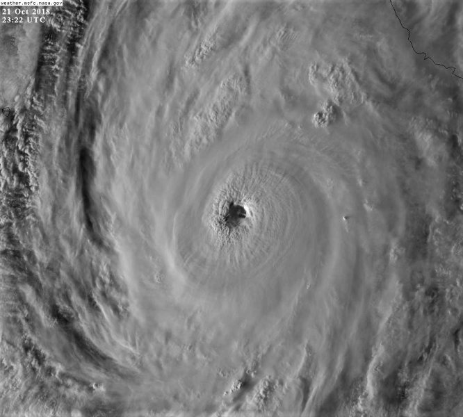
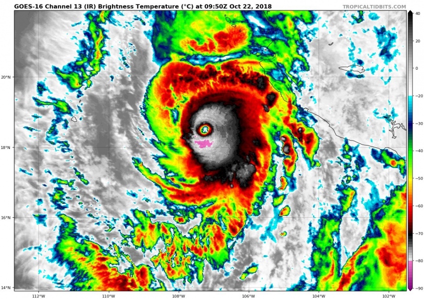
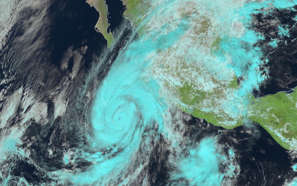
Satellite imagery is quite impressive through the past 24 hours while Willa went through the rapid intensification. A solid eyewall with very cold cloud tops suggest very intense deep convection is ongoing around the eye.
So #Willa went from a tropical storm to Category 4 hurricane in less than 24 hours. Talk about rapid intensification! Will it be another Patricia?? pic.twitter.com/uIxfhNi56L
— Christopher L. Castro (@CLCastro1974) October 22, 2018
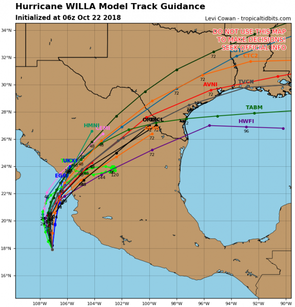
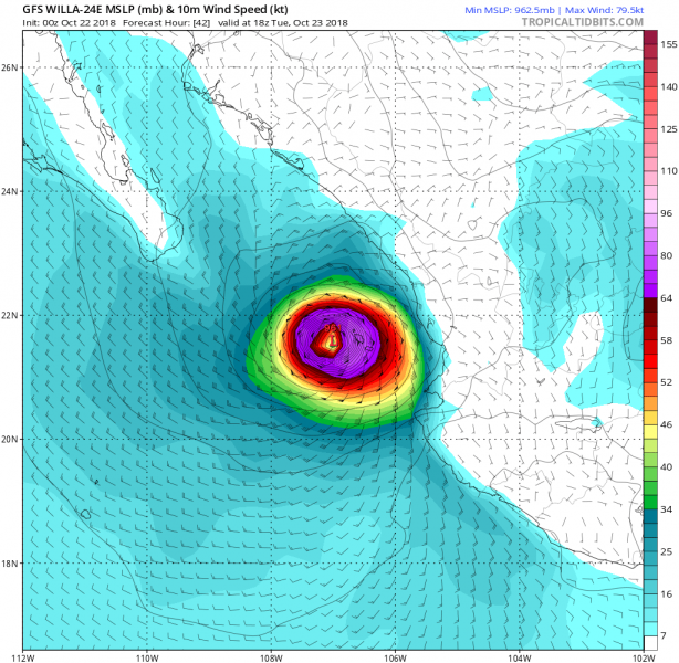
Willa’s future track leads it towards landfall in Mexico tomorrow, where it rapidly becomes post-tropical storm while moving towards southern Texas later this week. Willa will likely bring major rainfall into parts of Mexico and is forecast to be a dangerous hurricane when it reaches the Islas Marias and the coast of southwestern Mexico by late Tuesday. Life-threatening storm surge and flash floods are expected, along with damaging hurricane-force winds.
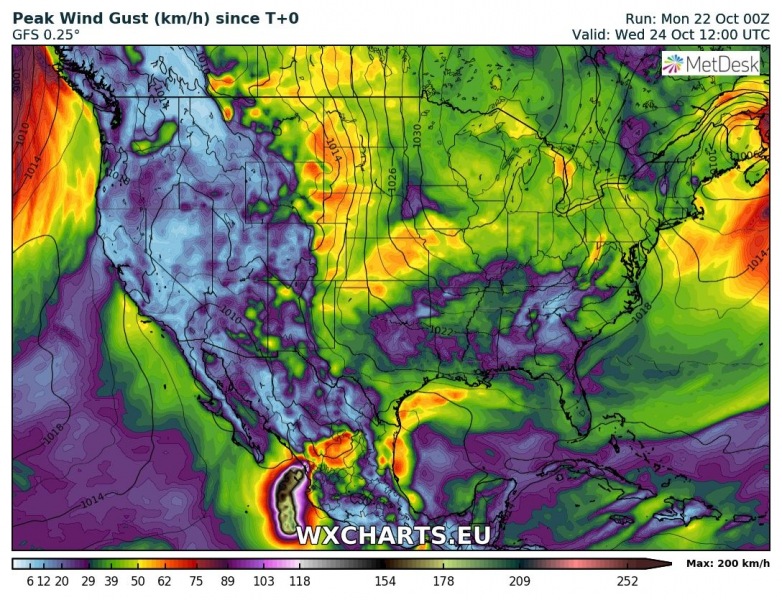
Follow the beautiful life of Major #hurricane #Willa and watch it fuel a Mid-Atlantic nor'easter in a fancy tracking map… pic.twitter.com/ztk5EuygXq
— wxcharts – a MetDesk Company (@wxcharts) October 22, 2018
Dvorak technique estimation of Willa indicates near 140 knots (155-160 mph) sustained winds!
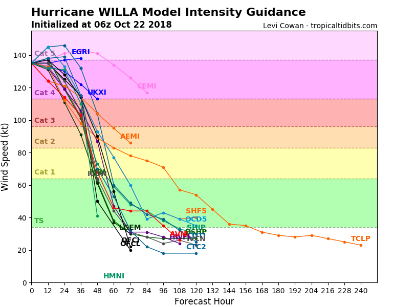
Model intensity guidance for Willa suggests it will remain a strong Category 4 or even a low-end Category 5 hurricane today before it starts quite rapid weakening tomorrow.
Willa is yet another major hurricane in this incredible Pacific season, after a number Category 4/5 hurricanes (Aletta, Bud, Hector, Lane, Olivia, Rosa, Sergo, Walaka) and super typhoons (Jebi, Jelawat, Maria, Mangkhut, Trami, Kong-Rey).
Stay tuned for further updates!
