SYNOPSIS
Strong ridge dominates south, central and eastern Europe while a deep trough with an intense core moves from the Bay of Biscay into N Iberia and W France. In between, a very strong SW-erly jet stream establishes and provides favorable ascent for storm development.
DISCUSSION
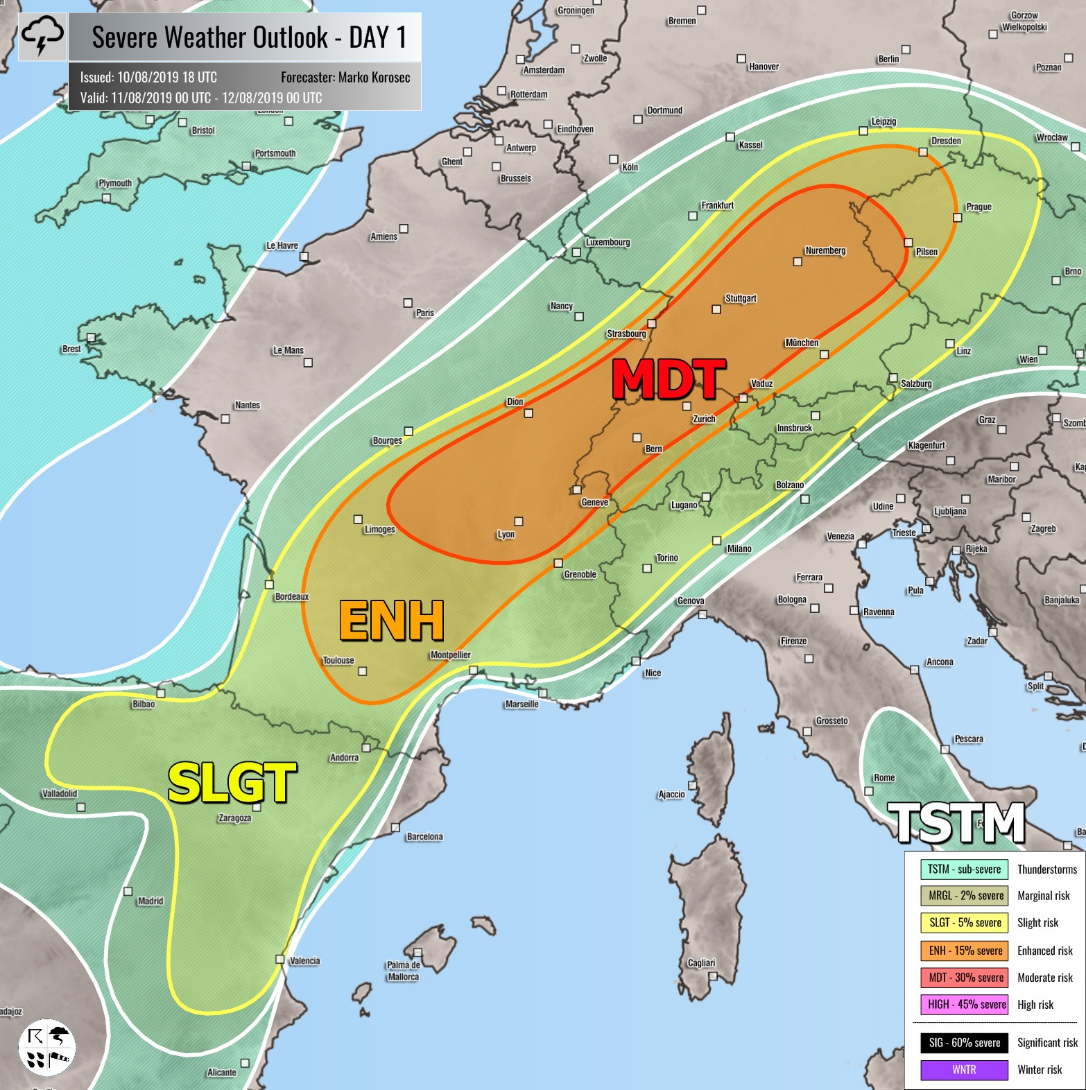
MDT / ENH risks have been issued for E/S France into N Switzerland, S-CNTRL Germany and towards W Czechia with threat for severe storms, capable of producing severe damaging winds, torrential rainfall, large to locally very large hail and tornadoes. Scattered organized storms are expected to develop across the warm sector. The airmass is rapidly recovering with strong WAA from the south and becoming moderately unstable with MLCAPE up to around 2000 J/kg, overlapped with very strong 50-70 knots bulk shear, entering from the SW. Intense supercell storms are likely to form by mid-afternoon, posing threat for severe damaging winds, very large hail and flash floods. Enhanced helicity should also become favorable for tornadoes. Storms will merge into a large MCS or two towards the evening hours and continue into Czechia while diminishing overnight.
SLGT risk has been issued for areas surrounding the MDT / ENH risks across NE Spain, S-CNTRL France, Austria, NW Italy, S-CNTRL Germany into Czechia and SW Poland with more isolated threat for severe storms, capable of producing severe winds, large hail and torrential rainfall. SLGT risk has been extended towards SW Poland as potential exists for late evening MCS from Germany and Czechia to move in from the SW.
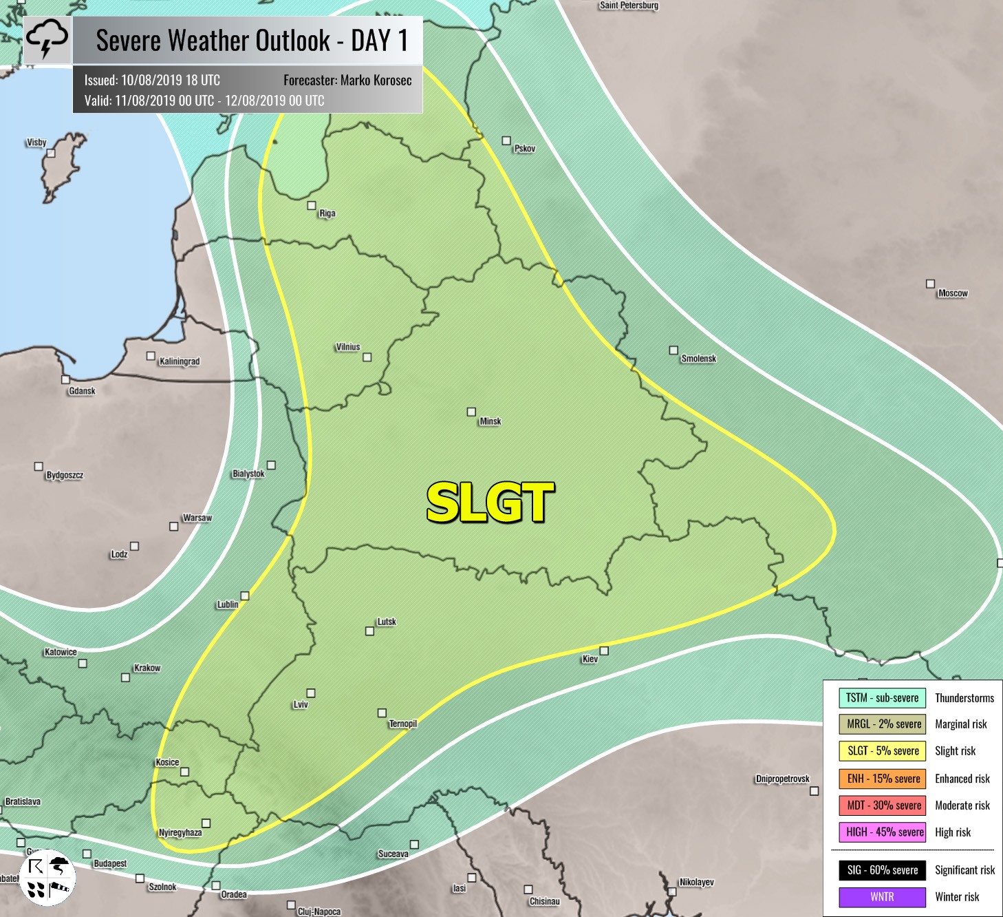
SLGT risk has been issued for E-NE Europe with threat for severe storms, capable of producing severe winds, marginally large hail and torrential rainfall. A few organized storms are likely near the moving front within moderate unstable and sheared airmass.
MRGL risk have been issued for N Morrocco and N Algeria with threat for isolated severe storms, capable of producing severe winds, large hail and torrential rainfall.
TSTM risk areas have been placed where convective storms are likely to occur but should remain sub-severe.


