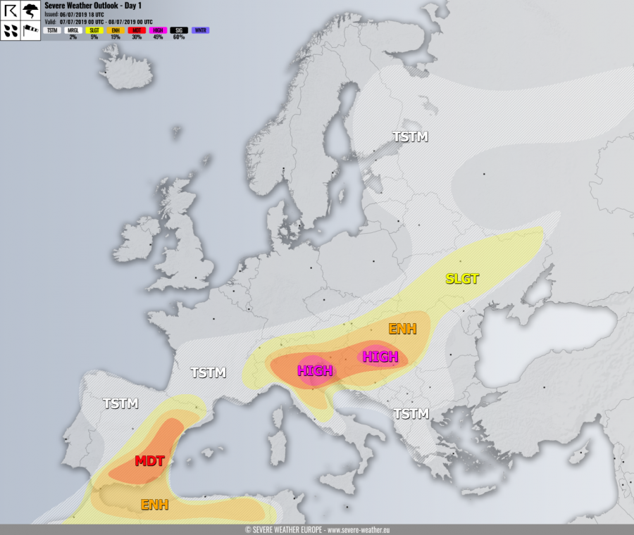
+++ An outbreak of severe storms with very large hail, damaging winds and tornadoes seem likely across parts of central Europe and the Balkan peninsula on Sunday +++
SYNOPSIS
A large trough over NNE Europe will dig more south with a wave crossing central Europe. A deepening upper low remains over W Iberia while N Atlantic is under the strong ridge. Higher geopotentials are also over the Mediterranean and S Balkans. In between, strong zonal flow is established across the N Mediterranean and N Balkans.
DISCUSSION
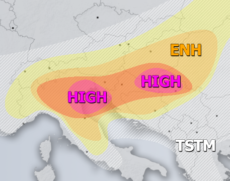
HIGH / MDT risks have been issued for N Italy, Slovenia, Croatia into S Hungary, N Serbia and N Bosnia with threat for severe storms, capable of producing severe damaging winds, very large to locally giant hail, torrential / excessive rainfall and tornadoes. A robust convective activity is expected with widespread storms, including intense supercells to develop by the early afternoon off the Alpine mountain range / from the old outflow boundaries and spread ESE through the mid/late afternoon and evening hours. Strong (40-50 knots) bulk shear overlapped with strong to extreme instability (MLCAPE locally in excess of 3500 J/kg) will support well-organized supercells with threat for very large and possibly even giant hail (8-10 cm in diameter) locally, as well as tornadoes. Severe damaging winds could develop with storms forming bowing segments, as models are hinting a line of intense storms forming near the moving convergence zone, especially across the E Croatia into S Hungary and N Serbia. However, strongly enhanced SR helicity is expected across the N Adriatic region. There, tornadic supercells could develop as well. Same intensity but less coverage of severe storms is expected within the MDT area. Storms will cluster into the MCS or two in the evening hours, resulting in a higher threat for damaging winds across both HIGH risk areas.
ENH / SLGT risks have been issued for areas surrounding the HIGH / MDT risks across N-CNTRL Italy, and N/E Balkans including S Austria, Hungary and Romania with threat for severe storms, capable of producing severe winds, torrential rainfall and large hail. SLGT risk was extended into N Moldova and central Ukraine where some isolated storms with large hail and severe winds are likely as well.
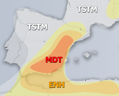
MDT / ENH / SLGT risks have been issued for E Spain into N Morocco and N Algeria with threat for severe storms, capable of producing severe winds, large hail, torrential rainfall and some tornado threat. Again quite widespread organized storms are expected within strongly sheared and moderately unstable airmass. Supercells are likely as well, severe damaging winds and very large hail will be possible too. While less coverage is expected across NW Africa, lots of activity and possibly a large cluster could form over ESE Spain.
TSTM risk areas have been placed where convective storms are likely to occur but should remain sub-severe.


