Significant sea-effect snow is expected across parts of central and southern Italy over the next 3-4 days (January 3-6), as the Arctic outbreak pushes cold Bora / Gregale winds over the relatively warm Adriatic and Tyrrhenian seas.
Sea-effect snowfall, the same phenomenon as the well-known lake-effect snowfall from the Great Lakes in the US. Essentially, as cold airmass passes across warmer waters of lakes, or in this case seas, it warms and takes on moisture. As it rises convectivelly it cools and produces snowfall on the downwind shore. It this case, cool airmass pushes across the Adriatic and Tyrrhenian seas, producing snowfall in central and southern Italy.
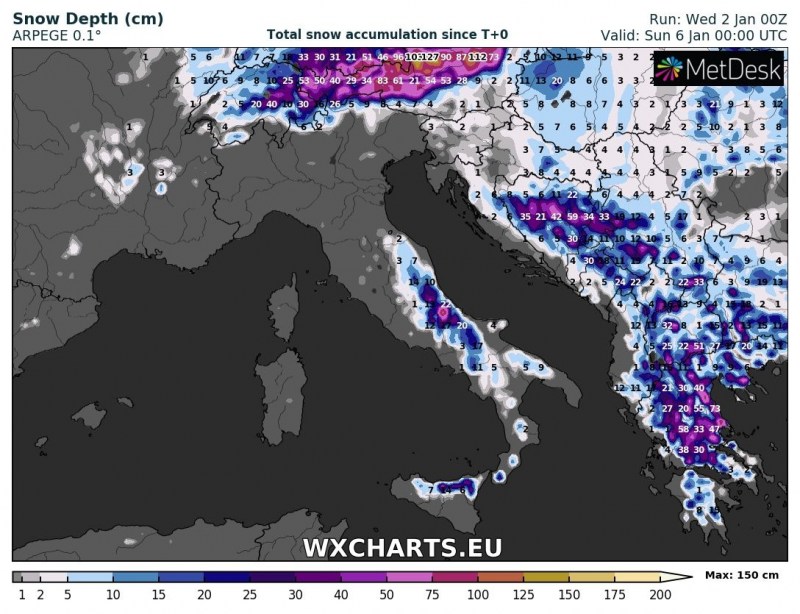
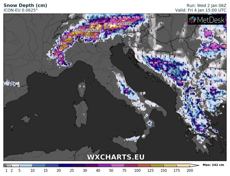
Up to about 5 to 30 cm of snow is expected across the region over the next 3-4 days, however, in places with the most intense snowfall (parts of the central Apennines), over 50 cm may accumulate.
Total snow depth early on Sunday, January 6. ARPEGE model guidance. Map: Wxcharts.eu
Total snow depth on Friday afternoon, January 4. ICON-EU model guidance. Map: Wxcharts.eu
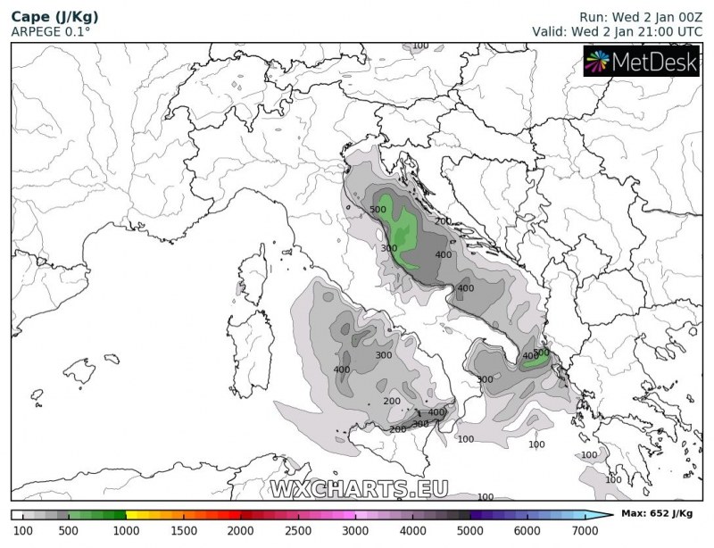
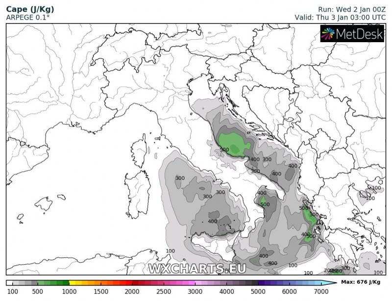
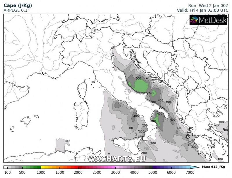
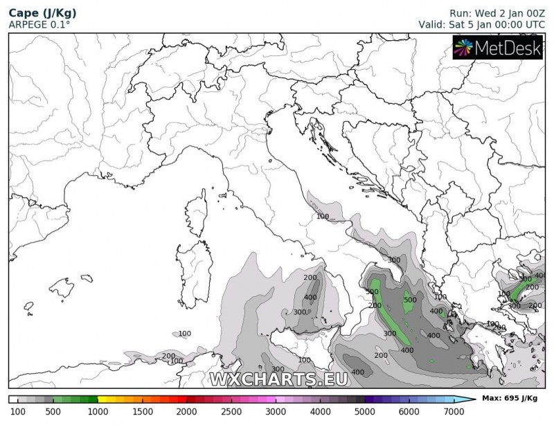
Instability (CAPE) over the region. Note the buildup of low, but significant instability with up to 500-600 J/kg CAPE. ARPEGE model guidance. Map: Wxcharts.eu
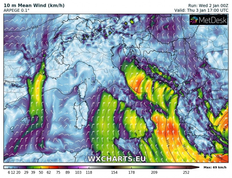
Surface wind across the region on Thursday, January 3. Note the northeasterly Bora winds. Map: Wxcharts.eu
