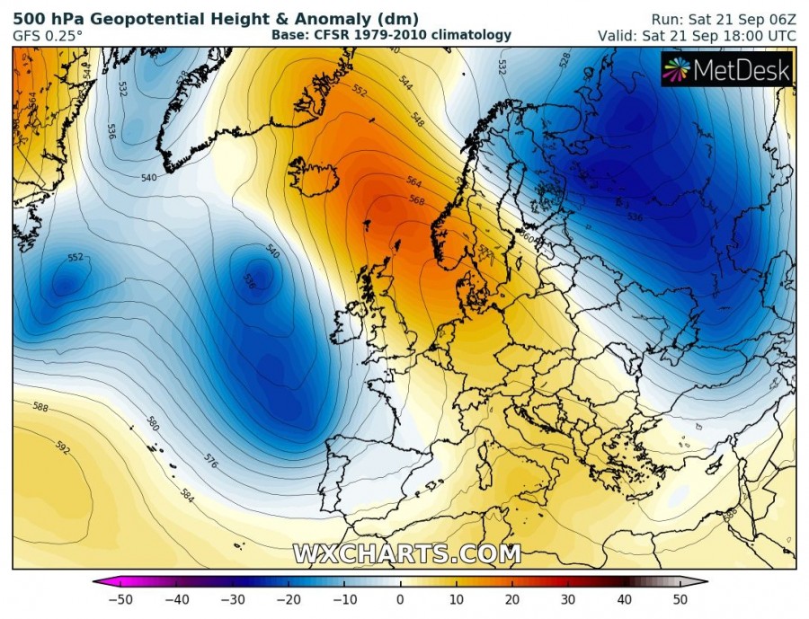
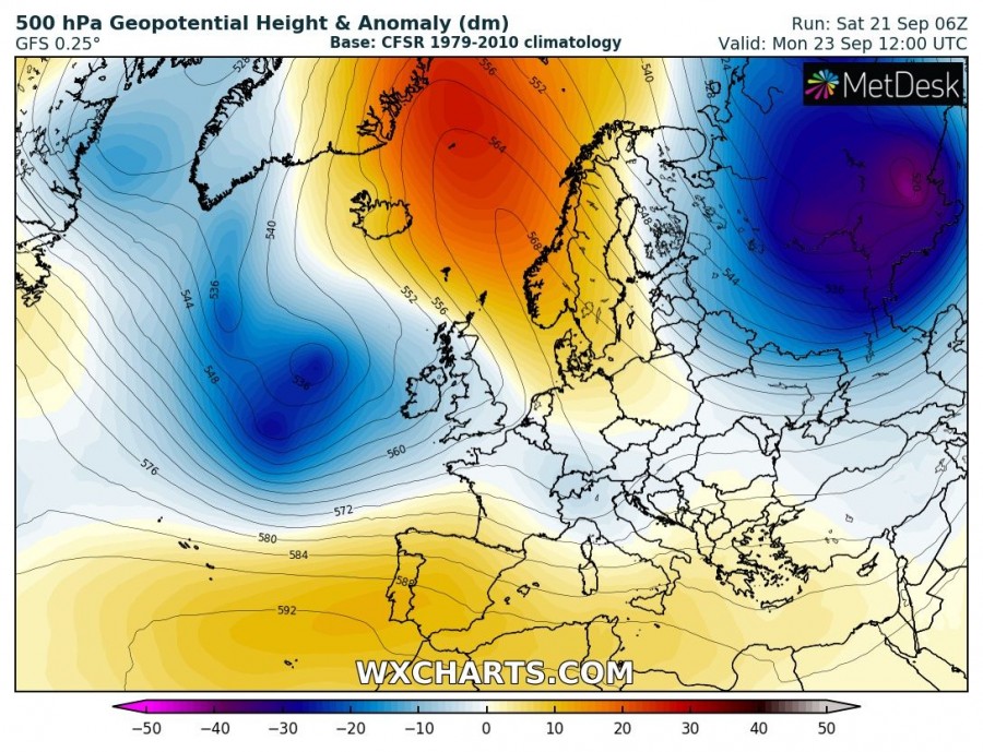
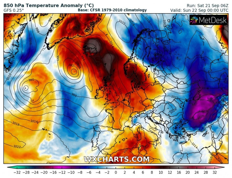
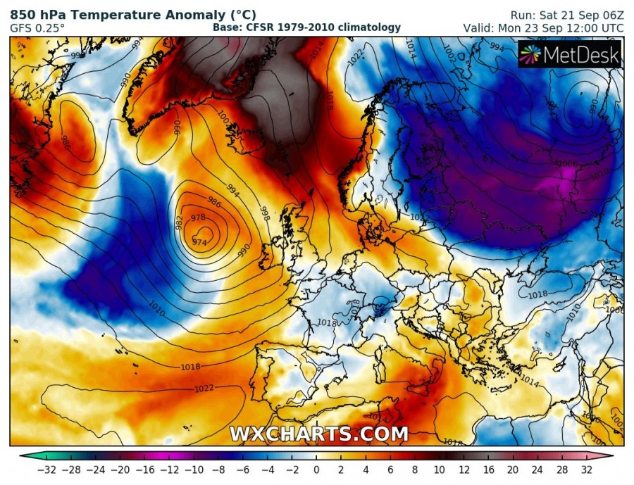
As strong meridional flow establishes, pushing warm air advection into NW Europe, temperatures there soar well above average. 850 mbar temperatures will be up to 15-25 °C above average over parts of Greenland.
A strong omega blocking pattern has established over Europe. A broad area of low pressure is located over the Atlantic, west of the British Isles and Ireland. Another broad and deep upper low is located over Russia, with a strong upper ridge extending across central into northwest Europe, the Norwegian sea and towards Greenland.
500 mbar temperature anomaly over Europe on Saturday and Monday. GFS model guidance.Wxcharts.
Strong warm air advection is established with meridional flow between the lows, producing a coridor of warm airmass advecting far north. 850 mbar temperatures across central Europe, North sea, British Isles and Ireland will be 8-12 °C above average (1979-2010), and 12-16 °C above average over thewestern Norwegian sea and Iceland. By early next week the 850 mbar temperatures will be about 2-6 °C above average across NW Europe, but 10-20 °C higher than average across Greenland and down south to Iceland. Meanwhile, a blast of cold polar air will push across far northeastern and eastern Europe, up to 8-12 °C below average.
Evolution of 850 mbar temperature anomaly from Saturday to Wednesday. GFS model guidance.Wxcharts.
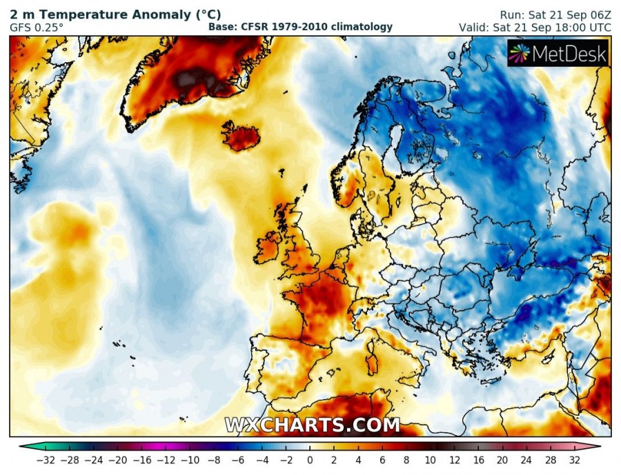
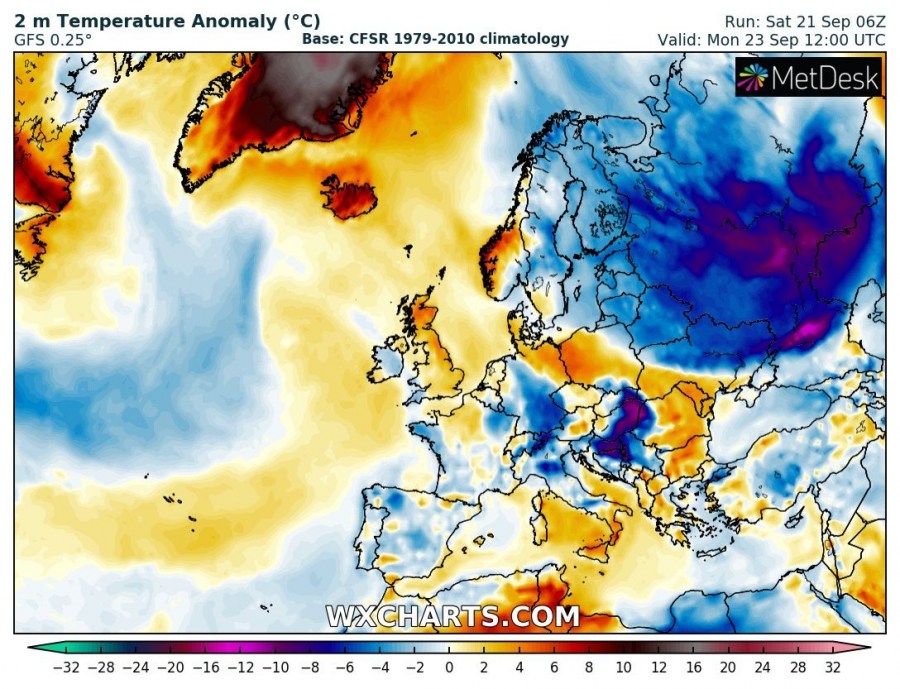
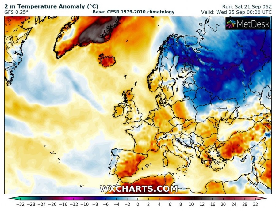
Surface temperatures will be up to 6-10 °C above average across parts of central and northwestern Europe (including parts of the UK, BeNeLux, Germany, south Norway, south Sweden, Denmark, Poland and into Iceland this weekend. Greenland will start with temperatures 5-12 °C above average, pushing to locally up to 20 °C above average in the first days of the coming week. See the maps below for details.
Evolution of 2 m temperature anomaly from Saturday to Wednesday. GFS model guidance.Wxcharts.
There may be a strong pattern flip in the offing later next week with a significant outbreak of cold polar maritime airmass into Europe. Still far away, we are monitoring the pattern evolution – stay tuned.
