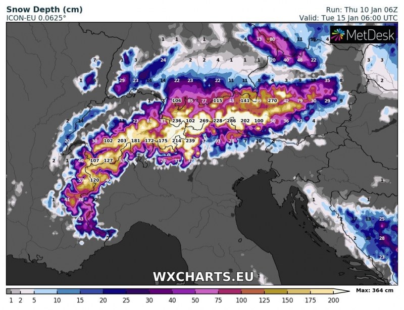
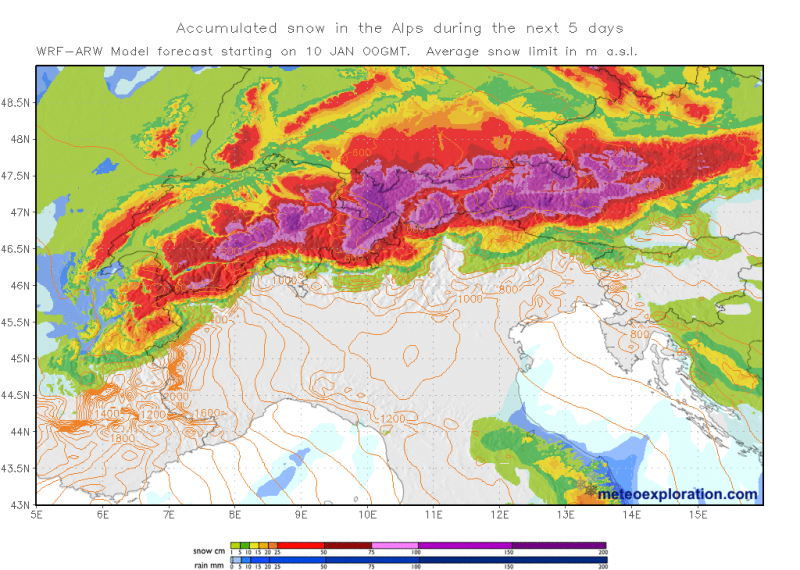
More heavy snowfall is expected over the next four days in areas already buried in meters of snow. Large areas will likely receive over half a meter of snow, while some areas may well see over 1 m of fresh snow by Tuesday morning.
The persistent northerly and northwesterly meridional flow continues, pushing more Arctic maritime airmass into the Alps. Further heavy stau-effect snowfall is expected, with a particularly intense episode of snowfall expected on Sunday and Monday.
4 successive waves of heavy snowfall (violet) for northern Alps over the next 4 days. ICON-EU model guidance. Maps: Wxcharts.eu
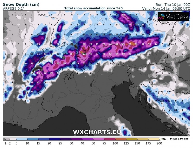
Over 50 cm of fresh snow is expected across a large area in Switzerland and Austria, extending also into the extreme NW Italy and extreme SE France. Peak amounts will likely reach 100-130 cm. Consult the maps below for details.
Total snow accumulation early on Thursday to early on Monday. Note over 50 cm of new snow across a large area and locally over 100 cm of fresh snow. ARPEGE model guidance. Map: Wxcharts.eu.
Total snow depth early on Tuesday. ICON-EU model guidance. Map: Wxcharts.eu.
Total snowfall through Tuesday. Map: Meteoexploration.


