A big polar blast is pushing into the CONUS, bringing cold weather, heavy snowfall, blizzard conditions and severe thunderstorms to some areas. The cold polar airmass will spill across much of the US by late this week, even pushing into Mexico and the Gulf of Mexico. Temperatures way below average for this period are expected!
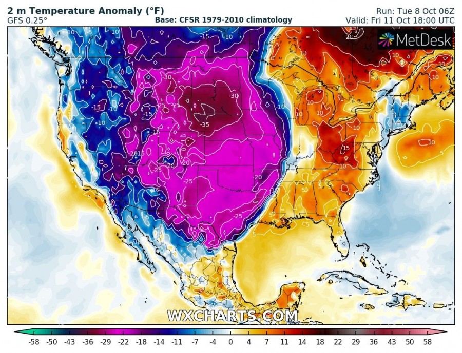
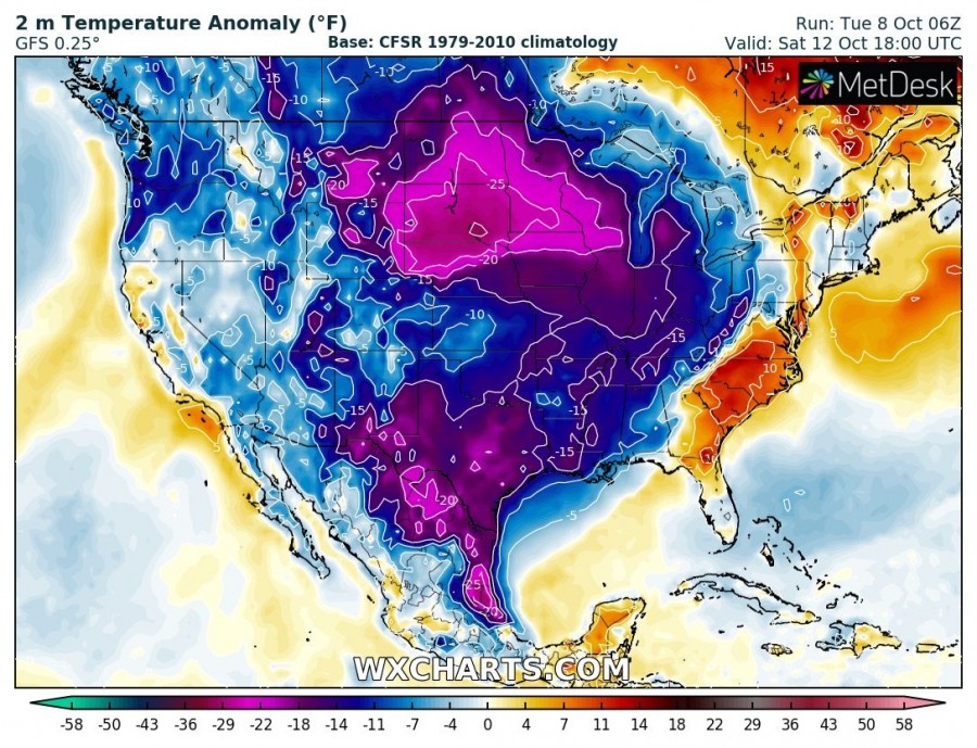
Cold polar airmass is already spilling across the Northwest as of writing this. It will spread across the Northwest into Southwest and Midwest by late on Thursday (UTC), pushing eastward across the Great plains by late on Friday (UTC), almost all the way to the East Coast by late on Saturday (UTC). Temperatures will be up to 15-20 °C (30-40 °F) below average for this period.
2 m temperature anomaly map (how much warmer or colder than average it will be) across the CONUS. GFS model guidance. Map: Wxcharts.
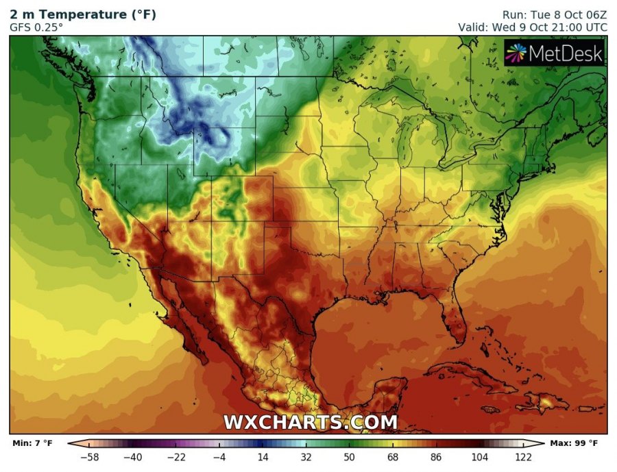
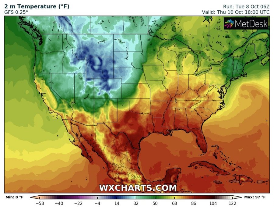
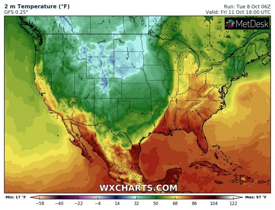
Note the very sharp temperature gradient along the front, particularly as it pushes across the southern Great Plains and the Southeast. In some places temperatures will plummet by over 20 °C!
2 m temperature across the CONUS. GFS model guidance. Map: Wxcharts.
Expect a deep surface low to develop by late on Wednesday over Colorado, pushing northeast towards Minnesota by Friday. Expect major snowfall from this system, with blizzard conditions behind the cold front, particularly across North and South Dakota, with heavy snowfall and temperatures below freezing combining with strong northerlies, gusting towards 80-100 km/h (50-65 mph).
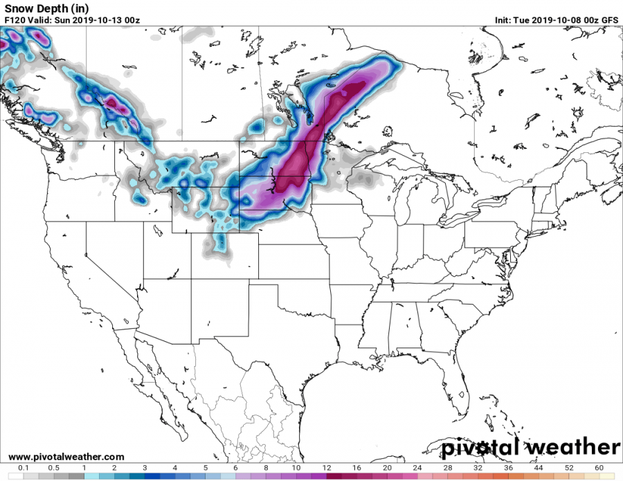
Expect significant amounts of snow in particular across North and South Dakota and into Minnesota and north into Manitoba and Quebec (Canada). Up to 20″ (50 cm) is expected locally!
Total accumulated snowfall across CONUS by late on Saturday (00h UTC, Sunday, October 13th). Up to 36-40″ in parts of North Dakota and Minnesota! GFS model guidance. Map: Pivotalweather.
Total snow on the ground across CONUS by late on Saturday (00h UTC, Sunday, October 13th). Up to 16-20″ in parts of North Dakota and Minnesota! GFS model guidance. Map: Pivotalweather.
In the south, across Texas and Oklahoma into Kansas, strong instability will develop ahead of the cold front on Thursday, overlapping with moderately strong shear. Severe thunderstorms will be possible across the three states, potentially pushing into Arkansas and Missouri.
Stay tuned for updates as the pattern evolves!

