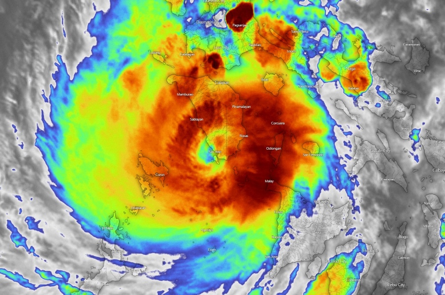
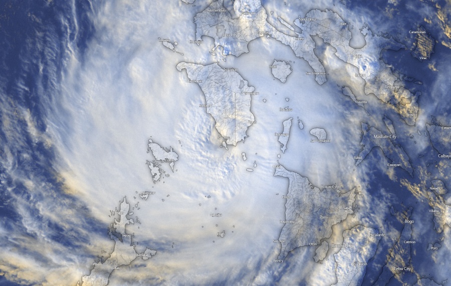
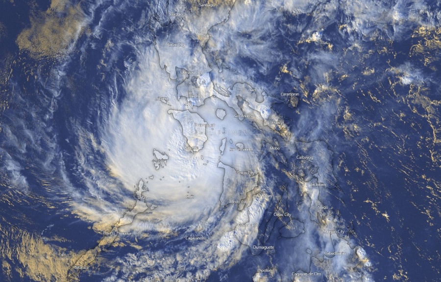
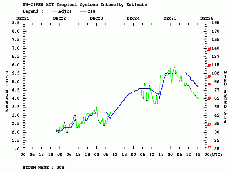
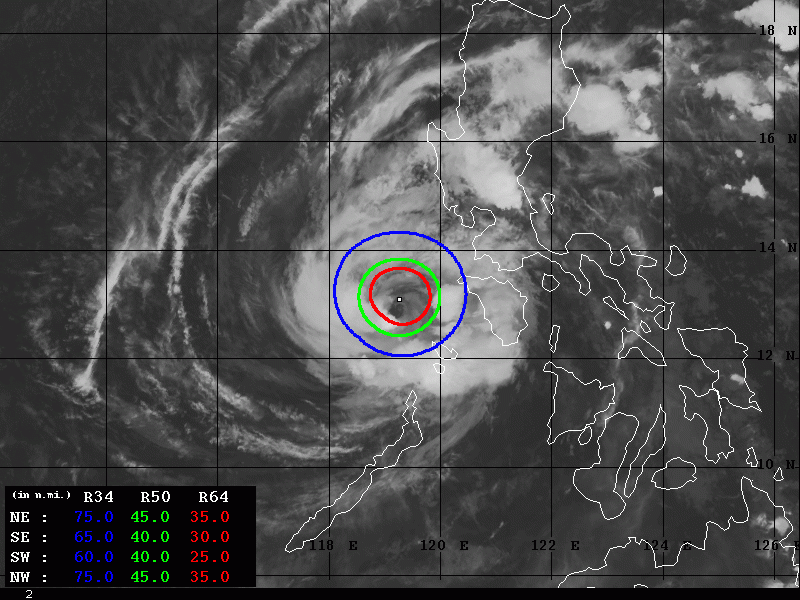
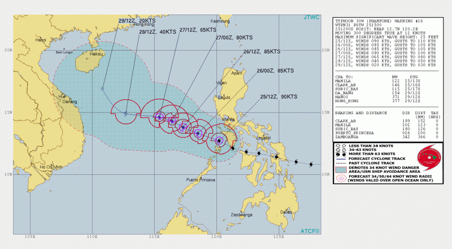
Typhoon Phanfone was moving across the Philippines through the past 24 hours as a dangerous typhoon of strong Category 1 to low-end Category 3 strength. Dvorak analysis estimated it may have been a solid Category 3 typhoon during its peak hours today, with maximum sustained winds of around 110 knots / 125 mph and central pressure below 960 mbar. Soon as it ejected off the westernmost islands of central Philippines, Phanfone started an eyewall replacement cycle (EWRC) and expanded its wind field. Overall trends are showing it is weakening while moving into the open waters of the South China Sea.
A couple of satellite images while Phanfone was still over the Philippines earlier today – notice a still very robust eyewall deep convection around the small cloud-filled eye until typhoon was still over the island Mindoro.
Advanced Dvorak Technique (ADT) analysis reveals the peak (possibly a Category 3) was likely reached in the afternoon hours local time, 00-06 UTC on Dec 25th. Since then, Phanfone is weakening while going through an EWRC on its way into the South China Sea. During the inner eyewall collapse, the wind field of the strongest winds usually expands. The 50 kt winds radii is now extending 40-45 miles around the large eye, while there is also 30-35 miles wide 64 kt wind radii.
Phanfone will now be moving west-northwest through the next couple of days across the South China Sea, gradually weakening along its path due to lower sea temperatures and getting more deep-layer shear disrupting its outflow when coming close to the SE Asia.
If nothing significant occurs with the system in the coming days, this is our last update on Phanfone / UrsulaPH typhoon.
There is another potentially strong typhoon forming north of Fiji, we will discuss it tomorrow – Stay tuned!
See also the previous discussions regarding Phanfone / UrsulaPH:
Interested in our calendar? We are proud to present and promote the best weather photographers in Europe – see details:
