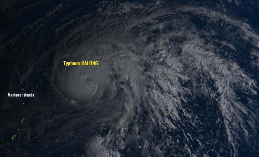
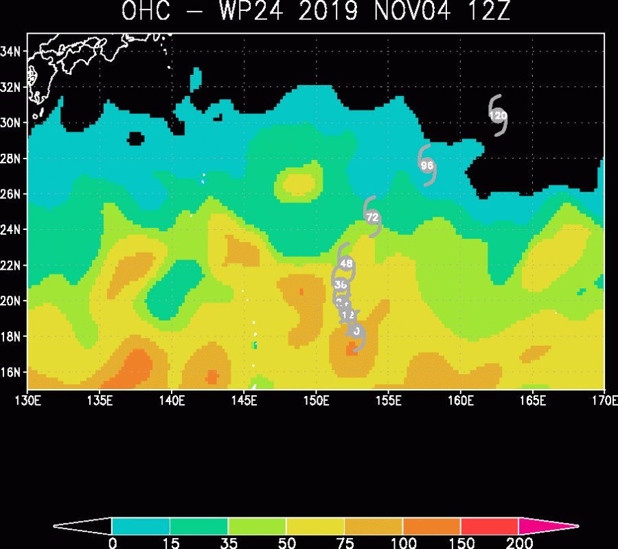
Very favorable western Pacific sea surface conditions are allowing a now Category 3 typhoon Halong to remain in its rapid intensification trend today, clearly visible on the latest satellite imagery and automatic analysis. Halong is packing winds of 105 knots / 120 mph / 195 km/h with a central pressure below 950 mbar. Although it will stay over open waters of the western Pacific and away from any land areas, it is very impressive to observe.
A very impressive satellite imagery has been observed lately, Halong is experiencing some intense burst of explosive convection around the forming eye, clouds top have pushed very high and indicate typhoon is in even more rapid strengthening this local morning.
https://twitter.com/krasmanalderey/status/1191390133116981248
Full Cold Dark Grey ring trying to surround the Off White eye of #Halong. Raw ADT T #'s coming in around 7.0 as of 1910z, and increasing quickly. pic.twitter.com/V3zwEybR34
— Andy Bollenbacher ⛳ (@reallif3hashtag) November 4, 2019
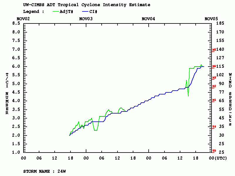
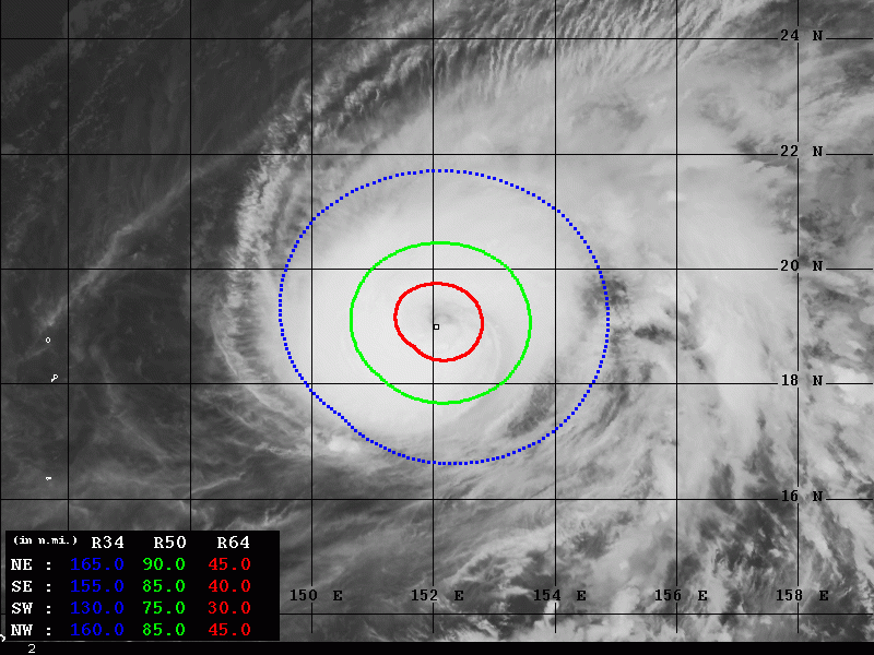
Advanced Dvorak Technique (ADT) analysis reveal even more impressive data lately, with estimated central pressure around 940 mbar and maximum sustained winds of around 115 knots – this could mean Halong will soon become a Super typhoon with a Category 4 strength. As of 18 UTC, Nov 4th, 50kt radii was expanding 80-90 miles away from the eye while the ADT analysis indicates typhoon’s rapid intensification during the past 6 hours. As Halong should stay in very favorable conditions for another 36-48 hours, it is quite likely its strengthening will continue until Wednesday.
We will continue monitoring the Halong’s evolution and will keep you updated – stay tuned!
Previous discussion:
Interested in our calendar? We are proud to present and promote the best weather photographers in Europe – see details:


