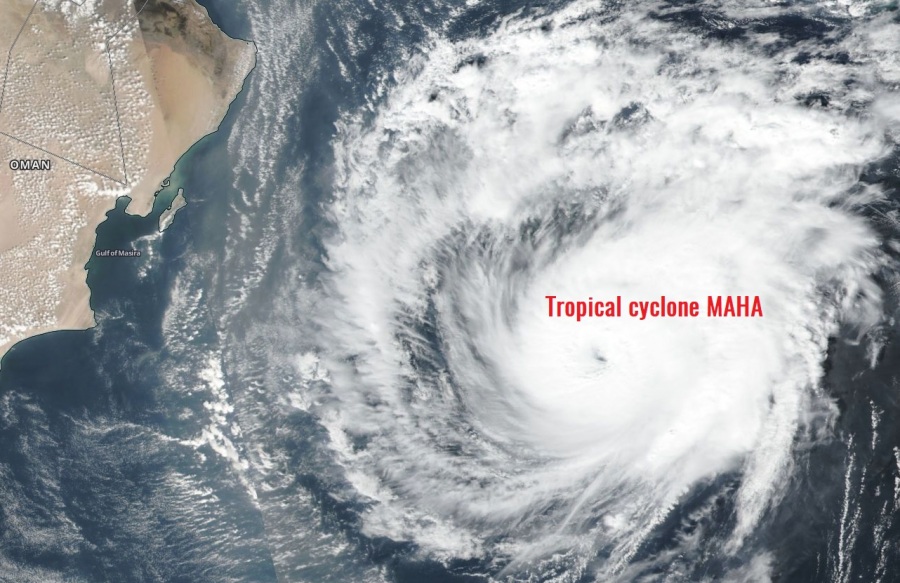
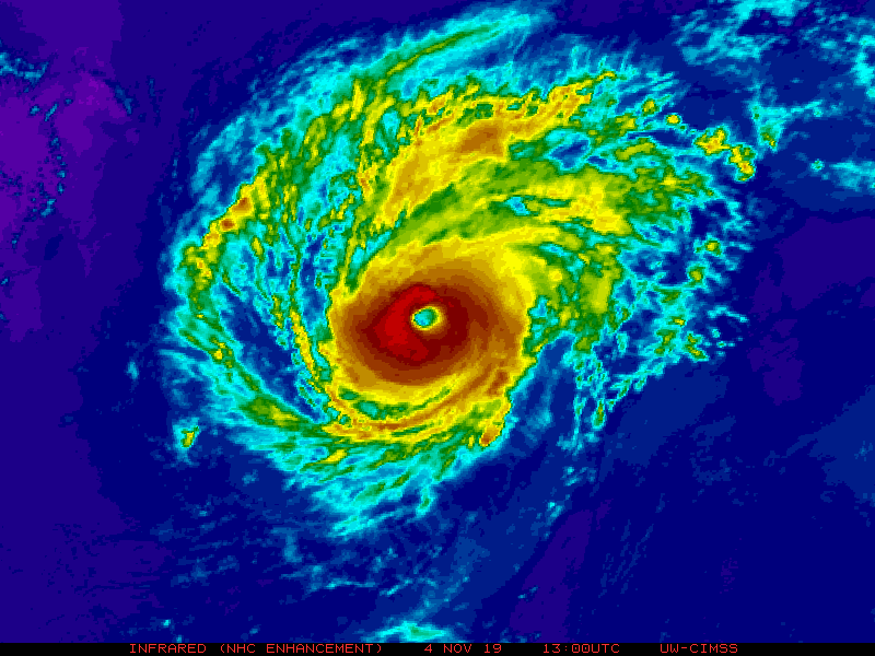
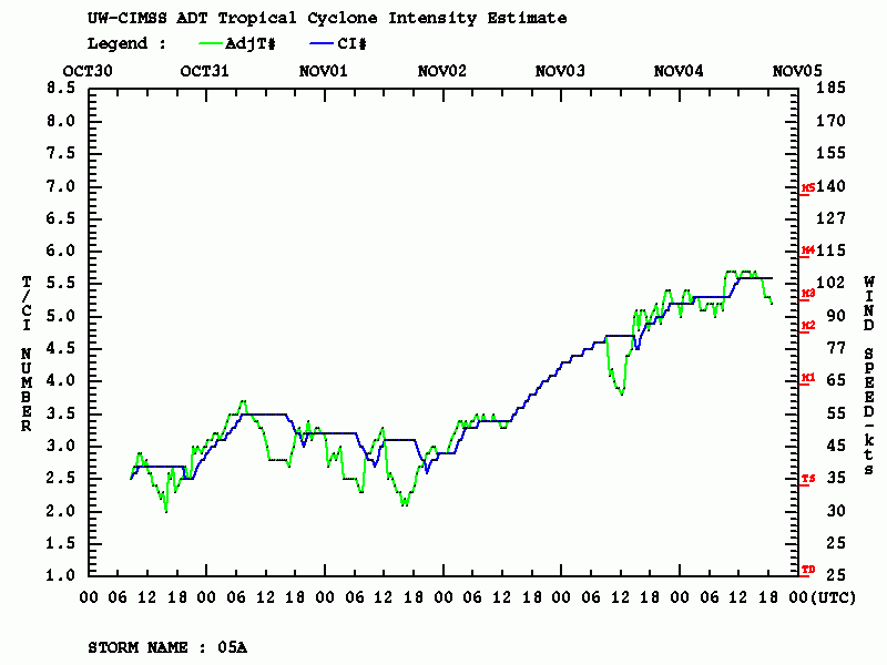
As expected, Tropical cyclone Maha continued strengthening since yesterday and has been upgraded into a Category 3 cyclone today at 12 UTC. Maha is packing maximum sustained winds of 105 knots / 120 mph / 195 km/h with a central pressure around 960 mbar. It is likely very near its peak strength as is soon coming into less favorable sea surface conditions and also the wind shear will increase after it turns sharp east tonight which usually results in the weakening trend of tropical systems. Maha continues towards landfall in India – expected on Thursday, Nov 7th as a Tropical Storm force.
Satellite imagery today reveal a pretty impressive textbook structure of the cyclone with a large clear eye and an intense symmetrical eyewall surrounding it. The upper-level outflow is also pretty strong and mostly undisturbed across all four quadrants.
شاهد حركة الإعصار المداري الشديد #مها #Maha من الفضاء خلال الـ ٢٤ ساعة الماضية وحتى هذه اللحظة pic.twitter.com/8C8qJtOkkQ
— تركي المحيا (@TurkiAlmohaiya) November 4, 2019
Cyclone #Maha going into a turn toward #India with Category 3 intensity but expected to weaken before landfall. https://t.co/qGdHTcDE3G pic.twitter.com/DADNqIz8E5
— UW-Madison CIMSS (@UWCIMSS) November 4, 2019
تبقى 8عقد للإعصار #MAHA "#مها" لبلوغ الفئة الرابعة ،وهذه أحدث المعطيات للإعصار:
-الموقع: 18.9 درجة شمال 64.3 درجة شرق .
-سرعة الرياح القصوى: 105 عقدة/194.46كم/س.
-الحد الأدنى للضغط المركزي: 959 مليبار. pic.twitter.com/DVabl9BGlz— ابراهيم اللامي (@ibrahimallami1) November 4, 2019
Advanced Dvorak Technique (ADT) analysis reveals a steady strengthening trend since Saturday and Maha’s 50 kt radii is now expending 40-45 miles around the eye. This means Maha is a solid Cat 3 system!
Maha is expected to make sharp turn east tonight and tomorrow morning and begin accelerating with steering flow towards NW India. With increasing shear and cooler surface waters of the Arabian sea, Maha is expected to lose its strength and gradually weaken back to Tropical Storm prior to landfall in India on Thursday this week.
Previous discussion:
Interested in our calendar? We are proud to present and promote the best weather photographers in Europe – see details:


