Tropics are still active, this time also over the western Pacific as another potentially intense typhoon is in development. Typhoon Halong is currently packing maximum sustained winds of 65 knots / 75 mph with central pressure around 982 mbar. Halong is expected to rapidly intensify into at least a Category 3 typhoon by late Tuesday. Current model simulations suggest Halong will not come anywhere close to any land areas.
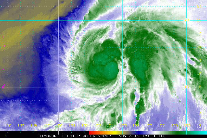
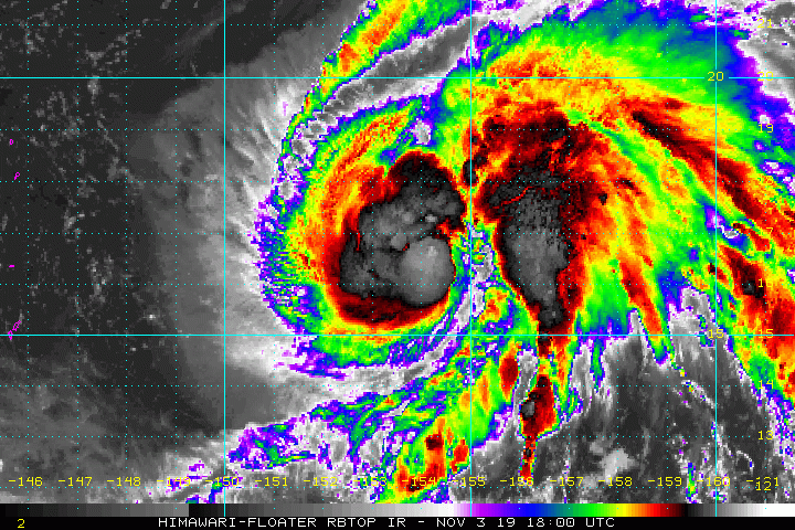
Latest satellite imagery indicates typhoon is beginning rapid strengthening with a well-defined upper-level outflow above the deep convection below. Convective storms are gradually organizing into bands around the virtual center of the typhoon. Note the location of Halong against the Mariana Islands.
Tropical Storm #Halong is firing some extremely deep central convection with tops even colder than -90ºC (white) in some areas. This might be the deepest organized core convection I've seen with a WPac TC since Meari '16. The WPac is clearly in late season mode. pic.twitter.com/3GhNI2WQAD
— Ryan Allen (@1900hurricane) November 3, 2019
https://twitter.com/guahanweather/status/1190723150901694464
Advanced Dvorak Technique (ADT) analysis reveals the gradual strengthening of Halong through the past 24 hours, maintaining typhoon intensity today. The 50 mph winds radii is still rather small given the still organizing system, expanding only 40-50 miles away from the center. Typhoon will continue strengthening in the coming days and intense winds will expand across much broader radii.
Ocean Heat Content (OHC) map analysis indicates Halong is in a very favorable environment for rapid strengthening through the next 48 hours, so an organized system should be expected soon. With sea surface temperatures near 29 °C, the typhoon has very favorable fuel for the ongoing deep convection.
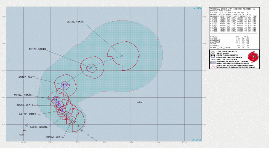
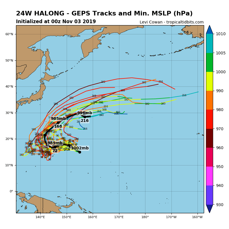
The future track of Halong should bring it towards northwest through the next two days, but it will not affect the Mariana islands. After Wednesday, when Halong reaches its peak intensity, it turns north and then northeast while accelerating and weakening during the second half of the week.
HWRF model forecast suggest Halong will be traveling across very favorable sea surface temperatures of around 29 °C through the next 3 days, but with some marginal deep-layer shear over the system. However, it seems the very favorable ocean conditions should easily allow it to intensify significantly.
Stay tuned for further updates on Halong’s evolution this week!
See also – another cyclone MAHA is ongoing in the Arabian Sea:


