Pacific ocean has been incredibly warm this year and shear pattern seems to be very supportive for development of very intense hurricanes and typhoons. There are now two intense Category 5 systems ongoing at the same time – a major hurricane Walaka west of Hawaii and a Super Typhoon Kong-Rey east of Philippines. Both systems have reached CAT 5 strength in the last 12 hours, packing max sustained winds of 160 mph and central pressure 917-920 mbar.
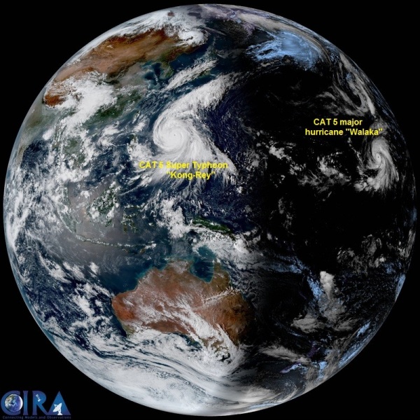
Full Disk satellite image of west-central Pacific by Himawari 8 this morning reveals both “monster” storms – Kong-Rey on the left and Walaka on the ridge side of the image.
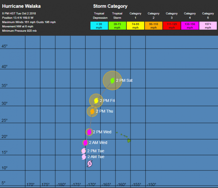
Major hurricane Walaka is currently moving towards NNW and is located west of Hawaii archipelago and is expected to remain a powerful CAT 5 hurricane for another 24 hours before it begins gradually weakening while moving north into cooler sea waters. Hawaii should not be affected.
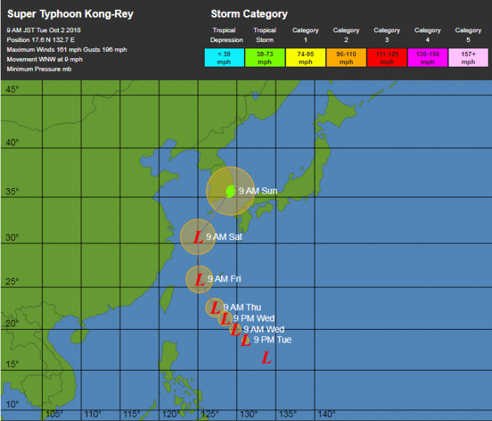
Super Typhoon Kong-Rey is currently located far east of the Philippines and also expected to remain a CAT 5 typhoon for another day or so, before it begins its weakening trend based on the global models. It heads towards Japan islands and possible also towards the South Korea this weekend.
Future track of Super Typhoon Kong-Rey by Wunderground.
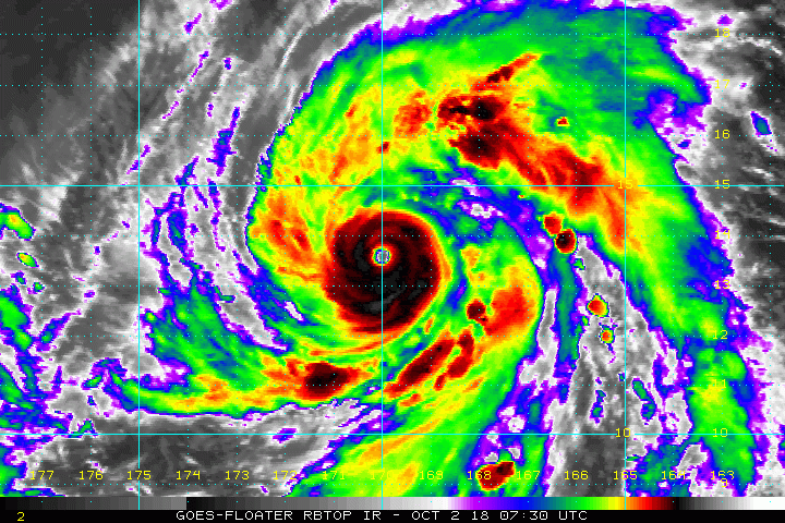
Infrared satellite image comparison of Walaka (first image) and Kong-Rey (second image) – both reveal an impressive symmetrical structure and closed eyewall with very deep convection around the eye. Images reveal a very cold cloud tops, around -80 °C with perfect upper-level outflow ventilation.
Please refer to the separate articles about Walaka and Kong-Rey for additional details and further updates.


