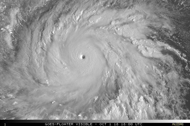
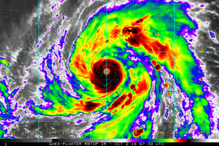
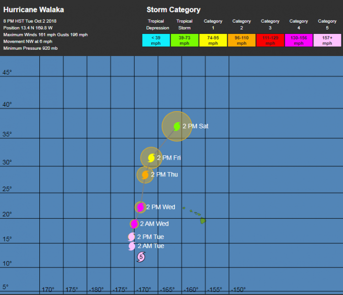
Major hurricane Walaka is the second CAT 5 tropical system currently ongoing in the Pacific ocean. Walaka has an impressive satellite presentation and packs maximum sustained winds of 160 mph, gusting up to 190 mph. Central pressure has been estimated at 920 mbar. Walaka is also the 2nd CAT 5 tropical system in the central Pacific this season, after the major hurricane Lane in late August. Walaka is moving towards NNW, far west of Hawaii islands and should not affect them.
Satellite imagery reveals very impressive structure, symmetrical and very intense eyewall. The eye has been clearly visible almost through the whole past 24 hours and Walaka was expected to intensify to Cat 5 strength.
Here is the past track analysis of Walaka – notice how it rapidly intensified from a CAT 1 hurricane into a CAT 5 major hurricane in just 24 hours, from 06 GMT on Oct 1st (yesterday morning) until October 2nd 06 GMT (toda< morning): max sustained winds have increased from 100 mph to 160 mph in this 24-hour period, which is a very rapid intensification! The official threshold for rapid intensification of tropical systems is an increase of 35 mph in max sustained winds in 24 hours). [singlepic id=5413 w=1000 h=600 float=center]
OHC (Ocean Heat Content) map indicates Walaka is in very favorable and warm sea waters of central Pacific, so maintaining strength at major hurricane level for another 36-48 hours is expected, before it begins gradually weakening while moving north into the cooler sea waters.
Walaka is currently moving towards NNW and is located west of Hawaii archipelago, moving towards NNW and should turn more NNE tomorrow.
Future track of Super Typhoon Kong-Rey by Wunderground.
Stay tuned for further updates!
You can see details about the other CAT 5 tropical system – Super Typhoon Kong-Rey in Pacific here:


