Hurricane Florence has been maintaining a solid strong CAT 2 strength through all day. However, the last few hours satellite and radar data are revealing a gradual strengthening of the system: the inner eyewall has closed and it appears likely the hurricane is intensifying again! Latest NOAA Hurricane Hunters mission through the eye is confirming the satellite/radar analysis with pressure now at around 952 mbar (officially NHC put it to 955 mbar previously) and sustained winds of 90 knots. Florence has slowed down and is moving towards NW, nearing the landfall in North Carolina coast tonight.
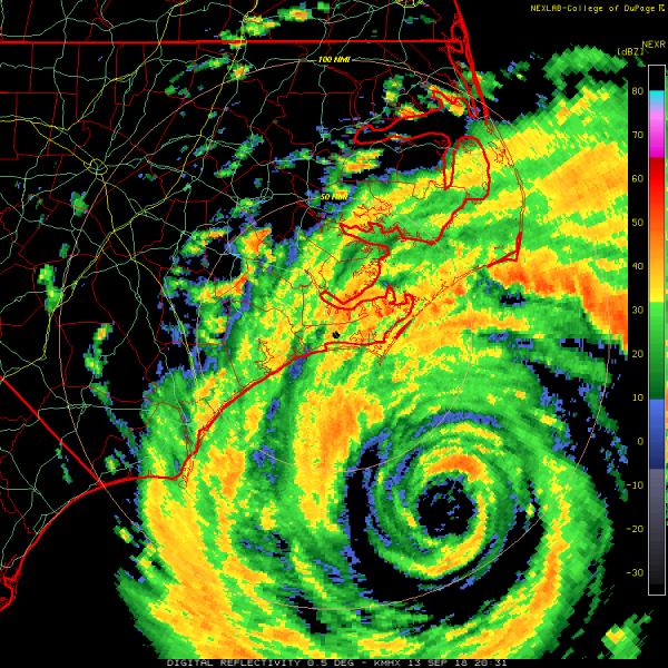
Latest radar imagery is revealing an impressive structure of the inner and also outer eyewall. Notice the inner eyewall has almost completely closed up. The strongest winds are expended far away from the center.
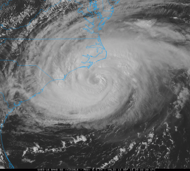
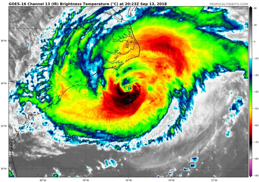
Latest visible and infrared satellite images of Florence – there is explosive new deep convection on its southern side, likely a sign that Florence has gained strength from the warmer Gulf stream swath and is becoming more organized.
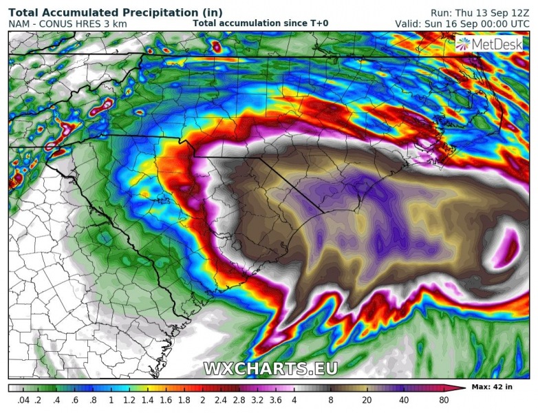
12z NAM simulation of total rainfall until Saturday afternoon local time: comfirming an extreme amount of rainfall on the coast of North Carolina – more than 40 inches remain possible.
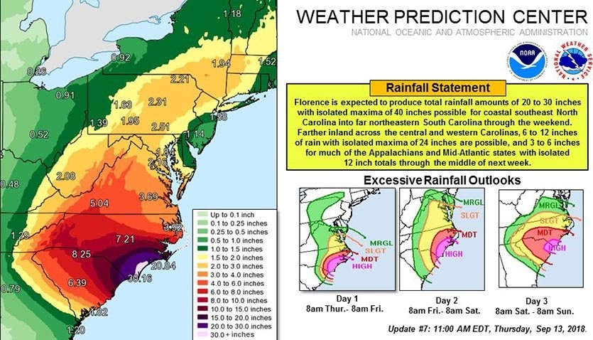
WPC (Weather Prediction Center) latest forecast discussion and graphics:
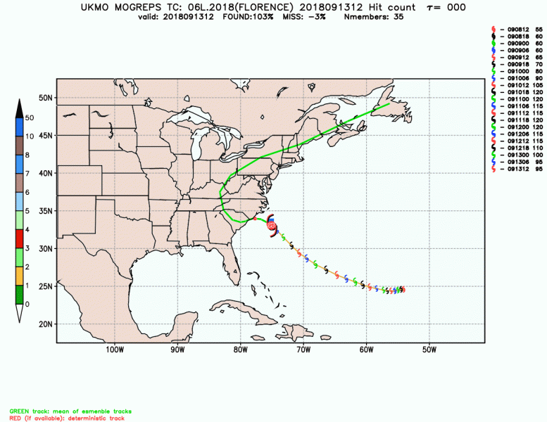
UKMO forecast track animation of the future path of Florence putting it into South Carolina on Sunday before it turns north and changes phase into post-tropical storm far inland in the US.
Stay tuned for further updates on the Florence’s evolution soon.
