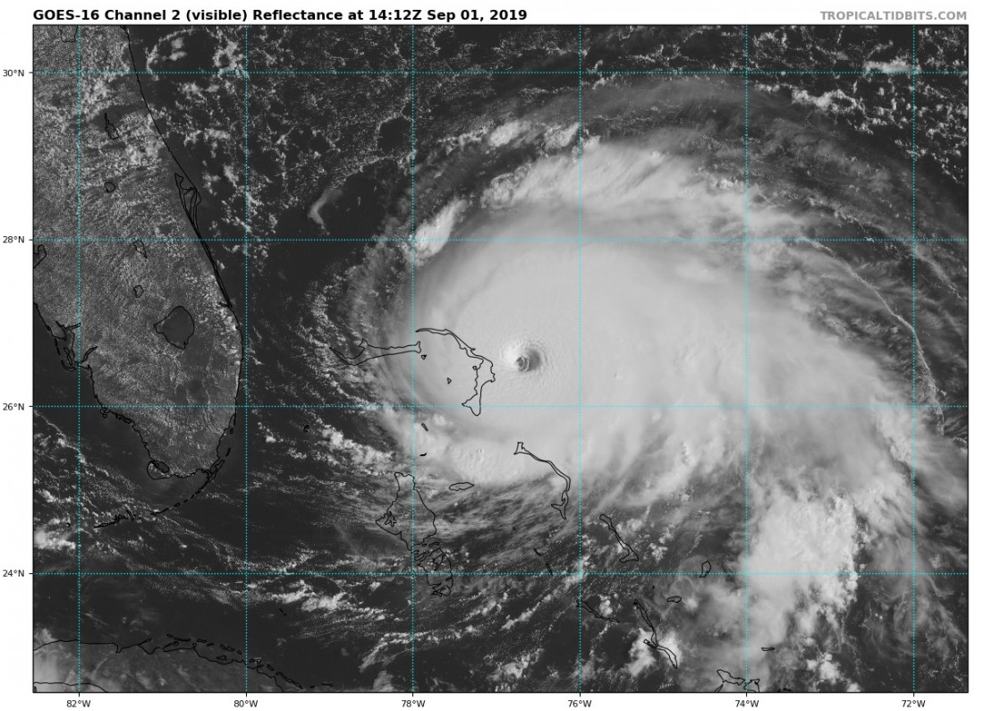
Potentially catastrophic Category 5 hurricane Dorian is bearing down on the Bahamas today, but there is more activity in the tropical Atlantic.
Potentially catastrophic CAT 5 hurricane Dorian in GOES-16 visual imagery as it grinds towards the Bahamas. September 1, 14:12 UTC. Image: Tropical Tidbits.
Three additional area of potential imminent tropical development are being monitored in the tropical Atlantic.
Five-day graphical tropical weather outlook indicating three additional disturbances / areas of potential imminent tropical development. Map: NOAA NWS National Hurricane Center.
A significant tropical disturbance, a broad area of low pressure associated with a tropical wave, is located just south of the Cape Verde islands off the western coast of Africa. NOAA National Hurricane Center estimates 80% chance of tropical cyclone formation in the next 5 days. Forecast track towards northwest.
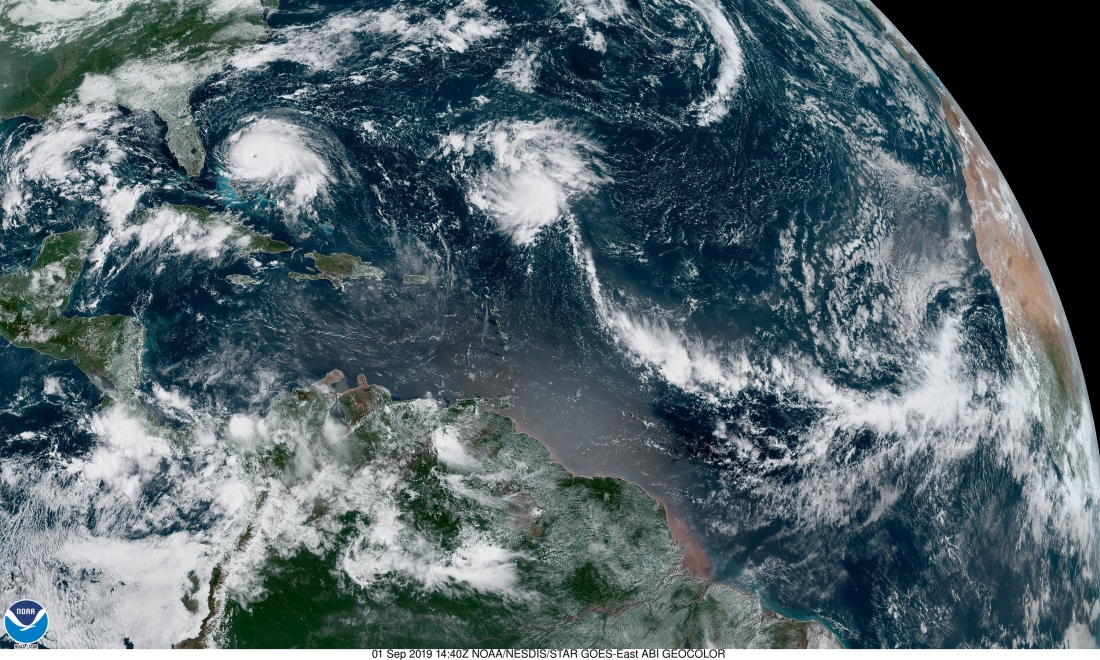
Two additional disturbances are currently ongoing in the Atlantic. Disturbance #2 is located in the central Atlantic, NNE of the Antilles / SSE of Bermuda. There is a 30% chance of cyclone formation in the next 5 days as it tracks NW. Disturbance #3 is located in the Gulf of Mexico, just north of the Yucatan peninsula. Currently disorganized, there is a 40% chance of cyclone formation in the next 5 days.
Tropical disturbance #1 north of Cape Verde islands and disturbance #2 in the central Atlantic. September 1st, 14:40 UTC. Image: NOAA GOES East.
Tropical disturbance #3, Gulf of Mexico, just north of the Yucatan peninsula. September 1st, 14:51 UTC. Image: NOAA GOES East.


