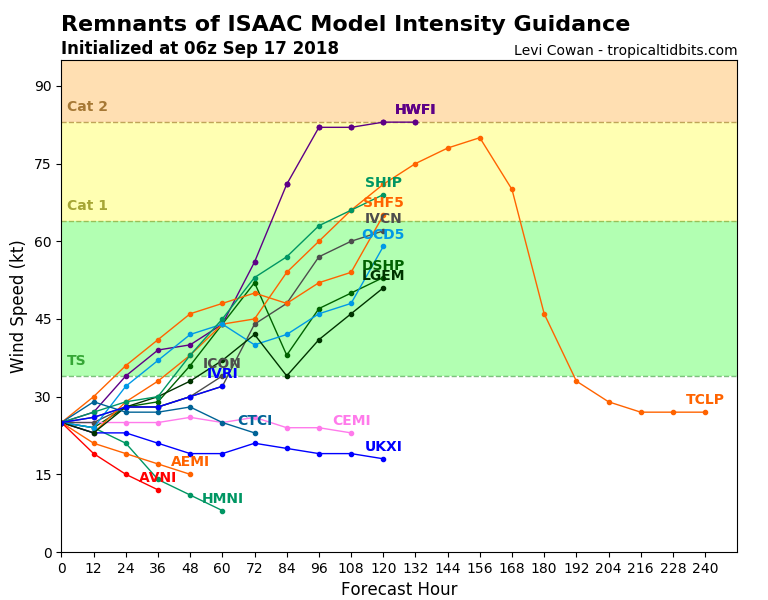
Interestingly enough, ex-Tropical storm Isaac is showing trends of re-development into a tropical storm or even a hurricane later this week. Isaac has been going through the Caribbean region in the past days and its remnants are now located near Jamaica.
We take a look at various models which are pushing the wave towards the northern tip of Yucatan, Mexico through the next 120 hours and then traveling towards the Gulf of Mexico as well. However, uncertainities are indeed very high as it is a very disorganized system for now.
Model intensity guidance suggest there is a fairly high probability of re-intentensification of the system in the coming days, even into a Category 1 strength per some models. We are definitely monitoring the system further and will keep you updated!
The most robust model is HWRF which is actually developing a very strong tropical system – a hurricane that could cross the Gulf of Mexico and make landfall in the southern US.


