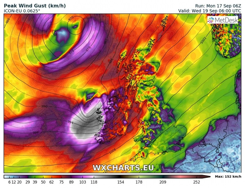
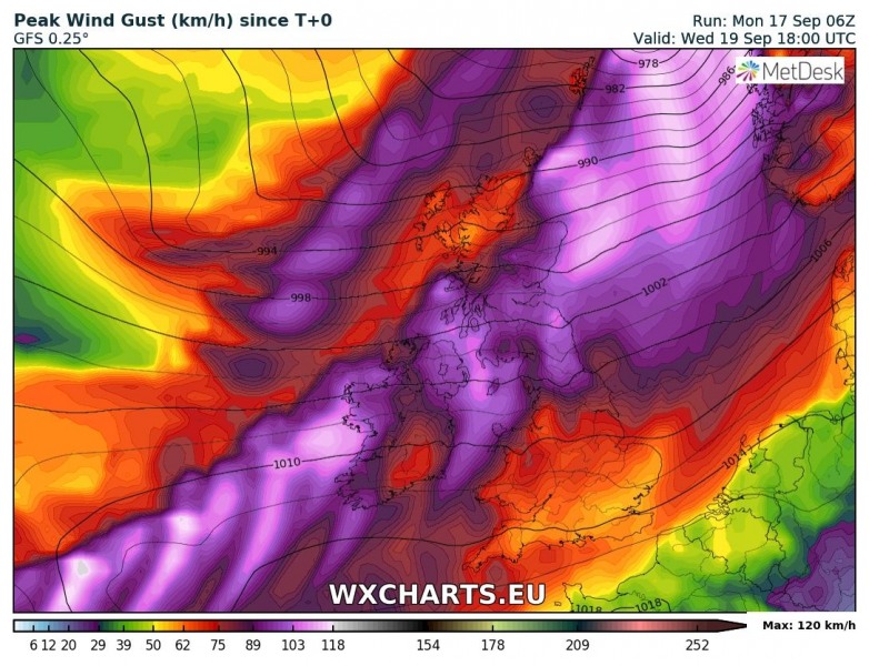
As noted in the mesoscale overview of expected windy weather across the British Isles and Ireland, a potentially damaging windstorm is becoming increasingly likely for parts of western, northwestern and northern Ireland as well as western Scotland on Wednesday. Based on various model outputs, a deep cylone develops over the eastern Atlantic early Wednesday morning and is pushed towards northern parts of Ireland during the day and continues northeastwards across Scotland in the afternoon hours. High-resolution models are trending into a possible extremely severe wind threat, simulating peak wind gusts well above 160 km/h.
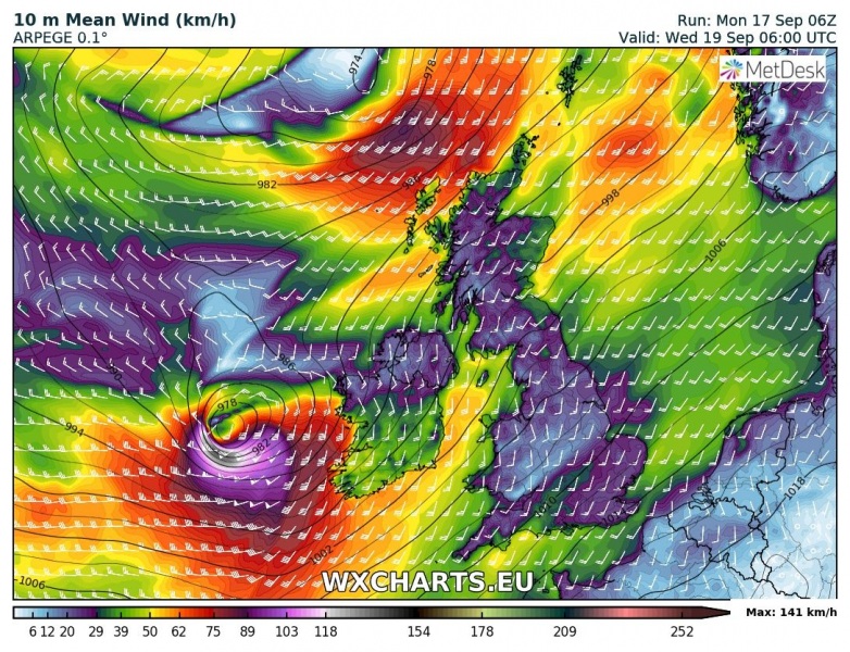
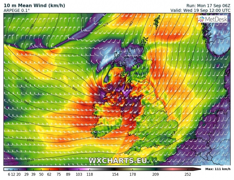
This is a 3-hour sequence through the Wednesday’s morning and midday hours per ARPEGE model, from 6 UTC until 12 UTC time frame. The development of the deep cyclone and its path is well visible, intensifying along its path during the morning hours. The strength of the system seems very violent, since the sustained winds of 130-150 km/h [81-93 mph] fit into “Category 1 hurricane” strength!
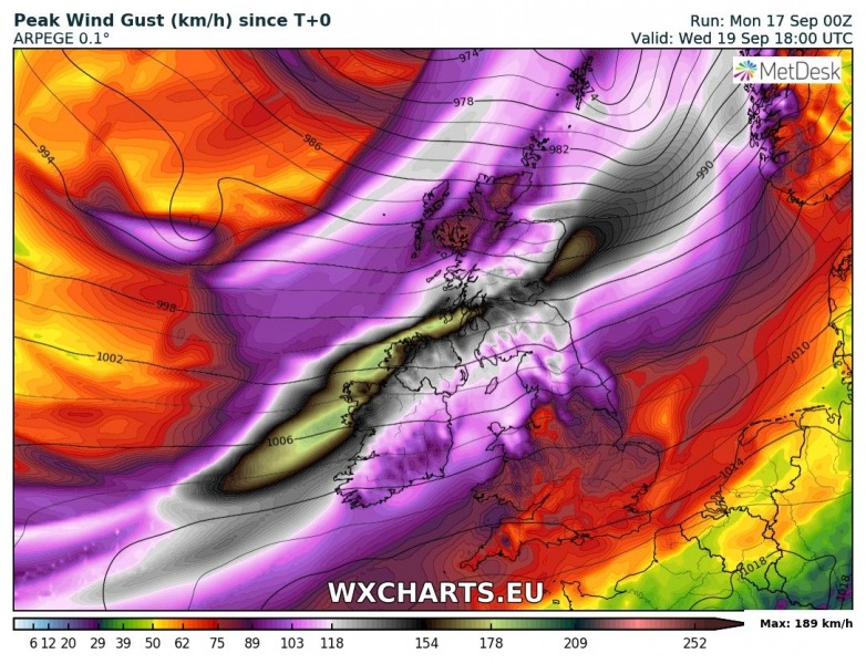
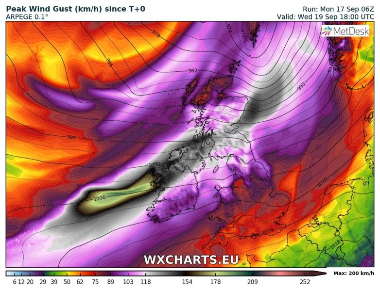
What is increasing the confidence in the development of this dangerous system, is the consistency in the last model runs from ARPEGE, also confirmed quite well with other models for the region. Below is comparsion of the ARPEGE model runs with other models – maps are revealing swaths of the strongest wind gusts until Wednesday late afternoon.
ARPEGE 12 UTC model run yesterday, Sept 16th:
ARPEGE 00 UTC model run today, Sept 17th:
ARPEGE 06 UTC model run today, Sept 17th:
As well as other models e.g. GFS and ICON-EU:
We can see the potential for a damaging windstorm with peak gusts in excess of 150 km/h is quite real. The exact path of the cyclone is yet to be determined precisely over the next 24 hours, but confidence is becoming higher that we will see a potentially damaging windstorm over parts of Ireland (and possibly western Scotland as well) on Wednesday.
The evolution of the pattern across the western Europe is closely monitored – we will keep you updated! Stay alert!
