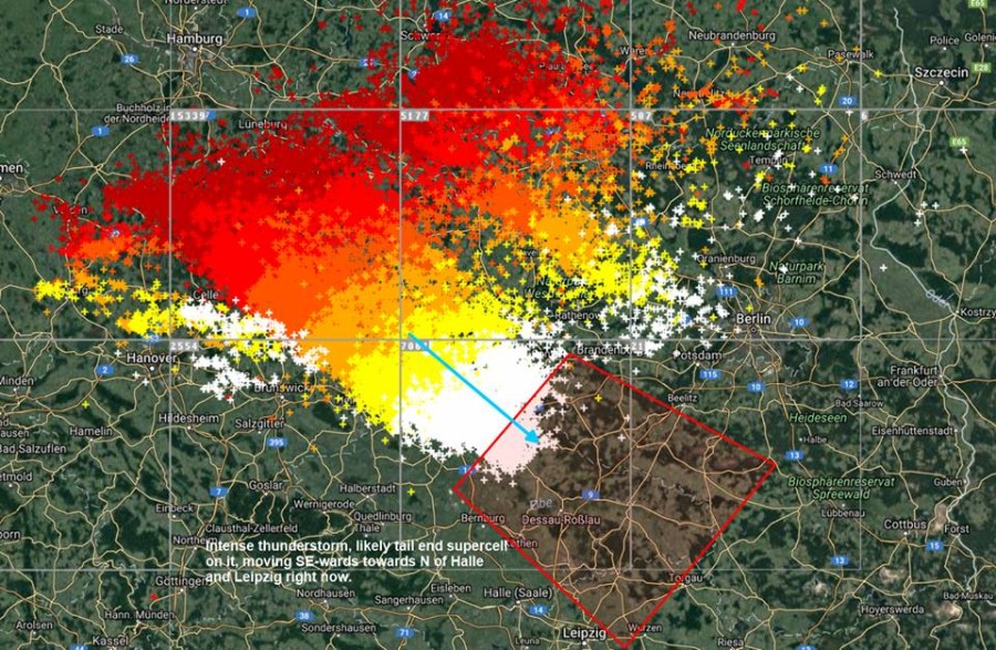
It was an exceptionally active day over Germany yesterday! Numerous severe thunderstorms hit much of the country, also moving into Czech Republic. We take a look at the best reports received so far. We are updating with additional reports, so check back soon!
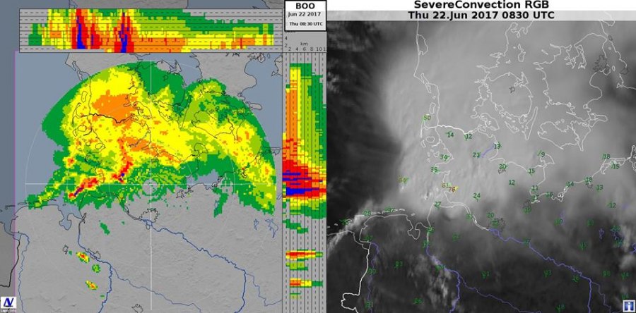
Thunderstorm activity commenced in the morning with a MCS/QLCS approaching N Germany across the North Sea. The QLCS intensified over land and hit several large cities, including Hambur and Hannover.
MCS/QLCS over N Germany in the morning hours.
https://www.facebook.com/severeweatherEU/videos/2030518980504526/
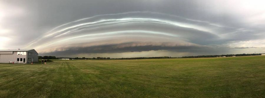
Amazing view at the approaching storm from Uetersen Airfield, Schleswig-Holstein, Germany! Amazing photos by Fabian Förster!
Approaching Mesoscale Convective System over Hamburg, N German. Photo: Samir Gaddah.
Spectacular view of the structure on the MCS over Hagenow, N Germany. Photo: Nadine We
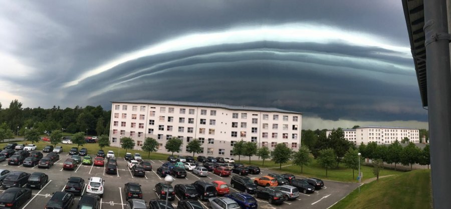
Exceptional multi-level shelf cloud on the MCS near Hamburg, N Germany! Report: Stormchasing S-H
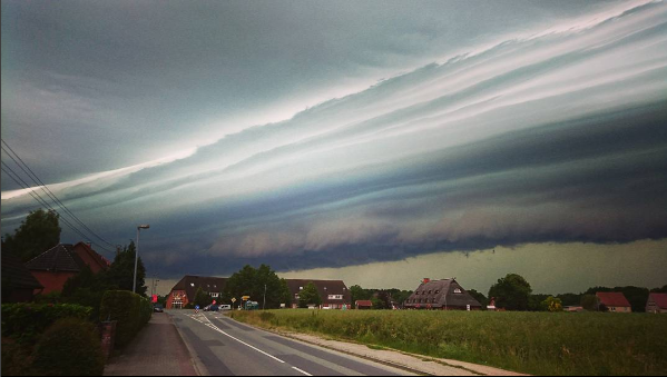
Amazing multi-layered shelf cloud over Erden, Germany by Andreas Hahn.
Approaching MCS near Wittenburg, Mecklenburg Vorpommern just after noon local time. Photo: Cindy Meyer
Severe thunderstorm approaching Prignitz, Germany. Photo: Johannes Herper.
Shelf cloud on the Mesoscale Convective System over Hamburg, N Germany. Report: partners Cyclone Of Rhodes.
https://www.facebook.com/severeweatherEU/posts/2030600090496415
By mid afternoon the QLCS had weakened, but several discrete intense tail end HP supercells developed.
Dissipating QLCS and forming discrete HP supercells.
Exceptional radar presentation of the monster supercell near Giessen, SE Germany. Lightning rate on this storm alone was 500 flashes per minute! Radar: Kachelmannwetter.com
Monster HP supercell near Magdeburg, Germany in mid afternoon! Images: David Steg / Markus Riexinger.
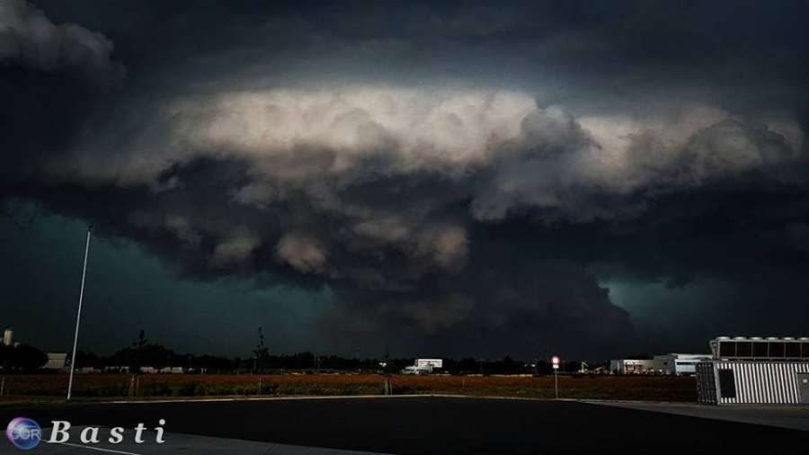
Wall cloud on the monster HP supercell near Magdeburg, Germany! Photo: B a s t i.
https://www.facebook.com/severeweatherEU/videos/2030342447188846/
Large hail in Blankenheim, Germany this afternoon. Photo by @Walrathis.
Additional organized thunderstorms were initiating across SW and CNTRL Germany.
https://www.facebook.com/severeweatherEU/videos/2030059483883809/
By mid evening most of Germany (except the south) was under very active thunderstorms, which were moving also into Czech Republic.
https://www.facebook.com/severeweatherEU/videos/2030206817202409/
Nearly half a million lightning flashes over central Europe on June 22!
Also check out these videos of today’s thunderstorms, from the morning MCS/QLCS over N Germany to intense isolated supercells later in the afternoon and evening.
https://www.facebook.com/severeweatherEU/videos/2029976560558768/
https://www.facebook.com/severeweatherEU/videos/2029947317228359/
https://www.facebook.com/severeweatherEU/videos/2030048207218270/
https://www.facebook.com/severeweatherEU/videos/2030142110542213/
https://www.facebook.com/severeweatherEU/videos/2030325633857194/
https://www.facebook.com/severeweatherEU/videos/2030254270530997/
');
}());

