The northern Alps are buried in thick fresh snow, literally meters in some places. The situation is critical in many areas, with extreme avalanche danger. Indeed, a number of fatalities related to avalanches have already been reported. Further episodes of intense snowfall are expected in the second half of week and likely to persist into next week. We take a closer look.
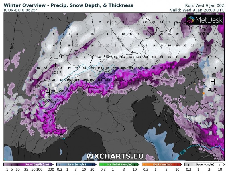
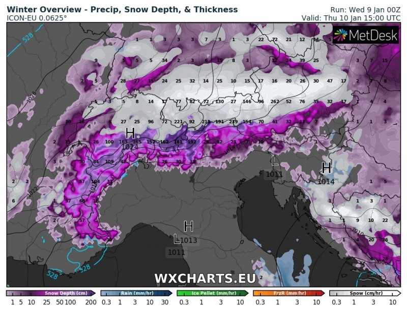
As the synoptic pattern persists, it sustains the meridional flow of Arctic maritime airmass from the north towards the south. Persistent stau-effect snowfall is ongoing. Expect it to persist through Wednesday and Thursday. A pause is expected on Friday and Saturday, with some places not receiving any snow and others experiencing somewhat more moderate snowfall.
Stau-effect snowfall across the northern Alps and foreland. ICON-EU model guidance. Map: Wxcharts.eu.
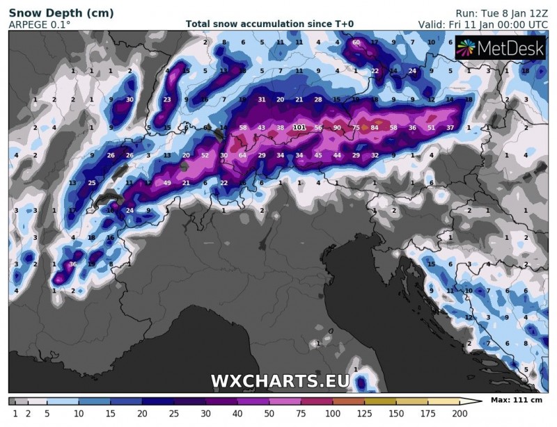
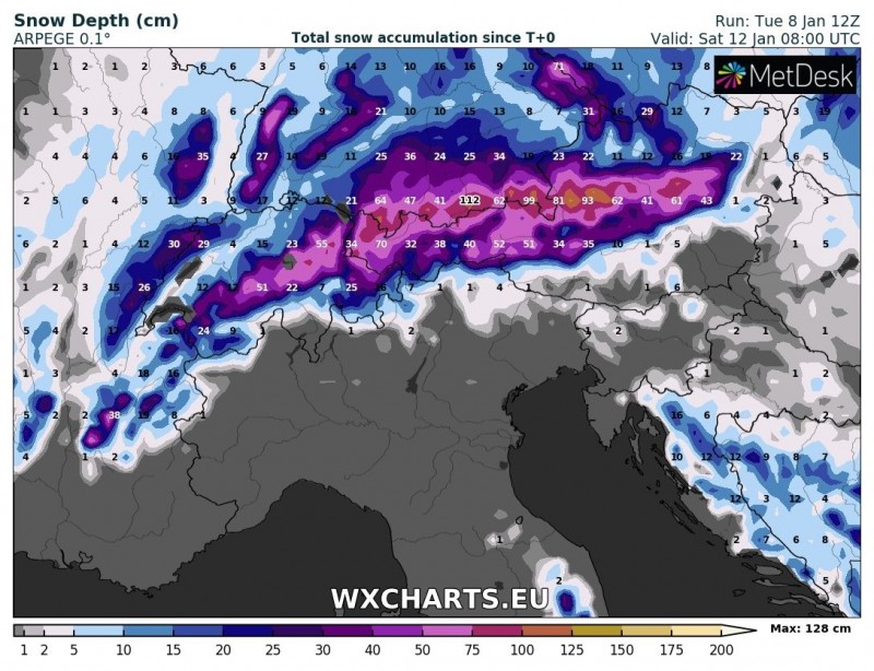
Expect up to 40-80 cm of additional fresh snow in the northern Alps of Austria, southern Germany and Switzerland by early on Friday and an additional 20-40 cm on Friday. Probably about 10-30 cm of additional snow in some places on Saturday, for a total of 50-120 cm of fresh snow across the northern Alps by early on Sunday.
A new wave of intense snowfall is very likely from Sunday to Tuesday. Current model guidance indicates extremely high snowfall rates, however, being still 4+ days away details may well change. More on this in the coming days.
This is potentially a life-threatening situation. Exercise proper precautions and avoid areas of high avalanche danger.
Total snow accumulation from Tuesday noon to early on Friday and early on Saturday. ARPEGE model guidance. Map: Wxcharts.eu.
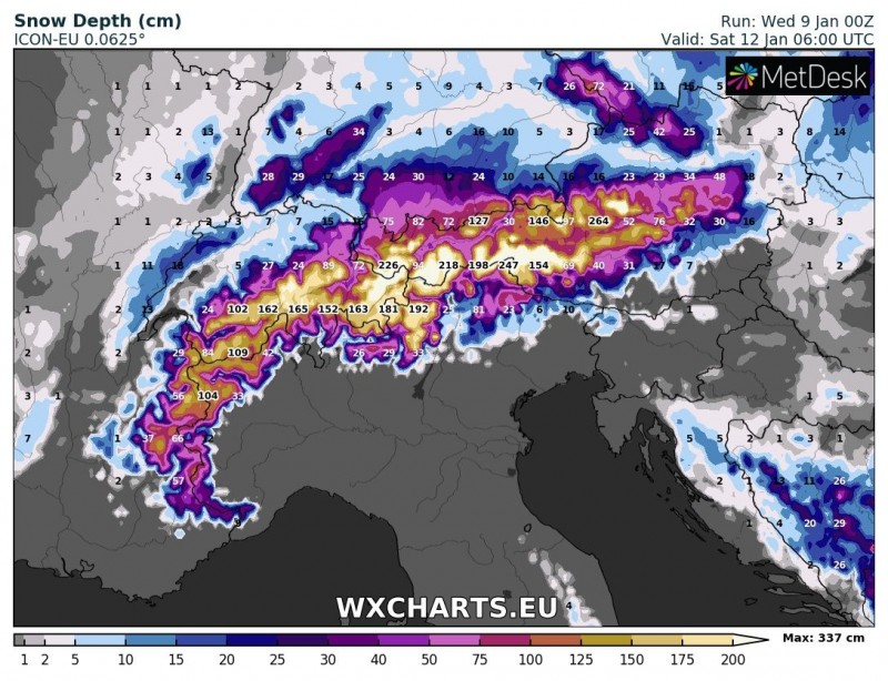
Total snow depth early on Saturday. ICON-EU model guidance. Map: Wxcharts.eu.
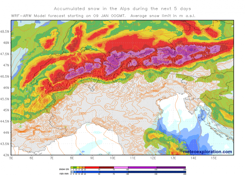
Total snowfall through Sunday. Map: Meteoexploration.
Also see:
