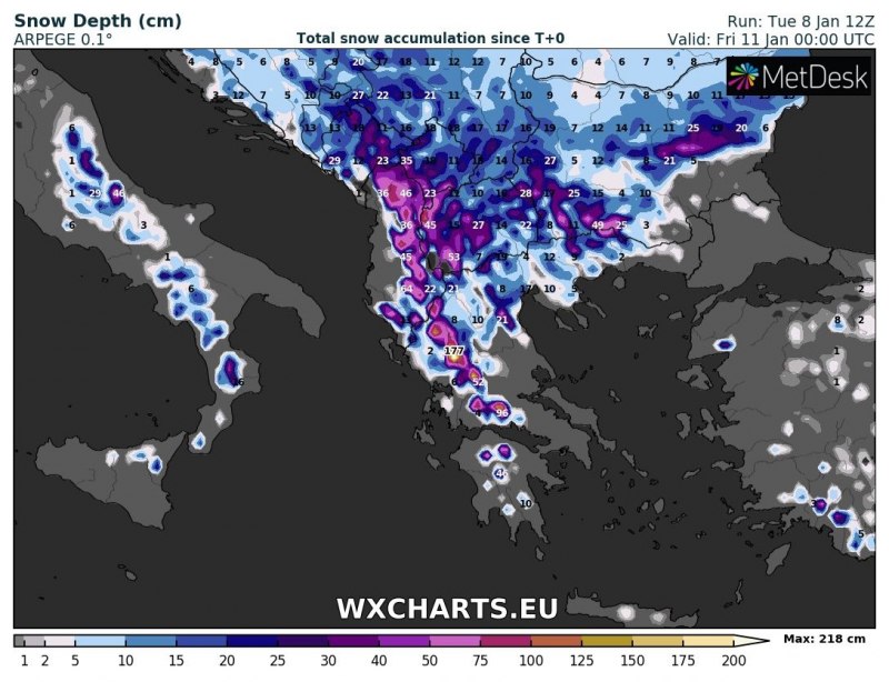
Southeastern Europe remains on track for a blast of snowfall in the next 24-48 hours. Montenegro, Albania, Greece and FYR Macedonia are in for locally very intense snowfall. Up to 30-60 cm of snow is expected at higher elevations, locally up to 100 cm.
A cutoff low has formed in the northern Mediterranean, and has moved across the Tyrrhenian sea over southern Italy and the Ionian sea. It will stall there and produce heavy stau-effect snowfall across parts of southeastern Europe over the next 24-36 hours. Heavy snowfall is expected in the mountainous terrain of Montenegro, Albania, Greece and FYR Macedonia, with 30-60 cm of fresh snow over a wide area and locally up to 100 cm.
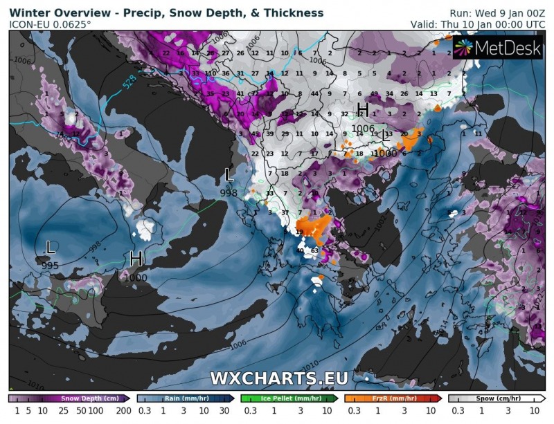
Meanwhile, locations at lower elevations, particularly across the Peloponnese will receive persistent rainfall. Totals will approach and locally exceed 100 mm over the next 24-36 hours. Local flooding is possible. Some locations in central and eastern Greece will also receive periods of freezing rain, black ice is likely.
Cutoff low over the region on Thursday. ICON-EU model guidance. Note the freezing rain in orange. Southern Greece gets major rainfall. Map: Wxcharts.eu.
Total snow depth across southeastern Europe late on Friday. ARPEGE model guidance. Map: Wxcharts.eu.
Total snow depth across southeastern Europe early on Friday. ICON-EU model guidance. Map: Wxcharts.eu.
Total snow depth across southeastern Europe late on Friday. ARPEGE model guidance. Map: Wxcharts.eu.
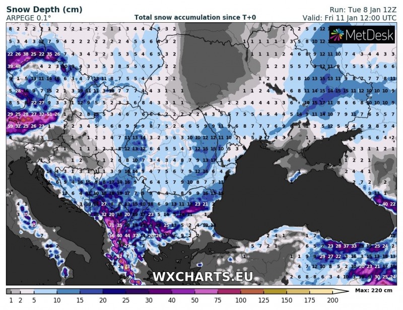
Total snow depth across southeastern Europe (wider view) early Friday afternoon. ARPEGE model guidance. Map: Wxcharts.eu.


