VALID FOR 23-04-2018
SYNOPSIS
An upper ridge still extending across much of south-central Europe where a short wave moves across N Germany/Denmark towards ENE. An upper low SW of Iberia finally weakens while moving south. A weak upper low is moving across S Mediterranean towards E.
DISCUSSION
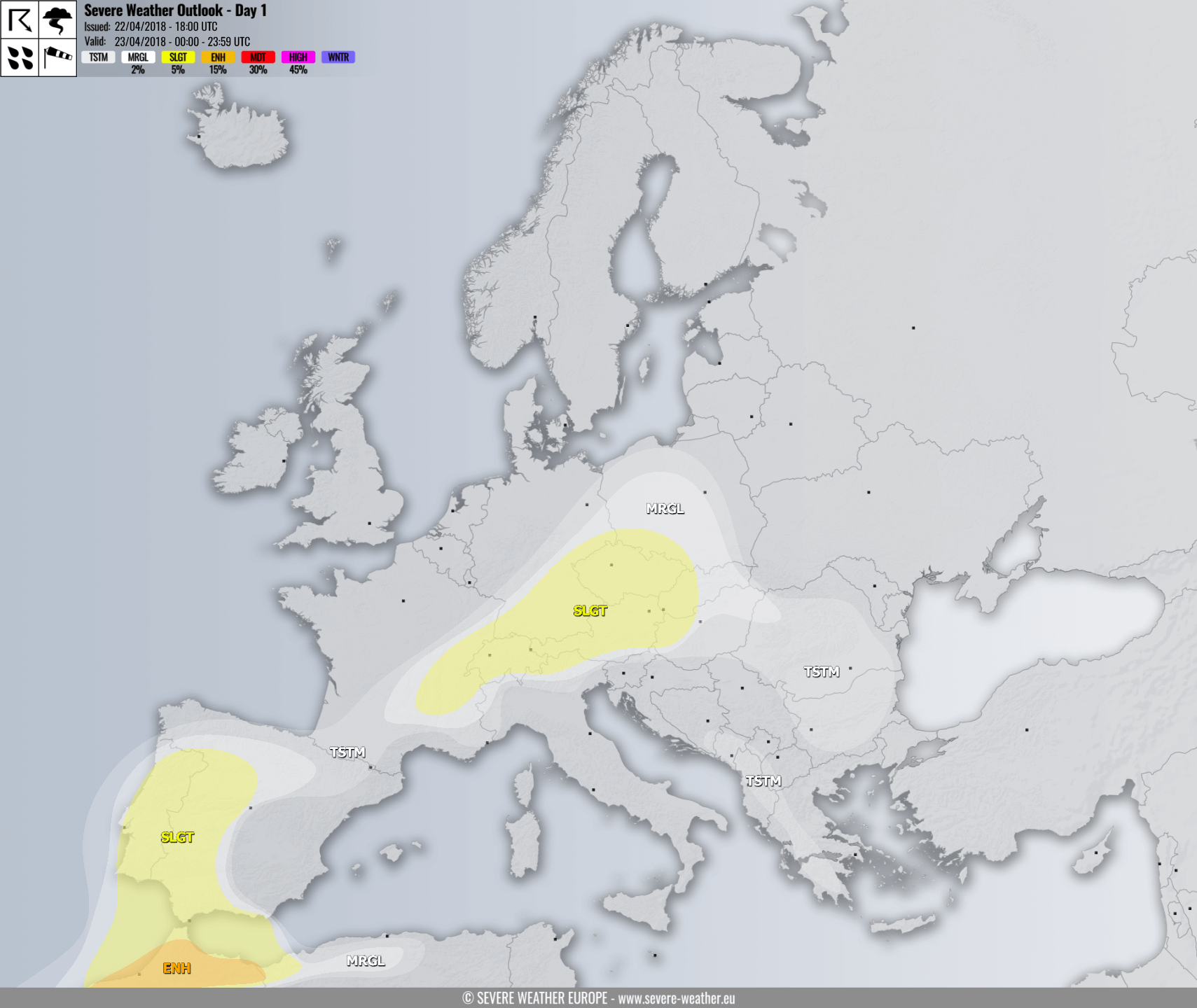
An ENH risk has been issued for N Morrocco with threat for severe storms capable of producing severe winds, large hail and torrential rainfall. Rather widespread organized severe storms are expected given the moderate instability (1000+ J/kg) and moderate shear in place.
A SLGT risk has been issued for areas surrounding ENH risk across N Morrocco into Portugal and SW Spain with more isolated threat for severe storms.
A MRGL risk has been issued for surrounding areas of SLGT/ENH across parts of Iberia, N Morocco into NW Algeria with threat for isolated storms, some threat for marginally large hail and heavy rainfall exists.
A SLGT risk has been issued for SE France, Switzerland, S Germany, Czech Republic, SW Poland, W Slovakia, Austria and WNW Hungary with threat for isolated severe storms, capable of producing large hail, strong to severe winds and torrential rainfall. Rather widespread convective activity is expected within moderately unstable and weakly to moderately sheared environment, some storms could merge into small clusters with time.
A MRGL risk has been issued for surrounding areas of SLGT risk across central Europe where only isolated threat for strong to severe storms will exist. Area includes more of Poland, Slovakia and N Hungary.
